close
-
Layers w
- Weather Layers
- Pro
- Pro
- Pro
- Pro
- Pro
- Pro
- More Layers
- Pro
- Pro
- Pro
- Pro
-
Upgrade to

3D
Trail Conditions
- Unknown
- Snow Groomed
- Snow Packed
- Snow Covered
- Snow Cover Partial
- Freeze/thaw Cycle
- Icy
- Prevalent Mud
- Wet
- Variable
- Ideal
- Dry
- Very Dry
Trail Flow (Ridden Direction)
Trailforks scans users ridelogs to determine the most popular direction each trail is ridden. A good flowing trail network will have most trails flowing in a single direction according to their intension.
The colour categories are based on what percentage of riders are riding a trail in its intended direction.
The colour categories are based on what percentage of riders are riding a trail in its intended direction.
- > 96%
- > 90%
- > 80%
- > 70%
- > 50%
- < 50%
- bi-directional trail
- no data
Trail Last Ridden
Trailforks scans ridelogs to determine the last time a trail was ridden.
- < 2 days
- < 1 week
- < 2 weeks
- < 1 month
- < 6 months
- > 6 months
Trail Ridden Direction
The intended direction a trail should be ridden.
- Downhill Only
- Downhill Primary
- Both Directions
- Uphill Primary
- Uphill Only
- One Direction
Contribute Details
Colors indicate trail is missing specified detail.
- Description
- Photos
- Description & Photos
- Videos
Trail Popularity ?
Trailforks scans ridelogs to determine which trails are ridden the most in the last 9 months.
Trails are compared with nearby trails in the same city region with a possible 25 colour shades.
Think of this as a heatmap, more rides = more kinetic energy = warmer colors.
- most popular
- popular
- less popular
- not popular
ATV/ORV/OHV Filter
Max Vehicle Width
inches
US Cell Coverage
Legend

Radar Time
Activity Recordings
Trailforks uses anonymized public activity data.
?
Activity Recordings
Trailforks uses anonymized public activity data.
?
Personal Heatmap
▶
Activity Types
all
/
none
▶
Options
2
Date range
month
–
Winter Trails
Warning
A routing network for winter maps does not exist. Selecting trails using the winter trails layer has been disabled.
Missing Trails
Most Popular
Least Popular
Trails are colored based on popularity. The more popular a trail is, the more red. Less popular trails trend towards green.
Jump Magnitude Heatmap
Heatmap of where riders jump on trails. Zoom in to see individual jumps, click circles to view jump details.
BC Backroad Status
![map legend]()
Service Road Atlas is a free to use, community-driven service for viewing and creating reports on the numerous back-country service roads around B.C. and Alberta.

Slope Aspect
Direction the slope faces
Trails Deemphasized
Trails are shown in grey.
Only show trails with no bike usage.
Suggested Layers
Based on selected activity type
Save the current map location and zoom level as your default home location whenever this page is loaded.
SaveCroatia (Croatian: Hrvatska) is a country situated in Central Europe. It is on the east side of the Adriatic Sea, east of Italy. It is also bordered by Slovenia to the northwest, Hungary to the north, Bosnia and Herzegovina to the southeast, Serbia in the east, and Montenegro to the south.
Climate
Northern Croatia has a temperate continental climate whereas the central and upland regions have a mountainous climate. The entire Adriatic coast has a pleasant Mediterranean climate. Spring and autumn are mild along the coast, while winter is cold and snowy in central and northern regions.
The average temperature inland in January ranges from -10° to 5°C (14° to 41°F) and in August, from 19° to 39°C (66° to 102°). The average temperature at the seaside is higher: in January, from 6°C to 11°C (43° to 52°F) and in August from 21°C to 39°C (70° to 102°F).
Terrain
Geographically diverse; flat agricultural plains along the Hungarian border, mountains and highlands near the Adriatic coastline and islands. There are 1,246 islands; the largest ones are Krk and Cres. The highest point is Dinara, at 1,830m.
source: Wikitravel - Croatia
AKA: Hrvatska
This region uses the Uk/Euro style trail grading system.
Region Details
- 939
- 10
- 567
- 468
- 244
- 66
- 4
Stats
- Avg Trail Rating
- Trails (view details)
- 2,565
- Trails Mountain Bike
- 2,389
- Trails E-Bike
- 1,481
- Trails Gravel Bike
- 15
- Trails Adaptive Bike
- 14
- Trails Winter Fat Bike
- 14
- Trails Horse
- 458
- Trails Hike
- 2,246
- Trails Trail Running
- 2,236
- Trails Dirtbike/Moto
- 369
- Trails Observed Trials
- 133
- Trails ATV/ORV/OHV
- 329
- Trails Snowmobile
- 9
- Trails Snowshoe
- 20
- Trails Downhill Ski
- 17
- Trails Backcountry Ski
- 30
- Trails Nordic Ski
- 4
- Total Distance
- 3,316 miles
- Total Descent
- 638,517 ft
- Total Vertical
- 5,313 ft
- Highest Trailhead
- 5,313 ft
- Reports
- 8,084
- Photos
- 3,267
- Ridden Counter
- 66,294
Articles
Video: RAW Sounds of Isolation During Quarantine in Croatia
May 26, 2020 from pinkbike.com
The two friends behind this video were inspired by Red Bull's Raw 100 series.

Video: Searching for Singletrack in Croatia's Velebit Mountains
Apr 26, 2020 from pinkbike.com
The Kill Hill crew search for golden trails in Croatia.

Video & Race Report: Enduro Grozni, SloEnduro Final
Oct 17, 2019 from pinkbike.com
The 2019 SloEnduro comes to a close in Grožnjan, Croatia.
Sub Regions
- Banovo Brdo (0)
- Dubrovnik-Neretva (2)
- Ploče (2)
- Ploče (2)
- Hvar (0)
- Istarska (197)
- Karlovačka (0)
- Ličko - senjska (170)
- Pag Island (1)
- Novalja (3)
- Senj (156)
- Stinica (7)
- Pag Island (1)
- Mljet (0)
- Moslavačka Gora (1)
- Pasman island (0)
- Primorsko - goranska (1,258)
- Gorski kotar (5)
- Delnice (5)
- Kvarner (286)
- Crikvenica (59)
- Kraljevica (8)
- Krk (214)
- Omisalj (5)
- Lošinj (3)
- Cres (30)
- Lopar (12)
- Losinj (10)
- novi vinodolski (39)
- Otocac (8)
- Rab (5)
- Rijeka (624)
- Rovinj (24)
- Tršće (1)
- Gorski kotar (5)
- Šibensko - kninska (176)
- Slavonija (20)
- Splitsko - dalmatinska (189)
- Varaždinska (12)
- Zadarska (51)
- Južni Velebit (55)
- Sv Filip I Jakov (4)
- Zadar (52)
- Zadar (3)
- Pag (19)
- Južni Velebit (55)
- Zagrebačka (256)
- Ivanić Grad (1)
- Samobor (105)
- Sošice (1)
- Sveta Nedelja (10)
- Zagreb (119)
- Zapresic (6)
- Ivanić Grad (1)
- Žumberačko gorje (0)
- Beli Manastir (2)
- Dubrovnik (7)
- Jastrebarsko (3)
- Kutina (1)
- Levade (4)
- Novigrad (1)
- Osijek (1)
- Posedarje (4)
- Zelina (36)
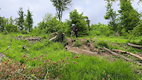
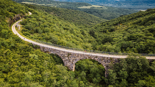
Popular Croatia Mountain Biking Trails
• 90 ★ 4.4 • 2 miles • 3 ft • 380 •
Difficulty: demanding Length: 3000 m Surface: natural terrain
• 100 ★ 4.5 • 2 miles • 811 ft • 339 •
Popular green difficulty alpine singletrack. This mountain bike primary trail can be used both directions and has a moderate overall physical rating with a 811 ft blue climb. On average it takes 25 minutes to complete this trail.
• 100 ★ 4.3 • 1,483 ft • 88 ft • 338 •
Difficulty: easy Length: 420 m Surface: fine sand
• 100 ★ 4.6 • 5,217 ft • 3 ft • 324 •
Highly rated popular red difficulty singletrack. This mountain bike primary trail can be used downhill primary and has a moderate overall physical rating with a 3 ft blue climb. On average it takes 7 minutes to complete this trail.
• 100 ★ 4.6 • 4,192 ft • 12 ft • 307 •
Highly rated popular blue difficulty singletrack. This mountain bike primary trail can be used downhill primary and has a moderate overall physical rating with a 12 ft blue climb. On average it takes 11 minutes to complete this trail.
• 85 ★ 4.8 • 3,641 ft • 2 ft • 296 •
Forrest trail with hardpack soil. Technical, but at the same time approachable. Begins on the tarmac road leading to Groznjan and ends up near the gravel road leading to Groznjan. The track was part of SloEnduro race.
• 100 ★ 3.3 • 489 ft • 0 ft • 284 •
Difficulty: demanding Length: 170 m Surface: natural terrain
Croatia Mountain Bike Routes
★ 4.0 • 10 miles • 2,605 ft • 3 • Out & Back •
Cool little loop in which climb ends on Mountain home Risnjak where there is always something nice to eat...
★ 5.0 • 12 miles • 888 ft • 2 • Loop •
Official track of UCI MTB XC Marathon, held on April 8th 2018 on Kamenjak. One loop 20 km. Elite category...
★ 4.0 • 10 miles • 1,062 ft • 2 • Loop •
This route will show you sights like , archaeological site, and Vrtuljak, small stone structures in fields...
11 miles • 1,106 ft • 4 • Loop •
A nice and comfy Marcelji -> Breza and then mostly downhill to . Fun, easy and scenic.
★ 4.0 • 20 miles • 1,073 ft • 0 •
A very nice XC trail/course. Part of the course was used (until 2017) for the international MTB Parenazan...
15 miles • 1,462 ft • 1 • Loop •
Route of amateur XC league of Dalmatia. Steep uphills, and loose downhills, with interesting technical...
Photos of Croatia Mountain Bike
Videos of Croatia Mountain Bike
trail: Oko groblja
0:51 |
5 |
May 30, 2026
trail: Stribor
3:11 |
8 |
Feb 27, 2026
trail: Tequila
4:20 |
9 |
Feb 26, 2026
trail: Regoč
2:10 |
12 |
Feb 26, 2026
trail: Goranska - Kotor
2:15 |
5 |
Feb 24, 2026
trail: RPO
2:00 |
5 |
Feb 15, 2026
trail: Flek
0:11 |
5 |
Dec 5, 2025
trail: Carolina Reaper
0:07 |
21 |
Dec 5, 2025
National Scenic Trails & Official Routes
-
Parenzana
- Mountain Bike
- E-Bike
Recent Comments
| username | type | title | comment | date |
|---|---|---|---|---|
| trail | Seems uphill not possible, and quite... | Jun 12, 2026 @ 12:42am Jun 12, 2026 | ||
| trail | Unrideable after the strorm, a lot of fallen... | May 11, 2026 @ 11:42am May 11, 2026 | ||
| trail | Couple of fallen trees on the trail. | May 9, 2026 @ 4:40am May 9, 2026 | ||
| trail | A climb or two is too brutal (for beginners at... | Apr 26, 2026 @ 5:46am Apr 26, 2026 | ||
| trail | Needs to be cleaned to become enjoyable. Now... | Apr 25, 2026 @ 5:23am Apr 25, 2026 |
Bike & Skill Parks
| name | type | city | rating |
|---|---|---|---|
| Pump Track Orešje | skill park | Zagreb | |
| Bike Skills Park | skill park | Labin | |
| Poreč Pumptrack | skill park | Poreč | |
| Pumptrack Opatija | skill park | ||
| Medane bike skills park | skill park | Punat |
Activity Type Stats
| activitytype | trails | distance | descent | descent distance | total vertical | rating | global rank | state rank | photos | reports | routes | ridelogs |
|---|---|---|---|---|---|---|---|---|---|---|---|---|
| Mountain Bike | 2,388 | 3,171 miles | 581,440 ft | 1,530 miles | 5,203 ft | #23 | 3,129 | 8,056 | 113 | 127,134 | ||
| E-Bike | 1,481 | 1,984 miles | 327,782 ft | 929 miles | 5,203 ft | #24 | 45 | 7,186 | 43 | 19,228 | ||
| Gravel Bike | 15 | #33 | 45 | 1,288 | ||||||||
| Adaptive Bike | 14 | #34 | 8 | 5 | ||||||||
| Winter Fat Bike | 14 | #35 | 24 | 2 | ||||||||
| Horse | 458 | 693 miles | 102,904 ft | 322 miles | 4,813 ft | #20 | 1,168 | 3 | 2 | |||
| Hike | 2,245 | 3,031 miles | 562,730 ft | 1,454 miles | 5,312 ft | #21 | 121 | 7,636 | 14 | 13,970 | ||
| Trail Running | 2,236 | 3,021 miles | 558,084 ft | 1,450 miles | 5,312 ft | #21 | 7,617 | 16 | 3,389 | |||
| Dirtbike/Moto | 369 | 888 miles | 95,302 ft | 381 miles | 4,813 ft | #16 | 1,372 | 3 | 34 | |||
| Observed Trials | 133 | 241 miles | 33,970 ft | 108 miles | 4,501 ft | #24 | 30 | 3 | ||||
| ATV/ORV/OHV | 329 | 795 miles | 83,950 ft | 338 miles | 4,813 ft | #16 | 6 | 1,108 | 1 | 19 | ||
| Snowmobile | 9 | 27 miles | 2,579 ft | 11 miles | 3,999 ft | #29 | 2 | |||||
| Snowshoe | 20 | 41 miles | 4,790 ft | 18 miles | 4,301 ft | #32 | 2 | 4 | ||||
| Downhill Ski | 17 | 12 miles | 6,247 ft | 10 miles | 3,921 ft | #30 | 2 | 1 | 99 | |||
| Backcountry Ski | 30 | 39 miles | 9,446 ft | 19 miles | 4,360 ft | #32 | 4 | 94 | ||||
| Nordic Ski | 4 | 6 miles | 1,076 ft | 4 miles | 2,956 ft | #36 | 1 | 90 |
Activities
- Croatia Mountain Biking Trails
- Croatia E-Biking Trails
- Croatia Gravel Biking Trails
- Croatia Adaptive Biking Trails
- Croatia Winter Fat Biking Trails
- Croatia Horseback Trails
- Croatia Hiking Trails
- Croatia Trail Running Trails
- Croatia Dirtbiking Trails
- Croatia Observed Trials Trails
- Croatia ATVing/Offroading Trails
- Croatia Snowmobiling Trails
- Croatia Snowshoeing Trails
- Croatia Skiing Trails
- Croatia Backcountry Skiing Trails
Trails
- By canadaka
 Trailforks & contributors
 - Admins: VjekoslavKrsanac
- #3171 - 60,124 views
- croatia activity log | embed map of Croatia mountain bike trails | croatia mountain biking points of interest
Downloading of trail gps tracks in kml & gpx formats is enabled for Croatia.
You must login to download files.