close
-
Layers w
- Weather Layers
- Pro
- Pro
- Pro
- Pro
- Pro
- Pro
- More Layers
- Pro
- Pro
- Pro
- Pro
-
Upgrade to

3D
Trail Conditions
- Unknown
- Snow Groomed
- Snow Packed
- Snow Covered
- Snow Cover Partial
- Freeze/thaw Cycle
- Icy
- Prevalent Mud
- Wet
- Variable
- Ideal
- Dry
- Very Dry
Trail Flow (Ridden Direction)
Trailforks scans users ridelogs to determine the most popular direction each trail is ridden. A good flowing trail network will have most trails flowing in a single direction according to their intension.
The colour categories are based on what percentage of riders are riding a trail in its intended direction.
The colour categories are based on what percentage of riders are riding a trail in its intended direction.
- > 96%
- > 90%
- > 80%
- > 70%
- > 50%
- < 50%
- bi-directional trail
- no data
Trail Last Ridden
Trailforks scans ridelogs to determine the last time a trail was ridden.
- < 2 days
- < 1 week
- < 2 weeks
- < 1 month
- < 6 months
- > 6 months
Trail Ridden Direction
The intended direction a trail should be ridden.
- Downhill Only
- Downhill Primary
- Both Directions
- Uphill Primary
- Uphill Only
- One Direction
Contribute Details
Colors indicate trail is missing specified detail.
- Description
- Photos
- Description & Photos
- Videos
Trail Popularity ?
Trailforks scans ridelogs to determine which trails are ridden the most in the last 9 months.
Trails are compared with nearby trails in the same city region with a possible 25 colour shades.
Think of this as a heatmap, more rides = more kinetic energy = warmer colors.
- most popular
- popular
- less popular
- not popular
ATV/ORV/OHV Filter
Max Vehicle Width
inches
US Cell Coverage
Legend

Radar Time
Activity Recordings
Trailforks uses anonymized public activity data.
?
Activity Recordings
Trailforks uses anonymized public activity data.
?
Personal Heatmap
▶
Activity Types
all
/
none
▶
Options
2
Date range
month
–
Winter Trails
Warning
A routing network for winter maps does not exist. Selecting trails using the winter trails layer has been disabled.
Missing Trails
Most Popular
Least Popular
Trails are colored based on popularity. The more popular a trail is, the more red. Less popular trails trend towards green.
Jump Magnitude Heatmap
Heatmap of where riders jump on trails. Zoom in to see individual jumps, click circles to view jump details.
BC Backroad Status
![map legend]()
Service Road Atlas is a free to use, community-driven service for viewing and creating reports on the numerous back-country service roads around B.C. and Alberta.

Slope Aspect
Direction the slope faces
Trails Deemphasized
Trails are shown in grey.
Only show trails with no bike usage.
Suggested Layers
Based on selected activity type
Save the current map location and zoom level as your default home location whenever this page is loaded.
SaveTrail Steward: Jim Hall
Email us: [email protected]
Nearest City: Gordonville/Whitesboro
Directions
Cedar Bayou trail head - Head North on 377 from Highway 82 in Whitesboro. Go about 13 miles to Cedar Bayou Billboard. Turn left and follow the signs to the marina,1/2 block on Cotton Franklin Road,turn left onto Cedar Bayou Blvd. Park on the right side of road before the black gate. **Click on link under facilities below to see basic map of trail**
Type
Single Track - Out & Back with many optional loops including, Lost Loop"
Distance
24 miles approx total out and back. 9 Miles from Cedar Bayou including lost loop to end, 3 miles from Juniper point to Cedar Bayou
Land Manager
ACOE
Hours
All
Description:
One word of caution. This trail can be difficult and remote, carry plenty of water and emergency gear.
Cedar Bayou is the preferred trail head to start where you can go west (to Texoma Marina) or east to Juniper Point. Park on the right shoulder before Marina entrance gate. Rental cabins are available at Cedar Bayou. From Cedar Bayou heading west out to Texoma Marina, it is a little over 9 rough and rugged miles out with lots of climbing and steep descents, bike bypasses are frequent. The trail is marked with white blazes sometimes on trees and is sometimes easy to follow. Signage has been updated in 2024 and is easy to follow. The Main Trail is marked and is usually more difficult with tough climbs. Bypasses are plentiful and are marked as Biking route(s). If you ride the trail in its entirety from Juniper Point to Rock Creek and back, it is over 33 miles Biking past Rock Creek is not recommended presently.
There are several primitive camping areas along the trail in which you'll encounter a few extra trails going nowhere but follow the signage and keep your eyes open for the white blazes on the trees and you should be able to pickup the Main trail and stay on track. The "Lost Loop" starts at an intersection of trails approx 3 miles from Cedar Bayou, it is marked with a colorful sign (Go right to do lost loop) (Left to continue on main trail). Lost loop will bring you back to this intersection, go straight across to continue a half loop (Found Loop) of up and down climbing that will dump you back on main trail, go left when you tee onto main trail to continue to the west end or right for short trip back to intersection. Since the trail for the most part follows the lake shore it makes it possible to keep your bearings. Further west you will encounter Kiwanis Loop, similar to Lost Loop, it circles a peninsula for 4.5 miles of awesome trail. After the Grate bridge go right to Rock Creek Marina or Left to circle back using Cajuns Connection.
The trail between Juniper Point (East trail head) and Cedar Bayou travels high above the lake on the rocky ledges that make up the shoreline. This short section of trail is very technical and should only be attempted by experienced riders who are aware of the "penalty for failure." While the 6 mile total length (out and back) may not seem that long the elevation changes of the trail are high and a fatigue factor of this trail is quite high. Be prepared for some ravenous descents into eroded gullies and plenty of rocks and roots to test your skills. SOB hill for example has 5 routes, but only 2 are groomed for biking. Enchanted Forest Loop and the Shoreline Trail Loop are worthy rides.
Facilities:
*Cedar Bayou Marina
• Restrooms/store at far west end, (Rock Creek Marina) go right down gravel road, curve up and right down paved road
• Gas/food in Whitesboro
• http://www.cedarbayou.com/cross_timbers.asp
Location
Cross Timbers Trailhead Gordonville, TX
United States
33° 50' 21.3612" N, 96° 50' 56.3604" W
 google parking directions
Links
Activities Click to view
- Mountain Bike
20 trails
- E-Bike
21 trails
- Hike
21 trails
- Trail Running
21 trails
Region Details
- 7
- 12
- 1
Region Status
Closed as of Jun 19, 2026Stats
- Avg Trail Rating
- Trails (view details)
- 21
- Trails Mountain Bike
- 20
- Trails E-Bike
- 21
- Trails Hike
- 21
- Trails Trail Running
- 21
- Total Distance
- 25 miles
- Total Descent
- 3,098 ft
- Total Vertical
- 127 ft
- Highest Trailhead
- 748 ft
- Reports
- 4,514
- Photos
- 300
- Ridden Counter
- 1,832
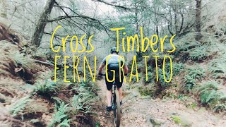
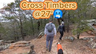
Photos of Cross Timbers Mountain Bike
Videos of Cross Timbers Mountain Bike
trail: Cross Timbers Main Trail
0:38 |
568 |
Feb 2, 2024 , Gordonville

14:43 |
1185 |
Dec 19, 2020
youtuber
![Mountain Biking Texas | ADVENTURE at Cross...]()

trail: Cross Timbers Main Trail
11:15 |
2253 |
Mar 22, 2018 , Gordonville
trail: Cross Timbers Main Trail
3:42 |
269 |
Jan 21, 2024 , Gordonville
Current Trail Warnings
| status | trail | date | condition | user | info |
|---|---|---|---|---|---|
| Stairway to Heaven | Jun 19, 2026 @ 7:52am (America/Chicago) Jun 19, 2026 | Wet | JimHallTx Trail Steward | ||
| Shoreline Trail | Jun 19, 2026 @ 7:52am (America/Chicago) Jun 19, 2026 | Wet | JimHallTx Trail Steward | ||
| Mr. Rogers Neighborhood | Jun 19, 2026 @ 7:52am (America/Chicago) Jun 19, 2026 | Wet | JimHallTx Trail Steward |
Recent Trail Reports
Activity Feed
| username | action | type | title | date |
|---|---|---|---|---|
| JimHallTx | add | report | activity #97310790 and 24 more | Jun 19, 2026 @ 5:52am Jun 19, 2026 |
| JimHallTx | add | report | activity #96808637 and 24 more | Jun 12, 2026 @ 9:05am Jun 12, 2026 |
| JimHallTx | add | report | activity #96662837 and 24 more | Jun 10, 2026 @ 4:05am Jun 10, 2026 |
| JimHallTx | add | report | activity #96385952 and 24 more | Jun 6, 2026 @ 10:34am Jun 6, 2026 |
| JimHallTx | add | report | activity #96365784 and 24 more | Jun 6, 2026 @ 6:56am Jun 6, 2026 |
Recent Comments
| username | type | title | comment | date |
|---|---|---|---|---|
| report | The trail was damp, we walked it rather than... | Sep 6, 2025 @ 10:43am Sep 6, 2025 | ||
| trail | Great improved section. Trail has been moved... | Mar 2, 2025 @ 2:08pm Mar 2, 2025 | ||
| trail | Overgrown, weeds up to my bars | Jun 19, 2024 @ 3:21pm Jun 19, 2024 | ||
| trail | Tough climb from 5 mile camp. Fun, flowy... | Mar 18, 2024 @ 11:10am Mar 18, 2024 | ||
| trail | Devils Backbone bypass. Bottom split is... | Mar 18, 2024 @ 11:09am Mar 18, 2024 |
Nearby Areas
| name | distance | ||||
|---|---|---|---|---|---|
| Preston Peninsula | 12.9 km | ||||
| Eisenhower State Park | 1 | 1 | 14.6 km | ||
| Big Ben's Park | 1 | 4 | 16.4 km | ||
| Waterloo Lake Regional Park | 4 | 2 | 17.7 km | ||
| Binkley Park | 6 | 19.9 km |
Local Badges
-

Completionist0 awarded
Local Products
Activity Type Stats
| activitytype | trails | distance | descent | descent distance | total vertical | rating | global rank | state rank | photos | reports | routes | ridelogs |
|---|---|---|---|---|---|---|---|---|---|---|---|---|
| Mountain Bike | 20 | 25 miles | 3,068 ft | 10 miles | 128 ft | #4,485 | #1,580 | 253 | 4,512 | 754 | ||
| E-Bike | 21 | 25 miles | 3,097 ft | 10 miles | 128 ft | #3,955 | #1,117 | 2,928 | 148 | |||
| Hike | 21 | 25 miles | 3,097 ft | 10 miles | 128 ft | #3,268 | #1,132 | 20 | 4,512 | 90 | ||
| Trail Running | 21 | 25 miles | 3,097 ft | 10 miles | 128 ft | #6,620 | #2,133 | 4,512 | 24 |
Frequently Asked Questions About Cross Timbers
▼
What are the highest rated mountain biking trails in Cross Timbers?
The highest rated mountain biking trails in Cross Timbers are:
- Cross Timber Alt East (4.3/5)
- Eagle's Roost Loop (4.2/5)
- HallPass (4.2/5)
- Lost Loop (4.2/5)
- Mauna Kea (4.1/5)
▼
What is the best time of the year to ride in Cross Timbers?
Based on ride log data, the most popular months to ride in Cross Timbers are:
- April (7 activities)
- November (6 activities)
- May (5 activities)
▼
Where can I park to ride in Cross Timbers?
There are 4 parking locations listed in Cross Timbers. The most popular parking spots are:
- Cross Timbers Juniper Point Parking
- Cedar Bayou Marina Parking
- Paw Paw Trailhead, Crosstimbers Trail
- Far West Trailhead, Cross Timbers Trail
▼
What is the longest trail in Cross Timbers?
The longest trail in Cross Timbers is Cross Timbers Main Trail at 12.0 miles. View all trails sorted by distance.
Activities
Trails
- By todd
 Trailforks & contributors
 - Admins: Trail Steward, DORBA MAIN
- #5018 - 51,017 views
- cross timbers activity log | embed map of Cross Timbers mountain bike trails | cross timbers mountain biking points of interest
Downloading of trail gps tracks in kml & gpx formats is enabled for Cross Timbers.
You must login to download files.