close
-
Layers w
- Weather Layers
- Pro
- Pro
- Pro
- Pro
- Pro
- Pro
- More Layers
- Pro
- Pro
- Pro
- Pro
-
Upgrade to

3D
Trail Conditions
- Unknown
- Snow Groomed
- Snow Packed
- Snow Covered
- Snow Cover Partial
- Freeze/thaw Cycle
- Icy
- Prevalent Mud
- Wet
- Variable
- Ideal
- Dry
- Very Dry
Trail Flow (Ridden Direction)
Trailforks scans users ridelogs to determine the most popular direction each trail is ridden. A good flowing trail network will have most trails flowing in a single direction according to their intension.
The colour categories are based on what percentage of riders are riding a trail in its intended direction.
The colour categories are based on what percentage of riders are riding a trail in its intended direction.
- > 96%
- > 90%
- > 80%
- > 70%
- > 50%
- < 50%
- bi-directional trail
- no data
Trail Last Ridden
Trailforks scans ridelogs to determine the last time a trail was ridden.
- < 2 days
- < 1 week
- < 2 weeks
- < 1 month
- < 6 months
- > 6 months
Trail Ridden Direction
The intended direction a trail should be ridden.
- Downhill Only
- Downhill Primary
- Both Directions
- Uphill Primary
- Uphill Only
- One Direction
Contribute Details
Colors indicate trail is missing specified detail.
- Description
- Photos
- Description & Photos
- Videos
Trail Popularity ?
Trailforks scans ridelogs to determine which trails are ridden the most in the last 9 months.
Trails are compared with nearby trails in the same city region with a possible 25 colour shades.
Think of this as a heatmap, more rides = more kinetic energy = warmer colors.
- most popular
- popular
- less popular
- not popular
ATV/ORV/OHV Filter
Max Vehicle Width
inches
US Cell Coverage
Legend

Radar Time
Activity Recordings
Trailforks uses anonymized public activity data.
?
Activity Recordings
Trailforks uses anonymized public activity data.
?
Personal Heatmap
▶
Activity Types
all
/
none
▶
Options
2
Date range
month
–
Winter Trails
Warning
A routing network for winter maps does not exist. Selecting trails using the winter trails layer has been disabled.
Missing Trails
Most Popular
Least Popular
Trails are colored based on popularity. The more popular a trail is, the more red. Less popular trails trend towards green.
Jump Magnitude Heatmap
Heatmap of where riders jump on trails. Zoom in to see individual jumps, click circles to view jump details.
BC Backroad Status
![map legend]()
Service Road Atlas is a free to use, community-driven service for viewing and creating reports on the numerous back-country service roads around B.C. and Alberta.

Slope Aspect
Direction the slope faces
Trails Deemphasized
Trails are shown in grey.
Only show trails with no bike usage.
Suggested Layers
Based on selected activity type
Save the current map location and zoom level as your default home location whenever this page is loaded.
Save
No description for Crossville has been added yet!
Login or register to submit one.
Activities Click to view
- Mountain Bike
13 trails
- E-Bike
13 trails
- Horse
0 trails
- Hike
29 trails
- Trail Running
29 trails
Region Details
- 7
- 4
- 1
- 1
Region Status
Open as of Oct 9, 2025Stats
- Avg Trail Rating
- Trails (view details)
- 13
- Trails Mountain Bike
- 13
- Trails E-Bike
- 13
- Trails Hike
- 29
- Trails Trail Running
- 29
- Total Distance
- 3 miles
- Total Descent Distance
- 1 mile
- Total Descent
- 325 ft
- Total Vertical
- 111 ft
- Highest Trailhead
- 1,865 ft
- Reports
- 77
- Photos
- 4
- Ridden Counter
- 652
Sub Regions
-
Cumberland Mountain State Park
- 7
- 4
- 1
- 1
Popular Crossville Mountain Biking Trails
• 45 ★ 0.0 • 709 ft • 53 ft • 40 •
Moderately popular blue difficulty singletrack. This mountain bike primary trail can be used one direction and has a easy overall physical rating with a 53 ft blue climb. Trail visibility is always easy to follow. On average it takes 1 minutes to complete this trail.
• 25 ★ 0.0 • 2,746 ft • 73 ft • 1 •
Less popular green difficulty singletrack. This mountain bike primary trail can be used both directions.
• 5 ★ 0.0 • 226 ft • 21 ft •
Less popular green difficulty singletrack. This mountain bike primary trail can be used both directions.
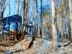
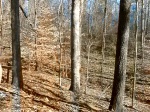
Photos of Crossville Mountain Bike
Recent Trail Reports
| status | trail | date | condition | info | user |
|---|---|---|---|---|---|
| Alley Cat(Short Cut) | Oct 9, 2025 @ 6:17pm (America/Chicago) Oct 9, 2025 | Ideal | RonN5PqgH | ||
| Peter Rabbit | Oct 9, 2025 @ 6:17pm (America/Chicago) Oct 9, 2025 | Unknown | RonN5PqgH | ||
| Rock City | Aug 14, 2025 @ 6:54pm Aug 14, 2025 | Prevalent Mud | RonN5PqgH | ||
| Devil Dog | Aug 14, 2025 @ 6:54pm Aug 14, 2025 | Unknown | RonN5PqgH | ||
| Alley Cat | Jul 26, 2025 @ 8:55am Jul 26, 2025 | Unknown | danielpwithers | ||
| Hurricane | May 23, 2025 @ 6:37pm May 23, 2025 | Variable | RonN5PqgH | ||
| Pioneer Short Loop Cutoff | Jan 3, 2025 @ 2:30pm Jan 3, 2025 | Ideal | RonN5PqgH | ||
| Byrd Lake Trail | Jan 3, 2025 @ 2:30pm Jan 3, 2025 | Ideal | RonN5PqgH | ||
| Return | Dec 28, 2024 @ 1:51pm Dec 28, 2024 | Wet | RonN5PqgH |
Activity Feed
| username | action | type | title | date |
|---|---|---|---|---|
| js1186755 | wishlist | trail | activity #83531594 | Nov 3, 2025 @ 2:57pm Nov 3, 2025 |
| trailszombie | wishlist | region | activity #82984720 | Oct 25, 2025 @ 8:14am Oct 25, 2025 |
| GripDynamite | ridden | trail | activity #82771527 and 1 more | Oct 21, 2025 @ 10:57am Oct 21, 2025 |
| GripTheory | ridden | trail | activity #82763393 and 1 more | Oct 21, 2025 @ 8:54am Oct 21, 2025 |
| RonN5PqgH | add | report | activity #82056534 and 1 more | Oct 10, 2025 @ 4:59am Oct 10, 2025 |
Recent Comments
| username | type | title | comment | date |
|---|---|---|---|---|
| trail | Sad situation for sure , please note this is a... | Sep 21, 2025 @ 3:06pm Sep 21, 2025 | ||
| trail | Trail should be considered abandoned until... | Sep 21, 2025 @ 2:01pm Sep 21, 2025 | ||
| trail | no trees down like the other trails this is... | Aug 9, 2025 @ 12:21pm Aug 9, 2025 | ||
| trail | trees down can’t even get to the entrance | Aug 9, 2025 @ 12:19pm Aug 9, 2025 | ||
| trail | big tree down | Aug 9, 2025 @ 12:19pm Aug 9, 2025 |
Local Badges
-

Epic Mountain Bike Climb 2k0 awarded -

Climbing 10k Badge0 awarded -

Mountain Biking 100k Badge0 awarded -

Epic Ride Descent 2k0 awarded -

Descent 10k Badge0 awarded -

Descent 100k Badge0 awarded
Activity Type Stats
| activitytype | trails | distance | descent | descent distance | total vertical | rating | global rank | state rank | photos | reports | routes | ridelogs |
|---|---|---|---|---|---|---|---|---|---|---|---|---|
| Mountain Bike | 13 | 3 miles | 325 ft | 1 mile | 112 ft | #9,662 | #3,026 | 5 | 77 | 429 | ||
| E-Bike | 13 | 3 miles | 325 ft | 1 mile | 112 ft | #8,963 | #2,744 | 68 | 7 | |||
| Hike | 29 | #8,593 | #3,007 | 65 | 415 | |||||||
| Trail Running | 29 | #12,297 | #4,301 | 65 | 9 |
Frequently Asked Questions About Crossville
▼
What are the best places to ride in Crossville?
Crossville has 4 areas to explore for mountain biking. The top rated areas are:
▼
What are the highest rated mountain biking trails in Crossville?
The highest rated mountain biking trails in Crossville are:
- Peter Rabbit (4.1/5)
- Alley Cat (4/5)
- Devil Dog (3.8/5)
- Hurricane (3.8/5)
- Rock City (3.7/5)
▼
What is the best time of the year to ride in Crossville?
Based on ride log data, the most popular months to ride in Crossville are:
- September (18 activities)
- August (11 activities)
- July (10 activities)
▼
Where can I park to ride in Crossville?
Activities
Trails
- By Wander512 & contributors
- Admins: apply
- #32086 - 3,582 views
- crossville activity log | embed map of Crossville mountain bike trails | crossville mountain biking points of interest
Downloading of trail gps tracks in kml & gpx formats is enabled for Crossville.
You must login to download files.