close
-
Layers w
- Weather Layers
- Pro
- Pro
- Pro
- Pro
- Pro
- Pro
- More Layers
- Pro
- Pro
- Pro
- Pro
-
Upgrade to

3D
Trail Conditions
- Unknown
- Snow Groomed
- Snow Packed
- Snow Covered
- Snow Cover Partial
- Freeze/thaw Cycle
- Icy
- Prevalent Mud
- Wet
- Variable
- Ideal
- Dry
- Very Dry
Trail Flow (Ridden Direction)
Trailforks scans users ridelogs to determine the most popular direction each trail is ridden. A good flowing trail network will have most trails flowing in a single direction according to their intension.
The colour categories are based on what percentage of riders are riding a trail in its intended direction.
The colour categories are based on what percentage of riders are riding a trail in its intended direction.
- > 96%
- > 90%
- > 80%
- > 70%
- > 50%
- < 50%
- bi-directional trail
- no data
Trail Last Ridden
Trailforks scans ridelogs to determine the last time a trail was ridden.
- < 2 days
- < 1 week
- < 2 weeks
- < 1 month
- < 6 months
- > 6 months
Trail Ridden Direction
The intended direction a trail should be ridden.
- Downhill Only
- Downhill Primary
- Both Directions
- Uphill Primary
- Uphill Only
- One Direction
Contribute Details
Colors indicate trail is missing specified detail.
- Description
- Photos
- Description & Photos
- Videos
Trail Popularity ?
Trailforks scans ridelogs to determine which trails are ridden the most in the last 9 months.
Trails are compared with nearby trails in the same city region with a possible 25 colour shades.
Think of this as a heatmap, more rides = more kinetic energy = warmer colors.
- most popular
- popular
- less popular
- not popular
ATV/ORV/OHV Filter
Max Vehicle Width
inches
US Cell Coverage
Legend

Radar Time
Activity Recordings
Trailforks uses anonymized public activity data.
?
Activity Recordings
Trailforks uses anonymized public activity data.
?
Personal Heatmap
▶
Activity Types
all
/
none
▶
Options
2
Date range
month
–
Winter Trails
Warning
A routing network for winter maps does not exist. Selecting trails using the winter trails layer has been disabled.
Missing Trails
Most Popular
Least Popular
Trails are colored based on popularity. The more popular a trail is, the more red. Less popular trails trend towards green.
Jump Magnitude Heatmap
Heatmap of where riders jump on trails. Zoom in to see individual jumps, click circles to view jump details.
BC Backroad Status
![map legend]()
Service Road Atlas is a free to use, community-driven service for viewing and creating reports on the numerous back-country service roads around B.C. and Alberta.

Slope Aspect
Direction the slope faces
Trails Deemphasized
Trails are shown in grey.
Only show trails with no bike usage.
Suggested Layers
Based on selected activity type
Save the current map location and zoom level as your default home location whenever this page is loaded.
Save
No description for Crozet has been added yet!
Login or register to submit one.
This region uses the Uk/Euro style trail grading system.
Activities Click to view
- Mountain Bike
73 trails
- E-Bike
61 trails
- Adaptive Bike
0 trails
- Horse
3 trails
- Hike
60 trails
- Trail Running
61 trails
- Dirtbike/Moto
0 trails
- Observed Trials
0 trails
- ATV/ORV/OHV
0 trails
Region Details
- 12
- 24
- 22
- 9
- 5
Region Status
Open as of Jun 6, 2026Stats
- Avg Trail Rating
- Trails (view details)
- 79
- Trails Mountain Bike
- 73
- Trails E-Bike
- 61
- Trails Horse
- 3
- Trails Hike
- 60
- Trails Trail Running
- 61
- Total Distance
- 46 miles
- Total Descent
- 24,578 ft
- Total Vertical
- 3,226 ft
- Highest Trailhead
- 4,920 ft
- Reports
- 563
- Photos
- 47
- Ridden Counter
- 4,754
Sub Regions
-
Monts Jura
- 11
- 16
- 7
- 5
Popular Crozet Mountain Biking Trails
• 100 ★ 5.0 • 3,291 ft • 0 ft • 198 •
Popular red difficulty singletrack. This mountain bike primary trail can be used downhill only. It features berm, drop and jump. Adaptive MTB rating: amtb black. Trail visibility is always easy to follow. On average it takes 4 minutes to complete this trail.
• 95 ★ 5.0 • 3,228 ft • 0 ft • 195 •
Highly rated popular red difficulty singletrack. This mountain bike primary trail can be used downhill only with a 0 ft blue climb. It features berm, drop, jump and gap jump. Adaptive MTB rating: amtb blue. Trail visibility is always easy to follow. On average it takes 5 minutes to complete this trail.
• 100 ★ 4.3 • 4,091 ft • 0 ft • 185 •
Highly rated popular red difficulty singletrack. This mountain bike primary trail can be used downhill only. It features berm and jump. Trail visibility is always easy to follow. On average it takes 6 minutes to complete this trail.
• 90 ★ 4.8 • 3,013 ft • 0 ft • 183 •
Popular red difficulty singletrack. This mountain bike primary trail can be used downhill primary. It features berm, drop and gap jump. Trail visibility is always easy to follow. On average it takes 5 minutes to complete this trail.
• 95 ★ 5.0 • 2,493 ft • 0 ft • 159 •
Popular black difficulty singletrack. This mountain bike primary trail can be used downhill only. It features drop, jump and rock garden. Trail visibility is always easy to follow. On average it takes 3 minutes to complete this trail.
• 90 ★ 4.5 • 4,065 ft • 0 ft • 140 •
Popular red difficulty singletrack. This mountain bike primary trail can be used downhill primary and has a moderate overall physical rating. It features berm, jump and rock garden. Trail visibility is always easy to follow. On average it takes 10 minutes to complete this trail.
• 100 ★ 5.0 • 3,189 ft • 0 ft • 137 •
Popular green difficulty singletrack. This mountain bike primary trail can be used both directions. Trail visibility is always easy to follow. On average it takes 8 minutes to complete this trail.
• 90 ★ 3.8 • 600 ft • 0 ft • 137 •
Most of it is very easy, but it has a steep end.
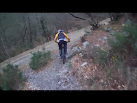
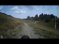
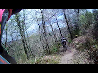
Photos of Crozet Mountain Bike
Videos of Crozet Mountain Bike

trail: la sensible
3:12 |
421 |
Apr 10, 2023

trail: pOle
2:21 |
294 |
Dec 20, 2018
trail: PaCo
6:21 |
155 |
Jul 30, 2017
trail: PaCo
4:03 |
141 |
Feb 27, 2017

trail: VTT FFC #3
0:19 |
220 |
Nov 17, 2016
trail: PaCo
6:15 |
87 |
Aug 30, 2016
trail: PaCo
3:23 |
52 |
Apr 19, 2016

trail: pOle
8:32 |
507 |
Oct 6, 2013
Current Trail Warnings
| status | trail | date | condition | user | info |
|---|---|---|---|---|---|
| Tralala track | Jun 6, 2026 @ 11:51am (Europe/Paris) Jun 6, 2026 | Unknown | menukunz Thun Kandertal | forestry work |
Recent Trail Reports
| status | trail | date | condition | info | user |
|---|---|---|---|---|---|
| pOle2 | May 27, 2026 @ 10:56am (Europe/Paris) May 27, 2026 | Dry | trinyolis | ||
| route forestière | May 27, 2026 @ 10:56am (Europe/Paris) May 27, 2026 | Variable | trinyolis | ||
| Dijo | May 27, 2026 @ 10:56am (Europe/Paris) May 27, 2026 | Ideal | trinyolis | ||
| Vino Rosso | May 27, 2026 @ 10:56am (Europe/Paris) May 27, 2026 | Ideal | trinyolis | ||
| Lynx | May 25, 2026 @ 9:42am (Europe/Zurich) May 25, 2026 | Dry | JeremieZ | ||
| le chalet du fierney | May 25, 2026 @ 9:42am (Europe/Zurich) May 25, 2026 | Ideal | JeremieZ | ||
| La boutique | May 25, 2026 @ 9:42am (Europe/Zurich) May 25, 2026 | Dry | JeremieZ | ||
| PaCo | May 25, 2026 @ 9:42am (Europe/Zurich) May 25, 2026 | Dry | JeremieZ | ||
| Télécabine le Fierney | May 25, 2026 @ 9:42am (Europe/Zurich) May 25, 2026 | Dry | JeremieZ | ||
| Petites Epipngles Crozati alt. | May 25, 2026 @ 9:42am (Europe/Zurich) May 25, 2026 | Dry | JeremieZ |
Activity Feed
| username | action | type | title | date |
|---|---|---|---|---|
| LucasPorter | comment | report | activity #97026051 | Jun 15, 2026 @ 12:09am Jun 15, 2026 |
| MrBeanz | wishlist | region | activity #96662924 | Jun 10, 2026 @ 4:09am Jun 10, 2026 |
| freerider48 | update | trail | activity #96532889 | Jun 8, 2026 @ 5:32am Jun 8, 2026 |
| menukunz | add | report | activity #96350912 | Jun 6, 2026 @ 2:51am Jun 6, 2026 |
| menukunz | ridden | trail | activity #96350872 | Jun 6, 2026 @ 2:50am Jun 6, 2026 |
Recent Comments
| username | type | title | comment | date |
|---|---|---|---|---|
| report | 15.06.2026 ferme / closed for forestry work | Jun 15, 2026 @ 12:09am Jun 15, 2026 | ||
| trail | as stated previousy, it is an amazing trail... | May 20, 2026 @ 12:18am May 20, 2026 | ||
| trail | it's unrideable. it's closed at the top... | May 19, 2026 @ 6:39am May 19, 2026 | ||
| trail | Avoid the first part (not worth it) by going... | Aug 26, 2025 @ 2:02pm Aug 26, 2025 | ||
| trail | One of the best in the area. | Aug 26, 2025 @ 2:02pm Aug 26, 2025 |
Local Badges
-

Epic Ride Climb 2k152 awarded -

Climbing 10k Badge38 awarded -

Climbing 100k Badge0 awarded -

Epic Ride Descent 2k153 awarded -

Descent 10k Badge46 awarded -

Descent 100k Badge0 awarded
Activity Type Stats
| activitytype | trails | distance | descent | descent distance | total vertical | rating | global rank | state rank | photos | reports | routes | ridelogs |
|---|---|---|---|---|---|---|---|---|---|---|---|---|
| Mountain Bike | 73 | 44 miles | 22,438 ft | 25 miles | 3,225 ft | #1,781 | #39 | 47 | 563 | 4,268 | ||
| E-Bike | 61 | 37 miles | 14,337 ft | 18 miles | 3,225 ft | #2,134 | #115 | 551 | 754 | |||
| Horse | 3 | 3 miles | 591 ft | 1 mile | 709 ft | #819 | #34 | 3 | ||||
| Hike | 60 | 35 miles | 14,419 ft | 17 miles | 3,225 ft | #3,617 | #94 | 542 | 224 | |||
| Trail Running | 61 | 37 miles | 14,744 ft | 18 miles | 3,225 ft | #3,106 | #87 | 542 | 283 |
Frequently Asked Questions About Crozet
▼
What are the best places to ride in Crozet?
Crozet has 1 areas to explore for mountain biking. The top rated areas are:
▼
What are the highest rated mountain biking trails in Crozet?
The highest rated mountain biking trails in Crozet are:
- pOle2 (4.6/5)
- pOle (4.5/5)
- Tralala track (4.5/5)
- PaCo (4.4/5)
- La DH du Ghetto (4.4/5)
▼
What is the best time of the year to ride in Crozet?
Based on ride log data, the most popular months to ride in Crozet are:
- October (56 activities)
- September (54 activities)
- July (45 activities)
▼
Where can I park to ride in Crozet?
There are 8 parking locations listed in Crozet. The most popular parking spots are: View all parking and trailhead locations on the map to plan your visit.
Activities
Trails
Points of Interest
- By Chadimac22
 & contributors
 - Admins: Whipperman, freerider48, Tintin916, CaptainSociss
- #14669 - 7,128 views
- crozet activity log | embed map of Crozet mountain bike trails | crozet mountain biking points of interest
Downloading of trail gps tracks in kml & gpx formats is enabled for Crozet.
You must login to download files.