close
-
Layers w
- Weather Layers
- Pro
- Pro
- Pro
- Pro
- Pro
- Pro
- More Layers
- Pro
- Pro
- Pro
- Pro
-
Upgrade to

3D
Trail Conditions
- Unknown
- Snow Groomed
- Snow Packed
- Snow Covered
- Snow Cover Partial
- Freeze/thaw Cycle
- Icy
- Prevalent Mud
- Wet
- Variable
- Ideal
- Dry
- Very Dry
Trail Flow (Ridden Direction)
Trailforks scans users ridelogs to determine the most popular direction each trail is ridden. A good flowing trail network will have most trails flowing in a single direction according to their intension.
The colour categories are based on what percentage of riders are riding a trail in its intended direction.
The colour categories are based on what percentage of riders are riding a trail in its intended direction.
- > 96%
- > 90%
- > 80%
- > 70%
- > 50%
- < 50%
- bi-directional trail
- no data
Trail Last Ridden
Trailforks scans ridelogs to determine the last time a trail was ridden.
- < 2 days
- < 1 week
- < 2 weeks
- < 1 month
- < 6 months
- > 6 months
Trail Ridden Direction
The intended direction a trail should be ridden.
- Downhill Only
- Downhill Primary
- Both Directions
- Uphill Primary
- Uphill Only
- One Direction
Contribute Details
Colors indicate trail is missing specified detail.
- Description
- Photos
- Description & Photos
- Videos
Trail Popularity ?
Trailforks scans ridelogs to determine which trails are ridden the most in the last 9 months.
Trails are compared with nearby trails in the same city region with a possible 25 colour shades.
Think of this as a heatmap, more rides = more kinetic energy = warmer colors.
- most popular
- popular
- less popular
- not popular
ATV/ORV/OHV Filter
Max Vehicle Width
inches
US Cell Coverage
Legend

Radar Time
Activity Recordings
Trailforks uses anonymized public activity data.
?
Activity Recordings
Trailforks uses anonymized public activity data.
?
Personal Heatmap
▶
Activity Types
all
/
none
▶
Options
2
Date range
month
–
Winter Trails
Warning
A routing network for winter maps does not exist. Selecting trails using the winter trails layer has been disabled.
Missing Trails
Most Popular
Least Popular
Trails are colored based on popularity. The more popular a trail is, the more red. Less popular trails trend towards green.
Jump Magnitude Heatmap
Heatmap of where riders jump on trails. Zoom in to see individual jumps, click circles to view jump details.
BC Backroad Status
![map legend]()
Service Road Atlas is a free to use, community-driven service for viewing and creating reports on the numerous back-country service roads around B.C. and Alberta.

Slope Aspect
Direction the slope faces
Trails Deemphasized
Trails are shown in grey.
Only show trails with no bike usage.
Suggested Layers
Based on selected activity type
Save the current map location and zoom level as your default home location whenever this page is loaded.
Save
No description for Cullowhee has been added yet!
Login or register to submit one.
Activities Click to view
- Mountain Bike
11 trails
- Adaptive Bike
1 trails
- Hike
11 trails
- Trail Running
11 trails
Region Details
- 3
- 4
- 4
Region Status
Open as of May 18, 2026Stats
- Avg Trail Rating
- Trails (view details)
- 12
- Trails Mountain Bike
- 11
- Trails Gravel Bike
- 4
- Trails Adaptive Bike
- 1
- Trails Winter Fat Bike
- 1
- Trails Hike
- 11
- Trails Trail Running
- 11
- Trails ATV/ORV/OHV
- 1
- Total Distance
- 41 miles
- Total Descent
- 9,272 ft
- Total Vertical
- 3,453 ft
- Highest Trailhead
- 5,555 ft
- Reports
- 42
- Photos
- 35
- Ridden Counter
- 869
Sub Regions
-
Caney Fork
-
Wayehuta ORV Park
- 1
-
WCU Trail System
- 4
- 3
Popular Cullowhee Mountain Biking Trails
• 65 ★ 5.0 • 2 miles • 217 ft • 119 •
Moderately popular blue difficulty singletrack. This mountain bike primary trail can be used both directions. On average it takes 17 minutes to complete this trail.
• 85 ★ 4.3 • 1 mile • 282 ft • 118 •
Popular blue difficulty singletrack. This mountain bike primary trail can be used both directions. On average it takes 19 minutes to complete this trail.
• 75 ★ 5.0 • 1,978 ft • 51 ft • 99 •
Popular green difficulty singletrack. This mountain bike primary trail can be used both directions. On average it takes 2 minutes to complete this trail.
• 95 ★ 4.7 • 1 mile • 164 ft • 96 •
Popular blue difficulty singletrack. This mountain bike primary trail can be used downhill primary. On average it takes 11 minutes to complete this trail.
• 45 ★ 5.0 • 1,440 ft • 152 ft • 79 •
Moderately popular green difficulty singletrack. This mountain bike primary trail can be used both directions. On average it takes 3 minutes to complete this trail.
• 55 ★ 3.9 • 2 miles • 486 ft • 78 •
Moderately popular green difficulty singletrack. This mountain bike primary trail can be used both directions. On average it takes 19 minutes to complete this trail.
• 100 ★ 2.5 • 686 ft • 37 ft • 74 •
Popular green difficulty singletrack. This mountain bike primary trail can be used both directions. On average it takes minutes to complete this trail.
• 5 ★ 0.0 • 9 miles • 2,064 ft • 2 • • atv
Roller coaster of machine built water bars for ORV access that are smooth jumps for mountain bikes. Big, tall, fast berms and high speeds. Plenty of air time, great visibility. Lots of fun. Previously referred to as the outer loop or on...
Cullowhee Mountain Bike Routes
45 miles • 6,540 ft • 0 • Loop •
Start at East Laporte Park in Jackson County. Cross Highway 107 and turn onto Caney Fork Road. Turn left...
18 miles • 4,022 ft • 0 • Point to Point •
This route takes you from campus all the way up to the parkway.
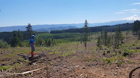
Photos of Cullowhee Mountain Bike
Videos of Cullowhee Mountain Bike
trail: Parking Lot
0:15 |
59 |
Aug 27, 2017

trail: Parking Lot
0:29 |
784 |
Mar 6, 2016

trail: Parking Lot
0:06 |
283 |
Oct 11, 2009

trail: Parking Lot
0:08 |
165 |
Oct 11, 2009

trail: Parking Lot
0:12 |
89 |
Oct 11, 2009
Recent Trail Reports
| status | trail | date | condition | info | user |
|---|---|---|---|---|---|
| Wayehutta - Maximum Whoops Loop | Sep 14, 2025 @ 1:17pm (America/New_York) Sep 14, 2025 | Ideal | backcountryaddict | ||
| Upper Long Branch Loop | Jun 10, 2024 @ 8:28am Jun 10, 2024 | Ideal | Jeremy122776 EBCI | ||
| Gribble Gap Loop | Jun 10, 2024 @ 8:28am Jun 10, 2024 | Ideal | Jeremy122776 EBCI | ||
| Little Savannah Connector | Jun 10, 2024 @ 8:28am Jun 10, 2024 | Ideal | Jeremy122776 EBCI | ||
| Lower Long Branch Loop | Jun 10, 2024 @ 8:28am Jun 10, 2024 | Ideal | Jeremy122776 EBCI | ||
| Cullowhee Connector | Jun 10, 2024 @ 8:28am Jun 10, 2024 | Ideal | Jeremy122776 EBCI | ||
| HHS Connector | Aug 17, 2022 @ 11:43am Aug 17, 2022 | Ideal | ottprime | ||
| Moses Creek Road | Jan 19, 2020 @ 9:41pm Jan 19, 2020 | Variable | cyclingdude4452 | ||
| Corkscrew | Aug 27, 2018 @ 3:14pm Aug 27, 2018 | Dry | hpiguy |
Activity Feed
| username | action | type | title | date |
|---|---|---|---|---|
| MOp0G5CC | ridden | trail | activity #92505847 | Apr 12, 2026 @ 3:43pm Apr 12, 2026 |
| Jiml4uWct | wishlist | trail | activity #92256822 | Apr 9, 2026 @ 8:58am Apr 9, 2026 |
| maelwen | wishlist | trail | activity #89139256 | Feb 18, 2026 @ 12:10pm Feb 18, 2026 |
| srhull | wishlist | region | activity #86469488 | Jan 1, 2026 @ 2:28pm Jan 1, 2026 |
| susan-c | comment | trail | activity #84465732 | Nov 20, 2025 @ 5:51pm Nov 20, 2025 |
Recent Comments
| username | type | title | comment | date |
|---|---|---|---|---|
| trail | three minutes to go up the road and two hours... | Nov 20, 2025 @ 5:51pm Nov 20, 2025 | ||
| trail | Recommend the connector trail be upgraded from... | May 20, 2024 @ 1:45pm May 20, 2024 | ||
| trail | 4/3/24. We did an East Coast high altitude... | Apr 24, 2024 @ 5:38am Apr 24, 2024 | ||
| trail | A well-maintained XC trail. Riding the branch... | Jul 13, 2021 @ 6:07am Jul 13, 2021 | ||
| trail | A well-maintained and fun XC trail. Riding the... | Jul 13, 2021 @ 6:05am Jul 13, 2021 |
Local Badges
-

Epic Ride Climb 2k43 awarded -

Climbing 10k Badge15 awarded -

Climbing 100k Badge3 awarded -

Epic Ride Descent 2k42 awarded -

Descent 10k Badge15 awarded -

Descent 100k Badge3 awarded
Activity Type Stats
| activitytype | trails | distance | descent | descent distance | total vertical | rating | global rank | state rank | photos | reports | routes | ridelogs |
|---|---|---|---|---|---|---|---|---|---|---|---|---|
| Mountain Bike | 11 | 41 miles | 9,272 ft | 19 miles | 3,314 ft | #3,636 | #1,237 | 35 | 41 | 2 | 3,511 | |
| Gravel Bike | 4 | 34 miles | 8,314 ft | 17 miles | 3,219 ft | #2,707 | #1,113 | 2 | 4 | |||
| Adaptive Bike | 1 | 446 ft | 49 ft | #2,716 | #181 | |||||||
| Winter Fat Bike | 1 | 9 miles | 2,028 ft | 4 miles | 1,726 ft | #2,707 | #1,113 | |||||
| Hike | 11 | 33 miles | 7,244 ft | 15 miles | 3,451 ft | #6,713 | #2,368 | 41 | 1 | 354 | ||
| Trail Running | 11 | 33 miles | 7,244 ft | 15 miles | 3,451 ft | #6,241 | #2,012 | 41 | 1 | 43 | ||
| ATV/ORV/OHV | 1 | 9 miles | 2,028 ft | 4 miles | 1,726 ft | 7 |
Frequently Asked Questions About Cullowhee
▼
What are the best places to ride in Cullowhee?
Cullowhee has 3 areas to explore for mountain biking. The top rated areas are:
▼
What are the highest rated mountain biking trails in Cullowhee?
The highest rated mountain biking trails in Cullowhee are:
- Little Savannah Connector (4.2/5)
- Upper Long Branch Loop (4.2/5)
- HHS Connector (4.2/5)
- Gribble Gap Loop (4.2/5)
- Lower Long Branch Loop (4.1/5)
▼
What is the best time of the year to ride in Cullowhee?
Based on ride log data, the most popular months to ride in Cullowhee are:
- October (63 activities)
- November (41 activities)
- September (35 activities)
▼
Where can I park to ride in Cullowhee?
There are 3 parking locations listed in Cullowhee. The most popular parking spots are: View all parking and trailhead locations on the map to plan your visit.
Trails
Points of Interest
- By blowmyfuse
 & contributors
 - Admins: apply
- #8897 - 4,068 views
- cullowhee activity log | embed map of Cullowhee mountain bike trails | cullowhee mountain biking points of interest polygons
Downloading of trail gps tracks in kml & gpx formats is enabled for Cullowhee.
You must login to download files.