close
-
Layers w
- Weather Layers
- Pro
- Pro
- Pro
- Pro
- Pro
- Pro
- More Layers
- Pro
- Pro
- Pro
- Pro
-
Upgrade to

3D
Trail Conditions
- Unknown
- Snow Groomed
- Snow Packed
- Snow Covered
- Snow Cover Partial
- Freeze/thaw Cycle
- Icy
- Prevalent Mud
- Wet
- Variable
- Ideal
- Dry
- Very Dry
Trail Flow (Ridden Direction)
Trailforks scans users ridelogs to determine the most popular direction each trail is ridden. A good flowing trail network will have most trails flowing in a single direction according to their intension.
The colour categories are based on what percentage of riders are riding a trail in its intended direction.
The colour categories are based on what percentage of riders are riding a trail in its intended direction.
- > 96%
- > 90%
- > 80%
- > 70%
- > 50%
- < 50%
- bi-directional trail
- no data
Trail Last Ridden
Trailforks scans ridelogs to determine the last time a trail was ridden.
- < 2 days
- < 1 week
- < 2 weeks
- < 1 month
- < 6 months
- > 6 months
Trail Ridden Direction
The intended direction a trail should be ridden.
- Downhill Only
- Downhill Primary
- Both Directions
- Uphill Primary
- Uphill Only
- One Direction
Contribute Details
Colors indicate trail is missing specified detail.
- Description
- Photos
- Description & Photos
- Videos
Trail Popularity ?
Trailforks scans ridelogs to determine which trails are ridden the most in the last 9 months.
Trails are compared with nearby trails in the same city region with a possible 25 colour shades.
Think of this as a heatmap, more rides = more kinetic energy = warmer colors.
- most popular
- popular
- less popular
- not popular
ATV/ORV/OHV Filter
Max Vehicle Width
inches
US Cell Coverage
Legend

Radar Time
Activity Recordings
Trailforks uses anonymized public activity data.
?
Activity Recordings
Trailforks uses anonymized public activity data.
?
Personal Heatmap
▶
Activity Types
all
/
none
▶
Options
2
Date range
month
–
Winter Trails
Warning
A routing network for winter maps does not exist. Selecting trails using the winter trails layer has been disabled.
Missing Trails
Most Popular
Least Popular
Trails are colored based on popularity. The more popular a trail is, the more red. Less popular trails trend towards green.
Jump Magnitude Heatmap
Heatmap of where riders jump on trails. Zoom in to see individual jumps, click circles to view jump details.
BC Backroad Status
![map legend]()
Service Road Atlas is a free to use, community-driven service for viewing and creating reports on the numerous back-country service roads around B.C. and Alberta.

Slope Aspect
Direction the slope faces
Trails Deemphasized
Trails are shown in grey.
Only show trails with no bike usage.
Suggested Layers
Based on selected activity type
Save the current map location and zoom level as your default home location whenever this page is loaded.
SaveNestled in the foothills of the Beaufort Range beneath the shadow of the Comox Glacier, the historic Village of Cumberland invites you to come experience our rich history and our bright future The mix of mining and logging history has led to a vast network of old roads that are now intermixed with an ample amount of singletrack.
Cumberland has become a mecca for riders on Vancouver Island and beyond. With the most varied selection of trails, easy access and a fabulous trail crew, it should become a regular destination for mountain bikers throughout BC and western Canada.
Be sure to visit a bike shop in Cumberland or the Comox Valley Visitor Centre to pickup one of the Cumberland trail maps!
Primary Trail Type: All-Mountain & Downhill
Land Status: Managed by Local Riding Association
 google parking directions
 Access Info:
CRI gravel parking lot located at Dunsmuir Ave. and Sutton Rd.
Links
Activities Click to view
- Mountain Bike
215 trails
- E-Bike
218 trails
- Hike
207 trails
- Trail Running
207 trails
Region Details
- 48
- 2
- 5
- 87
- 47
- 17
Region Status
Open as of 5 hoursLocal Trail Association
Stats
- Avg Trail Rating
- Trails (view details)
- 207
- Trails Mountain Bike
- 220
- Trails E-Bike
- 218
- Trails Hike
- 207
- Trails Trail Running
- 207
- Trails Dirtbike/Moto
- 1
- Trails ATV/ORV/OHV
- 1
- Total Distance
- 128 miles
- Total Descent
- 25,470 ft
- Total Vertical
- 1,844 ft
- Highest Trailhead
- 2,309 ft
- Reports
- 15,045
- Photos
- 3,055
- Ridden Counter
- 425,705
Articles
5 Years in the Making: Cumberland Opens Their Most Ambitious Backcountry Trail Project Yet
Jun 6, 2026 from pinkbike.com
Expanding what's possible in a working forest, Cumberland's newest backcountry-style loop introduces long alpine descents, high-speed loam, and...
Race Report: Disera Makes it 2-1 Against the GOAT as Holcomb Dominates Cumberland's Mud-Soaked Queen Stage
May 26, 2026 from pinkbike.com
Rain turns the Queen Stage into a slick, technical gauntlet where Peter Disera edges out Nino Schurter 2-1 and Ruth Holcomb extends her overall lead.

Video: Dylan Siggers Gets Tricky in 'Don't Tap The Glass '
Mar 31, 2026 from pinkbike.com
Stunts on stunts on stunts.
Video: Five Days In Vacation Town With The Forbidden Bikes Crew
Jan 27, 2026 from pinkbike.com
All the summer good vibes as the Forbidden crew rides some of Cumberland and the surrounding area’s finest.
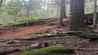
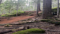
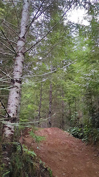
Popular Cumberland trail network Mountain Biking Trails
• 100 ★ 4.8 • 1 mile • 384 ft • 8,159 •
祖母の道 - "Sobo No Michi" means "Grandmothers Path" (Trail/Road) in Japanese. It is the first trail in Cumberland to be named after Japanese Canadian Pioneers. Built by Bill McLane of Workhorse Trail design through the vision of...
• 100 ★ 4.9 • 2 miles • 582 ft • 7,641 •
祖母の道 - "Sobo No Michi" means "Grandmothers Path" (Trail/Road) in Japanese. It is the first trail in Cumberland to be named after Japanese Canadian Pioneers. Built by Bill McLane of Workhorse Trail design through the vision of...
• 100 ★ 4.1 • 2,075 ft • 42 ft • 7,087 •
Highly rated popular blue difficulty singletrack. This mountain bike primary trail and has a moderate overall physical rating. It features a-frame, bridge, drop, teeter totter and wallride. On average it takes 4 minutes to complete this trail.
• 100 ★ 3.4 • 791 ft • 11 ft • 6,932 •
Connector trail to cross the creek from to trails on the other side. At the north end of the trail, turn left to follow the doubletrack to Sunset Strip, and Short and Curly. Or turn right to connect to and .
• 100 ★ 4.0 • 1,365 ft • 11 ft • 6,775 •
Popular blue difficulty singletrack. This mountain bike primary trail and has a moderate overall physical rating. It features bridge. On average it takes 2 minutes to complete this trail.
• 100 ★ 4.6 • 2,772 ft • 19 ft • 6,718 •
The orginal flow trail through the middle of the network joining from to . Good for a broad range of riders, a few viewpoints and some fun berms.
• 95 ★ 4.2 • 1,647 ft • 0 ft • 6,699 •
Highly rated popular blue difficulty singletrack. This mountain bike primary trail and has a moderate overall physical rating. It features bridge, jump and skinny. On average it takes 1 minutes to complete this trail.
• 100 ★ 4.5 • 3,579 ft • 10 ft • 6,445 •
Lower section of Vanilla - continues across road with big berms and sweeping turns to intersection with Shortline.
Cumberland trail network Mountain Bike Routes
★ 5.0 • 2 miles • 77 ft • 5 •
UROC Fiver series presented by Fox and supported by our Comox Valley bike stores. All riders who complete...
★ 4.0 • 14 miles • 2,965 ft • 17 •
The Cumberland EPIC is a big, backcountry-style loop that links the highest and best outer trails in the...
★ 4.0 • 3 miles • 390 ft • 8 •
UROC Fiver series presented by Fox and supported by our Comox Valley bike stores. All riders who complete...
★ 4.5 • 7 miles • 1,495 ft • 7 •
This is the suggested route to complete the required trails for the 2021 United Riders of Cumberland(UROC)...
★ 5.0 • 2 miles • 22 ft • 3 •
UROC Fiver series presented by Fox and supported by our Comox Valley bike stores. All riders who complete...
★ 3.9 • 13 miles • 2,347 ft • 14 • Loop •
This is a yet another classic epic expert level ride in Cumberland, BC featuring Further Burger, and . For...
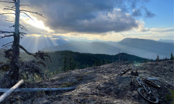
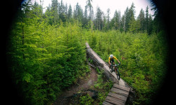
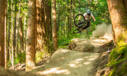
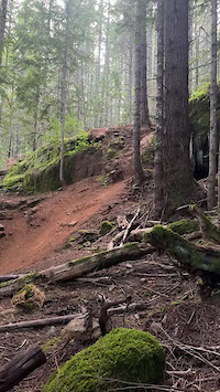
Photos of Cumberland trail network Mountain Bike
Videos of Cumberland trail network Mountain Bike

trail: Chunder
3:15 |
242 |
Aug 5, 2025

trail: Chunder
0:12 |
|
Sep 22, 2024
trail: Chunder
0:12 |
|
Sep 21, 2024
trail: Chunder
0:12 |
|
Sep 21, 2024
trail: Chunder
0:12 |
|
Sep 21, 2024

trail: Lower Roughneck
3:51 |
83 |
May 30, 2023

trail: Six Pack
0:08 |
101 |
Apr 2, 2023
trail: Off Broadway
0:10 |
238 |
Feb 11, 2023
Recent Trail Reports
| status | trail | date | condition | info | user |
|---|---|---|---|---|---|
| Iron Curtain | Jun 17, 2026 @ 10:04am (America/Vancouver) 5 hours | Ideal | ColbyBergen | ||
| Captains' Log | Jun 17, 2026 @ 10:04am (America/Vancouver) 5 hours | Ideal | ColbyBergen | ||
| Double Pumper | Jun 17, 2026 @ 10:04am (America/Vancouver) 5 hours | Dry | ColbyBergen | ||
| Upper Crafty Butcher | Jun 17, 2026 @ 10:04am (America/Vancouver) 5 hours | Ideal | ColbyBergen | ||
| Trestle | Jun 17, 2026 @ 10:04am (America/Vancouver) 5 hours | Ideal | ColbyBergen | ||
| Middle Vanilla | Jun 17, 2026 @ 10:04am (America/Vancouver) 5 hours | Ideal | ColbyBergen | ||
| Old Vanilla | Jun 17, 2026 @ 10:04am (America/Vancouver) 5 hours | Ideal | ColbyBergen | ||
| Short Guts | Jun 17, 2026 @ 10:04am (America/Vancouver) 5 hours | Dry | ColbyBergen | ||
| Sobo no Michi - Climbing Trail - Lower Section | Jun 17, 2026 @ 10:04am (America/Vancouver) 5 hours | Dry | ColbyBergen | ||
| Water Main trail | Jun 17, 2026 @ 10:04am (America/Vancouver) 5 hours | Dry | ColbyBergen |
Activity Feed
| username | action | type | title | date |
|---|---|---|---|---|
| eastfyfes | add | video | activity #97211718 | Jun 17, 2026 @ 3:09pm 16 mins |
| ColbyBergen | add | report | activity #97206038 and 9 more | Jun 17, 2026 @ 1:18pm 2 hours |
| Type2meister | wishlist | route | activity #97200056 | Jun 17, 2026 @ 11:47am 4 hours |
| Patbush | wishlist | trail | activity #97195513 and 1 more | Jun 17, 2026 @ 10:46am 5 hours |
| DougalB | update | trail | activity #97188920 and 1 more | Jun 17, 2026 @ 9:15am 6 hours |
Recent Comments
| username | type | title | comment | date |
|---|---|---|---|---|
| trail | More technical than Upper, but with longer... | Jun 6, 2026 @ 12:52pm Jun 6, 2026 | ||
| trail | I would say it’s a black trail. Punchy... | Jun 6, 2026 @ 12:49pm Jun 6, 2026 | ||
| report | Packed down and raked. Need rain | May 31, 2026 @ 4:43pm May 31, 2026 | ||
| report | Yn | May 23, 2026 @ 12:50pm May 23, 2026 | ||
| trail | Bear hanging out where it forks into teacup. | May 18, 2026 @ 6:21pm May 18, 2026 |
Nearby Areas
| name | distance | ||||
|---|---|---|---|---|---|
| Cumberland Moto | 2.5 km | ||||
| The Vortex | 10 | 40 | 8 | 4 km | |
| Forbidden Plateau | 10 | 18 | 50 | 4 | 4.8 km |
| Nymph Falls Park | 5 km | ||||
| Chinook Forest Woodlands | 12 | 9 | 5 km |
Local Badges
-
Cumberland Epic - Ultimatums0 awarded -
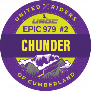
Cumberland EPIC - Chunder, Prohibition0 awarded -
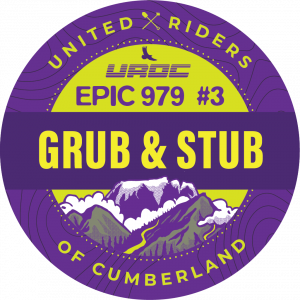
Cumberland EPIC - Grub, Stub, Pity the Fool0 awarded -
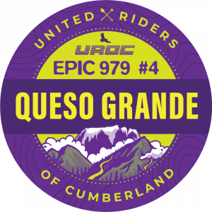
Cumberland EPIC - Queso's0 awarded -

Completionist17 awarded
Bike & Skill Parks
| name | type | city | rating |
|---|---|---|---|
| Village Park Dirt Jump and Skate Park | skill park | Cumberland |
Local Trail Supporters
- UROC/Trail Harvest Crew/DMR/River Rats
- River Rats
![]()
- UROC/Trail Harvest Crew/DMR
![]()
- UROC/CS/DMR/River Rats
Activity Type Stats
| activitytype | trails | distance | descent | descent distance | total vertical | rating | global rank | state rank | photos | reports | routes | ridelogs |
|---|---|---|---|---|---|---|---|---|---|---|---|---|
| Mountain Bike | 215 | 127 miles | 25,436 ft | 62 miles | 1,844 ft | #4 | #2 | 2,991 | 15,093 | 83 | 185,124 | |
| E-Bike | 218 | 127 miles | 25,436 ft | 62 miles | 1,844 ft | #33 | #17 | 14 | 13,531 | 2 | 9,174 | |
| Hike | 207 | 122 miles | 22,362 ft | 57 miles | 1,844 ft | #171 | #17 | 23 | 14,981 | 2 | 3,367 | |
| Trail Running | 207 | 122 miles | 22,362 ft | 57 miles | 1,844 ft | #31 | #7 | 22 | 14,993 | 12 | 17,192 | |
| Dirtbike/Moto | 1 | 3,750 ft | 52 ft | 1,844 ft | 56 ft | 1 | 3,543 | 99 | ||||
| ATV/ORV/OHV | 1 | 3,750 ft | 52 ft | 1,844 ft | 56 ft | 3,541 | 20 |
Frequently Asked Questions About Cumberland trail network
▼
What are the highest rated mountain biking trails in Cumberland trail network?
The highest rated mountain biking trails in Cumberland trail network are:
- Sobo no Michi - Climbing Trail - Upper Section (4.8/5)
- Sobo no Michi - Climbing Trail - Lower Section (4.7/5)
- New Vanilla (4.7/5)
- Blueprint (4.6/5)
- Numbskulls (4.6/5)
▼
What is the best time of the year to ride in Cumberland trail network?
Based on ride log data, the most popular months to ride in Cumberland trail network are:
- July (3,753 activities)
- August (2,797 activities)
- June (2,376 activities)
▼
Where can I park to ride in Cumberland trail network?
There are 3 parking locations listed in Cumberland trail network. The most popular parking spots are: View all parking and trailhead locations on the map to plan your visit.
▼
What is the longest trail in Cumberland trail network?
The longest trail in Cumberland trail network is Rapture Genisis at 2.7 km. View all trails sorted by distance.
Activities
Trails
- Hard trails in Cumberland trail network
- Easy trails in Cumberland trail network
- Favorite trails in Cumberland trail network
- Most ridden trails in Cumberland trail network
- Singletrack in Cumberland trail network
- Viewpoint trails in Cumberland trail network
- Trails with technical features in Cumberland trail network
- Race routes in Cumberland trail network
- By primodeelux
 & contributors
 - Admins: DougalB, VoC, UROC, benjohnstone, DougalB
- #382 - 210,819 views
- cumberland trail network activity log | embed map of Cumberland trail network mountain bike trails | cumberland trail network mountain biking points of interest
Downloading of trail gps tracks in kml & gpx formats is enabled for Cumberland trail network.
You must login to download files.