close
-
Layers w
- Weather Layers
- Pro
- Pro
- Pro
- Pro
- Pro
- Pro
- More Layers
- Pro
- Pro
- Pro
- Pro
-
Upgrade to

3D
Trail Conditions
- Unknown
- Snow Groomed
- Snow Packed
- Snow Covered
- Snow Cover Partial
- Freeze/thaw Cycle
- Icy
- Prevalent Mud
- Wet
- Variable
- Ideal
- Dry
- Very Dry
Trail Flow (Ridden Direction)
Trailforks scans users ridelogs to determine the most popular direction each trail is ridden. A good flowing trail network will have most trails flowing in a single direction according to their intension.
The colour categories are based on what percentage of riders are riding a trail in its intended direction.
The colour categories are based on what percentage of riders are riding a trail in its intended direction.
- > 96%
- > 90%
- > 80%
- > 70%
- > 50%
- < 50%
- bi-directional trail
- no data
Trail Last Ridden
Trailforks scans ridelogs to determine the last time a trail was ridden.
- < 2 days
- < 1 week
- < 2 weeks
- < 1 month
- < 6 months
- > 6 months
Trail Ridden Direction
The intended direction a trail should be ridden.
- Downhill Only
- Downhill Primary
- Both Directions
- Uphill Primary
- Uphill Only
- One Direction
Contribute Details
Colors indicate trail is missing specified detail.
- Description
- Photos
- Description & Photos
- Videos
Trail Popularity ?
Trailforks scans ridelogs to determine which trails are ridden the most in the last 9 months.
Trails are compared with nearby trails in the same city region with a possible 25 colour shades.
Think of this as a heatmap, more rides = more kinetic energy = warmer colors.
- most popular
- popular
- less popular
- not popular
ATV/ORV/OHV Filter
Max Vehicle Width
inches
US Cell Coverage
Legend

Radar Time
Activity Recordings
Trailforks uses anonymized public activity data.
?
Activity Recordings
Trailforks uses anonymized public activity data.
?
Personal Heatmap
▶
Activity Types
all
/
none
▶
Options
2
Date range
month
–
Winter Trails
Warning
A routing network for winter maps does not exist. Selecting trails using the winter trails layer has been disabled.
Missing Trails
Most Popular
Least Popular
Trails are colored based on popularity. The more popular a trail is, the more red. Less popular trails trend towards green.
Jump Magnitude Heatmap
Heatmap of where riders jump on trails. Zoom in to see individual jumps, click circles to view jump details.
BC Backroad Status
![map legend]()
Service Road Atlas is a free to use, community-driven service for viewing and creating reports on the numerous back-country service roads around B.C. and Alberta.

Slope Aspect
Direction the slope faces
Trails Deemphasized
Trails are shown in grey.
Only show trails with no bike usage.
Suggested Layers
Based on selected activity type
Save the current map location and zoom level as your default home location whenever this page is loaded.
Save
No description for Cumbria has been added yet!
Login or register to submit one.
This region uses the Uk/Euro style trail grading system.
Activities Click to view
- Mountain Bike
322 trails
- E-Bike
169 trails
- Horse
54 trails
- Hike
228 trails
- Trail Running
246 trails
Stats
- Avg Trail Rating
- Trails (view details)
- 329
- Trails Mountain Bike
- 322
- Trails E-Bike
- 169
- Trails Horse
- 54
- Trails Hike
- 228
- Trails Trail Running
- 246
- Trails Nordic Ski
- 1
- Total Distance
- 188 miles
- Total Descent
- 71,569 ft
- Total Vertical
- 3,031 ft
- Highest Trailhead
- 3,090 ft
- Reports
- 1,785
- Photos
- 1,617
- Ridden Counter
- 70,898
Articles
Race Report: Tracy Moseley Wins the PMBA Enduro at Grizedale
Oct 9, 2019 from pinkbike.com
Grizedale provided the toughest trails of the year at the Hope PMBA Enduro Series finale
Sub Regions
- Ambleside (3)
- Armathwaite (28)
- Carlisle (0)
- Cleator Moor (71)
- Dent (71)
- Cockermouth (54)
- Setmurthy Woods (47)
- Egremont (7)
- Ennerdale Bridge (1)
- Grizedale (1)
- Hawkshead (55)
- Grizedale Forest (36)
- Kendal (14)
- Farleton (6)
- Keswick (77)
- Whinlatter (56)
- Mill Side (3)
- Penrith (2)
- Ennerdale Valley (0)
- GNAR Bike Park (4)
- Lake District National Park (0)
- Staveley (6)
Popular Cumbria Mountain Biking Trails
• 95 ★ 3.8 • 1 mile • 85 ft • 1,855 •
Starts off fast with mellow berms, before a still fast but more technical section in the trees, with turns, rock rolls, and small kickers, stumps etc that you can gap off if looking for extra fun or that faster line. Has a flattish...
• 100 ★ 4.4 • 4,285 ft • 11 ft • 1,853 •
Short section traverses through the trees before opening out into exposed descent with views across the valley. On hardpack / gravel this fast descent goes through well-built berms with several switchbacks to finish the Loop. Optional...
• 90 ★ 3.4 • 1 mile • 240 ft • 1,816 •
Popular red difficulty singletrack. This mountain bike primary trail can be used downhill primary. On average it takes 12 minutes to complete this trail.
• 95 ★ 3.6 • 2,457 ft • 54 ft • 1,728 •
Popular red difficulty singletrack. This mountain bike primary trail can be used downhill primary. On average it takes 2 minutes to complete this trail.
• 90 ★ 3.3 • 4,283 ft • 309 ft • 1,659 •
Popular red difficulty singletrack. This mountain bike primary trail can be used one direction. On average it takes 10 minutes to complete this trail.
• 95 ★ 3.7 • 3,521 ft • 249 ft • 1,655 •
Popular red difficulty singletrack. This mountain bike primary trail can be used uphill only. On average it takes 8 minutes to complete this trail.
• 100 ★ 4.1 • 3,556 ft • 3 ft • 1,629 •
Highly rated popular red difficulty singletrack. This mountain bike primary trail can be used downhill primary. On average it takes 3 minutes to complete this trail.
• 100 ★ 3.0 • 482 ft • 0 ft • 1,567 •
Popular red difficulty singletrack. This mountain bike primary trail can be used downhill primary. On average it takes minutes to complete this trail.
Cumbria Mountain Bike Routes
★ 4.4 • 11 miles • 1,358 ft • 1 • Loop •
Mostly off-road loop around Kentmere from Staveley.
★ 3.0 • 17 miles • 2,654 ft • 4 • Loop •
Great loop around the southern areas of the forest taking in the Parkamoor descent, Breasty Haw and parts of .
★ 4.0 • 7 miles • 1,115 ft • 11 • Loop •
A train track for a five stage Enduro, easy but fun.
★ 3.0 • 6 miles • 909 ft • 15 • Loop •
Waymarked, with 200 metres height gain of climbing. This is a singletrack trail, with steep climbs,...
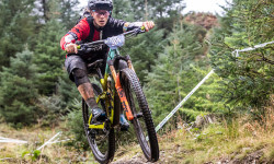
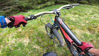
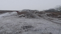
Photos of Cumbria Mountain Bike
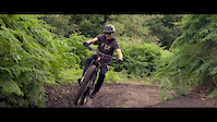
Videos of Cumbria Mountain Bike
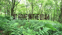
trail: Loam!
3:26 |
152 |
Jun 8, 2021

trail: Grisedale Valley
9:22 |
72 |
Apr 20, 2021
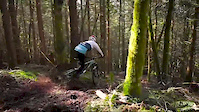
trail: Loam!
0:14 |
1034 |
Jan 8, 2021
trail: Loam!
3:01 |
70 |
Aug 2, 2020
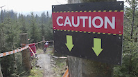
trail: Loam!
0:49 |
9550 |
Jun 14, 2020
trail: Loam sweet loam
0:00 |
2485 |
Apr 11, 2020
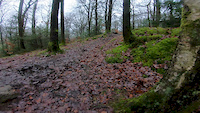
trail: Satterthwaite DH
0:13 |
977 |
Jan 28, 2020
trail: Link
4:56 |
1203 |
Apr 9, 2019
Current Trail Warnings
| status | trail | date | condition | user | info |
|---|---|---|---|---|---|
| Dirty Harry Dent | Jun 5, 2026 @ 12:21pm (Europe/London) Jun 5, 2026 | Wet | bishwasps | Large tree down across trail, blocking trail |
Recent Trail Reports
Activity Feed
| username | action | type | title | date |
|---|---|---|---|---|
| chrisgreenbank | add | trail | activity #97302508 | Jun 19, 2026 @ 1:20am 6 hours |
| K24STE | ridden | trail | activity #97134773 and 1 more | Jun 16, 2026 @ 1:27pm 3 days |
| K24STE | comment | trail | activity #97134670 | Jun 16, 2026 @ 1:25pm 3 days |
| K24STE | add | report | activity #97134275 | Jun 16, 2026 @ 1:18pm 3 days |
| jode | wishlist | trail | activity #97118261 | Jun 16, 2026 @ 9:50am 3 days |
Recent Comments
| username | type | title | comment | date |
|---|---|---|---|---|
| trail | a good descent, a tree is down near the top... | Jun 16, 2026 @ 1:25pm 3 days | ||
| trail | few trees down to the east of mainline. its... | Jun 1, 2026 @ 12:52pm Jun 1, 2026 | ||
| trail | more of a walkers path than anything you would... | Jun 1, 2026 @ 12:51pm Jun 1, 2026 | ||
| trail | closed due to lack of use | Jun 1, 2026 @ 12:50pm Jun 1, 2026 | ||
| trail | trail no longer exists | Jun 1, 2026 @ 12:50pm Jun 1, 2026 |
Local Badges
-

Mountain Biking 100k Badge0 awarded -

Epic Mountain Bike Climb 2k5 awarded -

Climbing 10k Badge14 awarded -
Climbing 10k Badge5 awarded -
Mountain Biking 100k Badge0 awarded -

Epic Ride Descent 2k5 awarded
Bike & Skill Parks
| name | type | city | rating |
|---|---|---|---|
| GNAR Bike Park | bike park | Carlisle | |
| Bootle Pumptrack | skill park | Hawkshead | |
| Keswick BMX Track | skill park | Keswick | |
| Seascale Pumptrack | skill park | Hawkshead |
Local Trail Supporters
- North Face
Activity Type Stats
| activitytype | trails | distance | descent | descent distance | total vertical | rating | global rank | state rank | photos | reports | routes | ridelogs |
|---|---|---|---|---|---|---|---|---|---|---|---|---|
| Mountain Bike | 322 | 170 miles | 66,467 ft | 100 miles | 3,031 ft | 1,609 | 1,783 | 26 | 74,932 | |||
| E-Bike | 169 | 61 miles | 24,905 ft | 34 miles | 2,907 ft | 1,434 | 8 | 9,433 | ||||
| Horse | 54 | 26 miles | 7,526 ft | 11 miles | 961 ft | 229 | ||||||
| Hike | 228 | 159 miles | 56,339 ft | 91 miles | 3,031 ft | 1,566 | 3 | 13,242 | ||||
| Trail Running | 246 | 164 miles | 58,097 ft | 94 miles | 3,031 ft | 1,593 | 2 | 2,997 | ||||
| Nordic Ski | 1 | 11 |
Frequently Asked Questions About Cumbria
▼
What are the best places to ride in Cumbria?
Cumbria has 9 areas to explore for mountain biking. The top rated areas are:
▼
What are the highest rated mountain biking trails in Cumbria?
The highest rated mountain biking trails in Cumbria are:
- Grandad, Dad and The Dentist (4.4/5)
- Sticks Pass (4.3/5)
- Superanoodle (4.3/5)
- Golden Shower (4.3/5)
- #loamoerotic (4.3/5)
▼
What is the best time of the year to ride in Cumbria?
Based on ride log data, the most popular months to ride in Cumbria are:
- July (273 activities)
- August (182 activities)
- April (160 activities)
▼
What is the longest trail in Cumbria?
The longest trail in Cumbria is The North Face Trail at 7.8 miles. View all trails sorted by distance.
Activities
Trails
- By brenthillier
 NSMBA TRAILFORKS & contributors
 - Admins: UKTP, 20twenty-p, wisey, MathieuC, cemoorelife
- #6820 - 19,755 views
- cumbria activity log | embed map of Cumbria mountain bike trails | cumbria mountain biking points of interest
Downloading of trail gps tracks in kml & gpx formats is enabled for Cumbria.
You must login to download files.