close
-
Layers w
- Weather Layers
- Pro
- Pro
- Pro
- Pro
- Pro
- Pro
- More Layers
- Pro
- Pro
- Pro
- Pro
-
Upgrade to

3D
Trail Conditions
- Unknown
- Snow Groomed
- Snow Packed
- Snow Covered
- Snow Cover Partial
- Freeze/thaw Cycle
- Icy
- Prevalent Mud
- Wet
- Variable
- Ideal
- Dry
- Very Dry
Trail Flow (Ridden Direction)
Trailforks scans users ridelogs to determine the most popular direction each trail is ridden. A good flowing trail network will have most trails flowing in a single direction according to their intension.
The colour categories are based on what percentage of riders are riding a trail in its intended direction.
The colour categories are based on what percentage of riders are riding a trail in its intended direction.
- > 96%
- > 90%
- > 80%
- > 70%
- > 50%
- < 50%
- bi-directional trail
- no data
Trail Last Ridden
Trailforks scans ridelogs to determine the last time a trail was ridden.
- < 2 days
- < 1 week
- < 2 weeks
- < 1 month
- < 6 months
- > 6 months
Trail Ridden Direction
The intended direction a trail should be ridden.
- Downhill Only
- Downhill Primary
- Both Directions
- Uphill Primary
- Uphill Only
- One Direction
Contribute Details
Colors indicate trail is missing specified detail.
- Description
- Photos
- Description & Photos
- Videos
Trail Popularity ?
Trailforks scans ridelogs to determine which trails are ridden the most in the last 9 months.
Trails are compared with nearby trails in the same city region with a possible 25 colour shades.
Think of this as a heatmap, more rides = more kinetic energy = warmer colors.
- most popular
- popular
- less popular
- not popular
ATV/ORV/OHV Filter
Max Vehicle Width
inches
US Cell Coverage
Legend

Radar Time
Activity Recordings
Trailforks uses anonymized public activity data.
?
Activity Recordings
Trailforks uses anonymized public activity data.
?
Personal Heatmap
▶
Activity Types
all
/
none
▶
Options
2
Date range
month
–
Winter Trails
Warning
A routing network for winter maps does not exist. Selecting trails using the winter trails layer has been disabled.
Missing Trails
Most Popular
Least Popular
Trails are colored based on popularity. The more popular a trail is, the more red. Less popular trails trend towards green.
Jump Magnitude Heatmap
Heatmap of where riders jump on trails. Zoom in to see individual jumps, click circles to view jump details.
BC Backroad Status
![map legend]()
Service Road Atlas is a free to use, community-driven service for viewing and creating reports on the numerous back-country service roads around B.C. and Alberta.

Slope Aspect
Direction the slope faces
Trails Deemphasized
Trails are shown in grey.
Only show trails with no bike usage.
Suggested Layers
Based on selected activity type
Save the current map location and zoom level as your default home location whenever this page is loaded.
Save
No description for Cumming has been added yet!
Login or register to submit one.
Activities Click to view
- Mountain Bike
26 trails
- E-Bike
19 trails
- Adaptive Bike
0 trails
- Horse
0 trails
- Hike
42 trails
- Trail Running
42 trails
Region Details
- 10
- 11
- 3
Region Status
Open as of Sep 18, 2025Stats
- Avg Trail Rating
- Trails (view details)
- 40
- Trails Mountain Bike
- 26
- Trails E-Bike
- 19
- Trails Hike
- 42
- Trails Trail Running
- 42
- Total Distance
- 39 miles
- Total Descent
- 2,785 ft
- Total Vertical
- 778 ft
- Highest Trailhead
- 1,747 ft
- Reports
- 340
- Photos
- 224
- Ridden Counter
- 2,631
Sub Regions
-
Central Park
-
Charleston Park
- 4
- 3
-
Eagle's Beak Park
-
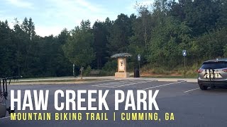
Haw Creek Park
- 2
-
Matt Community Park
- 5
Popular Cumming Mountain Biking Trails
• 100 ★ 4.3 • 4 miles • 313 ft • 274 •
Lots of smooth flowing dirt through some dense forest with fast ups and downs. Well used trails with some exposed roots keeps it fun. Long bridges to connect the trail systems are kind of cool.
• 95 ★ 4.0 • 1,306 ft • 6 ft • 265 •
Popular green difficulty singletrack. This multi-use trail can be used both directions and has a easy overall physical rating with a 6 ft green climb. Trail visibility is always easy to follow. On average it takes 1 minutes to complete this trail.
• 90 ★ 3.0 • 1 mile • 151 ft • 262 •
Popular green difficulty singletrack. This multi-use trail can be used one direction and has a easy overall physical rating with a 151 ft green climb. Trail visibility is always easy to follow. On average it takes 9 minutes to complete this trail.
• 100 ★ 4.3 • 3 miles • 178 ft • 206 •
is basically one little loop, but provides a fun ride with a mix of smooth and easy sections mixed with little narrow and rooty areas that will drop you down and quickly back up.
• 60 ★ 0.0 • 404 ft • 4 ft • 131 •
Moderately popular green difficulty singletrack. This mountain bike primary trail can be used both directions. On average it takes minutes to complete this trail.
• 85 ★ 0.0 • 1,240 ft • 9 ft • 103 •
Popular green difficulty singletrack. This mountain bike primary trail can be used both directions. On average it takes 1 minutes to complete this trail.
• 75 ★ 0.0 • 2,310 ft • 4 ft • 41 •
Popular green difficulty singletrack. This multi-use trail can be used both directions and has a moderate overall physical rating with a 4 ft green climb. On average it takes 2 minutes to complete this trail.
Photos of Cumming Mountain Bike
Videos of Cumming Mountain Bike

trail: Haw Creek
0:23 |
112 |
Jul 11, 2021

trail: Haw Creek
0:48 |
986 |
Jan 28, 2018 , Cumming
trail: Haw Creek
2:02 |
1710 |
Jan 28, 2018 , Cumming

trail: Loop B (Charleston)
1118 |
Mar 11, 2017 , Cumming
Recent Trail Reports
| status | trail | date | condition | info | user |
|---|---|---|---|---|---|
| Fälgmassagen | Nov 2, 2025 @ 12:42pm (Europe/Stockholm) Nov 2, 2025 | Variable | cubist HSF | ||
| Yellow Loop | Sep 28, 2025 @ 5:53pm (America/Detroit) Sep 28, 2025 | Dry | TheytINt1 | ||
| Haw Creek | Sep 18, 2025 @ 7:49am (America/Kentucky/Monticello) Sep 18, 2025 | Very Dry | JosephhpZt0F | ||
| Purple Trail | Jul 10, 2025 @ 4:18pm Jul 10, 2025 | Very Dry | multisportexplorer | ||
| Blue Trail | Jul 10, 2025 @ 4:18pm Jul 10, 2025 | Very Dry | multisportexplorer | ||
| Red Trail | Jul 10, 2025 @ 4:18pm Jul 10, 2025 | Very Dry | multisportexplorer | ||
| Yellow Trail | Jul 10, 2025 @ 4:18pm Jul 10, 2025 | Very Dry | multisportexplorer | ||
| Orange Extension | Jun 1, 2025 @ 3:48pm Jun 1, 2025 | Ideal | Tkeating61 | ||
| Orange Loop - Bidirectional Section | Jun 1, 2025 @ 3:48pm Jun 1, 2025 | Ideal | Tkeating61 | ||
| Green Trail | Aug 12, 2024 @ 5:08pm Aug 12, 2024 | Ideal | Tkeating61 |
Activity Feed
| username | action | type | title | date |
|---|---|---|---|---|
| WillieJacobsz | update | region | activity #97835861 | Jun 26, 2026 @ 8:21am 3 days |
| WillieJacobsz | update | region | activity #97835770 | Jun 26, 2026 @ 8:19am 3 days |
| stuey-the-sender | add | poi | activity #93941670 | May 3, 2026 @ 6:42am May 3, 2026 |
| stuey-the-sender | update | trail | activity #93941510 | May 3, 2026 @ 6:40am May 3, 2026 |
| lonniemilligan | update | trail | activity #93597976 and 1 more | Apr 28, 2026 @ 12:13pm Apr 28, 2026 |
Recent Comments
| username | type | title | comment | date |
|---|---|---|---|---|
| trail | Better loop than the inner loop. Still lots of... | May 17, 2024 @ 7:24am May 17, 2024 | ||
| trail | Tough loop. Big roots and steep short ups and... | May 17, 2024 @ 7:22am May 17, 2024 | ||
| trail | Nothing intermediate about this trail. Very... | Jan 7, 2023 @ 6:58am Jan 7, 2023 | ||
| trail | Tried it for the first time yesterday. I... | Jul 9, 2020 @ 8:10am Jul 9, 2020 | ||
| trail | Lots of huge roots in very steep narrow... | Jul 5, 2020 @ 4:51pm Jul 5, 2020 |
Local Badges
-

Epic Ride Climb 2k5 awarded -

Climbing 10k Badge36 awarded -

Climbing 100k Badge0 awarded -

Epic Ride Descent 2k5 awarded -

Descent 10k Badge36 awarded -

Descent 100k Badge1 awarded
Activity Type Stats
| activitytype | trails | distance | descent | descent distance | total vertical | rating | global rank | state rank | photos | reports | routes | ridelogs |
|---|---|---|---|---|---|---|---|---|---|---|---|---|
| Mountain Bike | 26 | 25 miles | 1,276 ft | 8 miles | 394 ft | #4,274 | #1,442 | 83 | 340 | 8,567 | ||
| E-Bike | 19 | 21 miles | 915 ft | 7 miles | 394 ft | #4,991 | #1,561 | 274 | 603 | |||
| Hike | 42 | 39 miles | 2,785 ft | 13 miles | 778 ft | #2,835 | #1,062 | 59 | 338 | 3 | 1,067 | |
| Trail Running | 42 | 39 miles | 2,785 ft | 13 miles | 778 ft | #5,025 | #1,569 | 338 | 1 | 317 |
Frequently Asked Questions About Cumming
▼
What are the best places to ride in Cumming?
Cumming has 6 areas to explore for mountain biking. The top rated areas are:
▼
What are the highest rated mountain biking trails in Cumming?
The highest rated mountain biking trails in Cumming are:
- Haw Creek (4.1/5)
- Loop B (Charleston) (4.1/5)
- Haw Creek North Access (4/5)
- Charleston Park Access (4/5)
- Loop A (Charleston) (3.8/5)
▼
What is the best time of the year to ride in Cumming?
Based on ride log data, the most popular months to ride in Cumming are:
- June (37 activities)
- May (36 activities)
- July (24 activities)
▼
Where can I park to ride in Cumming?
There are 10 parking locations listed in Cumming. The most popular parking spots are: View all parking and trailhead locations on the map to plan your visit.
Activities
Trails
Points of Interest
- By rgcaron & contributors
- Admins: apply
- #13320 - 5,220 views
- cumming activity log | embed map of Cumming mountain bike trails | cumming mountain biking points of interest
Downloading of trail gps tracks in kml & gpx formats is enabled for Cumming.
You must login to download files.