close
-
Layers w
- Weather Layers
- Pro
- Pro
- Pro
- Pro
- Pro
- Pro
- More Layers
- Pro
- Pro
- Pro
- Pro
-
Upgrade to

3D
Trail Conditions
- Unknown
- Snow Groomed
- Snow Packed
- Snow Covered
- Snow Cover Partial
- Freeze/thaw Cycle
- Icy
- Prevalent Mud
- Wet
- Variable
- Ideal
- Dry
- Very Dry
Trail Flow (Ridden Direction)
Trailforks scans users ridelogs to determine the most popular direction each trail is ridden. A good flowing trail network will have most trails flowing in a single direction according to their intension.
The colour categories are based on what percentage of riders are riding a trail in its intended direction.
The colour categories are based on what percentage of riders are riding a trail in its intended direction.
- > 96%
- > 90%
- > 80%
- > 70%
- > 50%
- < 50%
- bi-directional trail
- no data
Trail Last Ridden
Trailforks scans ridelogs to determine the last time a trail was ridden.
- < 2 days
- < 1 week
- < 2 weeks
- < 1 month
- < 6 months
- > 6 months
Trail Ridden Direction
The intended direction a trail should be ridden.
- Downhill Only
- Downhill Primary
- Both Directions
- Uphill Primary
- Uphill Only
- One Direction
Contribute Details
Colors indicate trail is missing specified detail.
- Description
- Photos
- Description & Photos
- Videos
Trail Popularity ?
Trailforks scans ridelogs to determine which trails are ridden the most in the last 9 months.
Trails are compared with nearby trails in the same city region with a possible 25 colour shades.
Think of this as a heatmap, more rides = more kinetic energy = warmer colors.
- most popular
- popular
- less popular
- not popular
ATV/ORV/OHV Filter
Max Vehicle Width
inches
US Cell Coverage
Legend

Radar Time
Activity Recordings
Trailforks uses anonymized public activity data.
?
Activity Recordings
Trailforks uses anonymized public activity data.
?
Personal Heatmap
▶
Activity Types
all
/
none
▶
Options
2
Date range
month
–
Winter Trails
Warning
A routing network for winter maps does not exist. Selecting trails using the winter trails layer has been disabled.
Missing Trails
Most Popular
Least Popular
Trails are colored based on popularity. The more popular a trail is, the more red. Less popular trails trend towards green.
Jump Magnitude Heatmap
Heatmap of where riders jump on trails. Zoom in to see individual jumps, click circles to view jump details.
BC Backroad Status
![map legend]()
Service Road Atlas is a free to use, community-driven service for viewing and creating reports on the numerous back-country service roads around B.C. and Alberta.

Slope Aspect
Direction the slope faces
Trails Deemphasized
Trails are shown in grey.
Only show trails with no bike usage.
Suggested Layers
Based on selected activity type
Save the current map location and zoom level as your default home location whenever this page is loaded.
SaveThis region is Unsanctioned, Ride at your own Risk!
No description for Děčín has been added yet! Login or register to submit one.This region uses the Uk/Euro style trail grading system.
Activities Click to view
- Mountain Bike
13 trails
- Winter Fat Bike
0 trails
- Hike
6 trails
- Trail Running
6 trails
Region Details
- 2
- 4
- 1
- 2
Region Status
Caution as of Sep 24, 2024Stats
- Avg Trail Rating
- Trails (view details)
- 13
- Trails Mountain Bike
- 13
- Trails E-Bike
- 3
- Trails Hike
- 6
- Trails Trail Running
- 6
- Total Distance
- 12 miles
- Total Descent
- 7,868 ft
- Total Vertical
- 1,291 ft
- Highest Trailhead
- 1,935 ft
- Reports
- 34
- Photos
- 22
- Ridden Counter
- 135
Sub Regions
-
Benešov nad Ploučnicí
- 3
- 1
Popular Děčín Mountain Biking Trails
• 65 ★ 4.0 • 2 miles • 8 ft • 35 •
Trail začíná u zastávky autobusu kam se dá vyvézt. Ze začátku je to lehký a zábavný trail a postupně přitvrďuje a ke konci je více rozbitý a je laděn více do sjezdu.
• 95 ★ 0.0 • 3,343 ft • 3 ft • 13 •
Popular red difficulty singletrack. This mountain bike primary trail can be used downhill only. On average it takes 5 minutes to complete this trail.
• 100 ★ 0.0 • 1 mile • 442 ft • 12 •
Popular blue difficulty singletrack. This mountain bike primary trail can be used uphill only with a 442 ft blue climb. On average it takes 15 minutes to complete this trail.
• 80 ★ 0.0 • 3,130 ft • 0 ft • 10 •
Popular black difficulty singletrack. This mountain bike primary trail can be used downhill only. On average it takes 29 minutes to complete this trail.
• 5 ★ 0.0 • 1 mile • 31 ft • 9 •
Typical enduro trail with a couple up hills. Trail is smooth and has a good flow except some trial sections.
• 5 ★ 5.0 • 1 mile • 2 ft • 8 •
Less popular black diamond difficulty wilderness trail. This mountain bike primary trail can be used downhill primary and has a hard overall physical rating. It features rock garden. Trail visibility is sometimes hard to follow. On average it takes 26 minutes to complete this trail.
• 70 ★ 0.0 • 4,846 ft • 10 ft • 8 •
Popular double black diamond difficulty singletrack. This mountain bike primary trail can be used downhill only and has a extreme overall physical rating with a 10 ft double black diamond climb. It features drop, rock garden and roller coaster. On average it takes 12 minutes to complete this trail.
• 5 ★ 0.0 • 1,854 ft • 0 ft • 7 •
Less popular blue difficulty singletrack. This mountain bike primary trail can be used both directions. It features rock face, rock garden and roller coaster. On average it takes 1 minutes to complete this trail.
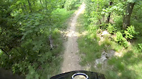
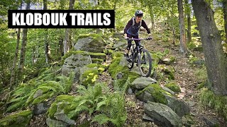
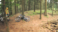
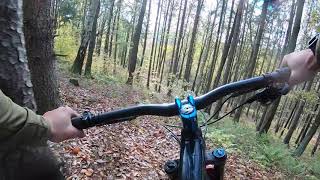
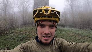
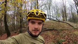
Photos of Děčín Mountain Bike
Videos of Děčín Mountain Bike
trail: Ovesná Enduro
0:16 |
734 |
Jun 23, 2015
trail: Druhá Vlna
14:02 |
35 |
Mar 18, 2026 , Děčín
trail: Ovesná Enduro
19:11 |
871 |
Nov 19, 2011

trail: Sněžník North Shore
3:52 |
1439 |
Aug 4, 2020 , Děčín
trail: Ovesná Enduro
6:36 |
674 |
Mar 25, 2020 , Děčín
trail: Kohout
8:59 |
639 |
Mar 25, 2020 , Děčín
trail: Březinskej
7:34 |
560 |
Mar 25, 2020 , Děčín
Recent Trail Reports
| status | trail | date | condition | info | user |
|---|---|---|---|---|---|
| Rollercoaster | Sep 24, 2024 @ 2:24am Sep 24, 2024 | Ideal | Mysak | ||
| Březinskej | Sep 24, 2024 @ 2:22am Sep 24, 2024 | Unknown | Mysak | ||
| Frantiskovskej Theathre | Sep 24, 2024 @ 2:19am Sep 24, 2024 | Ideal | Mysak | ||
| Sněžník North Shore | Mar 18, 2023 @ 3:03am Mar 18, 2023 | Variable | apaguha | ||
| Pod Jehlou | Jun 3, 2021 @ 12:06am Jun 3, 2021 | Variable | VaclavR | ||
| Ovesná Enduro | Nov 11, 2019 @ 1:21am Nov 11, 2019 | Wet | Mysak |
Activity Feed
| username | action | type | title | date |
|---|---|---|---|---|
| ViktoriePc6pZB | wishlist | trail | activity #96061575 and 1 more | Jun 1, 2026 @ 9:20pm Jun 1, 2026 |
| paja-tousek | ridden | trail | activity #94010076 | May 4, 2026 @ 12:41am May 4, 2026 |
| Jensen1234 | add | video | activity #90798254 | Mar 18, 2026 @ 8:02am Mar 18, 2026 |
| Fjusch | wishlist | trail | activity #86459654 | Jan 1, 2026 @ 12:28pm Jan 1, 2026 |
| zby3579 | wishlist | trail | activity #81617520 | Oct 3, 2025 @ 11:13am Oct 3, 2025 |
Recent Comments
| username | type | title | comment | date |
|---|---|---|---|---|
| trail | Really difficult to find... | Oct 9, 2020 @ 2:12am Oct 9, 2020 | ||
| trail | There is a "download" button below the weather... | Dec 29, 2019 @ 11:16pm Dec 29, 2019 | ||
| trail | Hey everybody, I am new to this site. Is it... | Dec 25, 2019 @ 11:17am Dec 25, 2019 |
Local Badges
-

Epic Mountain Bike Climb 2k0 awarded -

Climbing 10k Badge0 awarded -

Mountain Biking 100k Badge0 awarded -

Epic Ride Descent 2k0 awarded -

Descent 10k Badge0 awarded -

Descent 100k Badge0 awarded
Local Mountain Biking Directory
-
Kur SportBike Shop
Activity Type Stats
| activitytype | trails | distance | descent | descent distance | total vertical | rating | global rank | state rank | photos | reports | routes | ridelogs |
|---|---|---|---|---|---|---|---|---|---|---|---|---|
| Mountain Bike | 13 | 12 miles | 7,867 ft | 10 miles | 1,293 ft | #3,095 | #24 | 22 | 34 | 1,420 | ||
| E-Bike | 3 | 2 miles | 1,578 ft | 2 miles | 951 ft | 18 | 266 | |||||
| Hike | 6 | 6 miles | 4,308 ft | 6 miles | 1,270 ft | #3,595 | #24 | 20 | 376 | |||
| Trail Running | 6 | 6 miles | 4,308 ft | 6 miles | 1,270 ft | #3,075 | #24 | 20 | 2 |
Frequently Asked Questions About Děčín
▼
What are the best places to ride in Děčín?
Děčín has 1 areas to explore for mountain biking. The top rated areas are:
▼
What are the highest rated mountain biking trails in Děčín?
The highest rated mountain biking trails in Děčín are:
- Kohout (4.1/5)
- Sněžník North Shore (4/5)
- Březinskej (3.9/5)
- Stoupací (0/5)
- Rollercoaster (0/5)
▼
What is the best time of the year to ride in Děčín?
Based on ride log data, the most popular months to ride in Děčín are:
- June (7 activities)
- May (7 activities)
- October (6 activities)
▼
Where can I park to ride in Děčín?
Check the Děčín trail map for trailhead and parking information. Community members regularly update access and parking details for trails in the area.
- By zvirze
 ČeMBA & contributors
 - Admins: ČeMBA, ČeMBA, ČeMBA, ČeMBA, ČeMBA, ČeMBA, ČeMBA, ČeMBA, ČeMBA, ČeMBA
- #24139 - 4,824 views
- děčín activity log | embed map of Děčín mountain bike trails |
Downloading of trail gps tracks in kml & gpx formats is enabled for Děčín.
You must login to download files.