close
-
Layers w
- Weather Layers
- Pro
- Pro
- Pro
- Pro
- Pro
- Pro
- More Layers
- Pro
- Pro
- Pro
- Pro
-
Upgrade to

3D
Trail Conditions
- Unknown
- Snow Groomed
- Snow Packed
- Snow Covered
- Snow Cover Partial
- Freeze/thaw Cycle
- Icy
- Prevalent Mud
- Wet
- Variable
- Ideal
- Dry
- Very Dry
Trail Flow (Ridden Direction)
Trailforks scans users ridelogs to determine the most popular direction each trail is ridden. A good flowing trail network will have most trails flowing in a single direction according to their intension.
The colour categories are based on what percentage of riders are riding a trail in its intended direction.
The colour categories are based on what percentage of riders are riding a trail in its intended direction.
- > 96%
- > 90%
- > 80%
- > 70%
- > 50%
- < 50%
- bi-directional trail
- no data
Trail Last Ridden
Trailforks scans ridelogs to determine the last time a trail was ridden.
- < 2 days
- < 1 week
- < 2 weeks
- < 1 month
- < 6 months
- > 6 months
Trail Ridden Direction
The intended direction a trail should be ridden.
- Downhill Only
- Downhill Primary
- Both Directions
- Uphill Primary
- Uphill Only
- One Direction
Contribute Details
Colors indicate trail is missing specified detail.
- Description
- Photos
- Description & Photos
- Videos
Trail Popularity ?
Trailforks scans ridelogs to determine which trails are ridden the most in the last 9 months.
Trails are compared with nearby trails in the same city region with a possible 25 colour shades.
Think of this as a heatmap, more rides = more kinetic energy = warmer colors.
- most popular
- popular
- less popular
- not popular
ATV/ORV/OHV Filter
Max Vehicle Width
inches
US Cell Coverage
Legend

Radar Time
Activity Recordings
Trailforks uses anonymized public activity data.
?
Activity Recordings
Trailforks uses anonymized public activity data.
?
Personal Heatmap
▶
Activity Types
all
/
none
▶
Options
2
Date range
month
–
Winter Trails
Warning
A routing network for winter maps does not exist. Selecting trails using the winter trails layer has been disabled.
Missing Trails
Most Popular
Least Popular
Trails are colored based on popularity. The more popular a trail is, the more red. Less popular trails trend towards green.
Jump Magnitude Heatmap
Heatmap of where riders jump on trails. Zoom in to see individual jumps, click circles to view jump details.
BC Backroad Status
![map legend]()
Service Road Atlas is a free to use, community-driven service for viewing and creating reports on the numerous back-country service roads around B.C. and Alberta.

Slope Aspect
Direction the slope faces
Trails Deemphasized
Trails are shown in grey.
Only show trails with no bike usage.
Suggested Layers
Based on selected activity type
Save the current map location and zoom level as your default home location whenever this page is loaded.
SaveDalbeattie is world famous for its granite and it’s the rock that defines the riding at Dalbeattie. With a broad range of trails on offer you can look forward to a great experience.
A skills area with differently-graded loops gives a taste of Dalbeattie riding for those new to the area or to mountain biking.
A skills area with differently-graded loops gives a taste of Dalbeattie riding for those new to the area or to mountain biking.
source: 7stanes Mountain Biking
 google parking directions
 Disclaimer:
All trails currently closed to cycling except fire roads.
Links
This region uses the Uk/Euro style trail grading system.
Activities Click to view
- Mountain Bike
85 trails
- E-Bike
26 trails
- Hike
64 trails
- Trail Running
64 trails
Region Details
- 29
- 1
- 9
- 28
- 16
Region Status
Caution as of Oct 5, 2025Stats
- Avg Trail Rating
- Trails (view details)
- 83
- Trails Mountain Bike
- 85
- Trails E-Bike
- 26
- Trails Horse
- 1
- Trails Hike
- 64
- Trails Trail Running
- 64
- Total Distance
- 45 miles
- Total Descent
- 6,396 ft
- Total Vertical
- 411 ft
- Highest Trailhead
- 476 ft
- Reports
- 664
- Photos
- 69
- Ridden Counter
- 13,155
Popular Dalbeattie Forest Mountain Biking Trails
• 100 ★ 3.0 • 4,108 ft • 114 ft • 649 •
Moyle Magic is part the official 7stanes Mountain Bike Trail network, RED graded single-track links from Post 27 (at the Heart Stone) to Post 28. At the end of the section the trail has a BLACK option line to riders right, the final...
• 100 ★ 4.0 • 1,726 ft • 0 ft • 629 •
Hyper Link is a shared RED - BLUE section of the official 7stanes Mountain BiIke Trail Network and links the two forest roads between Post 58 and Post 60. The granite slab in the latter part challenges the BLUE grade giving riders a...
• 95 ★ 4.0 • 1 mile • 218 ft • 613 •
The is part of the official 7stanes Mountain Bike Trail. The trail is graded RED, the narrow single-track climbs (with very small descents) round to the dead-end that links to the Slab and Slab bypass.
• 45 ★ 4.0 • 3,579 ft • 31 ft • 529 •
Road to Nowhere is part of the 7stanes official Red graded trail (Post 37 to Post 40). The old leads into a single-track with a short climb followed by a technical bed rock section before descending to post 40 at the junction.
• 90 ★ 3.3 • 2,736 ft • 40 ft • 522 •
This single-track sections forms part of the official RED grade 7stanes Mountain Bike Trail network. Exposed bedrock and large boulders make for a tough traverse linking the dead-end at Post 63 to the at Post 64. The section can be...
• 80 ★ 3.4 • 1,099 ft • 8 ft • 514 •
The link section of the official 7stanes Red graded Mountain Bike Trail joins the two forest roads from Post 42 to 44.
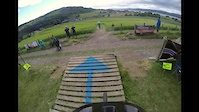
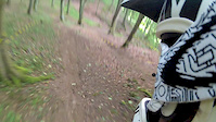
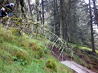
Photos of Dalbeattie Forest Mountain Bike
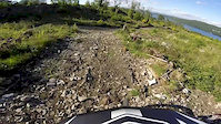
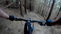
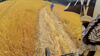
Videos of Dalbeattie Forest Mountain Bike
trail: Eliminator
2:10 |
182 |
Jun 25, 2017
trail: On Your Toes.
0:32 |
216 |
Jun 23, 2015
trail: Final fling
3:13 |
330 |
Jun 9, 2015
trail: Eliminator
3:45 |
374 |
Aug 10, 2013
trail: Eliminator
3:08 |
250 |
Jul 4, 2013
trail: Slab Bypass
0:05 |
206 |
Apr 20, 2012
youtuber
![SCHOTTLAND Dalbeattie: Mini Squamish - sind...]()
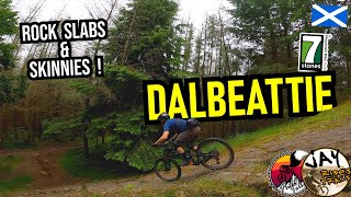
trail: Road to nowhere
16:53 |
109 |
Dec 13, 2024 , Dalbeattie
trail: Slab Bypass
0:06 |
108 |
May 10, 2009
Recent Trail Reports
| status | trail | date | condition | info | user |
|---|---|---|---|---|---|
| Trail | Oct 5, 2025 @ 10:35am (Europe/London) Oct 5, 2025 | Dry | Alex-012 | ||
| Cloak Cut | Oct 5, 2025 @ 10:35am (Europe/London) Oct 5, 2025 | Unknown | Alex-012 | ||
| Rock-Don't Roll | Oct 5, 2025 @ 10:35am (Europe/London) Oct 5, 2025 | Variable | Alex-012 | ||
| Hyper Link | Oct 5, 2025 @ 10:35am (Europe/London) Oct 5, 2025 | Wet | Alex-012 | ||
| Forest Road | Oct 5, 2025 @ 10:35am (Europe/London) Oct 5, 2025 | Variable | Alex-012 | ||
| The Twins singletrack | Oct 5, 2025 @ 10:35am (Europe/London) Oct 5, 2025 | Variable | Alex-012 | ||
| Smithland Hill | Oct 5, 2025 @ 10:35am (Europe/London) Oct 5, 2025 | Wet | Alex-012 | ||
| Shake Rattle and Roll | Oct 5, 2025 @ 10:35am (Europe/London) Oct 5, 2025 | Variable | Alex-012 | ||
| Slab Bypass | Oct 5, 2025 @ 10:35am (Europe/London) Oct 5, 2025 | Variable | Alex-012 | ||
| Gallowleck Plantation | Oct 5, 2025 @ 10:35am (Europe/London) Oct 5, 2025 | Variable | Alex-012 |
Activity Feed
| username | action | type | title | date |
|---|---|---|---|---|
| formidable | ridden | trail | activity #95862257 and 13 more | May 30, 2026 @ 9:41am May 30, 2026 |
| iamloz | add | photo | activity #93779173 | May 1, 2026 @ 6:55am May 1, 2026 |
| dgriffit | wishlist | region | activity #93519319 | Apr 27, 2026 @ 8:36am Apr 27, 2026 |
| Alex-012 | add | report | activity #81775938 and 15 more | Oct 5, 2025 @ 12:31pm Oct 5, 2025 |
| TamGB7 | add | report | activity #79045548 and 1 more | Aug 27, 2025 @ 6:54am Aug 27, 2025 |
Recent Comments
| username | type | title | comment | date |
|---|---|---|---|---|
| trail | Closed no access | May 27, 2025 @ 3:15am May 27, 2025 | ||
| trail | The bottom half is just pure gold, nice one | Jul 12, 2024 @ 5:32am Jul 12, 2024 | ||
| trail | great trail, so far the best in the west at... | Jul 10, 2024 @ 7:45am Jul 10, 2024 | ||
| trail | Blocked | Aug 13, 2023 @ 9:40pm Aug 13, 2023 | ||
| trail | Blocked | Aug 13, 2023 @ 9:38pm Aug 13, 2023 |
Nearby Areas
| name | distance | ||||
|---|---|---|---|---|---|
| Mark Hill | 3 | 4 | 1.9 km | ||
| Shambellie | 2 | 7.9 km | |||
| Mabie Forest | 2 | 2 | 9.6 km | ||
| White Hill Wood | 1 | 12.6 km | |||
| Glengap Forest | 3 | 13.3 km |
Local Badges
-

Completionist1 awarded
Activity Type Stats
| activitytype | trails | distance | descent | descent distance | total vertical | rating | global rank | state rank | photos | reports | routes | ridelogs |
|---|---|---|---|---|---|---|---|---|---|---|---|---|
| Mountain Bike | 85 | 45 miles | 6,398 ft | 23 miles | 410 ft | #1,565 | #56 | 69 | 663 | 4,984 | ||
| E-Bike | 26 | 11 miles | 1,617 ft | 6 miles | 361 ft | #4,288 | #181 | 539 | 528 | |||
| Horse | 1 | 1,896 ft | 49 ft | 702 ft | 49 ft | 89 | ||||||
| Hike | 64 | 37 miles | 4,744 ft | 19 miles | 410 ft | #4,384 | #75 | 579 | 72 | |||
| Trail Running | 64 | 37 miles | 4,744 ft | 19 miles | 410 ft | #3,463 | #68 | 578 | 1 | 411 |
Frequently Asked Questions About Dalbeattie Forest
▼
What are the highest rated mountain biking trails in Dalbeattie Forest?
The highest rated mountain biking trails in Dalbeattie Forest are:
- Danger Mouse (4.4/5)
- Magical Mystery Pies (4.2/5)
- The Widdowmaker. (4.2/5)
- The Rollercoaster (4.1/5)
- Donny's Descent (4.1/5)
▼
What is the best time of the year to ride in Dalbeattie Forest?
Based on ride log data, the most popular months to ride in Dalbeattie Forest are:
- August (17 activities)
- April (15 activities)
- July (12 activities)
▼
Where can I park to ride in Dalbeattie Forest?
There are 1 parking locations listed in Dalbeattie Forest. The most popular parking spots are:
▼
What is the longest trail in Dalbeattie Forest?
The longest trail in Dalbeattie Forest is Barnbarroch Loop at 1.9 km. View all trails sorted by distance.
Activities
Trails
Points of Interest
- By brenthillier
 NSMBA TRAILFORKS & contributors
 - Admins: ATB, GHBC
- #6490 - 15,236 views
- dalbeattie forest activity log | embed map of Dalbeattie Forest mountain bike trails | dalbeattie forest mountain biking points of interest
Downloading of trail gps tracks in kml & gpx formats is enabled for Dalbeattie Forest.
You must login to download files.