close
-
Layers w
- Weather Layers
- Pro
- Pro
- Pro
- Pro
- Pro
- Pro
- More Layers
- Pro
- Pro
- Pro
- Pro
-
Upgrade to

3D
Trail Conditions
- Unknown
- Snow Groomed
- Snow Packed
- Snow Covered
- Snow Cover Partial
- Freeze/thaw Cycle
- Icy
- Prevalent Mud
- Wet
- Variable
- Ideal
- Dry
- Very Dry
Trail Flow (Ridden Direction)
Trailforks scans users ridelogs to determine the most popular direction each trail is ridden. A good flowing trail network will have most trails flowing in a single direction according to their intension.
The colour categories are based on what percentage of riders are riding a trail in its intended direction.
The colour categories are based on what percentage of riders are riding a trail in its intended direction.
- > 96%
- > 90%
- > 80%
- > 70%
- > 50%
- < 50%
- bi-directional trail
- no data
Trail Last Ridden
Trailforks scans ridelogs to determine the last time a trail was ridden.
- < 2 days
- < 1 week
- < 2 weeks
- < 1 month
- < 6 months
- > 6 months
Trail Ridden Direction
The intended direction a trail should be ridden.
- Downhill Only
- Downhill Primary
- Both Directions
- Uphill Primary
- Uphill Only
- One Direction
Contribute Details
Colors indicate trail is missing specified detail.
- Description
- Photos
- Description & Photos
- Videos
Trail Popularity ?
Trailforks scans ridelogs to determine which trails are ridden the most in the last 9 months.
Trails are compared with nearby trails in the same city region with a possible 25 colour shades.
Think of this as a heatmap, more rides = more kinetic energy = warmer colors.
- most popular
- popular
- less popular
- not popular
ATV/ORV/OHV Filter
Max Vehicle Width
inches
US Cell Coverage
Legend

Radar Time
Activity Recordings
Trailforks uses anonymized public activity data.
?
Activity Recordings
Trailforks uses anonymized public activity data.
?
Personal Heatmap
▶
Activity Types
all
/
none
▶
Options
2
Date range
month
–
Winter Trails
Warning
A routing network for winter maps does not exist. Selecting trails using the winter trails layer has been disabled.
Missing Trails
Most Popular
Least Popular
Trails are colored based on popularity. The more popular a trail is, the more red. Less popular trails trend towards green.
Jump Magnitude Heatmap
Heatmap of where riders jump on trails. Zoom in to see individual jumps, click circles to view jump details.
BC Backroad Status
![map legend]()
Service Road Atlas is a free to use, community-driven service for viewing and creating reports on the numerous back-country service roads around B.C. and Alberta.

Slope Aspect
Direction the slope faces
Trails Deemphasized
Trails are shown in grey.
Only show trails with no bike usage.
Suggested Layers
Based on selected activity type
Save the current map location and zoom level as your default home location whenever this page is loaded.
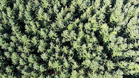
SaveDalby Forest is situated on the southern slopes of the North York Moors National Park. The southern part of the forest is divided by a number of valleys creating a 'Rigg and Dale' landscape whilst to the north the forest sits on the upland plateau. There are a number of trails for all abilities available in Dalby Forest.
source: Forestry Commission England
Primary Trail Type: Cross-Country
Land Status: National Forest
Land Manager: Forestry England
 google parking directions
Files
- Dalby_Forest_Old_Map.jpg (1.13 MB)
- Dalby_Map_(April_2007).pdf (6.13 MB)
- DalbyMap2006.pdf (6.78 MB)
This region uses the Uk/Euro style trail grading system.
Activities Click to view
- Mountain Bike
174 trails
- E-Bike
160 trails
- Horse
34 trails
- Hike
115 trails
- Trail Running
115 trails
- Dirtbike/Moto
6 trails
- ATV/ORV/OHV
6 trails
Region Details
- 80
- 18
- 22
- 38
- 15
Region Status
Open as of Jun 15, 2026Stats
- Avg Trail Rating
- Trails (view details)
- 175
- Trails Mountain Bike
- 174
- Trails E-Bike
- 160
- Trails Horse
- 34
- Trails Hike
- 115
- Trails Trail Running
- 115
- Trails Dirtbike/Moto
- 6
- Trails ATV/ORV/OHV
- 6
- Total Distance
- 143 miles
- Total Descent
- 14,394 ft
- Total Vertical
- 750 ft
- Highest Trailhead
- 904 ft
- Reports
- 1,310
- Photos
- 90
- Ridden Counter
- 60,657
Popular Dalby Forest Mountain Biking Trails
• 100 ★ 2.0 • 3,084 ft • 278 ft • 1,262 •
Fairly steep climb with switchbacks. Red option shortcuts that take an even steeper route.
• 100 ★ 3.0 • 574 ft • 0 ft • 1,202 •
Couple of drops at the start into fast flowing side-cut singletrack.
• 100 ★ 3.0 • 4,383 ft • 55 ft • 1,154 •
Singletrack shared with the red and blue route.
• 100 ★ 3.4 • 1 mile • 25 ft • 1,134 •
A short climb followed by a long, fast but easy descent with a few jumpable rollers. Watch out for a couple of surprise roots towards the last part of the trail.
• 95 ★ 5.0 • 1 mile • 42 ft • 1,114 •
New section of trail added to previous existing one. Starts with a short switchback followed by big smooth berms, rollable jumps which then merges into the old trail, which has sweeping berms.
• 100 ★ 0.0 • 728 ft • 6 ft • 1,112 •
Simple downhill winding end section to the red loop at Dalby Forest
• 95 ★ 3.2 • 932 ft • 34 ft • 1,110 •
Roots, rocks and a technical climb.
• 100 ★ 4.0 • 4,478 ft • 27 ft • 1,101 •
Fast flowy single track with some optional "bomb holes" (rolling short steep drops).
Dalby Forest Mountain Bike Routes
Dalby Blue Cycling Trail Featured
★ 5.0 • 7 miles • 579 ft • 18 • Loop •
Start the Blue Cycle Trail from Dalby Visitor Centre trail start in Low Dalby. After a challenging but...
Jerry Noddle Featured
★ 4.0 • 10 miles • 676 ft • 31 • Loop •
"Take in fantastic views on the fast flowing route." Offical Dalby Forest route.
★ 4.3 • 22 miles • 1,928 ft • 43 • Loop •
Long route, mainly single track.
★ 4.0 • 2 miles • 224 ft • 14 • Loop •
Follow the yellow signs with "DEMO ROUTE" on them. A good short loop of fun parts of Dalby. Used on bike...
7 miles • 600 ft • 20 • Loop •
Starting off with a big climb from the Vistors Centre and short easy loamy climb unique to this route...
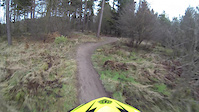
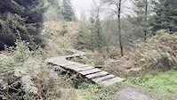
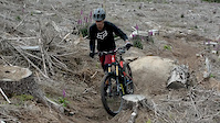
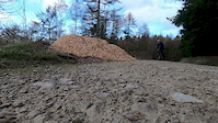
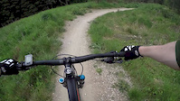
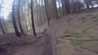
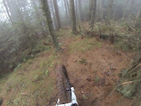
Photos of Dalby Forest Mountain Bike
Videos of Dalby Forest Mountain Bike
trail: Dalby Forest Drive
0:11 |
|
Oct 15, 2024
trail: Dalby Forest Drive
3:55 |
370 |
Oct 5, 2020
trail: Dalby Forest Drive
0:44 |
92 |
Mar 28, 2020
trail: Dalby Forest Drive
0:01 |
105 |
Nov 1, 2019
trail: Endless Berms
0:53 |
575 |
Jun 4, 2019
trail: Dalby Forest Drive
0:10 |
125 |
Nov 22, 2017
trail: Dalby Forest Drive
0:00 |
167 |
Jan 8, 2017
trail: Dalby Forest Drive
0:08 |
128 |
Jan 2, 2017
Current Trail Warnings
| status | trail | date | condition | user | info |
|---|---|---|---|---|---|
| Outgang Lane DH | Jun 4, 2026 @ 8:35am (Europe/Isle_of_Man) Jun 4, 2026 | Wet | Jxroussel | This trail is not open for bikes as per... |
Recent Trail Reports
| status | trail | date | condition | info | user |
|---|---|---|---|---|---|
| Ellerburn Road | Jun 4, 2026 @ 8:35am (Europe/Isle_of_Man) Jun 4, 2026 | Variable | Jxroussel | ||
| Farm/Forest Road | Jun 4, 2026 @ 8:35am (Europe/Isle_of_Man) Jun 4, 2026 | Variable | Jxroussel | ||
| E31 London Borough of Islington (Post 27) | Jun 4, 2026 @ 8:35am (Europe/Isle_of_Man) Jun 4, 2026 | Variable | Jxroussel | ||
| E31 London Borough of Islington (Post 26) | Jun 4, 2026 @ 8:35am (Europe/Isle_of_Man) Jun 4, 2026 | Variable | Jxroussel | ||
| Bomb Holes (Post 25) | Jun 4, 2026 @ 8:35am (Europe/Isle_of_Man) Jun 4, 2026 | Variable | Jxroussel | ||
| Unnamed Trail (Post 24) | Jun 4, 2026 @ 8:35am (Europe/Isle_of_Man) Jun 4, 2026 | Variable | Jxroussel | ||
| Unnamed Trail (Post 23) | Jun 4, 2026 @ 8:35am (Europe/Isle_of_Man) Jun 4, 2026 | Variable | Jxroussel | ||
| Bickley (Post 22) | Jun 4, 2026 @ 8:35am (Europe/Isle_of_Man) Jun 4, 2026 | Variable | Jxroussel | ||
| Adders Back Climb (Post 20) | Jun 4, 2026 @ 8:35am (Europe/Isle_of_Man) Jun 4, 2026 | Variable | Jxroussel | ||
| Medusa's Drop (Post 18) | Jun 4, 2026 @ 8:35am (Europe/Isle_of_Man) Jun 4, 2026 | Variable | Jxroussel |
Activity Feed
| username | action | type | title | date |
|---|---|---|---|---|
| ptrchap | wishlist | region | activity #97206639 | Jun 17, 2026 @ 1:28pm Jun 17, 2026 |
| JoshuaAf0RXOC | vote | route | activity #96929418 | Jun 13, 2026 @ 5:42pm Jun 13, 2026 |
| Jxroussel | comment | trail | activity #96245974 | Jun 4, 2026 @ 12:34pm Jun 4, 2026 |
| Jxroussel | add | report | activity #96245887 and 36 more | Jun 4, 2026 @ 12:33pm Jun 4, 2026 |
| Nathanowen26 | wishlist | region | activity #95933622 | May 31, 2026 @ 6:32am May 31, 2026 |
Recent Comments
| username | type | title | comment | date |
|---|---|---|---|---|
| trail | Not open for bicycles. | Jun 4, 2026 @ 12:34pm Jun 4, 2026 | ||
| report | trees cleared | Oct 28, 2025 @ 12:43pm Oct 28, 2025 | ||
| trail | Получите помощь... | Oct 19, 2025 @ 4:56am Oct 19, 2025 | ||
| trail | Bit overgrown, but rideable and fun | Jul 11, 2025 @ 11:11am Jul 11, 2025 | ||
| trail | Fairly flat single track, not really that... | Aug 28, 2024 @ 8:47am Aug 28, 2024 |
Nearby Areas
| name | distance | ||||
|---|---|---|---|---|---|
| Wykeham Forest | 5 | 2 | 4 km | ||
| Langdale Forest | 12 | 4.4 km | |||
| Newbridge Park | 1 | 5 km | |||
| Broxa Forest | 18 | 8 | 5.3 km | ||
| Raincliffe Woods | 9 | 6 | 7.3 km |
Local Badges
-

Completionist0 awarded
Bike & Skill Parks
| name | type | city | rating |
|---|---|---|---|
| Dixon's Hollow | skill park | Scarborough | |
| Low Dalby Skills Area | skill park | Scarborough |
Activity Type Stats
| activitytype | trails | distance | descent | descent distance | total vertical | rating | global rank | state rank | photos | reports | routes | ridelogs |
|---|---|---|---|---|---|---|---|---|---|---|---|---|
| Mountain Bike | 174 | 142 miles | 14,275 ft | 66 miles | 751 ft | #172 | #8 | 90 | 1,310 | 10 | 11,467 | |
| E-Bike | 160 | 126 miles | 12,054 ft | 55 miles | 751 ft | #160 | #27 | 1,096 | 4 | 3,312 | ||
| Horse | 34 | 44 miles | 3,839 ft | 21 miles | 679 ft | #96 | #8 | 259 | ||||
| Hike | 115 | 119 miles | 10,600 ft | 54 miles | 751 ft | #614 | #15 | 1,064 | 148 | |||
| Trail Running | 115 | 119 miles | 10,600 ft | 54 miles | 751 ft | #317 | #14 | 1,064 | 184 | |||
| Dirtbike/Moto | 6 | 12 miles | 1,027 ft | 6 miles | 538 ft | #191 | #2 | 239 | ||||
| ATV/ORV/OHV | 6 | 12 miles | 1,027 ft | 6 miles | 538 ft | #101 | #1 | 239 |
Frequently Asked Questions About Dalby Forest
▼
What are the highest rated mountain biking trails in Dalby Forest?
The highest rated mountain biking trails in Dalby Forest are:
- E31 London Borough of Islington (Post 26) (4.4/5)
- Berming Mad (4.3/5)
- The Garden and Temptation (Post 8) (4.2/5)
- Jingleby (Post 17) (4.2/5)
- E31 London Borough of Islington (Post 27) (4.2/5)
▼
What is the best time of the year to ride in Dalby Forest?
Based on ride log data, the most popular months to ride in Dalby Forest are:
- August (71 activities)
- June (58 activities)
- July (58 activities)
▼
Where can I park to ride in Dalby Forest?
There are 13 parking locations listed in Dalby Forest. The most popular parking spots are:
- Dixon's Hollow Parking
- Parking
- Dalby Forest Visitor Center Parking
- Crosscliffe Disabled Parking
- Bickley Gate Parking
▼
What is the longest trail in Dalby Forest?
The longest trail in Dalby Forest is Simon's Howe Bridleway at 5.3 km. View all trails sorted by distance.
Activities
Trails
- By bfit4life & contributors
- Admins: Singletraction, loamcoach
- #5173 - 75,605 views
- dalby forest activity log | embed map of Dalby Forest mountain bike trails | dalby forest mountain biking points of interest
Downloading of trail gps tracks in kml & gpx formats is enabled for Dalby Forest.
You must login to download files.