close
-
Layers w
- Weather Layers
- Pro
- Pro
- Pro
- Pro
- Pro
- Pro
- More Layers
- Pro
- Pro
- Pro
- Pro
-
Upgrade to

3D
Trail Conditions
- Unknown
- Snow Groomed
- Snow Packed
- Snow Covered
- Snow Cover Partial
- Freeze/thaw Cycle
- Icy
- Prevalent Mud
- Wet
- Variable
- Ideal
- Dry
- Very Dry
Trail Flow (Ridden Direction)
Trailforks scans users ridelogs to determine the most popular direction each trail is ridden. A good flowing trail network will have most trails flowing in a single direction according to their intension.
The colour categories are based on what percentage of riders are riding a trail in its intended direction.
The colour categories are based on what percentage of riders are riding a trail in its intended direction.
- > 96%
- > 90%
- > 80%
- > 70%
- > 50%
- < 50%
- bi-directional trail
- no data
Trail Last Ridden
Trailforks scans ridelogs to determine the last time a trail was ridden.
- < 2 days
- < 1 week
- < 2 weeks
- < 1 month
- < 6 months
- > 6 months
Trail Ridden Direction
The intended direction a trail should be ridden.
- Downhill Only
- Downhill Primary
- Both Directions
- Uphill Primary
- Uphill Only
- One Direction
Contribute Details
Colors indicate trail is missing specified detail.
- Description
- Photos
- Description & Photos
- Videos
Trail Popularity ?
Trailforks scans ridelogs to determine which trails are ridden the most in the last 9 months.
Trails are compared with nearby trails in the same city region with a possible 25 colour shades.
Think of this as a heatmap, more rides = more kinetic energy = warmer colors.
- most popular
- popular
- less popular
- not popular
ATV/ORV/OHV Filter
Max Vehicle Width
inches
US Cell Coverage
Legend

Radar Time
Activity Recordings
Trailforks uses anonymized public activity data.
?
Activity Recordings
Trailforks uses anonymized public activity data.
?
Personal Heatmap
▶
Activity Types
all
/
none
▶
Options
2
Date range
month
–
Winter Trails
Warning
A routing network for winter maps does not exist. Selecting trails using the winter trails layer has been disabled.
Missing Trails
Most Popular
Least Popular
Trails are colored based on popularity. The more popular a trail is, the more red. Less popular trails trend towards green.
Jump Magnitude Heatmap
Heatmap of where riders jump on trails. Zoom in to see individual jumps, click circles to view jump details.
BC Backroad Status
![map legend]()
Service Road Atlas is a free to use, community-driven service for viewing and creating reports on the numerous back-country service roads around B.C. and Alberta.

Slope Aspect
Direction the slope faces
Trails Deemphasized
Trails are shown in grey.
Only show trails with no bike usage.
Suggested Layers
Based on selected activity type
Save the current map location and zoom level as your default home location whenever this page is loaded.
Save
No description for Dalmarnock has been added yet!
Login or register to submit one.
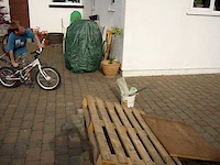
 google parking directions
Primary Trail Type: All-Mountain & Downhill
Land Status: Crown Land
Land Manager: Forestry And Land Scotland
google parking directionsThis region uses the Uk/Euro style trail grading system.
Activities Click to view
- Mountain Bike
67 trails
- E-Bike
67 trails
- Horse
16 trails
- Hike
22 trails
- Trail Running
22 trails
Region Details
- 16
- 2
- 19
- 27
Region Status
Caution as of May 31, 2026Stats
- Avg Trail Rating
- Trails (view details)
- 64
- Trails Mountain Bike
- 67
- Trails E-Bike
- 67
- Trails Horse
- 16
- Trails Hike
- 22
- Trails Trail Running
- 22
- Total Distance
- 31 miles
- Total Descent Distance
- 19 miles
- Total Descent
- 9,550 ft
- Total Vertical
- 1,370 ft
- Highest Trailhead
- 1,599 ft
- Reports
- 412
- Photos
- 70
- Ridden Counter
- 7,262
Popular Dalmarnock Mountain Biking Trails
• 95 ★ 3.5 • 1,053 ft • 0 ft • 272 •
Popular red difficulty singletrack. This mountain bike primary trail can be used one direction and has a moderate overall physical rating with a 0 ft blue climb. Trail visibility is always easy to follow. On average it takes 7 minutes to complete this trail.
• 95 ★ 2.0 • 794 ft • 0 ft • 256 •
Popular red difficulty singletrack. This mountain bike primary trail can be used one direction and has a moderate overall physical rating with a 0 ft blue climb. Trail visibility is always easy to follow. On average it takes 1 minutes to complete this trail.
• 85 ★ 5.0 • 1,634 ft • 5 ft • 250 •
Popular black difficulty singletrack. This mountain bike primary trail can be used one direction and has a moderate overall physical rating with a 5 ft blue climb. Trail visibility is always easy to follow. On average it takes 3 minutes to complete this trail.
• 90 ★ 3.0 • 807 ft • 0 ft • 237 •
Popular red difficulty singletrack. This mountain bike primary trail can be used one direction and has a moderate overall physical rating with a 0 ft blue climb. Trail visibility is always easy to follow. On average it takes 1 minutes to complete this trail.
• 80 ★ 4.4 • 1,102 ft • 0 ft • 233 •
Highly rated popular black difficulty singletrack. This mountain bike primary trail can be used one direction and has a moderate overall physical rating. Trail visibility is always easy to follow. On average it takes 2 minutes to complete this trail.
• 95 ★ 5.0 • 915 ft • 0 ft • 232 •
Popular red difficulty singletrack. This mountain bike primary trail can be used one direction and has a moderate overall physical rating with a 0 ft blue climb. Trail visibility is always easy to follow. On average it takes 1 minutes to complete this trail.
• 85 ★ 5.0 • 817 ft • 0 ft • 230 •
Popular black difficulty singletrack. This mountain bike primary trail can be used one direction and has a moderate overall physical rating with a 0 ft blue climb. Trail visibility is always easy to follow. On average it takes 1 minutes to complete this trail.
• 95 ★ 3.0 • 568 ft • 0 ft • 225 •
Popular red difficulty singletrack. This mountain bike primary trail can be used one direction and has a moderate overall physical rating with a 0 ft blue climb. Trail visibility is always easy to follow. On average it takes minutes to complete this trail.
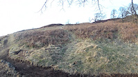
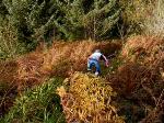
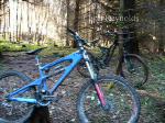
Photos of Dalmarnock Mountain Bike

Recent Trail Reports
| status | trail | date | condition | info | user |
|---|---|---|---|---|---|
| Access Track | May 12, 2026 @ 12:28pm (Europe/London) May 12, 2026 | Unknown | GordonSmith | ||
| Stingy Stingy (Pt. 5) | Apr 30, 2026 @ 9:53pm (Europe/London) Apr 30, 2026 | Ideal | fm092 | ||
| Dalmarnock Singletrack | Apr 15, 2026 @ 2:04pm (Europe/London) Apr 15, 2026 | Prevalent Mud | fm092 | ||
| Stingy Stingy (Pt. 2) | Apr 11, 2026 @ 6:45pm (Europe/Isle_of_Man) Apr 11, 2026 | Variable | craigfalconer626 | ||
| Stingy Stingy | Apr 11, 2026 @ 6:45pm (Europe/Isle_of_Man) Apr 11, 2026 | Variable | craigfalconer626 | ||
| Dalmarnock Descent Part 1 | Apr 6, 2026 @ 12:09pm (Europe/London) Apr 6, 2026 | Wet | razz-lightyear | ||
| Big Mac FRC | Mar 7, 2026 @ 9:38am (Europe/London) Mar 7, 2026 | Ideal | craigfalconer626 | ||
| Dalmarnock Descent Part 5 | Mar 7, 2026 @ 9:38am (Europe/London) Mar 7, 2026 | Variable | craigfalconer626 | ||
| Dalmarnock Descent Part 4 | Mar 7, 2026 @ 9:38am (Europe/London) Mar 7, 2026 | Variable | craigfalconer626 | ||
| Dalmarnock Descent Part 3 | Mar 7, 2026 @ 9:38am (Europe/London) Mar 7, 2026 | Variable | craigfalconer626 |
Activity Feed
| username | action | type | title | date |
|---|---|---|---|---|
| UnkleCornelius | wishlist | trail | activity #97063019 and 4 more | Jun 15, 2026 @ 1:37pm 2 days |
| gaelm234 | ridden | trail | activity #96956438 | Jun 14, 2026 @ 5:03am Jun 14, 2026 |
| DesmyxSDq | ridden | trail | activity #96921351 | Jun 13, 2026 @ 3:31pm Jun 13, 2026 |
| gaelm234 | ridden | trail | activity #96877483 | Jun 13, 2026 @ 7:58am Jun 13, 2026 |
| dhj49er | ridden | trail | activity #95878685 | May 30, 2026 @ 12:37pm May 30, 2026 |
Recent Comments
| username | type | title | comment | date |
|---|---|---|---|---|
| trail | Blocked by trees | Feb 16, 2025 @ 2:46am Feb 16, 2025 | ||
| trail | New start on the fire road running parallel to... | Jan 30, 2025 @ 10:14am Jan 30, 2025 | ||
| trail | Blocked with multiple trees. | Jan 30, 2025 @ 10:03am Jan 30, 2025 | ||
| trail | Trail is clear of fallen trees. | Apr 16, 2024 @ 8:38am Apr 16, 2024 | ||
| trail | ❌ Impassible. Destroyed by flooding. | Feb 24, 2024 @ 6:53am Feb 24, 2024 |
Nearby Areas
| name | distance | ||||
|---|---|---|---|---|---|
| Craigvinean | 7 | 1 | 1.6 km | ||
| Atholl Hill | 11 | 4 | 2 km | ||
| Deuchary Hill | 2 | 3.5 km | |||
| Birnam Hill | 2 | 2 | 4.2 km | ||
| Newtyle Hill | 2 | 4.3 km |
Local Badges
-

Completionist0 awarded
Activity Type Stats
| activitytype | trails | distance | descent | descent distance | total vertical | rating | global rank | state rank | photos | reports | routes | ridelogs |
|---|---|---|---|---|---|---|---|---|---|---|---|---|
| Mountain Bike | 67 | 31 miles | 9,551 ft | 19 miles | 1,371 ft | #2,960 | #94 | 67 | 412 | 615 | ||
| E-Bike | 67 | 31 miles | 9,551 ft | 19 miles | 1,371 ft | #2,694 | #94 | 2 | 401 | 280 | ||
| Horse | 16 | 19 miles | 2,169 ft | 9 miles | 1,280 ft | #1,748 | #88 | 33 | ||||
| Hike | 22 | 22 miles | 2,628 ft | 10 miles | 1,371 ft | #7,804 | #193 | 1 | 188 | 15 | ||
| Trail Running | 22 | 22 miles | 2,628 ft | 10 miles | 1,371 ft | #7,337 | #183 | 188 | 18 |
Frequently Asked Questions About Dalmarnock
▼
What are the highest rated mountain biking trails in Dalmarnock?
The highest rated mountain biking trails in Dalmarnock are:
- Stingy Stingy (Pt. 4) (4.2/5)
- Stingy Stingy (Pt. 3) (4.2/5)
- Squid Catcher V3 (4.2/5)
- Dalmarnock Descent Part 5 (4.1/5)
- Stingy Stingy (Pt. 5) (4.1/5)
▼
What is the best time of the year to ride in Dalmarnock?
Based on ride log data, the most popular months to ride in Dalmarnock are:
- September (3 activities)
- October (1 activities)
- August (1 activities)
▼
Where can I park to ride in Dalmarnock?
There are 2 parking locations listed in Dalmarnock. The most popular parking spots are:
▼
What is the longest trail in Dalmarnock?
The longest trail in Dalmarnock is Access Track at 2.3 km. View all trails sorted by distance.
Activities
Trails
Points of Interest
- By gav-s
 & contributors
 - Admins: TTA, TTA
- #46554 - 2,639 views
- dalmarnock activity log | embed map of Dalmarnock mountain bike trails | dalmarnock mountain biking points of interest
Downloading of trail gps tracks in kml & gpx formats is enabled for Dalmarnock.
You must login to download files.