close
-
Layers w
- Weather Layers
- Pro
- Pro
- Pro
- Pro
- Pro
- Pro
- More Layers
- Pro
- Pro
- Pro
- Pro
-
Upgrade to

3D
Trail Conditions
- Unknown
- Snow Groomed
- Snow Packed
- Snow Covered
- Snow Cover Partial
- Freeze/thaw Cycle
- Icy
- Prevalent Mud
- Wet
- Variable
- Ideal
- Dry
- Very Dry
Trail Flow (Ridden Direction)
Trailforks scans users ridelogs to determine the most popular direction each trail is ridden. A good flowing trail network will have most trails flowing in a single direction according to their intension.
The colour categories are based on what percentage of riders are riding a trail in its intended direction.
The colour categories are based on what percentage of riders are riding a trail in its intended direction.
- > 96%
- > 90%
- > 80%
- > 70%
- > 50%
- < 50%
- bi-directional trail
- no data
Trail Last Ridden
Trailforks scans ridelogs to determine the last time a trail was ridden.
- < 2 days
- < 1 week
- < 2 weeks
- < 1 month
- < 6 months
- > 6 months
Trail Ridden Direction
The intended direction a trail should be ridden.
- Downhill Only
- Downhill Primary
- Both Directions
- Uphill Primary
- Uphill Only
- One Direction
Contribute Details
Colors indicate trail is missing specified detail.
- Description
- Photos
- Description & Photos
- Videos
Trail Popularity ?
Trailforks scans ridelogs to determine which trails are ridden the most in the last 9 months.
Trails are compared with nearby trails in the same city region with a possible 25 colour shades.
Think of this as a heatmap, more rides = more kinetic energy = warmer colors.
- most popular
- popular
- less popular
- not popular
ATV/ORV/OHV Filter
Max Vehicle Width
inches
US Cell Coverage
Legend

Radar Time
Activity Recordings
Trailforks uses anonymized public activity data.
?
Activity Recordings
Trailforks uses anonymized public activity data.
?
Personal Heatmap
▶
Activity Types
all
/
none
▶
Options
2
Date range
month
–
Winter Trails
Warning
A routing network for winter maps does not exist. Selecting trails using the winter trails layer has been disabled.
Missing Trails
Most Popular
Least Popular
Trails are colored based on popularity. The more popular a trail is, the more red. Less popular trails trend towards green.
Jump Magnitude Heatmap
Heatmap of where riders jump on trails. Zoom in to see individual jumps, click circles to view jump details.
BC Backroad Status
![map legend]()
Service Road Atlas is a free to use, community-driven service for viewing and creating reports on the numerous back-country service roads around B.C. and Alberta.

Slope Aspect
Direction the slope faces
Trails Deemphasized
Trails are shown in grey.
Only show trails with no bike usage.
Suggested Layers
Based on selected activity type
Save the current map location and zoom level as your default home location whenever this page is loaded.
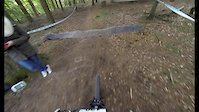
SaveThere is an area of jumps, singletrack trails, as well as 5-6 different DH trails.
Access Info
There will be a house to the right, ride down the path for 10 meters, then the network of dh trails start on the left
Access Info
There will be a house to the right, ride down the path for 10 meters, then the network of dh trails start on the left
This region uses the Uk/Euro style trail grading system.
Activities Click to view
- Mountain Bike
29 trails
- E-Bike
29 trails
- Gravel Bike
0 trails
- Adaptive Bike
0 trails
- Winter Fat Bike
0 trails
- Horse
5 trails
- Hike
56 trails
- Trail Running
56 trails
Region Details
- 5
- 12
- 10
- 2
Region Status
Open as of Apr 14, 2024Stats
- Avg Trail Rating
- Trails (view details)
- 56
- Trails Mountain Bike
- 29
- Trails E-Bike
- 29
- Trails Horse
- 5
- Trails Hike
- 56
- Trails Trail Running
- 56
- Total Distance
- 18 miles
- Total Descent
- 1,894 ft
- Total Vertical
- 244 ft
- Highest Trailhead
- 363 ft
- Reports
- 308
- Photos
- 470
- Ridden Counter
- 4,081
Sub Regions
-
Danbury Common
- 1
Popular Danbury Mountain Biking Trails
• 100 ★ 3.5 • 1,162 ft • 14 ft • 217 •
Drop into the main trail and turn left at the first fork and second. through the trees there is a tight bermed switchback then drops down a sweeping right hander jump back up for another sweeping right left folowed by a handful of...
• 95 ★ 4.0 • 394 ft • 5 ft • 192 •
Short Intense run. Drop into the main trail, do the first mini berm and at the fork turn right and head through two trees just wide enough for 800mm ish bars. As it opens out veer off the beaten trail line to the right and drop into a...
• 90 ★ 0.0 • 274 ft • 6 ft • 183 •
Popular blue difficulty singletrack. This multi-use trail can be used downhill primary. On average it takes minutes to complete this trail.
• 80 ★ 0.0 • 208 ft • 0 ft • 182 •
Popular blue difficulty singletrack. This mountain bike primary trail can be used downhill primary. It features jump. On average it takes minutes to complete this trail.
• 75 ★ 0.0 • 371 ft • 17 ft • 169 •
Popular blue difficulty singletrack. This mountain bike primary trail can be used downhill primary. It features jump. On average it takes minutes to complete this trail.
• 70 ★ 4.0 • 341 ft • 2 ft • 166 •
Popular blue difficulty singletrack. This mountain bike primary trail can be used downhill primary. It features jump. On average it takes minutes to complete this trail.
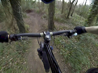
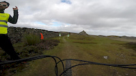
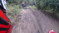
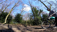
Photos of Danbury Mountain Bike
Videos of Danbury Mountain Bike

trail: Blue Bell
0:59 |
245 |
Sep 24, 2019
trail: Blue Bell
0:53 |
350 |
Mar 15, 2017

trail: Blue Bell
3:02 |
46 |
Nov 28, 2016

trail: Footpath
6:25 |
154 |
Aug 22, 2016
trail: Footpath
5:23 |
60 |
Aug 9, 2016
trail: Blue Bell
0:30 |
106 |
Jun 10, 2016
trail: Blue Bell
2:36 |
149 |
Apr 6, 2016
trail: Footpath
2:02 |
170 |
Oct 20, 2015
Recent Trail Reports
| status | trail | date | condition | info | user |
|---|---|---|---|---|---|
| Hidden DH Run | Apr 14, 2024 @ 11:28am Apr 14, 2024 | Dry | Malcgreen | ||
| Fireroad Climb | Apr 14, 2024 @ 11:28am Apr 14, 2024 | Dry | Malcgreen | ||
| Rollercoaster | Apr 14, 2024 @ 11:28am Apr 14, 2024 | Dry | Malcgreen | ||
| Coffin | Apr 14, 2024 @ 11:28am Apr 14, 2024 | Dry | Malcgreen | ||
| Feel The Payne | Apr 14, 2024 @ 11:28am Apr 14, 2024 | Dry | Malcgreen | ||
| Volcano Run | Apr 14, 2024 @ 11:28am Apr 14, 2024 | Dry | Malcgreen | ||
| Climb Up | Apr 14, 2024 @ 11:28am Apr 14, 2024 | Dry | Malcgreen | ||
| Blue Bell | Apr 14, 2024 @ 11:28am Apr 14, 2024 | Dry | Malcgreen | ||
| Route A | Mar 24, 2023 @ 3:34pm Mar 24, 2023 | Variable | Lewis-56 | ||
| Hip Jump Loop | Feb 5, 2023 @ 12:00am Feb 5, 2023 | Ideal | Thumper38 |
Activity Feed
| username | action | type | title | date |
|---|---|---|---|---|
| Moxxi28 | add | photo | activity #91334926 and 9 more | Mar 26, 2026 @ 12:08pm Mar 26, 2026 |
| trailforks | add | video | activity #89397640 | Feb 22, 2026 @ 8:08pm Feb 22, 2026 |
| trailforks | add | video | activity #89190188 | Feb 19, 2026 @ 1:00pm Feb 19, 2026 |
| trailforks | add | video | activity #87587952 | Jan 21, 2026 @ 12:00pm Jan 21, 2026 |
| trailforks | add | video | activity #86100920 | Dec 26, 2025 @ 12:00pm Dec 26, 2025 |
Recent Comments
| username | type | title | comment | date |
|---|---|---|---|---|
| trail | It’s a bridle way so horse riding is allowed | Jan 26, 2020 @ 10:42am Jan 26, 2020 | ||
| trail | Hey, there is no extra steep section at all. A... | Jul 7, 2017 @ 12:49pm Jul 7, 2017 | ||
| trail | This trail is called Bluebell Berms, with love... | Jul 7, 2017 @ 12:47pm Jul 7, 2017 | ||
| trail | This is actually called Main Line, with love... | Jul 7, 2017 @ 12:46pm Jul 7, 2017 | ||
| trail | year opened 2014? LOL these trails have been... | Jan 28, 2015 @ 6:21am Jan 28, 2015 |
Local Badges
-

Epic Ride Climb 2k2 awarded -

Climbing 10k Badge20 awarded -

Climbing 100k Badge2 awarded -

Epic Ride Descent 2k2 awarded -

Descent 10k Badge20 awarded -

Descent 100k Badge2 awarded
Bike & Skill Parks
| name | type | city | rating |
|---|---|---|---|
| Tiptree Pumptrack | skill park | Danbury | |
| Promenade Park Pumptrack | skill park | Danbury |
Local Trail Supporters
- Danbury Dig crew
Activity Type Stats
| activitytype | trails | distance | descent | descent distance | total vertical | rating | global rank | state rank | photos | reports | routes | ridelogs |
|---|---|---|---|---|---|---|---|---|---|---|---|---|
| Mountain Bike | 29 | 8 miles | 853 ft | 4 miles | 243 ft | #3,401 | #113 | 470 | 308 | 6,593 | ||
| E-Bike | 29 | 8 miles | 853 ft | 4 miles | 243 ft | #3,405 | #122 | 297 | 671 | |||
| Horse | 5 | 2 miles | 135 ft | 3,094 ft | 220 ft | #1,292 | #66 | 77 | 1 | |||
| Hike | 56 | 18 miles | 1,893 ft | 9 miles | 243 ft | #4,485 | #101 | 303 | 65 | |||
| Trail Running | 56 | 18 miles | 1,893 ft | 9 miles | 243 ft | #4,633 | #103 | 303 | 57 |
Frequently Asked Questions About Danbury
▼
What are the best places to ride in Danbury?
Danbury has 1 areas to explore for mountain biking. The top rated areas are:
▼
What are the highest rated mountain biking trails in Danbury?
The highest rated mountain biking trails in Danbury are:
- Bottom Berm (4/5)
- Volcano Run (4/5)
- Holly Bush/Two Drops (4/5)
- Golf Course East Bound (4/5)
- Pinball/Table Run (3.9/5)
▼
What is the best time of the year to ride in Danbury?
Based on ride log data, the most popular months to ride in Danbury are:
- May (22 activities)
- April (15 activities)
- June (10 activities)
▼
Where can I park to ride in Danbury?
There are 2 parking locations listed in Danbury. The most popular parking spots are:
- By sidsmith & contributors
- Admins: wisey, MathieuC, cemoorelife
- #5857 - 7,369 views
- danbury activity log | embed map of Danbury mountain bike trails | danbury mountain biking points of interest
Downloading of trail gps tracks in kml & gpx formats is enabled for Danbury.
You must login to download files.