close
-
Layers w
- Weather Layers
- Pro
- Pro
- Pro
- Pro
- Pro
- Pro
- More Layers
- Pro
- Pro
- Pro
- Pro
-
Upgrade to

3D
Trail Conditions
- Unknown
- Snow Groomed
- Snow Packed
- Snow Covered
- Snow Cover Partial
- Freeze/thaw Cycle
- Icy
- Prevalent Mud
- Wet
- Variable
- Ideal
- Dry
- Very Dry
Trail Flow (Ridden Direction)
Trailforks scans users ridelogs to determine the most popular direction each trail is ridden. A good flowing trail network will have most trails flowing in a single direction according to their intension.
The colour categories are based on what percentage of riders are riding a trail in its intended direction.
The colour categories are based on what percentage of riders are riding a trail in its intended direction.
- > 96%
- > 90%
- > 80%
- > 70%
- > 50%
- < 50%
- bi-directional trail
- no data
Trail Last Ridden
Trailforks scans ridelogs to determine the last time a trail was ridden.
- < 2 days
- < 1 week
- < 2 weeks
- < 1 month
- < 6 months
- > 6 months
Trail Ridden Direction
The intended direction a trail should be ridden.
- Downhill Only
- Downhill Primary
- Both Directions
- Uphill Primary
- Uphill Only
- One Direction
Contribute Details
Colors indicate trail is missing specified detail.
- Description
- Photos
- Description & Photos
- Videos
Trail Popularity ?
Trailforks scans ridelogs to determine which trails are ridden the most in the last 9 months.
Trails are compared with nearby trails in the same city region with a possible 25 colour shades.
Think of this as a heatmap, more rides = more kinetic energy = warmer colors.
- most popular
- popular
- less popular
- not popular
ATV/ORV/OHV Filter
Max Vehicle Width
inches
US Cell Coverage
Legend

Radar Time
Activity Recordings
Trailforks uses anonymized public activity data.
?
Activity Recordings
Trailforks uses anonymized public activity data.
?
Personal Heatmap
▶
Activity Types
all
/
none
▶
Options
2
Date range
month
–
Winter Trails
Warning
A routing network for winter maps does not exist. Selecting trails using the winter trails layer has been disabled.
Missing Trails
Most Popular
Least Popular
Trails are colored based on popularity. The more popular a trail is, the more red. Less popular trails trend towards green.
Jump Magnitude Heatmap
Heatmap of where riders jump on trails. Zoom in to see individual jumps, click circles to view jump details.
BC Backroad Status
![map legend]()
Service Road Atlas is a free to use, community-driven service for viewing and creating reports on the numerous back-country service roads around B.C. and Alberta.

Slope Aspect
Direction the slope faces
Trails Deemphasized
Trails are shown in grey.
Only show trails with no bike usage.
Suggested Layers
Based on selected activity type
Save the current map location and zoom level as your default home location whenever this page is loaded.
SaveSelection of downhill trails with jumps and bomb holes and some cross country single track
Primary Trail Type: All-Mountain & Downhill
Land Status: Crown Land
Access Info:
Entry via dirt road off of Gay Bowers Lane, Danbury. Trails begin on left hand side about 10 meters down the lane.
This region uses the Uk/Euro style trail grading system.
Activities Click to view
- Mountain Bike
1 trails
- Hike
1 trails
- Trail Running
1 trails
Region Details
- 1
Region Status
Open as of Jan 1, 2019Stats
- Trails (view details)
- 1
- Trails Mountain Bike
- 1
- Trails E-Bike
- 1
- Trails Hike
- 1
- Trails Trail Running
- 1
- Photos
- 13
- Ridden Counter
- 481
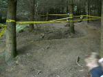
Popular Danbury Common Mountain Biking Trails
• 5 ★ 0.0 • 0 ft • 0 ft •
Less popular blue difficulty singletrack. This mountain bike primary trail can be used downhill only and has a moderate overall physical rating with a 0 ft blue climb. It features berm, drop and jump.
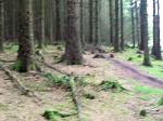
Photos of Danbury Common Mountain Bike
Videos of Danbury Common Mountain Bike
trail: Bottom Berm
0:11 |
480 |
Oct 1, 2008
trail: Bottom Berm
0:24 |
328 |
Jul 12, 2008
Activity Feed
| username | action | type | title | date |
|---|---|---|---|---|
| nhb201 | wishlist | region | activity #40514791 | Jun 1, 2023 @ 11:30am Jun 1, 2023 |
| darren1wright | wishlist | region | activity #36284923 | Dec 28, 2022 @ 10:09am Dec 28, 2022 |
| martinholroyd | comment | trail | activity #7560815 | Dec 17, 2019 @ 7:08am Dec 17, 2019 |
| joeg885 | ridden | trail | activity #6194494 | Sep 1, 2019 @ 1:12am Sep 1, 2019 |
| joeg885 | ridden | trail | activity #5775979 and 2 more | Aug 7, 2019 @ 5:27am Aug 7, 2019 |
Nearby Areas
| name | distance | ||||
|---|---|---|---|---|---|
| Hadleigh Park | 3 | 12.1 km | |||
| Benfleet Downs | 12.2 km | ||||
| Thorndon | 2 | 3 | 15 km | ||
| Great Chattenden Wood | 1 | 20.1 km | |||
| Hainault Forest | 9 | 2 | 20.5 km |
Local Badges
-

Completionist0 awarded
Activity Type Stats
| activitytype | trails | distance | descent | descent distance | total vertical | rating | global rank | state rank | photos | reports | routes | ridelogs |
|---|---|---|---|---|---|---|---|---|---|---|---|---|
| Mountain Bike | 1 | #13,311 | #492 | 13 | 1,217 | |||||||
| E-Bike | 1 | |||||||||||
| Hike | 1 | #10,429 | #297 | 15 | ||||||||
| Trail Running | 1 | #9,500 | #274 |
- By unityjon & contributors
- Admins: apply
- #7409 - 23,396 views
- danbury common activity log | embed map of Danbury Common mountain bike trails |
Downloading of trail gps tracks in kml & gpx formats is enabled for Danbury Common.
You must login to download files.