close
-
Layers w
- Weather Layers
- Pro
- Pro
- Pro
- Pro
- Pro
- Pro
- More Layers
- Pro
- Pro
- Pro
- Pro
-
Upgrade to

3D
Trail Conditions
- Unknown
- Snow Groomed
- Snow Packed
- Snow Covered
- Snow Cover Partial
- Freeze/thaw Cycle
- Icy
- Prevalent Mud
- Wet
- Variable
- Ideal
- Dry
- Very Dry
Trail Flow (Ridden Direction)
Trailforks scans users ridelogs to determine the most popular direction each trail is ridden. A good flowing trail network will have most trails flowing in a single direction according to their intension.
The colour categories are based on what percentage of riders are riding a trail in its intended direction.
The colour categories are based on what percentage of riders are riding a trail in its intended direction.
- > 96%
- > 90%
- > 80%
- > 70%
- > 50%
- < 50%
- bi-directional trail
- no data
Trail Last Ridden
Trailforks scans ridelogs to determine the last time a trail was ridden.
- < 2 days
- < 1 week
- < 2 weeks
- < 1 month
- < 6 months
- > 6 months
Trail Ridden Direction
The intended direction a trail should be ridden.
- Downhill Only
- Downhill Primary
- Both Directions
- Uphill Primary
- Uphill Only
- One Direction
Contribute Details
Colors indicate trail is missing specified detail.
- Description
- Photos
- Description & Photos
- Videos
Trail Popularity ?
Trailforks scans ridelogs to determine which trails are ridden the most in the last 9 months.
Trails are compared with nearby trails in the same city region with a possible 25 colour shades.
Think of this as a heatmap, more rides = more kinetic energy = warmer colors.
- most popular
- popular
- less popular
- not popular
ATV/ORV/OHV Filter
Max Vehicle Width
inches
US Cell Coverage
Legend

Radar Time
Activity Recordings
Trailforks uses anonymized public activity data.
?
Activity Recordings
Trailforks uses anonymized public activity data.
?
Personal Heatmap
▶
Activity Types
all
/
none
▶
Options
2
Date range
month
–
Winter Trails
Warning
A routing network for winter maps does not exist. Selecting trails using the winter trails layer has been disabled.
Missing Trails
Most Popular
Least Popular
Trails are colored based on popularity. The more popular a trail is, the more red. Less popular trails trend towards green.
Jump Magnitude Heatmap
Heatmap of where riders jump on trails. Zoom in to see individual jumps, click circles to view jump details.
BC Backroad Status
![map legend]()
Service Road Atlas is a free to use, community-driven service for viewing and creating reports on the numerous back-country service roads around B.C. and Alberta.

Slope Aspect
Direction the slope faces
Trails Deemphasized
Trails are shown in grey.
Only show trails with no bike usage.
Suggested Layers
Based on selected activity type
Save the current map location and zoom level as your default home location whenever this page is loaded.
SavePopular Trail Networks
view all areas »
No description for Dane County has been added yet!
Login or register to submit one.
Activities Click to view
- Mountain Bike
211 trails
- E-Bike
145 trails
- Horse
41 trails
- Hike
339 trails
- Trail Running
316 trails
- Snowshoe
77 trails
- Downhill Ski
9 trails
- Nordic Ski
86 trails
Stats
- Avg Trail Rating
- Trails (view details)
- 520
- Trails Mountain Bike
- 211
- Trails E-Bike
- 145
- Trails Gravel Bike
- 18
- Trails Adaptive Bike
- 26
- Trails Winter Fat Bike
- 18
- Trails Horse
- 41
- Trails Hike
- 339
- Trails Trail Running
- 316
- Trails Snowmobile
- 2
- Trails Snowshoe
- 77
- Trails Downhill Ski
- 9
- Trails Nordic Ski
- 86
- Total Distance
- 286 miles
- Total Descent
- 17,099 ft
- Total Vertical
- 498 ft
- Highest Trailhead
- 1,308 ft
- Reports
- 1,955
- Photos
- 574
- Ridden Counter
- 43,843
Sub Regions
- Cambridge (29)
- CamRock County Park (28)
- Cross Plains (8)
- Fitchburg (34)
- Quarry Ridge (25)
- Saris Trails (5)
- Seminole (2)
- Madison (33)
- Middleton (69)
- Mount Horeb (0)
- Donald County Park (0)
- Stewart Park (0)
- Oregon (19)
- Sun Prairie (8)
- Sheehan Park (6)
- Verona (8)
Popular Dane County Mountain Biking Trails
• 100 ★ 4.4 • 778 ft • 0 ft • 847 •
is a short technical trail that is full of bridges, drops, berms, rollers and a jump for good measure. The 2017 addition of an elevated "Split" ladder bridge that passed through the tree canopy brings this trail to a double black...
• 80 ★ 4.3 • 2,589 ft • 31 ft • 813 •
Highly rated popular green difficulty singletrack. This mountain bike primary trail can be used one direction and has a moderate overall physical rating with a 31 ft blue climb. It features berm, bridge and skinny. Trail visibility is always easy to follow. On average it takes 11 minutes to complete this trail.
• 70 ★ 4.5 • 2,648 ft • 86 ft • 791 •
is good "Old Skool" technical single track with rocks, roots, climbs, descents and lot of dirt goodness.
• 65 ★ 4.0 • 3,350 ft • 24 ft • 776 •
is the beginner friendly start to the trail system. It's all downhill from here :)
• 55 ★ 3.9 • 2,297 ft • 33 ft • 737 •
is more old skool goodness with an extra dose of rocks as this section traverses the 1800's quarry.
• 100 ★ 4.2 • 2,306 ft • 113 ft • 720 •
is a moderate climb to the top of the Ridge which leads you to many choices of downhill goodness!
Dane County Mountain Bike Routes
7 miles • 669 ft • 14 • Loop •
If you are ready to let loose and go all out on your bike then this is the perfect route! It hits all the...
11 miles • 769 ft • 31 •
While the trails at CamRock have many twists and turns, this route is what the regular riders call the...
5,036 ft • 52 ft • 13 • Loop •
This quick loop makes for a fun section to run laps around. It connects all of the medium sized jump...
1 mile • 308 ft • 27 • Loop •
This route offers the kind of terrain that isn't often found in the mid-west, sand and rock! It's perfect...
2 miles • 199 ft • 6 • Loop •
If you like getting 2 wheels off of the ground this is the Cross Plains loop for you. It doesn't include...
2 miles • 62 ft • 4 • Loop • Race •
Loop for beginners that consistshe of all easy trails.
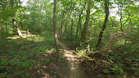
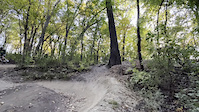
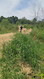
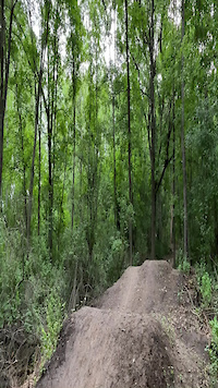
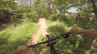
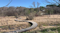
Photos of Dane County Mountain Bike
Videos of Dane County Mountain Bike

0:16 |
15 |
Nov 14, 2025
trail: The Fairway
4:05 |
7 |
Aug 3, 2025
trail: Northwoods
0:07 |
|
Oct 28, 2022
trail: Mayor's Playground Jump Line
0:05 |
235 |
Jul 22, 2022
trail: Bottoms Up
0:07 |
|
Jul 4, 2022
trail: Three Sisters
0:10 |
299 |
Nov 20, 2020

trail: Pork Chop
0:30 |
374 |
Jul 28, 2020
trail: Creek Trail
0:09 |
41 |
Jul 7, 2019
Current Trail Warnings
| status | trail | date | condition | user | info |
|---|---|---|---|---|---|
| Corkscrew CamRock County Park | May 30, 2026 @ 11:20am (America/Chicago) May 30, 2026 | Dry | mhayden37 | ||
| Gregg's Place CamRock County Park | May 30, 2026 @ 11:20am (America/Chicago) May 30, 2026 | Dry | mhayden37 | There is a tree down before the long... |
Recent Trail Reports
Activity Feed
| username | action | type | title | date |
|---|---|---|---|---|
| ErinAcekrL | wishlist | region | activity #97982592 | Jun 28, 2026 @ 6:14am 5 hours |
| ErinAcekrL | wishlist | region | activity #97982387 | Jun 28, 2026 @ 6:10am 5 hours |
| ErinAcekrL | wishlist | region | activity #97982335 | Jun 28, 2026 @ 6:10am 5 hours |
| SirRobin27 | wishlist | region | activity #97853177 | Jun 26, 2026 @ 1:11pm 2 days |
| makers1963 | add | report | activity #97799140 and 4 more | Jun 25, 2026 @ 4:09pm 3 days |
Recent Comments
| username | type | title | comment | date |
|---|---|---|---|---|
| trail | Actually, they’re blackberries. Tasty, worth... | Jul 22, 2025 @ 9:36pm Jul 22, 2025 | ||
| trail | Fun beginner trail, some nice roller, jumps... | Nov 17, 2024 @ 9:29am Nov 17, 2024 | ||
| trail | Great section. Not to be missed. | Aug 7, 2024 @ 9:41pm Aug 7, 2024 | ||
| trail | This trail has really changed a lot and now is... | Aug 7, 2024 @ 9:39pm Aug 7, 2024 | ||
| trail | Not as exciting as the river trail and doing... | Aug 7, 2024 @ 9:32pm Aug 7, 2024 |
Local Badges
-

Climbing 10k Badge0 awarded -

Descent 100k Badge0 awarded -

Epic Mountain Bike Climb 2k0 awarded -
Epic Mountain Bike Climb 2k0 awarded -

Mountain Biking 100k Badge0 awarded -
Mountain Biking 100k Badge0 awarded
Bike & Skill Parks
| name | type | city | rating |
|---|---|---|---|
| Middleton Bike Park | skill park | Middleton | |
| CamRock Bike Park | skill park | Cambridge | |
| Saris Foundation Bike Park | skill park | Madison |
Upcoming Local Events
Local Trail Supporters
![]()
- blackhawk
![Saris]()
Local Trail Supporters
![]()
- blackhawk
![Saris]()
Activity Type Stats
| activitytype | trails | distance | descent | descent distance | total vertical | rating | global rank | state rank | photos | reports | routes | ridelogs |
|---|---|---|---|---|---|---|---|---|---|---|---|---|
| Mountain Bike | 211 | 161 miles | 8,143 ft | 51 miles | 499 ft | 491 | 1,955 | 6 | 65,886 | |||
| E-Bike | 145 | 104 miles | 5,364 ft | 36 miles | 289 ft | 1,770 | 1 | 1,714 | ||||
| Gravel Bike | 18 | 27 miles | 896 ft | 10 miles | 318 ft | 43 | 270 | |||||
| Adaptive Bike | 26 | 40 miles | 1,411 ft | 16 miles | 318 ft | 63 | ||||||
| Winter Fat Bike | 18 | 17 miles | 604 ft | 6 miles | 285 ft | 1 | 20 | 98 | ||||
| Horse | 41 | 35 miles | 3,130 ft | 14 miles | 338 ft | 215 | 4 | |||||
| Hike | 339 | 218 miles | 10,453 ft | 72 miles | 499 ft | 82 | 1,875 | 1,452 | ||||
| Trail Running | 316 | 206 miles | 9,606 ft | 68 miles | 499 ft | 1,875 | 1,914 | |||||
| Snowmobile | 2 | 19 miles | 105 ft | 3 miles | 377 ft | |||||||
| Snowshoe | 77 | 58 miles | 2,825 ft | 18 miles | 453 ft | 12 | 139 | |||||
| Downhill Ski | 9 | 2,805 ft | 318 ft | 2,674 ft | 121 ft | 2 | 50 | |||||
| Nordic Ski | 86 | 42 miles | 2,418 ft | 16 miles | 299 ft | 8 | 706 |
Frequently Asked Questions About Dane County
▼
What are the best places to ride in Dane County?
Dane County has 38 areas to explore for mountain biking. The top rated areas are:
▼
What are the highest rated mountain biking trails in Dane County?
The highest rated mountain biking trails in Dane County are:
- Pork Chop (4.6/5)
- Slice (4.4/5)
- Bottoms Up (4.4/5)
- Howling Wolff (4.4/5)
- Three Sisters (4.3/5)
▼
What is the best time of the year to ride in Dane County?
Based on ride log data, the most popular months to ride in Dane County are:
- July (549 activities)
- August (313 activities)
- September (269 activities)
▼
What is the longest trail in Dane County?
The longest trail in Dane County is Military Ridge State Trail (Dane County Section) at 18.8 miles. View all trails sorted by distance.
Activities
Trails
- By brenthillier
 NSMBA TRAILFORKS & contributors
 - Admins: MW HIKING, feardabeast
- #10951 - 6,861 views
- dane county activity log | embed map of Dane County mountain bike trails | dane county mountain biking points of interest polygons
Downloading of trail gps tracks in kml & gpx formats is enabled for Dane County.
You must login to download files.