close
-
Layers w
- Weather Layers
- Pro
- Pro
- Pro
- Pro
- Pro
- Pro
- More Layers
- Pro
- Pro
- Pro
- Pro
-
Upgrade to

3D
Trail Conditions
- Unknown
- Snow Groomed
- Snow Packed
- Snow Covered
- Snow Cover Partial
- Freeze/thaw Cycle
- Icy
- Prevalent Mud
- Wet
- Variable
- Ideal
- Dry
- Very Dry
Trail Flow (Ridden Direction)
Trailforks scans users ridelogs to determine the most popular direction each trail is ridden. A good flowing trail network will have most trails flowing in a single direction according to their intension.
The colour categories are based on what percentage of riders are riding a trail in its intended direction.
The colour categories are based on what percentage of riders are riding a trail in its intended direction.
- > 96%
- > 90%
- > 80%
- > 70%
- > 50%
- < 50%
- bi-directional trail
- no data
Trail Last Ridden
Trailforks scans ridelogs to determine the last time a trail was ridden.
- < 2 days
- < 1 week
- < 2 weeks
- < 1 month
- < 6 months
- > 6 months
Trail Ridden Direction
The intended direction a trail should be ridden.
- Downhill Only
- Downhill Primary
- Both Directions
- Uphill Primary
- Uphill Only
- One Direction
Contribute Details
Colors indicate trail is missing specified detail.
- Description
- Photos
- Description & Photos
- Videos
Trail Popularity ?
Trailforks scans ridelogs to determine which trails are ridden the most in the last 9 months.
Trails are compared with nearby trails in the same city region with a possible 25 colour shades.
Think of this as a heatmap, more rides = more kinetic energy = warmer colors.
- most popular
- popular
- less popular
- not popular
ATV/ORV/OHV Filter
Max Vehicle Width
inches
US Cell Coverage
Legend

Radar Time
Activity Recordings
Trailforks uses anonymized public activity data.
?
Activity Recordings
Trailforks uses anonymized public activity data.
?
Personal Heatmap
▶
Activity Types
all
/
none
▶
Options
2
Date range
month
–
Winter Trails
Warning
A routing network for winter maps does not exist. Selecting trails using the winter trails layer has been disabled.
Missing Trails
Most Popular
Least Popular
Trails are colored based on popularity. The more popular a trail is, the more red. Less popular trails trend towards green.
Jump Magnitude Heatmap
Heatmap of where riders jump on trails. Zoom in to see individual jumps, click circles to view jump details.
BC Backroad Status
![map legend]()
Service Road Atlas is a free to use, community-driven service for viewing and creating reports on the numerous back-country service roads around B.C. and Alberta.

Slope Aspect
Direction the slope faces
Trails Deemphasized
Trails are shown in grey.
Only show trails with no bike usage.
Suggested Layers
Based on selected activity type
Save the current map location and zoom level as your default home location whenever this page is loaded.
Save
No description for Danville has been added yet!
Login or register to submit one.
Activities Click to view
- Mountain Bike
103 trails
- Gravel Bike
0 trails
- Adaptive Bike
0 trails
- Winter Fat Bike
0 trails
- Hike
103 trails
- Trail Running
103 trails
Region Details
- 5
- 25
- 57
- 9
- 2
Region Status
Open as of 2 daysLocal Trail Association
Stats
- Avg Trail Rating
- Trails (view details)
- 98
- Trails Mountain Bike
- 104
- Trails E-Bike
- 1
- Trails Hike
- 103
- Trails Trail Running
- 103
- Total Distance
- 33 miles
- Total Descent
- 7,122 ft
- Total Vertical
- 668 ft
- Highest Trailhead
- 1,192 ft
- Reports
- 1,151
- Photos
- 57
- Ridden Counter
- 16,763
Sub Regions
-
Geisinger Stewardship Forest
- 16
- 39
- 6
- 2
-
Hopewell Park
- 9
- 18
- 3
Popular Danville Mountain Biking Trails
• 100 ★ 4.0 • 968 ft • 54 ft • 354 •
Popular blue difficulty singletrack. This multi-use trail can be used both directions and has a moderate overall physical rating with a 54 ft blue climb. On average it takes 1 minutes to complete this trail.
• 95 ★ 5.0 • 1,542 ft • 0 ft • 281 •
Popular blue difficulty singletrack. This multi-use trail can be used both directions. On average it takes 1 minutes to complete this trail.
• 55 ★ 4.3 • 1 mile • 199 ft • 268 •
This is the main trail used to get up the mountain. Lots of fun coming down : berms, a double jump, and a super fun switchback section right before it dumps you out on the railroad bed.
• 95 ★ 4.3 • 2,687 ft • 31 ft • 256 •
New Trail 2019. Very off cambered, narrow, fun trail
• 100 ★ 4.0 • 912 ft • 0 ft • 250 •
Popular green difficulty singletrack. This multi-use trail can be used both directions. On average it takes 1 minutes to complete this trail.
• 55 ★ 3.0 • 2,762 ft • 146 ft • 244 •
Moderately popular blue difficulty singletrack. This multi-use trail can be used both directions and has a moderate overall physical rating with a 146 ft blue climb. On average it takes 5 minutes to complete this trail.
Danville Mountain Bike Routes
★ 4.0 • 3,999 ft • 3 •
Stage 4 of the Pig Iron Enduro. This is a downhill segment.
12 miles • 1,995 ft • 23 •
This is a full ride of the 2023 Pig Iron Enduro. It will be a shotgun start but this route rides stages 5...
5 miles • 743 ft • 8 • Loop •
Recommended to ride this route counter-clockwise. This is an introduction to a nice tour of the Geisinger...
3 miles • 244 ft • 9 • Out & Back •
New to mountain biking? Start with Down & Dirty. If that wasn't too difficult, continue on this...
4 miles • 863 ft • 7 •
This is a simple loop that takes you around the West side and a few of the Central trails and brings you...
Photos of Danville Mountain Bike
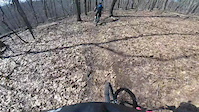
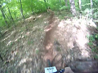
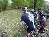
Videos of Danville Mountain Bike

trail: The Crippler
0:11 |
247 |
Dec 9, 2024
trail: Bullet Baby
0:05 |
677 |
Apr 14, 2018
trail: Concussion
0:19 |
155 |
Oct 18, 2016
trail: Concussion
14:43 |
375 |
Jan 29, 2014
trail: Concussion
13:18 |
422 |
Jan 29, 2014
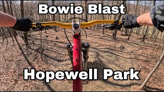
trail: Bowie Blast
0:35 |
121 |
May 20, 2025 , Danville
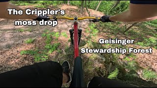
trail: The Crippler
0:25 |
135 |
May 20, 2025 , Danville

trail: The Crippler
2:55 |
121 |
Apr 9, 2025 , Danville
Current Trail Warnings
| status | trail | date | condition | user | info |
|---|---|---|---|---|---|
| Nikk's Big Banana | Jun 21, 2026 @ 8:14am (America/New_York) 2 days | Variable | kerryH1q1gt | Large tree down across trail, blocking trail |
Recent Trail Reports
| status | trail | date | condition | info | user |
|---|---|---|---|---|---|
| Bullet Baby | Jun 21, 2026 @ 8:15am (America/New_York) 2 days | Variable | kerryH1q1gt | ||
| The Crippler | Jun 6, 2026 @ 9:54am (America/New_York) Jun 6, 2026 | Dry | charlie225 | ||
| Life Flight | Jun 3, 2026 @ 10:38am (America/New_York) Jun 3, 2026 | Ideal | legacyoutback | ||
| Kidney Stone | Jun 3, 2026 @ 10:31am (America/New_York) Jun 3, 2026 | Ideal | legacyoutback | ||
| Stent | May 16, 2026 @ 9:24am (America/New_York) May 16, 2026 | Dry | whiskytangofox | ||
| Bypass | May 16, 2026 @ 9:24am (America/New_York) May 16, 2026 | Ideal | whiskytangofox | ||
| Stress Test Connector | May 16, 2026 @ 9:24am (America/New_York) May 16, 2026 | Ideal | whiskytangofox | ||
| Synapse | May 2, 2026 @ 5:03pm (America/New_York) May 2, 2026 | Prevalent Mud | DGavlick | ||
| Memory Lane | May 2, 2026 @ 5:03pm (America/New_York) May 2, 2026 | Prevalent Mud | DGavlick | ||
| B-Line | May 2, 2026 @ 5:03pm (America/New_York) May 2, 2026 | Dry | DGavlick |
Activity Feed
| username | action | type | title | date |
|---|---|---|---|---|
| kerryH1q1gt | add | report | activity #97473968 and 1 more | Jun 21, 2026 @ 5:14am 2 days |
| smokee1015 | ridden | trail | activity #96869628 | Jun 13, 2026 @ 6:28am Jun 13, 2026 |
| kerryH1q1gt | wishlist | route | activity #96489261 | Jun 7, 2026 @ 12:43pm Jun 7, 2026 |
| kerryH1q1gt | ridden | route | activity #96489243 | Jun 7, 2026 @ 12:43pm Jun 7, 2026 |
| charlie225 | add | report | activity #96384966 | Jun 6, 2026 @ 10:25am Jun 6, 2026 |
Recent Comments
| username | type | title | comment | date |
|---|---|---|---|---|
| trail | Signage suggests this has been renamed to Spin... | Mar 29, 2024 @ 12:47pm Mar 29, 2024 | ||
| trail | Downhill only. Most definitely NOT both ways | Aug 9, 2023 @ 7:16am Aug 9, 2023 | ||
| trail | Glass everywhere | Aug 9, 2023 @ 6:01am Aug 9, 2023 | ||
| report | Cleaned out. | Jul 30, 2023 @ 5:03pm Jul 30, 2023 | ||
| trail | Memory Lane is above this trail. Synapse was... | Apr 7, 2023 @ 3:10pm Apr 7, 2023 |
Local Badges
-

10 Blue Trails261 awarded -

Epic Ride Climb 2k7 awarded -

Climbing 10k Badge59 awarded -

Climbing 100k Badge7 awarded -

Epic Ride Descent 2k7 awarded -

Descent 10k Badge60 awarded
Bike & Skill Parks
| name | type | city | rating |
|---|---|---|---|
| Hopewell Park Skills Park | skill park | Danville |
Activity Type Stats
| activitytype | trails | distance | descent | descent distance | total vertical | rating | global rank | state rank | photos | reports | routes | ridelogs |
|---|---|---|---|---|---|---|---|---|---|---|---|---|
| Mountain Bike | 103 | 33 miles | 7,123 ft | 15 miles | 669 ft | #932 | #365 | 62 | 1,156 | 10 | 14,770 | |
| E-Bike | 1 | 1,037 | 2 | 1,631 | ||||||||
| Hike | 103 | 33 miles | 7,116 ft | 15 miles | 669 ft | #4,555 | #1,608 | 1,155 | 2 | 1,062 | ||
| Trail Running | 103 | 33 miles | 7,116 ft | 15 miles | 669 ft | #3,872 | #1,156 | 1,155 | 2 | 589 |
Frequently Asked Questions About Danville
▼
What are the best places to ride in Danville?
Danville has 2 areas to explore for mountain biking. The top rated areas are:
▼
What are the highest rated mountain biking trails in Danville?
The highest rated mountain biking trails in Danville are:
- Catheter (4.2/5)
- The Crippler (4.2/5)
- Abby's Way Section 3 (4.2/5)
- Abby's Way Section 1 (4.2/5)
- Abby's Way Section 2 (4.2/5)
▼
What is the best time of the year to ride in Danville?
Based on ride log data, the most popular months to ride in Danville are:
- July (276 activities)
- August (162 activities)
- June (132 activities)
▼
Where can I park to ride in Danville?
There are 3 parking locations listed in Danville. The most popular parking spots are: View all parking and trailhead locations on the map to plan your visit.
Trails
- By sjflow
 & contributors
 - Admins: apply
- #7352 - 10,175 views
- danville activity log | embed map of Danville mountain bike trails | danville mountain biking points of interest polygons
Downloading of trail gps tracks in kml & gpx formats is enabled for Danville.
You must login to download files.