close
-
Layers w
- Weather Layers
- Pro
- Pro
- Pro
- Pro
- Pro
- Pro
- More Layers
- Pro
- Pro
- Pro
- Pro
-
Upgrade to

3D
Trail Conditions
- Unknown
- Snow Groomed
- Snow Packed
- Snow Covered
- Snow Cover Partial
- Freeze/thaw Cycle
- Icy
- Prevalent Mud
- Wet
- Variable
- Ideal
- Dry
- Very Dry
Trail Flow (Ridden Direction)
Trailforks scans users ridelogs to determine the most popular direction each trail is ridden. A good flowing trail network will have most trails flowing in a single direction according to their intension.
The colour categories are based on what percentage of riders are riding a trail in its intended direction.
The colour categories are based on what percentage of riders are riding a trail in its intended direction.
- > 96%
- > 90%
- > 80%
- > 70%
- > 50%
- < 50%
- bi-directional trail
- no data
Trail Last Ridden
Trailforks scans ridelogs to determine the last time a trail was ridden.
- < 2 days
- < 1 week
- < 2 weeks
- < 1 month
- < 6 months
- > 6 months
Trail Ridden Direction
The intended direction a trail should be ridden.
- Downhill Only
- Downhill Primary
- Both Directions
- Uphill Primary
- Uphill Only
- One Direction
Contribute Details
Colors indicate trail is missing specified detail.
- Description
- Photos
- Description & Photos
- Videos
Trail Popularity ?
Trailforks scans ridelogs to determine which trails are ridden the most in the last 9 months.
Trails are compared with nearby trails in the same city region with a possible 25 colour shades.
Think of this as a heatmap, more rides = more kinetic energy = warmer colors.
- most popular
- popular
- less popular
- not popular
ATV/ORV/OHV Filter
Max Vehicle Width
inches
US Cell Coverage
Legend

Radar Time
Activity Recordings
Trailforks uses anonymized public activity data.
?
Activity Recordings
Trailforks uses anonymized public activity data.
?
Personal Heatmap
▶
Activity Types
all
/
none
▶
Options
2
Date range
month
–
Winter Trails
Warning
A routing network for winter maps does not exist. Selecting trails using the winter trails layer has been disabled.
Missing Trails
Most Popular
Least Popular
Trails are colored based on popularity. The more popular a trail is, the more red. Less popular trails trend towards green.
Jump Magnitude Heatmap
Heatmap of where riders jump on trails. Zoom in to see individual jumps, click circles to view jump details.
BC Backroad Status
![map legend]()
Service Road Atlas is a free to use, community-driven service for viewing and creating reports on the numerous back-country service roads around B.C. and Alberta.

Slope Aspect
Direction the slope faces
Trails Deemphasized
Trails are shown in grey.
Only show trails with no bike usage.
Suggested Layers
Based on selected activity type
Save the current map location and zoom level as your default home location whenever this page is loaded.
SaveDash Point is a state park. The trails are well marked, with difficulty information. The easy and intermediate trails have roots up to 4". Easy trails tend to be fairly wide. The diamond trails are tech 2, with a few hazards up to 12". There are no drops or jumps. The trails tend to be wide single track, hilly and flowing. The majority of the area is mixed second growth forest with typical Northwest undergrowth. The park is heavily used in the summer, expect to see other users in the winter.
source: Dash Point - Evergreen
 google parking directions
 Activities Click to view
- Mountain Bike
35 trails
- E-Bike
28 trails
- Hike
36 trails
- Trail Running
36 trails
Region Details
- 1
- 1
- 21
- 12
Region Status
Open as of Jun 19, 2026Local Trail Association
Stats
- Avg Trail Rating
- Trails (view details)
- 36
- Trails Mountain Bike
- 35
- Trails E-Bike
- 28
- Trails Hike
- 36
- Trails Trail Running
- 36
- Total Distance
- 16 miles
- Total Descent
- 1,717 ft
- Total Vertical
- 541 ft
- Highest Trailhead
- 549 ft
- Reports
- 293
- Photos
- 45
- Ridden Counter
- 6,644
Popular Dash Point State Park Mountain Biking Trails
• 85 ★ 4.5 • 3,980 ft • 44 ft • 345 •
Popular blue difficulty singletrack. This multi-use trail can be used both directions. On average it takes 5 minutes to complete this trail.
• 80 ★ 4.0 • 3,202 ft • 115 ft • 313 •
Popular blue difficulty singletrack. This mountain bike primary trail can be used both directions. On average it takes 9 minutes to complete this trail.
• 75 ★ 3.5 • 1,115 ft • 111 ft • 308 •
Popular blue difficulty singletrack. This multi-use trail can be used downhill primary and has a moderate overall physical rating with a 111 ft blue climb. On average it takes 2 minutes to complete this trail.
• 85 ★ 4.0 • 1,709 ft • 42 ft • 291 •
Popular green difficulty singletrack. This mountain bike primary trail can be used both directions and has a easy overall physical rating with a 42 ft green climb. On average it takes 3 minutes to complete this trail.
• 80 ★ 3.0 • 2 miles • 56 ft • 283 •
The first mile of the 6-mile Cushman trail. The trail is friendly to cyclists and hikers of all ages, and actively used for walking events and fundraisers.The path is paved and 12-16 feet in width. There is a bathroom and picnic tables...
• 85 ★ 0.0 • 820 ft • 34 ft • 277 •
Popular green difficulty singletrack. This mountain bike primary trail can be used both directions. On average it takes 1 minutes to complete this trail.
• 80 ★ 4.0 • 2,703 ft • 52 ft • 274 •
Popular blue difficulty singletrack. This mountain bike primary trail can be used both directions. It features bridge. On average it takes 4 minutes to complete this trail.
Dash Point State Park Mountain Bike Routes
5 miles • 358 ft • 29 • Loop •
The trail is approximately 5 miles in length, and starts/finishes at the Hoyt Road Parking Lot. There are...
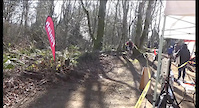
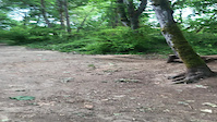
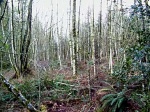
Photos of Dash Point State Park Mountain Bike
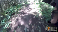
Videos of Dash Point State Park Mountain Bike
trail: Dash Point Access
0:07 |
175 |
Feb 17, 2022
trail: Know It All Kid
0:04 |
|
Jun 9, 2021
trail: Ridge Trail
3:20 |
193 |
Aug 6, 2016

trail: Technical Trail
16:56 |
685 |
Dec 29, 2010

trail: Technical Trail
17:00 |
1556 |
Aug 18, 2010
trail: Log Jam
0:17 |
521 |
Feb 16, 2010

trail: IMBA
6:25 |
917 |
May 8, 2020 , Tacoma

trail: The Downhill
0:11 |
181 |
Oct 15, 2008
Current Trail Warnings
| status | trail | date | condition | user | info |
|---|---|---|---|---|---|
| IMBA | Jun 19, 2026 @ 12:25pm (America/Vancouver) Jun 19, 2026 | Ideal | Vxtomgibbs | Trail is in good shape but it's been dry... | |
| Heartbreak Hill | Jun 16, 2026 @ 9:40am (America/Los_Angeles) Jun 16, 2026 | Ideal | Vxtomgibbs | The trail is closed now as of June 2026 |
Recent Trail Reports
| status | trail | date | condition | info | user |
|---|---|---|---|---|---|
| Know It All Kid | Jun 19, 2026 @ 12:25pm (America/Vancouver) Jun 19, 2026 | Ideal | Vxtomgibbs | ||
| Double Dip | Jun 19, 2026 @ 12:25pm (America/Vancouver) Jun 19, 2026 | Ideal | Vxtomgibbs | ||
| The Downhill | Jun 19, 2026 @ 12:25pm (America/Vancouver) Jun 19, 2026 | Ideal | Vxtomgibbs | ||
| Heart Attack Hill | Jun 19, 2026 @ 12:25pm (America/Vancouver) Jun 19, 2026 | Ideal | Vxtomgibbs | ||
| East Rim Trail | Jun 19, 2026 @ 12:25pm (America/Vancouver) Jun 19, 2026 | Ideal | Vxtomgibbs | ||
| Switchback | Jun 19, 2026 @ 12:25pm (America/Vancouver) Jun 19, 2026 | Ideal | Vxtomgibbs | ||
| Log Jam | Jun 19, 2026 @ 12:25pm (America/Vancouver) Jun 19, 2026 | Variable | Vxtomgibbs | ||
| Nightcrawler | Jun 19, 2026 @ 12:25pm (America/Vancouver) Jun 19, 2026 | Variable | Vxtomgibbs | ||
| Technical Trail | Jun 19, 2026 @ 12:25pm (America/Vancouver) Jun 19, 2026 | Ideal | Vxtomgibbs | ||
| trail-1 | Jun 16, 2026 @ 2:59pm (America/Vancouver) Jun 16, 2026 | Ideal | izzmo |
Activity Feed
| username | action | type | title | date |
|---|---|---|---|---|
| Vxtomgibbs | add | report | activity #97503015 and 9 more | Jun 21, 2026 @ 11:09am Jun 21, 2026 |
| izzmo | add | report | activity #97151555 and 5 more | Jun 16, 2026 @ 5:52pm Jun 16, 2026 |
| Vxtomgibbs | add | report | activity #97117164 and 1 more | Jun 16, 2026 @ 9:35am Jun 16, 2026 |
| Vxtomgibbs | add | report | activity #96388232 | Jun 6, 2026 @ 10:56am Jun 6, 2026 |
| raptor30 | wishlist | trail | activity #93260118 and 8 more | Apr 23, 2026 @ 8:27pm Apr 23, 2026 |
Recent Comments
| username | type | title | comment | date |
|---|---|---|---|---|
| trail | Double track connector trail | Feb 24, 2025 @ 11:45am Feb 24, 2025 | ||
| trail | Smooth and fast downhill with what is probably... | Feb 24, 2025 @ 11:40am Feb 24, 2025 | ||
| trail | IMO the most challenging trail in the park to... | Feb 17, 2025 @ 8:53pm Feb 17, 2025 | ||
| trail | Wont be doing that again on a mtb lol Lots and... | Jul 30, 2023 @ 4:02pm Jul 30, 2023 | ||
| trail | Now open to bikes | May 22, 2021 @ 2:48pm May 22, 2021 |
Nearby Areas
| name | distance | ||||
|---|---|---|---|---|---|
| Maury Island Natural Area | 5 | 6 | 1 | 4 km | |
| Dockton Forest | 14 | 8 | 3 | 1 | 4.5 km |
| Burton Acres | 3 | 5.8 km | |||
| Salt Water State Park | 5.8 km | ||||
| Point Defiance Park | 5.9 km |
Local Badges
-

Completionist3 awarded
Local Products
Activity Type Stats
| activitytype | trails | distance | descent | descent distance | total vertical | rating | global rank | state rank | photos | reports | routes | ridelogs |
|---|---|---|---|---|---|---|---|---|---|---|---|---|
| Mountain Bike | 35 | 15 miles | 1,716 ft | 7 miles | 541 ft | #3,244 | #1,136 | 45 | 293 | 2 | 6,502 | |
| E-Bike | 28 | 14 miles | 1,371 ft | 6 miles | 541 ft | #5,600 | #1,551 | 250 | 88 | |||
| Hike | 36 | 16 miles | 1,716 ft | 7 miles | 541 ft | #8,403 | #3,150 | 293 | 2 | 330 | ||
| Trail Running | 36 | 16 miles | 1,716 ft | 7 miles | 541 ft | #6,500 | #2,076 | 293 | 693 |
Frequently Asked Questions About Dash Point State Park
▼
What are the highest rated mountain biking trails in Dash Point State Park?
The highest rated mountain biking trails in Dash Point State Park are:
- IMBA (4.1/5)
- Milton Interurban Trail (4.1/5)
- Log Jam (4.1/5)
- Nightcrawler (4/5)
- Cushman Trail: Borgen to Grandview (4/5)
▼
What is the best time of the year to ride in Dash Point State Park?
Based on ride log data, the most popular months to ride in Dash Point State Park are:
- July (75 activities)
- August (64 activities)
- June (45 activities)
▼
Where can I park to ride in Dash Point State Park?
There are 1 parking locations listed in Dash Point State Park. The most popular parking spots are:
▼
What is the longest trail in Dash Point State Park?
The longest trail in Dash Point State Park is Cushman Trail: Borgen to Grandview at 2.7 miles. View all trails sorted by distance.
Activities
Trails
Points of Interest
- By jmahler
 TRAILFORKS WMBC Amb & contributors
 - Admins: EMBA SOSO, EMBA-C2S, EMBA SOSO
- #12153 - 11,949 views
- dash point state park activity log | embed map of Dash Point State Park mountain bike trails | dash point state park mountain biking points of interest
Downloading of trail gps tracks in kml & gpx formats is enabled for Dash Point State Park.
You must login to download files.