close
-
Layers w
- Weather Layers
- Pro
- Pro
- Pro
- Pro
- Pro
- Pro
- More Layers
- Pro
- Pro
- Pro
- Pro
-
Upgrade to

3D
Trail Conditions
- Unknown
- Snow Groomed
- Snow Packed
- Snow Covered
- Snow Cover Partial
- Freeze/thaw Cycle
- Icy
- Prevalent Mud
- Wet
- Variable
- Ideal
- Dry
- Very Dry
Trail Flow (Ridden Direction)
Trailforks scans users ridelogs to determine the most popular direction each trail is ridden. A good flowing trail network will have most trails flowing in a single direction according to their intension.
The colour categories are based on what percentage of riders are riding a trail in its intended direction.
The colour categories are based on what percentage of riders are riding a trail in its intended direction.
- > 96%
- > 90%
- > 80%
- > 70%
- > 50%
- < 50%
- bi-directional trail
- no data
Trail Last Ridden
Trailforks scans ridelogs to determine the last time a trail was ridden.
- < 2 days
- < 1 week
- < 2 weeks
- < 1 month
- < 6 months
- > 6 months
Trail Ridden Direction
The intended direction a trail should be ridden.
- Downhill Only
- Downhill Primary
- Both Directions
- Uphill Primary
- Uphill Only
- One Direction
Contribute Details
Colors indicate trail is missing specified detail.
- Description
- Photos
- Description & Photos
- Videos
Trail Popularity ?
Trailforks scans ridelogs to determine which trails are ridden the most in the last 9 months.
Trails are compared with nearby trails in the same city region with a possible 25 colour shades.
Think of this as a heatmap, more rides = more kinetic energy = warmer colors.
- most popular
- popular
- less popular
- not popular
ATV/ORV/OHV Filter
Max Vehicle Width
inches
US Cell Coverage
Legend

Radar Time
Activity Recordings
Trailforks uses anonymized public activity data.
?
Activity Recordings
Trailforks uses anonymized public activity data.
?
Personal Heatmap
▶
Activity Types
all
/
none
▶
Options
2
Date range
month
–
Winter Trails
Warning
A routing network for winter maps does not exist. Selecting trails using the winter trails layer has been disabled.
Missing Trails
Most Popular
Least Popular
Trails are colored based on popularity. The more popular a trail is, the more red. Less popular trails trend towards green.
Jump Magnitude Heatmap
Heatmap of where riders jump on trails. Zoom in to see individual jumps, click circles to view jump details.
BC Backroad Status
![map legend]()
Service Road Atlas is a free to use, community-driven service for viewing and creating reports on the numerous back-country service roads around B.C. and Alberta.

Slope Aspect
Direction the slope faces
Trails Deemphasized
Trails are shown in grey.
Only show trails with no bike usage.
Suggested Layers
Based on selected activity type
Save the current map location and zoom level as your default home location whenever this page is loaded.
Save
No description for Deiva Marina has been added yet!
Login or register to submit one.
This region uses the Uk/Euro style trail grading system.
Activities Click to view
- Mountain Bike
42 trails
- E-Bike
25 trails
- Adaptive Bike
0 trails
- Winter Fat Bike
0 trails
- Hike
34 trails
- Trail Running
31 trails
Region Details
- 10
- 10
- 17
Region Status
Open as of Jun 12, 2026Stats
- Avg Trail Rating
- Trails (view details)
- 41
- Trails Mountain Bike
- 42
- Trails E-Bike
- 25
- Trails Horse
- 2
- Trails Hike
- 34
- Trails Trail Running
- 31
- Trails Dirtbike/Moto
- 1
- Trails Snowmobile
- 1
- Total Distance
- 30 miles
- Total Descent Distance
- 19 miles
- Total Descent
- 13,388 ft
- Total Vertical
- 2,748 ft
- Highest Trailhead
- 2,804 ft
- Reports
- 531
- Photos
- 146
- Ridden Counter
- 2,199
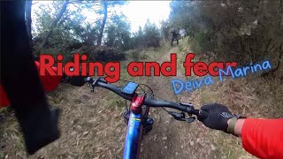
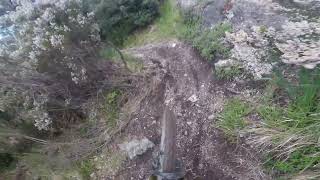
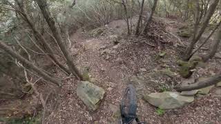
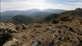
Popular Deiva Marina Mountain Biking Trails
• 90 ★ 4.8 • 1 mile • 11 ft • 173 •
Bellissima discesa che parte dalle Antenne del monte San Nicolao. L'innesto non è facilissimo da prendere, occorre costeggiare internamente il muretto per circa 20 metri e poi inizia il sentiero.
• 100 ★ 4.9 • 3,776 ft • 0 ft • 159 •
Super nice trail from the top of the San Nicolao Peak till the main road. mountain and forest terrain super fun features like berms little jumps and drops.
• 95 ★ 4.4 • 2 miles • 35 ft • 144 •
Bel sentiero che scende dalle Antenne del Monte San Nicola sopra a Levanto fino a raggiungere la strada statale. Dalla cima partono 3 sentieri verso Mattarana e 2 sentieri verso Tagliamento/Vasca
• 60 ★ 4.0 • 1 mile • 4 ft • 81 •
SENTIERO STORICO che dalla frazione panoramica di COSTA rientra verso DEIVA MARINA. OTTIMO trail per gli amanti dell'enduro e dell'All-Mountain
• 35 ★ 3.6 • 3,609 ft • 0 ft • 76 •
Sentiero nei boschi sopra Deiva Marina. Facilmente raggiungibile dalla strada del Bracco - aurelia - scendendo in direzione Deiva Marina o Facendo prima il sentiero partendo dal Passo del Bracco. Sentiero inizialmente veloce e poi...
• 75 ★ 4.0 • 3,904 ft • 91 ft • 66 •
Collegamento alla località Tagliamento, nell'ultima parte si abbandona il sentiero principale per una traccia evidente sulla destra in modo da evitare il passaggio vicino alle abitazioni
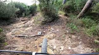
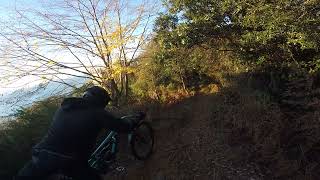
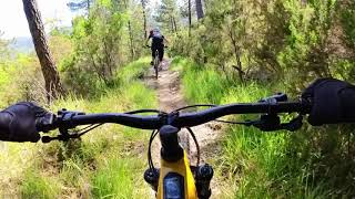
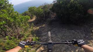
Photos of Deiva Marina Mountain Bike
Videos of Deiva Marina Mountain Bike
trail: Ciaparoc
10:03 |
72 |
Nov 29, 2025 , Deiva Marina
trail: Ciaparoc
8:20 |
109 |
Dec 25, 2024 , Deiva Marina
trail: La rai
5:37 |
169 |
May 20, 2024 , Deiva Marina
trail: Ciaparoc
7:45 |
314 |
Jul 13, 2023 , Deiva Marina
12:37 |
70 |
May 5, 2023
trail: Baracchino nuovo
7:34 |
207 |
May 2, 2023 , Deiva Marina
youtuber
![Baracchino Nuovo - Bracco Trail Center | Deiva...]()
trail: Baracchino nuovo
5:10 |
212 |
Feb 22, 2023 , Deiva Marina
Recent Trail Reports
| status | trail | date | condition | info | user |
|---|---|---|---|---|---|
| Link Vasca | Jun 13, 2026 @ 8:56am (Europe/Rome) Jun 12, 2026 | Ideal | mmax70 | ||
| Ruderi | Jun 13, 2026 @ 8:56am (Europe/Rome) Jun 12, 2026 | Ideal | mmax70 | ||
| Bracco access trails | Jun 13, 2026 @ 8:56am (Europe/Rome) Jun 12, 2026 | Ideal | mmax70 | ||
| Ciaparoc | Jun 1, 2026 @ 10:55am (Europe/Monaco) Jun 1, 2026 | Variable | Garru | ||
| Persico | May 21, 2026 @ 11:45am (Europe/Rome) May 21, 2026 | Dry | alexmetaam | ||
| La rai | May 21, 2026 @ 11:45am (Europe/Rome) May 21, 2026 | Ideal | alexmetaam | ||
| Baracchino - Vasca | May 21, 2026 @ 11:45am (Europe/Rome) May 21, 2026 | Ideal | alexmetaam | ||
| Baracchino nuovo | May 21, 2026 @ 11:45am (Europe/Rome) May 21, 2026 | Dry | alexmetaam | ||
| Rai lunga | May 14, 2026 @ 10:47am (Europe/Rome) May 14, 2026 | Variable | alexmetaam | ||
| Mezzema-S.Pantaleo | Apr 4, 2026 @ 6:12am (Pacific/Midway) Apr 4, 2026 | Dry | andreac4 |
Activity Feed
| username | action | type | title | date |
|---|---|---|---|---|
| Max5hVnEN | ridden | trail | activity #97614412 and 1 more | Jun 23, 2026 @ 3:00am Jun 23, 2026 |
| Max5hVnEN | ridden | trail | activity #97307487 | Jun 19, 2026 @ 4:28am Jun 19, 2026 |
| mmax70 | add | report | activity #97028985 and 2 more | Jun 15, 2026 @ 2:20am Jun 15, 2026 |
| EdoardoF3Ihym | wishlist | trail | activity #96164164 | Jun 3, 2026 @ 10:11am Jun 3, 2026 |
| Garru | add | report | activity #96025146 | Jun 1, 2026 @ 10:01am Jun 1, 2026 |
Recent Comments
| username | type | title | comment | date |
|---|---|---|---|---|
| trail | Trail spettacolare, da fare assolutamente! | May 4, 2026 @ 6:09am May 4, 2026 | ||
| trail | Scuola di trial, qua si impara...bellissimo e... | Feb 21, 2026 @ 11:37am Feb 21, 2026 | ||
| trail | Fatto! | Dec 26, 2025 @ 8:48am Dec 26, 2025 | ||
| trail | Thanks ;) | Dec 26, 2025 @ 6:23am Dec 26, 2025 | ||
| trail | If you enjoyed riding the area and want to... | Dec 26, 2025 @ 6:21am Dec 26, 2025 |
Local Badges
-

Epic Mountain Bike Climb 2k119 awarded -

Climbing 10k Badge20 awarded -

Mountain Biking 100k Badge0 awarded -

Epic Ride Descent 2k119 awarded -

Descent 10k Badge20 awarded -

Descent 100k Badge0 awarded
Activity Type Stats
| activitytype | trails | distance | descent | descent distance | total vertical | rating | global rank | state rank | photos | reports | routes | ridelogs |
|---|---|---|---|---|---|---|---|---|---|---|---|---|
| Mountain Bike | 42 | 30 miles | 13,389 ft | 19 miles | 2,749 ft | #3,740 | #221 | 131 | 531 | 1,029 | ||
| E-Bike | 25 | 16 miles | 8,369 ft | 11 miles | 2,749 ft | #2,193 | #214 | 15 | 454 | 354 | ||
| Horse | 2 | 3,015 ft | 95 ft | 1,037 ft | 1,709 ft | 9 | ||||||
| Hike | 34 | 25 miles | 10,692 ft | 16 miles | 2,749 ft | #5,547 | #253 | 511 | 24 | |||
| Trail Running | 31 | 24 miles | 10,384 ft | 15 miles | 2,749 ft | #5,132 | #243 | 509 | 12 | |||
| Dirtbike/Moto | 1 | 1,985 ft | 13 ft | 295 ft | 59 ft | 9 | ||||||
| Snowmobile | 1 | 1 mile | 771 ft | 4,787 ft | 728 ft | 1 |
Frequently Asked Questions About Deiva Marina
▼
What are the highest rated mountain biking trails in Deiva Marina?
The highest rated mountain biking trails in Deiva Marina are:
- Baracchino nuovo (4.6/5)
- La rai (4.6/5)
- Rai lunga (4.2/5)
- Ruderi (4.1/5)
- PelUgo (4.1/5)
▼
What is the best time of the year to ride in Deiva Marina?
Based on ride log data, the most popular months to ride in Deiva Marina are:
- April (4 activities)
- May (4 activities)
- March (4 activities)
▼
Where can I park to ride in Deiva Marina?
Check the Deiva Marina trail map for trailhead and parking information. Community members regularly update access and parking details for trails in the area.
▼
What is the longest trail in Deiva Marina?
The longest trail in Deiva Marina is Mezzema-S.Pantaleo at 2.8 km. View all trails sorted by distance.
Activities
Trails
Points of Interest
- By jack-Dodino & contributors
- Admins: denitopia
- #21439 - 8,493 views
- deiva marina activity log | embed map of Deiva Marina mountain bike trails | deiva marina mountain biking points of interest
Downloading of trail gps tracks in kml & gpx formats is enabled for Deiva Marina.
You must login to download files.