close
-
Layers w
- Weather Layers
- Pro
- Pro
- Pro
- Pro
- Pro
- Pro
- More Layers
- Pro
- Pro
- Pro
- Pro
-
Upgrade to

3D
Trail Conditions
- Unknown
- Snow Groomed
- Snow Packed
- Snow Covered
- Snow Cover Partial
- Freeze/thaw Cycle
- Icy
- Prevalent Mud
- Wet
- Variable
- Ideal
- Dry
- Very Dry
Trail Flow (Ridden Direction)
Trailforks scans users ridelogs to determine the most popular direction each trail is ridden. A good flowing trail network will have most trails flowing in a single direction according to their intension.
The colour categories are based on what percentage of riders are riding a trail in its intended direction.
The colour categories are based on what percentage of riders are riding a trail in its intended direction.
- > 96%
- > 90%
- > 80%
- > 70%
- > 50%
- < 50%
- bi-directional trail
- no data
Trail Last Ridden
Trailforks scans ridelogs to determine the last time a trail was ridden.
- < 2 days
- < 1 week
- < 2 weeks
- < 1 month
- < 6 months
- > 6 months
Trail Ridden Direction
The intended direction a trail should be ridden.
- Downhill Only
- Downhill Primary
- Both Directions
- Uphill Primary
- Uphill Only
- One Direction
Contribute Details
Colors indicate trail is missing specified detail.
- Description
- Photos
- Description & Photos
- Videos
Trail Popularity ?
Trailforks scans ridelogs to determine which trails are ridden the most in the last 9 months.
Trails are compared with nearby trails in the same city region with a possible 25 colour shades.
Think of this as a heatmap, more rides = more kinetic energy = warmer colors.
- most popular
- popular
- less popular
- not popular
ATV/ORV/OHV Filter
Max Vehicle Width
inches
US Cell Coverage
Legend

Radar Time
Activity Recordings
Trailforks uses anonymized public activity data.
?
Activity Recordings
Trailforks uses anonymized public activity data.
?
Personal Heatmap
▶
Activity Types
all
/
none
▶
Options
2
Date range
month
–
Winter Trails
Warning
A routing network for winter maps does not exist. Selecting trails using the winter trails layer has been disabled.
Missing Trails
Most Popular
Least Popular
Trails are colored based on popularity. The more popular a trail is, the more red. Less popular trails trend towards green.
Jump Magnitude Heatmap
Heatmap of where riders jump on trails. Zoom in to see individual jumps, click circles to view jump details.
BC Backroad Status
![map legend]()
Service Road Atlas is a free to use, community-driven service for viewing and creating reports on the numerous back-country service roads around B.C. and Alberta.

Slope Aspect
Direction the slope faces
Trails Deemphasized
Trails are shown in grey.
Only show trails with no bike usage.
Suggested Layers
Based on selected activity type
Save the current map location and zoom level as your default home location whenever this page is loaded.
Save
No description for Denny has been added yet!
Login or register to submit one.
This region uses the Uk/Euro style trail grading system.
Activities Click to view
- Mountain Bike
105 trails
- E-Bike
105 trails
- Gravel Bike
0 trails
- Adaptive Bike
0 trails
- Winter Fat Bike
0 trails
- Horse
6 trails
- Hike
94 trails
- Trail Running
94 trails
Region Details
- 56
- 20
- 16
- 7
- 4
Region Status
Caution as of Jun 6, 2026Stats
- Avg Trail Rating
- Trails (view details)
- 104
- Trails Mountain Bike
- 105
- Trails E-Bike
- 105
- Trails Horse
- 6
- Trails Hike
- 94
- Trails Trail Running
- 94
- Total Distance
- 83 miles
- Total Descent
- 8,994 ft
- Total Vertical
- 1,742 ft
- Highest Trailhead
- 1,832 ft
- Reports
- 756
- Photos
- 115
- Ridden Counter
- 7,311
Sub Regions
-
Carron Valley
- 10
- 16
- 7
- 4
Popular Denny Mountain Biking Trails
• 100 ★ 3.2 • 2,743 ft • 15 ft • 915 •
Enter The Breech then the Full Bore section, keeping your sights on the exit as you gun it round Recoil – a huge, bermed corner that is guaranteed to raise a smile. After the Recoil, bear right onto the and follow it to the top of The...
• 100 ★ 3.6 • 3,711 ft • 0 ft • 887 •
This freeride descent is packed with features, designed so beginners can roll the jumps while experienced riders can get some serious air. Experience Turbulence as you drop in, feel the speed through the Corkscrew and explode out of the...
• 100 ★ 3.0 • 2,713 ft • 0 ft • 865 •
Catch your breath and admire the stunning panoramic views before you begin the fast descent of (Ee-as Doo), the ‘Black Waterfall’. Take on the Kelpie Staircase, a steep stone-pitched section that’s not for the faint-hearted!...
• 100 ★ 2.8 • 4,852 ft • 221 ft • 852 •
Moderate, swoopy singletrack breaks up the gentle climb through the forest, and there are superb views across the valley from the viewpoint. The fast exit into the quarry through Stoney Broke sets you up for the ascent to . Starts at...
• 100 ★ 3.0 • 699 ft • 10 ft • 823 •
Popular green difficulty family friendly gravel path. This multi-use trail can be used both directions and has a easy overall physical rating with a 10 ft green climb. Trail visibility is always easy to follow. On average it takes 1 minutes to complete this trail.
• 90 ★ 2.0 • 1,056 ft • 3 ft • 649 •
Popular blue difficulty singletrack. This mountain bike primary trail can be used downhill primary. On average it takes 1 minutes to complete this trail.
• 95 ★ 2.5 • 1,227 ft • 66 ft • 378 •
Popular red difficulty singletrack. This mountain bike primary trail can be used uphill primary. On average it takes 2 minutes to complete this trail.
• 85 ★ 2.0 • 2,994 ft • 69 ft • 201 • • hike
Popular green difficulty family friendly gravel path. This hike primary trail can be used both directions and has a easy overall physical rating with a 69 ft green climb. Adaptive MTB rating: amtb green. Trail visibility is always easy to follow. On average it takes 3 minutes to complete this trail.
Denny Mountain Bike Routes
2 miles • 163 ft • 1 •
Circular Route - the shortes way I have found of lapping this trail.
13 miles • 1,147 ft • 3 • Loop •
Good circular route around Carron Valley Reservoir including a decent climb
1 mile • 205 ft • 3 •
Cannonball circular lap. Shortest route I have found for lapping this trail.
• 15 miles • 2,015 ft • 24 •
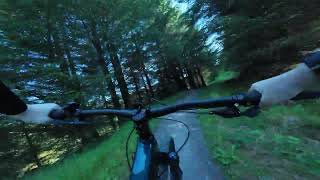
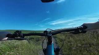
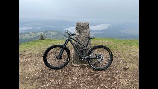
Photos of Denny Mountain Bike
Videos of Denny Mountain Bike
trail: Eas Dubh
2:08 |
287 |
Sep 12, 2016
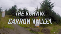
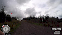
trail: Runway
2:36 |
931 |
Aug 18, 2016
trail: Runway
2:03 |
327 |
Sep 2, 2015

trail: Eas Dubh
2:38 |
229 |
Aug 16, 2013
trail: Eas Dubh
0:59 |
147 |
Jul 14, 2025 , Denny
trail: Runway
2:36 |
167 |
Jul 14, 2025 , Denny
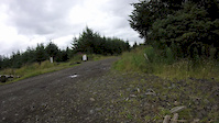
trail: Cannonball Run
2:29 |
123 |
Jul 13, 2025 , Denny
9:05 |
81 |
Aug 2, 2024
Recent Trail Reports
| status | trail | date | condition | info | user |
|---|---|---|---|---|---|
| Runway | Jun 6, 2026 @ 2:32pm (Europe/Isle_of_Man) Jun 6, 2026 | Dry | ShoodNoBetter BCDC | ||
| Cannonball Run | Jun 6, 2026 @ 2:32pm (Europe/Isle_of_Man) Jun 6, 2026 | Dry | ShoodNoBetter BCDC | ||
| Eas Dubh | Jun 6, 2026 @ 2:32pm (Europe/Isle_of_Man) Jun 6, 2026 | Dry | ShoodNoBetter BCDC | ||
| Trail | Jun 6, 2026 @ 2:32pm (Europe/Isle_of_Man) Jun 6, 2026 | Dry | ShoodNoBetter BCDC | ||
| Forest Road | May 16, 2026 @ 10:18am (Europe/Isle_of_Man) May 16, 2026 | Dry | ShoodNoBetter BCDC | ||
| Pipedream | May 16, 2026 @ 10:18am (Europe/Isle_of_Man) May 16, 2026 | Dry | ShoodNoBetter BCDC | ||
| Pipedream | May 16, 2026 @ 10:18am (Europe/Isle_of_Man) May 16, 2026 | Dry | ShoodNoBetter BCDC | ||
| Bin Burn Singletrack | May 10, 2026 @ 1:59pm (Europe/London) May 10, 2026 | Variable | Jamie-e92 | ||
| Forest Road | Dec 18, 2025 @ 10:09am (Europe/London) Dec 18, 2025 | Variable | ddd333hhh | ||
| Forest Road | Dec 18, 2025 @ 10:09am (Europe/London) Dec 18, 2025 | Ideal | ddd333hhh |
Activity Feed
| username | action | type | title | date |
|---|---|---|---|---|
| ShoodNoBetter | add | report | activity #96373168 and 4 more | Jun 6, 2026 @ 8:20am Jun 6, 2026 |
| torobravo17 | wishlist | region | activity #95919485 | May 31, 2026 @ 2:53am May 31, 2026 |
| ShoodNoBetter | add | report | activity #94804905 and 6 more | May 16, 2026 @ 5:24am May 16, 2026 |
| Jamie-e92 | add | report | activity #94418928 | May 10, 2026 @ 5:59am May 10, 2026 |
| IGcMZ | ridden | trail | activity #93983535 | May 3, 2026 @ 2:23pm May 3, 2026 |
Recent Comments
| username | type | title | comment | date |
|---|---|---|---|---|
| trail | Definitely not a black trail -- red at most. | Apr 22, 2026 @ 8:04am Apr 22, 2026 | ||
| trail | The recent revisions have been dramatic. All 3... | Jul 21, 2025 @ 12:54pm Jul 21, 2025 | ||
| report | Large trees blocking road | Jul 19, 2025 @ 7:01am Jul 19, 2025 | ||
| trail | Hike a bike or fat tyres - tried to go up as... | Aug 15, 2024 @ 7:28am Aug 15, 2024 | ||
| trail | Really good. You don’t need to go over the... | Nov 8, 2023 @ 4:04am Nov 8, 2023 |
Local Badges
-

Epic Mountain Bike Climb 2k20 awarded -

Climbing 10k Badge21 awarded -

Mountain Biking 100k Badge0 awarded -

Epic Ride Descent 2k20 awarded -

Descent 10k Badge21 awarded -

Descent 100k Badge0 awarded
Activity Type Stats
| activitytype | trails | distance | descent | descent distance | total vertical | rating | global rank | state rank | photos | reports | routes | ridelogs |
|---|---|---|---|---|---|---|---|---|---|---|---|---|
| Mountain Bike | 105 | 83 miles | 8,937 ft | 35 miles | 1,742 ft | #2,640 | #85 | 100 | 756 | 5 | 4,361 | |
| E-Bike | 105 | 83 miles | 8,937 ft | 35 miles | 1,742 ft | #924 | #47 | 14 | 732 | 4 | 798 | |
| Horse | 6 | 7 miles | 420 ft | 3 miles | 1,280 ft | 96 | ||||||
| Hike | 94 | 79 miles | 7,828 ft | 32 miles | 1,742 ft | #2,493 | #54 | 614 | 176 | |||
| Trail Running | 94 | 79 miles | 7,828 ft | 32 miles | 1,742 ft | #2,800 | #53 | 1 | 616 | 266 |
Frequently Asked Questions About Denny
▼
What are the best places to ride in Denny?
Denny has 1 areas to explore for mountain biking. The top rated areas are:
▼
What are the highest rated mountain biking trails in Denny?
The highest rated mountain biking trails in Denny are:
- Treebeard's Pubes (4/5)
- Path (3.8/5)
- Access Track (3.7/5)
- Path (3.7/5)
- Runway (3.7/5)
▼
What is the best time of the year to ride in Denny?
Based on ride log data, the most popular months to ride in Denny are:
- September (25 activities)
- October (21 activities)
- June (20 activities)
▼
Where can I park to ride in Denny?
There are 5 parking locations listed in Denny. The most popular parking spots are: View all parking and trailhead locations on the map to plan your visit.
Activities
Trails
- By gav-s
 & contributors
 - Admins: DMBinS, FLS, OTA
- #36466 - 2,096 views
- denny activity log | embed map of Denny mountain bike trails | denny mountain biking points of interest polygons
Downloading of trail gps tracks in kml & gpx formats is enabled for Denny.
You must login to download files.