close
-
Layers w
- Weather Layers
- Pro
- Pro
- Pro
- Pro
- Pro
- Pro
- More Layers
- Pro
- Pro
- Pro
- Pro
-
Upgrade to

3D
Trail Conditions
- Unknown
- Snow Groomed
- Snow Packed
- Snow Covered
- Snow Cover Partial
- Freeze/thaw Cycle
- Icy
- Prevalent Mud
- Wet
- Variable
- Ideal
- Dry
- Very Dry
Trail Flow (Ridden Direction)
Trailforks scans users ridelogs to determine the most popular direction each trail is ridden. A good flowing trail network will have most trails flowing in a single direction according to their intension.
The colour categories are based on what percentage of riders are riding a trail in its intended direction.
The colour categories are based on what percentage of riders are riding a trail in its intended direction.
- > 96%
- > 90%
- > 80%
- > 70%
- > 50%
- < 50%
- bi-directional trail
- no data
Trail Last Ridden
Trailforks scans ridelogs to determine the last time a trail was ridden.
- < 2 days
- < 1 week
- < 2 weeks
- < 1 month
- < 6 months
- > 6 months
Trail Ridden Direction
The intended direction a trail should be ridden.
- Downhill Only
- Downhill Primary
- Both Directions
- Uphill Primary
- Uphill Only
- One Direction
Contribute Details
Colors indicate trail is missing specified detail.
- Description
- Photos
- Description & Photos
- Videos
Trail Popularity ?
Trailforks scans ridelogs to determine which trails are ridden the most in the last 9 months.
Trails are compared with nearby trails in the same city region with a possible 25 colour shades.
Think of this as a heatmap, more rides = more kinetic energy = warmer colors.
- most popular
- popular
- less popular
- not popular
ATV/ORV/OHV Filter
Max Vehicle Width
inches
US Cell Coverage
Legend

Radar Time
Activity Recordings
Trailforks uses anonymized public activity data.
?
Activity Recordings
Trailforks uses anonymized public activity data.
?
Personal Heatmap
▶
Activity Types
all
/
none
▶
Options
2
Date range
month
–
Winter Trails
Warning
A routing network for winter maps does not exist. Selecting trails using the winter trails layer has been disabled.
Missing Trails
Most Popular
Least Popular
Trails are colored based on popularity. The more popular a trail is, the more red. Less popular trails trend towards green.
Jump Magnitude Heatmap
Heatmap of where riders jump on trails. Zoom in to see individual jumps, click circles to view jump details.
BC Backroad Status
![map legend]()
Service Road Atlas is a free to use, community-driven service for viewing and creating reports on the numerous back-country service roads around B.C. and Alberta.

Slope Aspect
Direction the slope faces
Trails Deemphasized
Trails are shown in grey.
Only show trails with no bike usage.
Suggested Layers
Based on selected activity type
Save the current map location and zoom level as your default home location whenever this page is loaded.
Save
No description for Derbyshire has been added yet!
Login or register to submit one.
This region uses the Uk/Euro style trail grading system.
Activities Click to view
- Mountain Bike
81 trails
- E-Bike
13 trails
- Horse
10 trails
- Hike
96 trails
- Trail Running
96 trails
Region Details
- 10
- 16
- 19
- 23
- 11
Stats
- Avg Trail Rating
- Trails (view details)
- 82
- Trails Mountain Bike
- 81
- Trails E-Bike
- 13
- Trails Horse
- 10
- Trails Hike
- 96
- Trails Trail Running
- 96
- Total Distance
- 51 miles
- Total Descent
- 8,961 ft
- Total Vertical
- 1,484 ft
- Highest Trailhead
- 1,745 ft
- Reports
- 395
- Photos
- 168
- Ridden Counter
- 12,744
Articles

Photo Report: Kid's Racing at Ard Rock 2025
Jul 30, 2025 from pinkbike.com
An event for the next generation of top riding talents.
Photo Report: Ard Rock Enduro 2025
Jul 30, 2025 from pinkbike.com
We headed out to the stages to capture as much of the action as possible.
Sub Regions
- Burton (2)
- Hicks Lodge (2)
- Castleton (5)
- Chesterfield (13)
- Hayfield (4)
- swadlincote (8)
- Black Rock (31)
- Shining Cliff Woods (10)
Popular Derbyshire Mountain Biking Trails
• 90 ★ 0.0 • 4,423 ft • 189 ft • 319 •
Long 1:8 climb on a wide traffic free gravel road. Links Cromford Canal with Black Rocks. Useable in both directions just be careful of walkers.
• 60 ★ 0.0 • 577 ft • 0 ft • 313 •
Moderately popular red difficulty singletrack. This mountain bike primary trail can be used both directions and has a moderate overall physical rating. On average it takes minutes to complete this trail.
• 25 ★ 4.0 • 2,546 ft • 322 ft • 242 •
Bit of an annoying climb but worth it for the grousemoor descent.
• 100 ★ 4.0 • 1,430 ft • 0 ft • 219 •
The most used line from the small stile down to the Birch Wood Traverse. An option is to do just the first half and cut right back to the trail before it heads downhill. This half is probably Blue.
• 100 ★ 4.5 • 4 miles • 192 ft • 211 •
The loop starts and finishes on the Family Forest Trail short loop but provides the chance to experience off-road trails and to progress skills and fitness levels. Taking riders around the whole site and mixed woodlands, it may be rough...
Derbyshire Mountain Bike Routes
28 miles • 4,353 ft • 7 • Loop •
This is a 28.3 mile mountain bike route that starts from the Upper Derwent Visitor Centre on the northern...
★ 5.0 • 13 miles • 1,885 ft • 1 • Loop •
Shortish loop, some cracking downhills - But be careful and look out for other users.
★ 4.4 • 13 miles • 2,080 ft • 0 • Loop •
Pedalnorth.com route around Mam Tor in the Peak District. 1. Head towards the Shivering Mountain, then...
20 miles • 2,945 ft • 10 • Loop •
Loop around Ladybower start & finishing in Hope.
★ 4.5 • 14 miles • 1,710 ft • 0 • Loop •
Always carry spares when on a ride
Photos of Derbyshire Mountain Bike
Videos of Derbyshire Mountain Bike
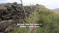
trail: Elle Bank
3:36 |
|
Aug 17, 2021
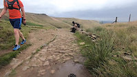
trail: Jacobs Ladder
3:39 |
168 |
Aug 17, 2021

trail: Elle Bank
3:36 |
|
Aug 17, 2021
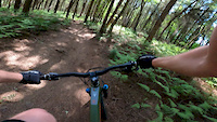
trail: From loamy to the bottom
0:23 |
617 |
Jun 1, 2020
trail: Loamy
3:16 |
134 |
Oct 21, 2018
trail: Loamy
0:58 |
135 |
May 1, 2017
trail: Loamy
0:18 |
66 |
Dec 31, 2016
trail: Loamy
0:08 |
533 |
Jun 27, 2016
Recent Trail Reports
| status | trail | date | condition | info | user |
|---|---|---|---|---|---|
| Wood Farm Trail Hicks Lodge | Jun 21, 2026 @ 5:51pm (Europe/London) Jun 21, 2026 | Ideal | Dartman67 | ||
| Shell Brook Hicks Lodge | Jun 19, 2026 @ 11:31am (Europe/London) Jun 19, 2026 | Ideal | DAZ1925 | ||
| Snake Path Hayfield | Apr 24, 2026 @ 8:46am (Europe/London) Apr 24, 2026 | Ideal | Gary026 | ||
| Access Path - Pit Lane To Nat Cyc R63 swadlincote | Oct 12, 2025 @ 8:57am (Europe/London) Oct 12, 2025 | Variable | Dartman67 | ||
| Shooting Cabins Hayfield | Sep 29, 2025 @ 10:34am (Europe/Isle_of_Man) Sep 29, 2025 | Ideal | MartynS | ||
| Endsor Byway Chesterfield | Sep 9, 2025 @ 8:01am Sep 9, 2025 | Ideal | Andymiff | ||
| Beely Green Lane Chesterfield | Sep 9, 2025 @ 8:01am Sep 9, 2025 | Ideal | Andymiff | ||
| Shining Cliff Climb Shining Cliff Woods | Sep 6, 2025 @ 1:43pm Sep 6, 2025 | Ideal | Andymiff | ||
| Loamy Black Rock | Aug 31, 2025 @ 11:21am Aug 31, 2025 | Ideal | Stolmie9444 | ||
| High Peak Trail to Middleton Top Black Rock | Aug 31, 2025 @ 11:21am Aug 31, 2025 | Ideal | Stolmie9444 |
Activity Feed
| username | action | type | title | date |
|---|---|---|---|---|
| FinleyoNMuLc | ridden | trail | activity #98260269 | Jul 2, 2026 @ 5:30am 3 hours |
| Houltym | ridden | route | activity #97844237 | Jun 26, 2026 @ 10:42am Jun 26, 2026 |
| Dartman67 | add | report | activity #97517528 | Jun 21, 2026 @ 1:45pm Jun 21, 2026 |
| DAZ1925 | add | report | activity #97321432 | Jun 19, 2026 @ 8:53am Jun 19, 2026 |
| Barry7DVxyh | wishlist | route | activity #97319013 | Jun 19, 2026 @ 8:17am Jun 19, 2026 |
Recent Comments
| username | type | title | comment | date |
|---|---|---|---|---|
| trail | Currently rideable. | Dec 31, 2024 @ 6:58am Dec 31, 2024 | ||
| trail | Good for beginners. Nothing that can’t just... | Aug 19, 2024 @ 8:13am Aug 19, 2024 | ||
| trail | This is not steep. Its a blue trail really | Oct 30, 2021 @ 2:26pm Oct 30, 2021 | ||
| trail | Good fun because even I can do it fast with my... | Sep 27, 2020 @ 5:23am Sep 27, 2020 | ||
| trail | This seems to be a footpath ? | Aug 13, 2020 @ 3:16am Aug 13, 2020 |
Local Badges
-

Epic Ride Climb 2k34 awarded -

Climbing 10k Badge54 awarded -

Climbing 100k Badge2 awarded -

Epic Ride Descent 2k35 awarded -

Descent 10k Badge55 awarded -

Descent 100k Badge2 awarded
Bike & Skill Parks
| name | type | city | rating |
|---|---|---|---|
| Chesterfield BMX Track | skill park | Chesterfield |
Activity Type Stats
| activitytype | trails | distance | descent | descent distance | total vertical | rating | global rank | state rank | photos | reports | routes | ridelogs |
|---|---|---|---|---|---|---|---|---|---|---|---|---|
| Mountain Bike | 81 | 50 miles | 8,960 ft | 26 miles | 1,483 ft | 168 | 395 | 14 | 29,944 | |||
| E-Bike | 13 | 13 miles | 1,033 ft | 5 miles | 997 ft | 363 | 4 | 3,790 | ||||
| Horse | 10 | 8 miles | 636 ft | 2 miles | 997 ft | 24 | 1 | |||||
| Hike | 96 | 47 miles | 8,740 ft | 25 miles | 1,483 ft | 383 | 1 | 2,901 | ||||
| Trail Running | 96 | 47 miles | 8,740 ft | 25 miles | 1,483 ft | 383 | 1 | 953 |
Frequently Asked Questions About Derbyshire
▼
What are the best places to ride in Derbyshire?
Derbyshire has 4 areas to explore for mountain biking. The top rated areas are:
▼
What are the highest rated mountain biking trails in Derbyshire?
The highest rated mountain biking trails in Derbyshire are:
- Near side line (4.2/5)
- Vernon Lane (4.2/5)
- Elle Bank (4.2/5)
- Snibston First Section (4.1/5)
- Dark Lane (4.1/5)
▼
What is the best time of the year to ride in Derbyshire?
Based on ride log data, the most popular months to ride in Derbyshire are:
- July (91 activities)
- April (73 activities)
- June (62 activities)
▼
What is the longest trail in Derbyshire?
The longest trail in Derbyshire is Shell Brook at 6.1 km. View all trails sorted by distance.
Activities
Trails
Points of Interest
- By brenthillier
 NSMBA TRAILFORKS & contributors
 - Admins: UKTP, 20twenty-p, wisey, MathieuC, cemoorelife
- #6810 - 12,853 views
- derbyshire activity log | embed map of Derbyshire mountain bike trails | derbyshire mountain biking points of interest
Downloading of trail gps tracks in kml & gpx formats is enabled for Derbyshire.
You must login to download files.