close
-
Layers w
- Weather Layers
- Pro
- Pro
- Pro
- Pro
- Pro
- Pro
- More Layers
- Pro
- Pro
- Pro
- Pro
-
Upgrade to

3D
Trail Conditions
- Unknown
- Snow Groomed
- Snow Packed
- Snow Covered
- Snow Cover Partial
- Freeze/thaw Cycle
- Icy
- Prevalent Mud
- Wet
- Variable
- Ideal
- Dry
- Very Dry
Trail Flow (Ridden Direction)
Trailforks scans users ridelogs to determine the most popular direction each trail is ridden. A good flowing trail network will have most trails flowing in a single direction according to their intension.
The colour categories are based on what percentage of riders are riding a trail in its intended direction.
The colour categories are based on what percentage of riders are riding a trail in its intended direction.
- > 96%
- > 90%
- > 80%
- > 70%
- > 50%
- < 50%
- bi-directional trail
- no data
Trail Last Ridden
Trailforks scans ridelogs to determine the last time a trail was ridden.
- < 2 days
- < 1 week
- < 2 weeks
- < 1 month
- < 6 months
- > 6 months
Trail Ridden Direction
The intended direction a trail should be ridden.
- Downhill Only
- Downhill Primary
- Both Directions
- Uphill Primary
- Uphill Only
- One Direction
Contribute Details
Colors indicate trail is missing specified detail.
- Description
- Photos
- Description & Photos
- Videos
Trail Popularity ?
Trailforks scans ridelogs to determine which trails are ridden the most in the last 9 months.
Trails are compared with nearby trails in the same city region with a possible 25 colour shades.
Think of this as a heatmap, more rides = more kinetic energy = warmer colors.
- most popular
- popular
- less popular
- not popular
ATV/ORV/OHV Filter
Max Vehicle Width
inches
US Cell Coverage
Legend

Radar Time
Activity Recordings
Trailforks uses anonymized public activity data.
?
Activity Recordings
Trailforks uses anonymized public activity data.
?
Personal Heatmap
▶
Activity Types
all
/
none
▶
Options
2
Date range
month
–
Winter Trails
Warning
A routing network for winter maps does not exist. Selecting trails using the winter trails layer has been disabled.
Missing Trails
Most Popular
Least Popular
Trails are colored based on popularity. The more popular a trail is, the more red. Less popular trails trend towards green.
Jump Magnitude Heatmap
Heatmap of where riders jump on trails. Zoom in to see individual jumps, click circles to view jump details.
BC Backroad Status
![map legend]()
Service Road Atlas is a free to use, community-driven service for viewing and creating reports on the numerous back-country service roads around B.C. and Alberta.

Slope Aspect
Direction the slope faces
Trails Deemphasized
Trails are shown in grey.
Only show trails with no bike usage.
Suggested Layers
Based on selected activity type
Save the current map location and zoom level as your default home location whenever this page is loaded.
Save
No description for Dervio has been added yet!
Login or register to submit one.
Files
- cartina-MTB-DERVIO_1683968522.pdf (4.56 MB)
This region uses the Uk/Euro style trail grading system.
Activities Click to view
- Mountain Bike
3 trails
- Adaptive Bike
0 trails
- Hike
3 trails
- Trail Running
3 trails
Region Details
- 2
- 1
Region Status
Caution as of Nov 3, 2025Stats
- Avg Trail Rating
- Trails (view details)
- 3
- Trails Mountain Bike
- 3
- Trails E-Bike
- 1
- Trails Horse
- 1
- Trails Hike
- 3
- Trails Trail Running
- 3
- Total Distance
- 6 miles
- Total Descent Distance
- 4 miles
- Total Descent
- 3,791 ft
- Total Vertical
- 3,281 ft
- Highest Trailhead
- 3,931 ft
- Reports
- 14
- Photos
- 8
- Ridden Counter
- 171
Popular Dervio Mountain Biking Trails
• 70 ★ 3.0 • 3 miles • 25 ft • 39 •
Uno dei giri classici del Lario: discesa tecnicamente molto impegnativa caratterizzata da elevata pendenza e gradoni, che metterà alla prova chiunque, consigliato da effettuare con una full. Nella prima parte non impegnativa, mentre,...
• 35 ★ 0.0 • 2 miles • 58 ft • 3 •
Dervio Mountain Bike Routes
24 miles • 5,771 ft • 7 • Loop • Race •
https://www.lakecomobikemarathon.it/
Videos of Dervio Mountain Bike
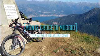
trail: Camaggiore AM
9:09 |
423 |
Sep 2, 2022 , Dervio
Recent Trail Reports
| status | trail | date | condition | info | user |
|---|---|---|---|---|---|
| Camaggiore AM | Nov 3, 2025 @ 7:54pm (Europe/Rome) Nov 3, 2025 | Variable | Baz084 | ||
| Ronchi | Jun 16, 2024 @ 4:58am Jun 16, 2024 | Ideal | poporni NORTHNLINE |
Activity Feed
| username | action | type | title | date |
|---|---|---|---|---|
| maooosnow | add | poi | activity #81548025 | Oct 2, 2025 @ 9:08am Oct 2, 2025 |
| PhilipWwsBcb | wishlist | trail | activity #78427793 | Aug 18, 2025 @ 12:20pm Aug 18, 2025 |
| Jimmy03 | comment | trail | activity #77688953 | Aug 8, 2025 @ 1:12pm Aug 8, 2025 |
| Lacustre | ridden | trail | activity #76482312 | Jul 22, 2025 @ 2:25pm Jul 22, 2025 |
| Dariollo78 | add | report | activity #76377167 | Jul 21, 2025 @ 2:05am Jul 21, 2025 |
Recent Comments
| username | type | title | comment | date |
|---|---|---|---|---|
| trail | Start of trail difficult to find, overgrown... | Aug 8, 2025 @ 1:12pm Aug 8, 2025 | ||
| trail | Impossibile da percorrere confermo pienamente... | Feb 19, 2023 @ 11:45am Feb 19, 2023 | ||
| trail | Sentiero quasi impossibile da imboccare e da... | Jun 13, 2022 @ 1:40pm Jun 13, 2022 | ||
| report | Overgrown, too many leaves | May 28, 2022 @ 12:50am May 28, 2022 | ||
| trail | Cooler Trail mit einigen S3 Stücken. | May 27, 2021 @ 5:28am May 27, 2021 |
Activity Type Stats
| activitytype | trails | distance | descent | descent distance | total vertical | rating | global rank | state rank | photos | reports | routes | ridelogs |
|---|---|---|---|---|---|---|---|---|---|---|---|---|
| Mountain Bike | 3 | 6 miles | 3,789 ft | 4 miles | 3,281 ft | #10,523 | #1,037 | 8 | 14 | 2 | 363 | |
| E-Bike | 1 | 2 miles | 52 ft | 2,782 ft | 33 ft | 5 | 1 | 20 | ||||
| Horse | 1 | 2 miles | 52 ft | 2,782 ft | 33 ft | 1 | ||||||
| Hike | 3 | 6 miles | 3,789 ft | 4 miles | 3,281 ft | #10,724 | #766 | 14 | 1 | 47 | ||
| Trail Running | 3 | 6 miles | 3,789 ft | 4 miles | 3,281 ft | #10,224 | #765 | 14 | 1 | 19 |
- By barc74 & contributors
- Admins: marcoangeletti, adessoomaipiu, micheletraversi, NORTHNLINE
- #21473 - 1,749 views
- dervio activity log | embed map of Dervio mountain bike trails | dervio mountain biking points of interest
Downloading of trail gps tracks in kml & gpx formats is enabled for Dervio.
You must login to download files.