close
-
Layers w
- Weather Layers
- Pro
- Pro
- Pro
- Pro
- Pro
- Pro
- More Layers
- Pro
- Pro
- Pro
- Pro
-
Upgrade to

3D
Trail Conditions
- Unknown
- Snow Groomed
- Snow Packed
- Snow Covered
- Snow Cover Partial
- Freeze/thaw Cycle
- Icy
- Prevalent Mud
- Wet
- Variable
- Ideal
- Dry
- Very Dry
Trail Flow (Ridden Direction)
Trailforks scans users ridelogs to determine the most popular direction each trail is ridden. A good flowing trail network will have most trails flowing in a single direction according to their intension.
The colour categories are based on what percentage of riders are riding a trail in its intended direction.
The colour categories are based on what percentage of riders are riding a trail in its intended direction.
- > 96%
- > 90%
- > 80%
- > 70%
- > 50%
- < 50%
- bi-directional trail
- no data
Trail Last Ridden
Trailforks scans ridelogs to determine the last time a trail was ridden.
- < 2 days
- < 1 week
- < 2 weeks
- < 1 month
- < 6 months
- > 6 months
Trail Ridden Direction
The intended direction a trail should be ridden.
- Downhill Only
- Downhill Primary
- Both Directions
- Uphill Primary
- Uphill Only
- One Direction
Contribute Details
Colors indicate trail is missing specified detail.
- Description
- Photos
- Description & Photos
- Videos
Trail Popularity ?
Trailforks scans ridelogs to determine which trails are ridden the most in the last 9 months.
Trails are compared with nearby trails in the same city region with a possible 25 colour shades.
Think of this as a heatmap, more rides = more kinetic energy = warmer colors.
- most popular
- popular
- less popular
- not popular
ATV/ORV/OHV Filter
Max Vehicle Width
inches
US Cell Coverage
Legend

Radar Time
Activity Recordings
Trailforks uses anonymized public activity data.
?
Activity Recordings
Trailforks uses anonymized public activity data.
?
Personal Heatmap
▶
Activity Types
all
/
none
▶
Options
2
Date range
month
–
Winter Trails
Warning
A routing network for winter maps does not exist. Selecting trails using the winter trails layer has been disabled.
Missing Trails
Most Popular
Least Popular
Trails are colored based on popularity. The more popular a trail is, the more red. Less popular trails trend towards green.
Jump Magnitude Heatmap
Heatmap of where riders jump on trails. Zoom in to see individual jumps, click circles to view jump details.
BC Backroad Status
![map legend]()
Service Road Atlas is a free to use, community-driven service for viewing and creating reports on the numerous back-country service roads around B.C. and Alberta.

Slope Aspect
Direction the slope faces
Trails Deemphasized
Trails are shown in grey.
Only show trails with no bike usage.
Suggested Layers
Based on selected activity type
Save the current map location and zoom level as your default home location whenever this page is loaded.
SavePopular Trail Networks
view all areas »
No description for Devon has been added yet!
Login or register to submit one.
This region uses the Uk/Euro style trail grading system.
Activities Click to view
- Mountain Bike
183 trails
- E-Bike
97 trails
- Horse
18 trails
- Hike
125 trails
- Trail Running
126 trails
- Dirtbike/Moto
4 trails
- Observed Trials
4 trails
- ATV/ORV/OHV
4 trails
- Snowmobile
0 trails
- Snowshoe
4 trails
- Downhill Ski
4 trails
- Backcountry Ski
4 trails
- Nordic Ski
4 trails
Region Details
- 48
- 10
- 64
- 35
- 9
- 1
Stats
- Avg Trail Rating
- Trails (view details)
- 172
- Trails Mountain Bike
- 184
- Trails E-Bike
- 97
- Trails Gravel Bike
- 2
- Trails Horse
- 18
- Trails Hike
- 126
- Trails Trail Running
- 126
- Trails Dirtbike/Moto
- 4
- Trails Observed Trials
- 4
- Trails ATV/ORV/OHV
- 4
- Trails Snowshoe
- 4
- Trails Downhill Ski
- 4
- Trails Backcountry Ski
- 4
- Trails Nordic Ski
- 4
- Total Distance
- 54 miles
- Total Descent
- 14,841 ft
- Total Vertical
- 1,789 ft
- Highest Trailhead
- 1,840 ft
- Reports
- 392
- Photos
- 610
- Ridden Counter
- 7,970
Sub Regions
- Axminster (13)
- Trinity Hill Woods (14)
- Barnstaple (2)
- Fremington Woods (0)
- Exeter (22)
- Cafe Side Haldon (6)
- Stoke Woods (8)
- Exmouth (33)
- Cafe Side Haldon (5)
- Woodbury (0)
- Woodbury Common (29)
- Newton Abbot (7)
- Lustleigh Cleave (4)
- Okehampton (3)
- Ottery St Mary (24)
- East Hill (24)
- Plymouth (15)
- Cann Woods (14)
- Sidmouth (6)
- Harpford Woods (3)
- Tavistock (23)
- Gawton Gravity Hub (7)
- Tavi Woodlands (12)
- Torquay (12)
- Canonteign (0)
- Cove Woods (0)
- Dartmoor (2)
- Haldon Forest Park (22)
Popular Devon Mountain Biking Trails
• 90 ★ 3.3 • 5 miles • 452 ft • 646 •
This is a technical, fast and flowing trail with tight corners and lively descents to test your reflexes.
• 100 ★ 4.0 • 4 miles • 373 ft • 617 •
Good progression from the . Single track, offering more challenging terrain with greater changes in gradient. Formally known as the . 6.4 km (4.0miles)
• 90 ★ 4.9 • 2,826 ft • 11 ft • 196 •
Highly rated popular black difficulty singletrack. This mountain bike primary trail can be used downhill only. On average it takes 5 minutes to complete this trail.
• 75 ★ 4.0 • 2,576 ft • 19 ft • 188 •
The main line down into Cann Woods. Main Line passes the main seating area situated about half way down the trail. Main Line takes you to the main downhilling area where other trails can be found.
• 75 ★ 4.4 • 3,785 ft • 15 ft • 185 •
is a thigh slapping, raucous, rip snorter of a track. By far the most popular track at Gawton Gravity Hub, is all things to all people. With its smooth flowing multi hit lines and easy going curves it is within the reach of most folk...
• 50 ★ 3.0 • 2,594 ft • 0 ft • 181 •
The Going-Home Trail. Starts at the same point that Main-Line does but rides back down to the Plym Valley trail and main Plymbridge Car Parking area.
• 100 ★ 3.0 • 4,554 ft • 14 ft • 155 •
Popular green difficulty singletrack. This mountain bike primary trail. On average it takes 16 minutes to complete this trail.
Devon Mountain Bike Routes
★ 4.6 • 14 miles • 768 ft • 0 • Loop •
It starts with an easy climb out of Princetown, with the only difficulty being the regular drainage...
★ 5.0 • 25 miles • 2,559 ft • 0 •
With over 1500m of climbing packed into this 40km Killer, you’ll want fresh legs and good weather before...
36 miles • 3,665 ft • 1 • Loop •
Ideal for gravel bikes, MTBs, cyclocross bikes & ebikes & takes in the best gravel trails of East...
★ 4.0 • 14 miles • 1,189 ft • 0 • Loop •
Just a short loop of South Dartmoor, starting and finishing in Princetown.
★ 4.0 • 23 miles • 1,058 ft • 0 •
Following various paths taking in the East side of Dartmoor
25 miles • 2,563 ft • 0 • Loop •
Starting off in North Bovey, you’re quickly off-road using the Dartmoor Way to make your way south west...
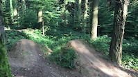
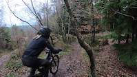
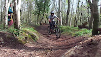
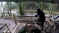
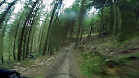
Photos of Devon Mountain Bike
Videos of Devon Mountain Bike

trail: Hsd
3:26 |
124 |
Nov 9, 2021
trail: Slush Puppy
0:06 |
107 |
Mar 11, 2021
trail: Super-Tavi
0:29 |
189 |
Dec 2, 2020
trail: Dirty Burger
0:51 |
254 |
May 11, 2019

trail: Proper Job
3:01 |
296 |
Feb 1, 2019

trail: Hsd
3:47 |
306 |
Jan 27, 2019
trail: Proper Job
3:11 |
144 |
Jan 27, 2019
trail: Proper Job
6:17 |
104 |
Jan 27, 2019
Current Trail Warnings
| status | trail | date | condition | user | info |
|---|---|---|---|---|---|
| Forest Road Tavi Woodlands | Jun 30, 2026 @ 12:35pm (Europe/London) 10 hours | Unknown | Gabrielenicotra | E-Bike This site has been closed down... |
Recent Trail Reports
| status | trail | date | condition | info | user |
|---|---|---|---|---|---|
| Traily McTrailface Haldon Forest Park | May 31, 2026 @ 7:53am (Europe/London) May 30, 2026 | Ideal | Dartmooradrian | ||
| Kiddens Trail Haldon Forest Park | May 31, 2026 @ 7:53am (Europe/London) May 30, 2026 | Ideal | Dartmooradrian | ||
| Shelter 1 Exeter | Feb 24, 2026 @ 5:34pm (Europe/London) Feb 24, 2026 | Variable | davemassive | ||
| Pleasure My Valley Haldon Forest Park | Dec 28, 2025 @ 9:57am (Europe/London) Dec 28, 2025 | Wet | RHoward1234 | ||
| Shirty Bertie Haldon Forest Park | Dec 28, 2025 @ 9:57am (Europe/London) Dec 28, 2025 | Wet | RHoward1234 | ||
| All The Way Exeter | Dec 28, 2025 @ 9:57am (Europe/London) Dec 28, 2025 | Ideal | RHoward1234 | ||
| Ridge Ride Trail Haldon Forest Park | Dec 21, 2025 @ 10:37am (Europe/London) Dec 21, 2025 | Wet | dartmoorphotog | ||
| Sidewinder East Hill | Aug 28, 2025 @ 2:15pm Aug 28, 2025 | Unknown | chrishowell1 | ||
| Grenofen Treeline Tavistock | May 16, 2025 @ 2:27pm May 16, 2025 | Dry | Wezzie | ||
| Blair Cann Woods | Mar 24, 2025 @ 3:51pm Mar 24, 2025 | Dry | Stephen15 |
Activity Feed
| username | action | type | title | date |
|---|---|---|---|---|
| Gabrielenicotra | add | report | activity #98137633 | Jun 30, 2026 @ 9:42am 5 hours |
| StephenkjZUHq | wishlist | region | activity #97727932 | Jun 24, 2026 @ 3:32pm Jun 24, 2026 |
| lines | add | video | activity #97719201 | Jun 24, 2026 @ 1:01pm Jun 24, 2026 |
| Joo4BJF01 | wishlist | route | activity #97033101 | Jun 15, 2026 @ 4:52am Jun 15, 2026 |
| Germanslayer | wishlist | route | activity #96860756 | Jun 13, 2026 @ 4:01am Jun 13, 2026 |
Recent Comments
| username | type | title | comment | date |
|---|---|---|---|---|
| trail | Freshened up recently and downed tree removed... | Apr 23, 2025 @ 2:41pm Apr 23, 2025 | ||
| trail | Started clearing, albeit slowly, a few trees... | May 9, 2024 @ 10:11am May 9, 2024 | ||
| trail | Puddley but a sweet trail. An easy blue. | May 7, 2024 @ 11:54am May 7, 2024 | ||
| trail | Half of this was closed today. 07 04 2024 | May 7, 2024 @ 11:50am May 7, 2024 | ||
| trail | Sweet singletrack | Aug 23, 2023 @ 6:58am Aug 23, 2023 |
Local Badges
-

Descent 100k Badge1 awarded -

Descent 10k Badge8 awarded -
Descent 10k Badge10 awarded -
Descent 100k Badge0 awarded -

Epic Ride Descent 2k8 awarded -

Epic Ride 50k53 awarded
Bike & Skill Parks
| name | type | city | rating |
|---|---|---|---|
| Gawton Gravity Hub | bike park | Tavistock | |
| Bideford BMX Track | skill park | Tavistock | |
| Pumptrack | skill park | Torquay | |
| Willand jumps | skill park | Exeter | |
| Landrake | skill park | Tavistock |
Activity Type Stats
| activitytype | trails | distance | descent | descent distance | total vertical | rating | global rank | state rank | photos | reports | routes | ridelogs |
|---|---|---|---|---|---|---|---|---|---|---|---|---|
| Mountain Bike | 183 | 54 miles | 14,839 ft | 30 miles | 1,788 ft | 608 | 390 | 16 | 62,297 | |||
| E-Bike | 97 | 26 miles | 5,328 ft | 13 miles | 1,726 ft | 1 | 337 | 7 | 5,443 | |||
| Gravel Bike | 2 | 1 | 217 | |||||||||
| Horse | 18 | 10 miles | 1,001 ft | 4 miles | 656 ft | 58 | 1 | 1 | ||||
| Hike | 125 | 40 miles | 8,950 ft | 21 miles | 1,742 ft | 351 | 1 | 4,025 | ||||
| Trail Running | 126 | 39 miles | 8,698 ft | 20 miles | 1,742 ft | 348 | 1 | 693 | ||||
| Dirtbike/Moto | 4 | 57 | 4 | |||||||||
| Observed Trials | 4 | 1 | ||||||||||
| ATV/ORV/OHV | 4 | 57 | ||||||||||
| Snowshoe | 4 | 1 | ||||||||||
| Downhill Ski | 4 | 1 | 24 | |||||||||
| Backcountry Ski | 4 | 1 | 3 | |||||||||
| Nordic Ski | 4 | 1 | 3 |
Frequently Asked Questions About Devon
▼
What are the best places to ride in Devon?
Devon has 19 areas to explore for mountain biking. The top rated areas are:
▼
What are the highest rated mountain biking trails in Devon?
The highest rated mountain biking trails in Devon are:
- Egypt (4.5/5)
- Proper Job (4.5/5)
- Super-Tavi (4.4/5)
- Hsd (4.2/5)
- González (4.2/5)
▼
What is the best time of the year to ride in Devon?
Based on ride log data, the most popular months to ride in Devon are:
- August (101 activities)
- May (98 activities)
- July (96 activities)
▼
What is the longest trail in Devon?
The longest trail in Devon is Ridge Ride Trail at 8.1 km. View all trails sorted by distance.
Activities
Trails
- By brenthillier
 NSMBA TRAILFORKS & contributors
 - Admins: UKTP, 20twenty-p, wisey, MathieuC, cemoorelife
- #6769 - 19,458 views
- devon activity log | embed map of Devon mountain bike trails | devon mountain biking points of interest
Downloading of trail gps tracks in kml & gpx formats is enabled for Devon.
You must login to download files.