close
-
Layers w
- Weather Layers
- Pro
- Pro
- Pro
- Pro
- Pro
- Pro
- More Layers
- Pro
- Pro
- Pro
- Pro
-
Upgrade to

3D
Trail Conditions
- Unknown
- Snow Groomed
- Snow Packed
- Snow Covered
- Snow Cover Partial
- Freeze/thaw Cycle
- Icy
- Prevalent Mud
- Wet
- Variable
- Ideal
- Dry
- Very Dry
Trail Flow (Ridden Direction)
Trailforks scans users ridelogs to determine the most popular direction each trail is ridden. A good flowing trail network will have most trails flowing in a single direction according to their intension.
The colour categories are based on what percentage of riders are riding a trail in its intended direction.
The colour categories are based on what percentage of riders are riding a trail in its intended direction.
- > 96%
- > 90%
- > 80%
- > 70%
- > 50%
- < 50%
- bi-directional trail
- no data
Trail Last Ridden
Trailforks scans ridelogs to determine the last time a trail was ridden.
- < 2 days
- < 1 week
- < 2 weeks
- < 1 month
- < 6 months
- > 6 months
Trail Ridden Direction
The intended direction a trail should be ridden.
- Downhill Only
- Downhill Primary
- Both Directions
- Uphill Primary
- Uphill Only
- One Direction
Contribute Details
Colors indicate trail is missing specified detail.
- Description
- Photos
- Description & Photos
- Videos
Trail Popularity ?
Trailforks scans ridelogs to determine which trails are ridden the most in the last 9 months.
Trails are compared with nearby trails in the same city region with a possible 25 colour shades.
Think of this as a heatmap, more rides = more kinetic energy = warmer colors.
- most popular
- popular
- less popular
- not popular
ATV/ORV/OHV Filter
Max Vehicle Width
inches
US Cell Coverage
Legend

Radar Time
Activity Recordings
Trailforks uses anonymized public activity data.
?
Activity Recordings
Trailforks uses anonymized public activity data.
?
Personal Heatmap
▶
Activity Types
all
/
none
▶
Options
2
Date range
month
–
Winter Trails
Warning
A routing network for winter maps does not exist. Selecting trails using the winter trails layer has been disabled.
Missing Trails
Most Popular
Least Popular
Trails are colored based on popularity. The more popular a trail is, the more red. Less popular trails trend towards green.
Jump Magnitude Heatmap
Heatmap of where riders jump on trails. Zoom in to see individual jumps, click circles to view jump details.
BC Backroad Status
![map legend]()
Service Road Atlas is a free to use, community-driven service for viewing and creating reports on the numerous back-country service roads around B.C. and Alberta.

Slope Aspect
Direction the slope faces
Trails Deemphasized
Trails are shown in grey.
Only show trails with no bike usage.
Suggested Layers
Based on selected activity type
Save the current map location and zoom level as your default home location whenever this page is loaded.
Save
No description for Devonport has been added yet!
Login or register to submit one.
Activities Click to view
- Mountain Bike
52 trails
- E-Bike
53 trails
- Gravel Bike
0 trails
- Adaptive Bike
0 trails
- Winter Fat Bike
0 trails
- Horse
1 trails
- Hike
49 trails
- Trail Running
50 trails
- Dirtbike/Moto
0 trails
- ATV/ORV/OHV
0 trails
- Nordic Ski
0 trails
Region Details
- 18
- 3
- 15
- 13
- 3
Region Status
Caution as of May 23, 2026Stats
- Avg Trail Rating
- Trails (view details)
- 56
- Trails Mountain Bike
- 52
- Trails E-Bike
- 53
- Trails Horse
- 1
- Trails Hike
- 49
- Trails Trail Running
- 50
- Total Distance
- 63 miles
- Total Descent
- 11,806 ft
- Total Vertical
- 4,303 ft
- Highest Trailhead
- 4,306 ft
- Reports
- 801
- Photos
- 143
- Ridden Counter
- 4,743
Sub Regions
-
Kelcey Tier
- 2
- 11
- 9
- 3
-
Stubb's Road
- 3
- 2
Popular Devonport Mountain Biking Trails
• 100 ★ 3.7 • 1,249 ft • 134 ft • 192 •
Popular blue difficulty family friendly singletrack. This mountain bike primary trail can be used one direction and has a easy overall physical rating with a 134 ft green climb. On average it takes 3 minutes to complete this trail.
• 70 ★ 3.8 • 1 mile • 136 ft • 182 •
A great new addition to the ever expanding trail network at Kelcey Tiers. This trail is just soooo flowy with big machine built berms a few rollable jumps it descends quickly with a few short climbs before you reach the bottom and begin...
• 95 ★ 3.5 • 3,687 ft • 256 ft • 175 •
Popular green difficulty family friendly singletrack. This mountain bike primary trail can be used uphill only and has a easy overall physical rating with a 256 ft green climb. Trail visibility is always easy to follow. On average it takes 10 minutes to complete this trail.
• 100 ★ 3.5 • 1,330 ft • 121 ft • 166 •
Popular green difficulty singletrack. This mountain bike primary trail can be used uphill only. On average it takes 4 minutes to complete this trail.
• 95 ★ 3.4 • 1,446 ft • 139 ft • 165 •
Popular green difficulty singletrack. This mountain bike primary trail can be used one direction and has a easy overall physical rating with a 139 ft green climb. On average it takes 2 minutes to complete this trail.
• 80 ★ 3.2 • 1 mile • 307 ft • 158 •
Popular blue difficulty singletrack. This mountain bike primary trail can be used one direction. It features drop. On average it takes 7 minutes to complete this trail.
• 90 ★ 4.3 • 1,289 ft • 0 ft • 145 •
Where did the clubs money go? Ask the club member who pocketed the money on this trail.......The wandering truth.
• 70 ★ 3.4 • 1,834 ft • 0 ft • 142 •
Popular blue difficulty singletrack. This mountain bike primary trail can be used one direction. It features berm, drop and jump. On average it takes 4 minutes to complete this trail.
Devonport Mountain Bike Routes
★ 5.0 • 597 miles • 37,570 ft • 1 • Point to Point •
Explore Tassie East coast with all the major climbs
8 miles • 1,223 ft • 37 •
289 miles • 23,717 ft • 0 • Point to Point •
The Tasmanian Trail is the only long distance (480km) multi-use trail in Tasmania. The experience is...
★ 5.0 • 10 miles • 1,136 ft • 28 • Loop • Race •
Stay tuned for the last man standing event
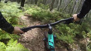
Photos of Devonport Mountain Bike
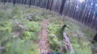
Videos of Devonport Mountain Bike
trail: Rigor Mortis
2:48 |
251 |
Oct 31, 2022 , Devonport

trail: Stubbs Rd Loop
0:42 |
681 |
Jan 21, 2020 , Devonport

trail: Rigor Mortis
2:06 |
1065 |
Oct 27, 2018 , Devonport

trail: Organ Donor
2:03 |
1664 |
Oct 27, 2018 , Devonport

trail: Serendipity
5:29 |
1701 |
Oct 27, 2018 , Devonport

trail: Devils Gate Single Track
3:21 |
425 |
Sep 22, 2018 , Devonport

trail: Devils Gate Single Track
7:21 |
382 |
Sep 22, 2018 , Devonport
trail: Fern Hook
6:28 |
575 |
Feb 5, 2018 , Devonport
Recent Trail Reports
| status | trail | date | condition | info | user |
|---|---|---|---|---|---|
| Wolfram Mine | Jan 12, 2026 @ 12:03pm (Australia/Hobart) Jan 11, 2026 | Unknown | streddaz CCMBC | ||
| Finns Dinosaur | Nov 14, 2025 @ 5:30pm (Australia/Hobart) Nov 13, 2025 | Ideal | streddaz CCMBC | ||
| Organ Donor | Nov 14, 2025 @ 5:30pm (Australia/Hobart) Nov 13, 2025 | Ideal | streddaz CCMBC | ||
| Gubba | Nov 14, 2025 @ 5:30pm (Australia/Hobart) Nov 13, 2025 | Ideal | streddaz CCMBC | ||
| Gubba (lower) | Nov 14, 2025 @ 5:30pm (Australia/Hobart) Nov 13, 2025 | Ideal | streddaz CCMBC | ||
| Darrell Lea | Nov 14, 2025 @ 5:30pm (Australia/Hobart) Nov 13, 2025 | Ideal | streddaz CCMBC | ||
| Booya Boys | Nov 14, 2025 @ 5:30pm (Australia/Hobart) Nov 13, 2025 | Ideal | streddaz CCMBC | ||
| Eastern woods | Nov 14, 2025 @ 5:30pm (Australia/Hobart) Nov 13, 2025 | Ideal | streddaz CCMBC | ||
| The Wandering Truth | Nov 14, 2025 @ 5:30pm (Australia/Hobart) Nov 13, 2025 | Ideal | streddaz CCMBC | ||
| Stony Rise | Nov 14, 2025 @ 5:30pm (Australia/Hobart) Nov 13, 2025 | Ideal | streddaz CCMBC |
Activity Feed
| username | action | type | title | date |
|---|---|---|---|---|
| GeorgeMAEURP | wishlist | route | activity #93073116 | Apr 21, 2026 @ 5:07am Apr 21, 2026 |
| Della1973 | add | photo | activity #88858610 and 10 more | Feb 13, 2026 @ 4:38pm Feb 13, 2026 |
| streddaz | update | poi | activity #87489030 | Jan 19, 2026 @ 12:59pm Jan 19, 2026 |
| streddaz | add | photo | activity #87060031 and 1 more | Jan 11, 2026 @ 6:06pm Jan 11, 2026 |
| streddaz | add | poi | activity #87060029 | Jan 11, 2026 @ 6:06pm Jan 11, 2026 |
Recent Comments
| username | type | title | comment | date |
|---|---|---|---|---|
| trail | Awesome track rebuilt and running mint | Oct 3, 2025 @ 2:35am Oct 3, 2025 | ||
| trail | Not ridden for a long time. Very over grown. | Dec 29, 2023 @ 2:04pm Dec 29, 2023 | ||
| trail | Not ridden for a long time. Very over grown | Dec 29, 2023 @ 2:03pm Dec 29, 2023 | ||
| trail | Sorry, my bad, fount it, she’s runnin mint! | Apr 11, 2022 @ 8:47pm Apr 11, 2022 | ||
| trail | Far out this thing is SO overgrown! If someone... | Apr 11, 2022 @ 8:43pm Apr 11, 2022 |
Local Badges
-

10 Green Trails59 awarded -

10 Blue Trails42 awarded -

Epic Ride Climb 2k53 awarded -

Climbing 10k Badge25 awarded -

Climbing 100k Badge2 awarded -

Epic Ride Descent 2k50 awarded
Activity Type Stats
| activitytype | trails | distance | descent | descent distance | total vertical | rating | global rank | state rank | photos | reports | routes | ridelogs |
|---|---|---|---|---|---|---|---|---|---|---|---|---|
| Mountain Bike | 52 | 59 miles | 11,486 ft | 27 miles | 3,182 ft | #2,410 | #113 | 143 | 786 | 7 | 5,559 | |
| E-Bike | 53 | 60 miles | 11,486 ft | 27 miles | 4,304 ft | #2,247 | #110 | 670 | 1 | 335 | ||
| Horse | 1 | 1 mile | 20 ft | 1,831 ft | 108 ft | #1,611 | #67 | 124 | ||||
| Hike | 49 | 60 miles | 10,915 ft | 27 miles | 4,304 ft | #3,681 | #103 | 768 | 771 | |||
| Trail Running | 50 | 60 miles | 11,089 ft | 27 miles | 4,304 ft | #3,173 | #93 | 770 | 2 | 100 |
Frequently Asked Questions About Devonport
▼
What are the best places to ride in Devonport?
Devonport has 3 areas to explore for mountain biking. The top rated areas are:
▼
What are the highest rated mountain biking trails in Devonport?
The highest rated mountain biking trails in Devonport are:
- Eastern woods (4.1/5)
- The Wandering Truth (4.1/5)
- Coastal Pathway Leith To Don Hill (4/5)
- Serendipity lower (4/5)
- KT DH (4/5)
▼
What is the best time of the year to ride in Devonport?
Based on ride log data, the most popular months to ride in Devonport are:
- October (61 activities)
- April (32 activities)
- March (30 activities)
▼
Where can I park to ride in Devonport?
There are 4 parking locations listed in Devonport. The most popular parking spots are:
- Tugrah Rd Entrance
- Dom River Tramway Trailhead Parkinh
- Parking for MTB trails and Walk lookout
- MTB Parking
Activities
Trails
- By SchrodingersGat
 MRTG & contributors
 - Admins: Jake-Hannah, Addzz, Sekt, SchrodingersGat, CCMBC, MVDCC
- #9780 - 8,203 views
- devonport activity log | embed map of Devonport mountain bike trails | devonport mountain biking points of interest
Downloading of trail gps tracks in kml & gpx formats is enabled for Devonport.
You must login to download files.