close
-
Layers w
- Weather Layers
- Pro
- Pro
- Pro
- Pro
- Pro
- Pro
- More Layers
- Pro
- Pro
- Pro
- Pro
-
Upgrade to

3D
Trail Conditions
- Unknown
- Snow Groomed
- Snow Packed
- Snow Covered
- Snow Cover Partial
- Freeze/thaw Cycle
- Icy
- Prevalent Mud
- Wet
- Variable
- Ideal
- Dry
- Very Dry
Trail Flow (Ridden Direction)
Trailforks scans users ridelogs to determine the most popular direction each trail is ridden. A good flowing trail network will have most trails flowing in a single direction according to their intension.
The colour categories are based on what percentage of riders are riding a trail in its intended direction.
The colour categories are based on what percentage of riders are riding a trail in its intended direction.
- > 96%
- > 90%
- > 80%
- > 70%
- > 50%
- < 50%
- bi-directional trail
- no data
Trail Last Ridden
Trailforks scans ridelogs to determine the last time a trail was ridden.
- < 2 days
- < 1 week
- < 2 weeks
- < 1 month
- < 6 months
- > 6 months
Trail Ridden Direction
The intended direction a trail should be ridden.
- Downhill Only
- Downhill Primary
- Both Directions
- Uphill Primary
- Uphill Only
- One Direction
Contribute Details
Colors indicate trail is missing specified detail.
- Description
- Photos
- Description & Photos
- Videos
Trail Popularity ?
Trailforks scans ridelogs to determine which trails are ridden the most in the last 9 months.
Trails are compared with nearby trails in the same city region with a possible 25 colour shades.
Think of this as a heatmap, more rides = more kinetic energy = warmer colors.
- most popular
- popular
- less popular
- not popular
ATV/ORV/OHV Filter
Max Vehicle Width
inches
US Cell Coverage
Legend

Radar Time
Activity Recordings
Trailforks uses anonymized public activity data.
?
Activity Recordings
Trailforks uses anonymized public activity data.
?
Personal Heatmap
▶
Activity Types
all
/
none
▶
Options
2
Date range
month
–
Winter Trails
Warning
A routing network for winter maps does not exist. Selecting trails using the winter trails layer has been disabled.
Missing Trails
Most Popular
Least Popular
Trails are colored based on popularity. The more popular a trail is, the more red. Less popular trails trend towards green.
Jump Magnitude Heatmap
Heatmap of where riders jump on trails. Zoom in to see individual jumps, click circles to view jump details.
BC Backroad Status
![map legend]()
Service Road Atlas is a free to use, community-driven service for viewing and creating reports on the numerous back-country service roads around B.C. and Alberta.

Slope Aspect
Direction the slope faces
Trails Deemphasized
Trails are shown in grey.
Only show trails with no bike usage.
Suggested Layers
Based on selected activity type
Save the current map location and zoom level as your default home location whenever this page is loaded.
SaveTurner Valley and neighboring Black Diamond offer a variety of paved paths, gravel double track, and single track to explore between the 2 towns. As well are a great gateway to lots of gravel riding and Kanaskis. There are some challenging hills with stunning views.
Activities Click to view
- Mountain Bike
69 trails
- E-Bike
14 trails
- Gravel Bike
0 trails
- Adaptive Bike
0 trails
- Horse
55 trails
- Hike
103 trails
- Trail Running
102 trails
- Snowshoe
58 trails
- Backcountry Ski
43 trails
- Nordic Ski
10 trails
Region Details
- 1
- 26
- 36
- 4
Region Status
Caution as of Apr 3, 2026Stats
- Avg Trail Rating
- Trails (view details)
- 103
- Trails Mountain Bike
- 69
- Trails E-Bike
- 14
- Trails Horse
- 55
- Trails Hike
- 103
- Trails Trail Running
- 102
- Trails Dirtbike/Moto
- 1
- Trails ATV/ORV/OHV
- 1
- Trails Snowmobile
- 3
- Trails Snowshoe
- 58
- Trails Backcountry Ski
- 43
- Trails Nordic Ski
- 10
- Total Distance
- 236 miles
- Total Descent
- 24,948 ft
- Total Vertical
- 4,383 ft
- Highest Trailhead
- 8,235 ft
- Reports
- 204
- Photos
- 333
- Ridden Counter
- 1,428
Sub Regions
-
Sheep River Provincial Park
- 2
- 18
- 2
Popular Diamond Valley Mountain Biking Trails
• 100 ★ 0.0 • 4,370 ft • 43 ft • 64 •
Popular green difficulty family friendly paved path. This multi-use trail can be used both directions and has a easy overall physical rating with a 43 ft green climb. Trail visibility is always easy to follow. On average it takes 9 minutes to complete this trail.
• 95 ★ 0.0 • 2 miles • 186 ft • 43 •
Popular green difficulty family friendly paved path. This multi-use trail can be used both directions and has a easy overall physical rating with a 186 ft green climb. Trail visibility is always easy to follow. On average it takes 21 minutes to complete this trail.
• 70 ★ 0.0 • 3,225 ft • 3 ft • 41 •
Popular blue difficulty singletrack. This multi-use trail can be used downhill primary. On average it takes 5 minutes to complete this trail.
• 35 ★ 0.0 • 6 miles • 1,590 ft • 37 •
The southern stretch of the , from the Gorge Creek Day Use Area to the Threepoint junction. Not good if it has been wet.
• 5 ★ 2.5 • 3 miles • 345 ft • 35 •
This is a good descending trail. Fast, steep, loose, with some fun drops. It is a steep fall line trail from the top, but has few different line options to keep it interesting. I would not recommend going up this trail, as it will be a...
• 75 ★ 4.0 • 8 miles • 2,644 ft • 29 •
Long steep double track climb up to the fire lookout
• 50 ★ 0.0 • 6 miles • 917 ft • 22 •
Moderately popular blue difficulty singletrack. This multi-use trail can be used both directions and has a moderate overall physical rating with a 917 ft blue climb. On average it takes 1 hour16 minutes to complete this trail.
• 80 ★ 0.0 • 1 mile • 14 ft • 19 •
Alberta summer games trail second section from the drop to the gravel path. Might be a bit hard to follow without the tape from the race.
Diamond Valley Mountain Bike Routes
9 miles • 2,004 ft • 0 • Out & Back •
A classic route from the pages of the now out of print book by Doug Eastcott "Backcountry Biking in the...
7 miles • 1,334 ft • 0 • Out & Back •
Off the beaten track. Great trail near Calgary, far away from busy trails of Bragg Creek. Climb is...
• 7 miles • 2,455 ft • 1 •
• 28 miles • 2,265 ft • 0 •
• 17 miles • 3,627 ft • 1 •
• 30 miles • 2,434 ft • 0 •
Photos of Diamond Valley Mountain Bike
Videos of Diamond Valley Mountain Bike
0:08 |
10 |
Sep 2, 2024
Recent Trail Reports
| status | trail | date | condition | info | user |
|---|---|---|---|---|---|
| Alberta Summer Games track - south half | Aug 10, 2025 @ 12:18pm Aug 10, 2025 | Ideal | y4R6mp | ||
| Loomis Lake | Oct 14, 2024 @ 7:55am Oct 14, 2024 | Prevalent Mud | BbOsV | ||
| Carnarvon Lake Almost | Oct 14, 2024 @ 7:46am Oct 14, 2024 | Dry | BbOsV | ||
| Old Forgetmenot (Unused Section) | Sep 2, 2024 @ 9:11pm Sep 2, 2024 | Dry | BbOsV | ||
| Sheep River | Jun 6, 2024 @ 5:17am Jun 6, 2024 | Prevalent Mud | digitalbytes | ||
| Alberta Summer Games Track - north half | Jun 6, 2024 @ 5:17am Jun 6, 2024 | Variable | digitalbytes | ||
| Junction Mountain Fire Lookout | Nov 11, 2023 @ 8:31am Nov 11, 2023 | Snow Covered | Vk8Pgn | ||
| Threepoint Creek | Sep 18, 2022 @ 2:12pm Sep 18, 2022 | Dry | DMm03i | ||
| South Gorge Creek | Sep 17, 2022 @ 11:22am Sep 17, 2022 | Variable | sullivad | ||
| Gorge Creek Trail - Connector | Sep 17, 2022 @ 11:22am Sep 17, 2022 | Ideal | sullivad |
Activity Feed
| username | action | type | title | date |
|---|---|---|---|---|
| Grl720 | add | photo | activity #93822939 and 2 more | May 1, 2026 @ 5:40pm May 1, 2026 |
| RyanhgjkSw | wishlist | region | activity #92446758 | Apr 11, 2026 @ 10:04pm Apr 11, 2026 |
| WestlandMTB | wishlist | trail | activity #92134809 and 1 more | Apr 7, 2026 @ 12:22pm Apr 7, 2026 |
| WestlandMTB | wishlist | trail | activity #92134726 | Apr 7, 2026 @ 12:21pm Apr 7, 2026 |
| Canadmos | add | trail | activity #87895577 | Jan 27, 2026 @ 9:04am Jan 27, 2026 |
Recent Comments
| username | type | title | comment | date |
|---|---|---|---|---|
| trail | Rode this in reverse as part of the Gorge... | Oct 14, 2025 @ 9:22pm Oct 14, 2025 | ||
| trail | With all the erosion, punchy climbs, horse and... | Oct 10, 2025 @ 6:55am Oct 10, 2025 | ||
| trail | Biked east to west full length through old... | Aug 22, 2025 @ 7:56am Aug 22, 2025 | ||
| trail | Rode this today as part of a bikepacking loop... | Jun 14, 2025 @ 7:13pm Jun 14, 2025 | ||
| trail | Cross country , with lots of roots and rocks... | May 2, 2025 @ 12:16pm May 2, 2025 |
Local Badges
-

Epic Ride Climb 2k40 awarded -

Climbing 10k Badge11 awarded -

Climbing 100k Badge0 awarded -

Epic Ride Descent 2k39 awarded -

Descent 10k Badge11 awarded -

Descent 100k Badge0 awarded
Activity Type Stats
| activitytype | trails | distance | descent | descent distance | total vertical | rating | global rank | state rank | photos | reports | routes | ridelogs |
|---|---|---|---|---|---|---|---|---|---|---|---|---|
| Mountain Bike | 69 | 179 miles | 17,638 ft | 69 miles | 4,383 ft | #1,983 | #22 | 323 | 200 | 3 | 3,462 | |
| E-Bike | 14 | 22 miles | 1,621 ft | 8 miles | 2,589 ft | #4,796 | #37 | 74 | 85 | |||
| Horse | 55 | 120 miles | 15,745 ft | 53 miles | 3,110 ft | #341 | #9 | 36 | 2 | 10 | ||
| Hike | 103 | 234 miles | 24,777 ft | 87 miles | 4,383 ft | #894 | #10 | 10 | 199 | 2 | 1,603 | |
| Trail Running | 102 | 228 miles | 24,560 ft | 86 miles | 4,383 ft | #687 | #10 | 198 | 2 | 658 | ||
| Dirtbike/Moto | 1 | 2,129 ft | 10 ft | 492 ft | 112 ft | 16 | 4 | |||||
| ATV/ORV/OHV | 1 | 2,129 ft | 10 ft | 492 ft | 112 ft | 16 | 4 | |||||
| Snowmobile | 3 | 14 miles | 1,572 ft | 6 miles | 1,037 ft | 8 | 5 | |||||
| Snowshoe | 58 | 80 miles | 8,865 ft | 28 miles | 3,271 ft | #346 | #11 | 6 | 16 | |||
| Backcountry Ski | 43 | 59 miles | 7,083 ft | 23 miles | 2,641 ft | #370 | #8 | 9 | 5 | |||
| Nordic Ski | 10 | 23 miles | 3,117 ft | 10 miles | 2,346 ft | #927 | #24 | 10 | 42 |
Frequently Asked Questions About Diamond Valley
▼
What are the best places to ride in Diamond Valley?
Diamond Valley has 3 areas to explore for mountain biking. The top rated areas are:
▼
What are the highest rated mountain biking trails in Diamond Valley?
The highest rated mountain biking trails in Diamond Valley are:
- Gorge Ware Connector (4/5)
- Junction Mountain Fire Lookout (4/5)
- Alberta Summer Games track - south half (4/5)
- Indian Oils (3.9/5)
- Old Forgetmenot (Unused Section) (3.7/5)
▼
What is the best time of the year to ride in Diamond Valley?
Based on ride log data, the most popular months to ride in Diamond Valley are:
- August (26 activities)
- July (22 activities)
- June (21 activities)
▼
Where can I park to ride in Diamond Valley?
Activities
Trails
Points of Interest
- Bluerock Campground Camping
- South Volcano Ridge Summit
- Windy Peak Summit
- The Hill of the Flowers Summit
- Missinglink Mountain Summit
- Bluerock Equestrian Campground Camping
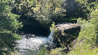
- Indian Oils Waterfalls Sight
- Windy Point Summit
- Windy Point Ridge Summit
- Volcano Ridge Summit
- Mist Mountain (10,148 ft)
- Courcelette Peak (9,967 ft)
- Mount Aldridge (9,905 ft)
- By chasingjoy
 & contributors
 - Admins: apply
- #5597 - 8,755 views
- diamond valley activity log | embed map of Diamond Valley mountain bike trails | diamond valley mountain biking points of interest
Downloading of trail gps tracks in kml & gpx formats is enabled for Diamond Valley.
You must login to download files.