close
-
Layers w
- Weather Layers
- Pro
- Pro
- Pro
- Pro
- Pro
- Pro
- More Layers
- Pro
- Pro
- Pro
- Pro
-
Upgrade to

3D
Trail Conditions
- Unknown
- Snow Groomed
- Snow Packed
- Snow Covered
- Snow Cover Partial
- Freeze/thaw Cycle
- Icy
- Prevalent Mud
- Wet
- Variable
- Ideal
- Dry
- Very Dry
Trail Flow (Ridden Direction)
Trailforks scans users ridelogs to determine the most popular direction each trail is ridden. A good flowing trail network will have most trails flowing in a single direction according to their intension.
The colour categories are based on what percentage of riders are riding a trail in its intended direction.
The colour categories are based on what percentage of riders are riding a trail in its intended direction.
- > 96%
- > 90%
- > 80%
- > 70%
- > 50%
- < 50%
- bi-directional trail
- no data
Trail Last Ridden
Trailforks scans ridelogs to determine the last time a trail was ridden.
- < 2 days
- < 1 week
- < 2 weeks
- < 1 month
- < 6 months
- > 6 months
Trail Ridden Direction
The intended direction a trail should be ridden.
- Downhill Only
- Downhill Primary
- Both Directions
- Uphill Primary
- Uphill Only
- One Direction
Contribute Details
Colors indicate trail is missing specified detail.
- Description
- Photos
- Description & Photos
- Videos
Trail Popularity ?
Trailforks scans ridelogs to determine which trails are ridden the most in the last 9 months.
Trails are compared with nearby trails in the same city region with a possible 25 colour shades.
Think of this as a heatmap, more rides = more kinetic energy = warmer colors.
- most popular
- popular
- less popular
- not popular
ATV/ORV/OHV Filter
Max Vehicle Width
inches
US Cell Coverage
Legend

Radar Time
Activity Recordings
Trailforks uses anonymized public activity data.
?
Activity Recordings
Trailforks uses anonymized public activity data.
?
Personal Heatmap
▶
Activity Types
all
/
none
▶
Options
2
Date range
month
–
Winter Trails
Warning
A routing network for winter maps does not exist. Selecting trails using the winter trails layer has been disabled.
Missing Trails
Most Popular
Least Popular
Trails are colored based on popularity. The more popular a trail is, the more red. Less popular trails trend towards green.
Jump Magnitude Heatmap
Heatmap of where riders jump on trails. Zoom in to see individual jumps, click circles to view jump details.
BC Backroad Status
![map legend]()
Service Road Atlas is a free to use, community-driven service for viewing and creating reports on the numerous back-country service roads around B.C. and Alberta.

Slope Aspect
Direction the slope faces
Trails Deemphasized
Trails are shown in grey.
Only show trails with no bike usage.
Suggested Layers
Based on selected activity type
Save the current map location and zoom level as your default home location whenever this page is loaded.
Save
No description for Diepsloot has been added yet!
Login or register to submit one.
Activities Click to view
- Mountain Bike
113 trails
- E-Bike
113 trails
- Gravel Bike
0 trails
- Hike
113 trails
- Trail Running
113 trails
Region Details
- 63
- 8
- 42
Region Status
Open as of Mar 8, 2026Stats
- Avg Trail Rating
- Trails (view details)
- 113
- Trails Mountain Bike
- 113
- Trails E-Bike
- 113
- Trails Horse
- 3
- Trails Hike
- 113
- Trails Trail Running
- 113
- Total Distance
- 61 miles
- Total Descent Distance
- 24 miles
- Total Descent
- 5,013 ft
- Total Vertical
- 335 ft
- Highest Trailhead
- 4,603 ft
- Reports
- 538
- Photos
- 3
- Ridden Counter
- 18,531
Sub Regions
-
Northern Farm (Diepsloot Nature Reserve)
- 8
- 42
Popular Diepsloot Mountain Biking Trails
• 90 ★ 5.0 • 4,623 ft • 31 ft • 364 •
Popular blue difficulty singletrack. This multi-use trail can be used both directions and has a moderate overall physical rating with a 31 ft green climb. Trail visibility is always easy to follow. On average it takes 4 minutes to complete this trail.
• 95 ★ 5.0 • 1 mile • 133 ft • 342 •
Popular blue difficulty singletrack. This multi-use trail can be used both directions and has a moderate overall physical rating with a 133 ft green climb. Trail visibility is always easy to follow. On average it takes 7 minutes to complete this trail.
• 95 ★ 4.5 • 692 ft • 15 ft • 328 •
Popular blue difficulty singletrack. This multi-use trail can be used both directions and has a moderate overall physical rating with a 15 ft green climb. Trail visibility is always easy to follow. On average it takes minutes to complete this trail.
• 100 ★ 5.0 • 1,375 ft • 40 ft • 326 •
Popular blue difficulty singletrack. This multi-use trail can be used both directions and has a moderate overall physical rating with a 40 ft green climb. Trail visibility is always easy to follow. On average it takes 1 minutes to complete this trail.
• 100 ★ 3.5 • 837 ft • 11 ft • 326 •
Popular blue difficulty singletrack. This multi-use trail can be used both directions and has a moderate overall physical rating with a 11 ft blue climb. Trail visibility is always easy to follow. On average it takes minutes to complete this trail.
• 90 ★ 5.0 • 1,634 ft • 16 ft • 324 •
Popular blue difficulty singletrack. This multi-use trail can be used both directions and has a moderate overall physical rating with a 16 ft green climb. Trail visibility is always easy to follow. On average it takes 1 minutes to complete this trail.
• 80 ★ 5.0 • 1,040 ft • 8 ft • 322 •
Notoriously sandy part of the singletrack along the river at the bottom of Northern Farms.
• 90 ★ 5.0 • 3,514 ft • 121 ft • 320 •
Popular blue difficulty singletrack. This multi-use trail can be used both directions and has a moderate overall physical rating with a 121 ft blue climb. Trail visibility is always easy to follow. On average it takes 5 minutes to complete this trail.
Diepsloot Mountain Bike Routes
★ 5.0 • 13 miles • 687 ft • 18 • Loop •
This is the full route if all Blue Route marker signs are followed. It is mostly dirt roads with a few...
43 miles • 3,025 ft • 69 • Loop •
The black route is is the longest option at North Farm selecting almost every trail including the most...
• 25 miles • 1,591 ft • 40 •
• 13 miles • 851 ft • 20 •
• 13 miles • 899 ft • 17 •
Videos of Diepsloot Mountain Bike
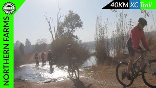
10:13 |
324 |
Jul 28, 2021
Recent Trail Reports
| status | trail | date | condition | info | user |
|---|---|---|---|---|---|
| Home Run | Nov 23, 2025 @ 2:48pm (Africa/Johannesburg) Nov 23, 2025 | Ideal | Nick-ZA | ||
| Bush Baby Corridor | Nov 23, 2025 @ 2:48pm (Africa/Johannesburg) Nov 23, 2025 | Ideal | Nick-ZA | ||
| NF Gravel 001 | Nov 23, 2025 @ 2:48pm (Africa/Johannesburg) Nov 23, 2025 | Variable | Nick-ZA | ||
| NF Gravel 012 | Jan 5, 2025 @ 7:59am Jan 5, 2025 | Variable | jd-shred | ||
| NF Gravel 022 | Jan 5, 2025 @ 7:59am Jan 5, 2025 | Variable | jd-shred | ||
| Northern Farm Access Road 003 | Sep 8, 2024 @ 8:46am Sep 8, 2024 | Very Dry | jd-shred | ||
| N14 Tunnel | Sep 8, 2024 @ 8:46am Sep 8, 2024 | Dry | jd-shred | ||
| Venice Canal | Sep 8, 2024 @ 8:46am Sep 8, 2024 | Dry | jd-shred | ||
| Grysbok Ridge | Sep 8, 2024 @ 8:46am Sep 8, 2024 | Very Dry | jd-shred | ||
| Hunters Trail | Sep 8, 2024 @ 8:46am Sep 8, 2024 | Very Dry | jd-shred |
Activity Feed
| username | action | type | title | date |
|---|---|---|---|---|
| cliffnel | wishlist | route | activity #96216550 | Jun 4, 2026 @ 4:23am Jun 4, 2026 |
| RoyIeOHrn | ridden | trail | activity #95914908 | May 31, 2026 @ 1:16am May 31, 2026 |
| SamsonymZauz | wishlist | route | activity #92749308 and 2 more | Apr 16, 2026 @ 2:52pm Apr 16, 2026 |
| TheovWnxjJ | ridden | route | activity #89760482 | Mar 1, 2026 @ 4:05am Mar 1, 2026 |
| StepfanaAynM7 | wishlist | region | activity #85975860 | Dec 23, 2025 @ 11:09pm Dec 23, 2025 |
Local Badges
-

10 Blue Trails216 awarded -

Epic Mountain Bike Climb 2k35 awarded -

Climbing 10k Badge39 awarded -

Mountain Biking 100k Badge0 awarded -

Epic Ride Descent 2k35 awarded -

Descent 10k Badge39 awarded
Activity Type Stats
| activitytype | trails | distance | descent | descent distance | total vertical | rating | global rank | state rank | photos | reports | routes | ridelogs |
|---|---|---|---|---|---|---|---|---|---|---|---|---|
| Mountain Bike | 113 | 61 miles | 5,013 ft | 24 miles | 335 ft | #971 | #23 | 3 | 538 | 3 | 4,385 | |
| E-Bike | 113 | 61 miles | 5,013 ft | 24 miles | 335 ft | #1,867 | #88 | 532 | 3 | 345 | ||
| Horse | 3 | 2 miles | 62 ft | 2,165 ft | 141 ft | 51 | ||||||
| Hike | 113 | 61 miles | 5,013 ft | 24 miles | 335 ft | #3,464 | #71 | 537 | 47 | |||
| Trail Running | 113 | 61 miles | 5,013 ft | 24 miles | 335 ft | #2,915 | #72 | 537 | 1 | 38 |
Frequently Asked Questions About Diepsloot
▼
What are the best places to ride in Diepsloot?
Diepsloot has 1 areas to explore for mountain biking. The top rated areas are:
▼
What are the highest rated mountain biking trails in Diepsloot?
The highest rated mountain biking trails in Diepsloot are:
- Paradise Flycatcher (4.2/5)
- Enchanted Forest (4.2/5)
- Sandy Bay (4.1/5)
- Mamba 1 (4.1/5)
- Bluegum Forest (4.1/5)
▼
What is the best time of the year to ride in Diepsloot?
Based on ride log data, the most popular months to ride in Diepsloot are:
- July (21 activities)
- November (13 activities)
- September (11 activities)
▼
Where can I park to ride in Diepsloot?
There are 1 parking locations listed in Diepsloot. The most popular parking spots are:
Activities
Trails
Points of Interest
- By WillieJacobsz
 Trailforks SBP SWW & contributors
 - Admins: Gauteng, Gauteng
- #37984 - 2,078 views
- diepsloot activity log | embed map of Diepsloot mountain bike trails | diepsloot mountain biking points of interest
Downloading of trail gps tracks in kml & gpx formats is enabled for Diepsloot.
You must login to download files.