close
-
Layers w
- Weather Layers
- Pro
- Pro
- Pro
- Pro
- Pro
- Pro
- More Layers
- Pro
- Pro
- Pro
- Pro
-
Upgrade to

3D
Trail Conditions
- Unknown
- Snow Groomed
- Snow Packed
- Snow Covered
- Snow Cover Partial
- Freeze/thaw Cycle
- Icy
- Prevalent Mud
- Wet
- Variable
- Ideal
- Dry
- Very Dry
Trail Flow (Ridden Direction)
Trailforks scans users ridelogs to determine the most popular direction each trail is ridden. A good flowing trail network will have most trails flowing in a single direction according to their intension.
The colour categories are based on what percentage of riders are riding a trail in its intended direction.
The colour categories are based on what percentage of riders are riding a trail in its intended direction.
- > 96%
- > 90%
- > 80%
- > 70%
- > 50%
- < 50%
- bi-directional trail
- no data
Trail Last Ridden
Trailforks scans ridelogs to determine the last time a trail was ridden.
- < 2 days
- < 1 week
- < 2 weeks
- < 1 month
- < 6 months
- > 6 months
Trail Ridden Direction
The intended direction a trail should be ridden.
- Downhill Only
- Downhill Primary
- Both Directions
- Uphill Primary
- Uphill Only
- One Direction
Contribute Details
Colors indicate trail is missing specified detail.
- Description
- Photos
- Description & Photos
- Videos
Trail Popularity ?
Trailforks scans ridelogs to determine which trails are ridden the most in the last 9 months.
Trails are compared with nearby trails in the same city region with a possible 25 colour shades.
Think of this as a heatmap, more rides = more kinetic energy = warmer colors.
- most popular
- popular
- less popular
- not popular
ATV/ORV/OHV Filter
Max Vehicle Width
inches
US Cell Coverage
Legend

Radar Time
Activity Recordings
Trailforks uses anonymized public activity data.
?
Activity Recordings
Trailforks uses anonymized public activity data.
?
Personal Heatmap
▶
Activity Types
all
/
none
▶
Options
2
Date range
month
–
Winter Trails
Warning
A routing network for winter maps does not exist. Selecting trails using the winter trails layer has been disabled.
Missing Trails
Most Popular
Least Popular
Trails are colored based on popularity. The more popular a trail is, the more red. Less popular trails trend towards green.
Jump Magnitude Heatmap
Heatmap of where riders jump on trails. Zoom in to see individual jumps, click circles to view jump details.
BC Backroad Status
![map legend]()
Service Road Atlas is a free to use, community-driven service for viewing and creating reports on the numerous back-country service roads around B.C. and Alberta.

Slope Aspect
Direction the slope faces
Trails Deemphasized
Trails are shown in grey.
Only show trails with no bike usage.
Suggested Layers
Based on selected activity type
Save the current map location and zoom level as your default home location whenever this page is loaded.
SaveActivities Click to view
- Mountain Bike
34 trails
- E-Bike
19 trails
- Adaptive Bike
0 trails
- Horse
21 trails
- Hike
40 trails
- Trail Running
38 trails
- Dirtbike/Moto
23 trails
- ATV/ORV/OHV
2 trails
- Snowshoe
7 trails
- Nordic Ski
6 trails
Region Details
- 5
- 9
- 19
Region Status
Caution as of Jun 18, 2026Stats
- Avg Trail Rating
- Trails (view details)
- 41
- Trails Mountain Bike
- 34
- Trails E-Bike
- 19
- Trails Horse
- 21
- Trails Hike
- 40
- Trails Trail Running
- 38
- Trails Dirtbike/Moto
- 23
- Trails ATV/ORV/OHV
- 2
- Trails Snowshoe
- 7
- Trails Nordic Ski
- 6
- Total Distance
- 84 miles
- Total Descent
- 10,073 ft
- Total Vertical
- 2,386 ft
- Highest Trailhead
- 11,412 ft
- Reports
- 889
- Photos
- 131
- Ridden Counter
- 8,371
Sub Regions
-
Tenderfoot Mountain Area
- 2
- 15
Popular Dillon Mountain Biking Trails
• 90 ★ 3.5 • 3 miles • 193 ft • 427 •
The Trail travels through lodgepole pine and aspen groves. The views of the Tenmile Range, the Gore Range and Dillon Reservoir from this trail are impressive. You have reached the end of the Forest Development Trail (FDT) when you reach...
• 85 ★ 4.0 • 1 mile • 276 ft • 401 •
Mix of climbing and flow above the Landfill. Connects to , , and up high, and down low. Smells pretty bad sometimes!
• 75 ★ 0.0 • 3,950 ft • 44 ft • 340 •
Popular blue difficulty singletrack. This multi-use trail can be used both directions. On average it takes 6 minutes to complete this trail.
• 95 ★ 3.7 • 1 mile • 86 ft • 330 •
After a fun, easy section through trees, this trail flows to a section of the flumes. Watch for an 8' quick climb to the top edge of the flume.
• 100 ★ 3.7 • 1 mile • 575 ft • 309 •
Short connected that is pretty steep, but got a nice reroute in 2019 near the top to make it a bit better climb
• 90 ★ 4.0 • 1 mile • 253 ft • 304 •
Mellow flow trail with a few nice berms. Good for climbing to reach nearby trails.
• 85 ★ 4.5 • 2 miles • 140 ft • 290 •
Nice trail with some built berms on the lower section. Fairly easy for most riders
• 65 ★ 2.5 • 922 ft • 0 ft • 196 •
This short connector trail stemming off of Tenderfoot Mtn Trail is a fun straight shot with some high speed smaller tabletop jumps. Caution if you try to climb this as riders may be coming down very fast.
Dillon Mountain Bike Routes
10 miles • 722 ft • 2 •
It's not often you'll find this much easy beginner singletrack way up in the Rockies! This is a great ride...
19 miles • 3,427 ft • 2 • Loop •
Ride around . E-Bikes only allowed during moto season.
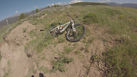
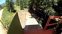
Photos of Dillon Mountain Bike


Current Trail Warnings
| status | trail | date | condition | user | info |
|---|---|---|---|---|---|
| Roost | Jun 14, 2026 @ 1:59pm (America/Denver) Jun 14, 2026 | Unknown | JeffG37 | Trail still not clear above the Lucky... | |
| Outer Wide Open | May 24, 2026 @ 9:45pm (America/Denver) May 24, 2026 | Dry | ronahue | Tons of trees down, maybe 20+. Two trees... | |
| Tenderfoot Mountain | May 24, 2026 @ 8:32pm (America/Denver) May 24, 2026 | Unknown | nmiodice | many trees down as you approach the upper... |
Recent Trail Reports
| status | trail | date | condition | info | user |
|---|---|---|---|---|---|
| Power Hair | Jun 18, 2026 @ 7:26am (America/Denver) Jun 18, 2026 | Unknown | tarvisg Reporter | ||
| Lucky | Jun 14, 2026 @ 9:49am (America/Denver) Jun 14, 2026 | Dry | JeffG37 | ||
| Dillon Res Recpath | Jun 13, 2026 @ 9:28pm (America/Denver) Jun 13, 2026 | Unknown | nolanvanharte Reporter | ||
| Wide Open | Jun 9, 2026 @ 9:08pm (America/Denver) Jun 9, 2026 | Dry | Brianfuerst | ||
| Tenmile Recpath Connector | Jun 5, 2026 @ 10:04am (America/Denver) Jun 5, 2026 | Ideal | extrapulp | ||
| Pile Driver | May 31, 2026 @ 11:07am (America/Denver) May 31, 2026 | Ideal | halite | ||
| Seven of Nine | May 23, 2026 @ 5:10pm (America/Denver) May 23, 2026 | Dry | pbosque | ||
| Snake River Bluffs | May 3, 2026 @ 11:41am (America/Denver) May 3, 2026 | Ideal | ajerred | ||
| Seven of Nine Connector | May 3, 2026 @ 11:41am (America/Denver) May 3, 2026 | Variable | ajerred | ||
| N. Scrappy | May 3, 2026 @ 11:41am (America/Denver) May 3, 2026 | Dry | ajerred |
Activity Feed
| username | action | type | title | date |
|---|---|---|---|---|
| zZSUT7 | ridden | trail | activity #97543562 | Jun 21, 2026 @ 10:28pm 8 hours |
| mkisley | comment | trail | activity #97532492 | Jun 21, 2026 @ 5:11pm 13 hours |
| mkisley | vote | trail | activity #97532403 | Jun 21, 2026 @ 5:09pm 13 hours |
| mkisley | comment | trail | activity #97532288 | Jun 21, 2026 @ 5:07pm 13 hours |
| mkisley | vote | trail | activity #97532247 and 1 more | Jun 21, 2026 @ 5:06pm 13 hours |
Recent Comments
| username | type | title | comment | date |
|---|---|---|---|---|
| trail | Leave the car behind. If you’re staying in... | Jun 21, 2026 @ 5:11pm 13 hours | ||
| trail | Custom built, flowy and smooth. A gem of the... | Jun 21, 2026 @ 5:07pm 13 hours | ||
| trail | Lots of trees down on Moab before the new downhill | Jun 6, 2026 @ 10:28am Jun 6, 2026 | ||
| trail | Fallen trees have been cleared. Trailer is in... | May 23, 2026 @ 3:06pm May 23, 2026 | ||
| trail | Clear and dry | May 23, 2026 @ 3:04pm May 23, 2026 |
Local Badges
-

Epic Ride Climb 2k21 awarded -

Climbing 10k Badge63 awarded -

Climbing 100k Badge4 awarded -

Epic Ride Descent 2k21 awarded -

Descent 10k Badge63 awarded -

Descent 100k Badge4 awarded
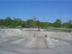
Bike & Skill Parks
| name | type | city | rating |
|---|---|---|---|
| Tenderfoot Track Club | skill park | Dillon |
Activity Type Stats
| activitytype | trails | distance | descent | descent distance | total vertical | rating | global rank | state rank | photos | reports | routes | ridelogs |
|---|---|---|---|---|---|---|---|---|---|---|---|---|
| Mountain Bike | 34 | 74 miles | 9,514 ft | 34 miles | 2,385 ft | #2,801 | #993 | 112 | 888 | 2 | 9,014 | |
| E-Bike | 19 | 54 miles | 8,383 ft | 29 miles | 2,385 ft | #2,925 | #1,101 | 8 | 757 | 1 | 355 | |
| Horse | 21 | 42 miles | 6,152 ft | 16 miles | 2,385 ft | #1,177 | #740 | 459 | 2 | 2 | ||
| Hike | 40 | 82 miles | 9,948 ft | 35 miles | 2,385 ft | #3,272 | #1,152 | 4 | 886 | 14 | 845 | |
| Trail Running | 38 | 81 miles | 9,931 ft | 35 miles | 2,385 ft | #2,977 | #865 | 1 | 883 | 12 | 391 | |
| Dirtbike/Moto | 23 | 46 miles | 7,940 ft | 21 miles | 2,146 ft | #652 | #223 | 2 | 537 | 37 | ||
| ATV/ORV/OHV | 2 | 4 miles | 1,073 ft | 3 miles | 919 ft | #836 | #377 | 299 | 1 | |||
| Snowshoe | 7 | 8 miles | 1,073 ft | 4 miles | 1,073 ft | #1,095 | #558 | 361 | 8 | 30 | ||
| Nordic Ski | 6 | 7 miles | 1,070 ft | 4 miles | 1,024 ft | #1,173 | #518 | 354 | 187 |
Frequently Asked Questions About Dillon
▼
What are the best places to ride in Dillon?
Dillon has 1 areas to explore for mountain biking. The top rated areas are:
▼
What are the highest rated mountain biking trails in Dillon?
The highest rated mountain biking trails in Dillon are:
- Wide Open (4.2/5)
- Power Hair (4.1/5)
- Snake River Bluffs (4.1/5)
- BB Trail (4/5)
- Powerline (4/5)
▼
What is the best time of the year to ride in Dillon?
Based on ride log data, the most popular months to ride in Dillon are:
- July (87 activities)
- June (58 activities)
- August (58 activities)
▼
Where can I park to ride in Dillon?
There are 10 parking locations listed in Dillon. The most popular parking spots are: View all parking and trailhead locations on the map to plan your visit.
Activities
Trails
- By J4m3z420
 SCoMBA & contributors
 - Admins: SCoMBA
- #16883 - 9,693 views
- dillon activity log | embed map of Dillon mountain bike trails | dillon mountain biking points of interest
Downloading of trail gps tracks in kml & gpx formats is enabled for Dillon.
You must login to download files.