close
-
Layers w
- Weather Layers
- Pro
- Pro
- Pro
- Pro
- Pro
- Pro
- More Layers
- Pro
- Pro
- Pro
- Pro
-
Upgrade to

3D
Trail Conditions
- Unknown
- Snow Groomed
- Snow Packed
- Snow Covered
- Snow Cover Partial
- Freeze/thaw Cycle
- Icy
- Prevalent Mud
- Wet
- Variable
- Ideal
- Dry
- Very Dry
Trail Flow (Ridden Direction)
Trailforks scans users ridelogs to determine the most popular direction each trail is ridden. A good flowing trail network will have most trails flowing in a single direction according to their intension.
The colour categories are based on what percentage of riders are riding a trail in its intended direction.
The colour categories are based on what percentage of riders are riding a trail in its intended direction.
- > 96%
- > 90%
- > 80%
- > 70%
- > 50%
- < 50%
- bi-directional trail
- no data
Trail Last Ridden
Trailforks scans ridelogs to determine the last time a trail was ridden.
- < 2 days
- < 1 week
- < 2 weeks
- < 1 month
- < 6 months
- > 6 months
Trail Ridden Direction
The intended direction a trail should be ridden.
- Downhill Only
- Downhill Primary
- Both Directions
- Uphill Primary
- Uphill Only
- One Direction
Contribute Details
Colors indicate trail is missing specified detail.
- Description
- Photos
- Description & Photos
- Videos
Trail Popularity ?
Trailforks scans ridelogs to determine which trails are ridden the most in the last 9 months.
Trails are compared with nearby trails in the same city region with a possible 25 colour shades.
Think of this as a heatmap, more rides = more kinetic energy = warmer colors.
- most popular
- popular
- less popular
- not popular
ATV/ORV/OHV Filter
Max Vehicle Width
inches
US Cell Coverage
Legend

Radar Time
Activity Recordings
Trailforks uses anonymized public activity data.
?
Activity Recordings
Trailforks uses anonymized public activity data.
?
Personal Heatmap
▶
Activity Types
all
/
none
▶
Options
2
Date range
month
–
Winter Trails
Warning
A routing network for winter maps does not exist. Selecting trails using the winter trails layer has been disabled.
Missing Trails
Most Popular
Least Popular
Trails are colored based on popularity. The more popular a trail is, the more red. Less popular trails trend towards green.
Jump Magnitude Heatmap
Heatmap of where riders jump on trails. Zoom in to see individual jumps, click circles to view jump details.
BC Backroad Status
![map legend]()
Service Road Atlas is a free to use, community-driven service for viewing and creating reports on the numerous back-country service roads around B.C. and Alberta.

Slope Aspect
Direction the slope faces
Trails Deemphasized
Trails are shown in grey.
Only show trails with no bike usage.
Suggested Layers
Based on selected activity type
Save the current map location and zoom level as your default home location whenever this page is loaded.
Save
No description for Disston has been added yet!
Login or register to submit one.
Activities Click to view
- Mountain Bike
16 trails
- E-Bike
7 trails
- Hike
16 trails
- Trail Running
16 trails
Region Details
- 3
- 4
- 5
Region Status
Open as of Jun 14, 2026Local Trail Association
Stats
- Avg Trail Rating
- Trails (view details)
- 12
- Trails Mountain Bike
- 16
- Trails E-Bike
- 7
- Trails Horse
- 1
- Trails Hike
- 16
- Trails Trail Running
- 16
- Trails Dirtbike/Moto
- 1
- Trails ATV/ORV/OHV
- 1
- Total Distance
- 21 miles
- Total Descent
- 5,644 ft
- Total Vertical
- 2,992 ft
- Highest Trailhead
- 4,372 ft
- Reports
- 104
- Photos
- 25
- Ridden Counter
- 273
Popular Disston Mountain Biking Trails
• 100 ★ 4.6 • 2 miles • 28 ft • 106 •
A one-way downhill. To access, shuttle the roads up to the drop-in or you can pedal up the surrounding logging roads to get in from the top. This is a fast flowing technical trail with some rhythm sections filled with jumps. Other areas...
• 60 ★ 5.0 • 2 miles • 0 ft • 46 •
This is Upper trail and a nice connection between the Trail and the lower segments. Steep in places and with some switchbacks higher up, the lower portion is fairly rutted and rocky but rideable. Ascending is hard in this portion. The...
• 90 ★ 4.5 • 5 miles • 1,952 ft • 28 •
Short, but beautiful trail along . Moderate difficulty, including some small exposure sections that would unnerve a beginner. Short, punchy climbs
• 45 ★ 5.0 • 3 miles • 219 ft • 4 •
Steep climb up this historic shortcut for firetower supply teams and the . Lots of sugar pines to see as one recovers from their anaerobic stretches if climbing. Some old mine scrapings and some medium distance views. I cleared the...
• 5 ★ 3.0 • 1 mile • 780 ft • 2 • • hike
Less popular blue difficulty singletrack. This hike primary trail can be used both directions.
• 5 ★ 3.0 • 1 mile • 570 ft • 2 • • hike
Less popular blue difficulty singletrack. This hike primary trail can be used both directions.
• ★ 0.0 • 3,058 ft • 367 ft •
Easy wide trail to lake from below, but trail above lake is much steeper and very primitive. Still a great short connection.
Disston Mountain Bike Routes
• 2 miles • 145 ft • 1 •
• 4 miles • 135 ft • 2 •
• 8 miles • 1,806 ft • 1 •
• 12 miles • 2,780 ft • 0 •
• 2 miles • 41 ft • 1 •
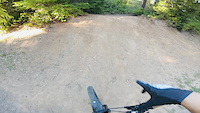
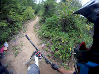
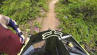
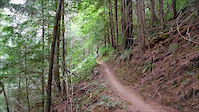
Photos of Disston Mountain Bike
Videos of Disston Mountain Bike
trail: Lower Crawfish
6:20 |
377 |
Jun 4, 2021
trail: Lower Crawfish
0:54 |
1153 |
Jul 27, 2015
trail: Lower Crawfish
5:24 |
275 |
Mar 16, 2015
trail: Lower Crawfish
3:18 |
774 |
Feb 5, 2015

trail: Lower Crawfish
10:32 |
209 |
Oct 25, 2014

trail: Lower Crawfish
10:53 |
337 |
Oct 18, 2014
trail: Lower Crawfish
5:58 |
561 |
Jul 27, 2014
trail: Lower Crawfish
8:05 |
659 |
Feb 25, 2014
Recent Trail Reports
| status | trail | date | condition | info | user |
|---|---|---|---|---|---|
| Adams Mountain Way | Jun 14, 2026 @ 7:11pm (America/Los_Angeles) Jun 14, 2026 | Unknown | gabrielamadeus OTTA | ||
| Lower Crawfish | May 17, 2026 @ 8:58pm (America/Los_Angeles) May 17, 2026 | Ideal | pizzamouse | ||
| Crawfish Trail | May 17, 2026 @ 8:58pm (America/Los_Angeles) May 17, 2026 | Ideal | pizzamouse | ||
| Access road | Apr 4, 2026 @ 4:15pm (America/Los_Angeles) Apr 4, 2026 | Ideal | lukey1 OTA | ||
| Brice Creek | Aug 16, 2025 @ 10:14pm Aug 16, 2025 | Unknown | frgibson | ||
| Upper Trestle Creek Trail | Aug 11, 2025 @ 8:42am Aug 11, 2025 | Ideal | RW385 | ||
| Trestle Creek Trail | Aug 11, 2025 @ 8:42am Aug 11, 2025 | Ideal | RW385 | ||
| NF-2241 / Adams Mountain | May 27, 2025 @ 5:46pm May 27, 2025 | Ideal | lukey1 OTA |
Activity Feed
| username | action | type | title | date |
|---|---|---|---|---|
| gabrielamadeus | add | trail | activity #97155717 | Jun 16, 2026 @ 7:03pm Jun 16, 2026 |
| gabrielamadeus | update | trail | activity #97155057 and 2 more | Jun 16, 2026 @ 6:49pm Jun 16, 2026 |
| gabrielamadeus | add | report | activity #97018864 | Jun 14, 2026 @ 7:11pm Jun 14, 2026 |
| Twweaver | wishlist | route | activity #96294155 | Jun 5, 2026 @ 7:26am Jun 5, 2026 |
| LdF6mOxI | wishlist | trail | activity #95761494 | May 29, 2026 @ 12:59am May 29, 2026 |
Recent Comments
| username | type | title | comment | date |
|---|---|---|---|---|
| trail | Minimal water flow in mid August but still a... | Aug 11, 2025 @ 4:23pm Aug 11, 2025 | ||
| trail | Great decent very steep in some sections. I... | May 29, 2023 @ 8:48am May 29, 2023 | ||
| trail | Cleared from Brice Creek up to the first... | Feb 16, 2023 @ 8:58am Feb 16, 2023 | ||
| trail | Sometimes chunky, sometimes flowy, sometimes... | Nov 21, 2021 @ 10:12pm Nov 21, 2021 | ||
| trail | This track is Forest road # 2241 and is not... | Aug 5, 2021 @ 9:20am Aug 5, 2021 |
Local Badges
-

Epic Mountain Bike Climb 2k0 awarded -

Climbing 10k Badge0 awarded -

Mountain Biking 100k Badge0 awarded -

Epic Ride Descent 2k0 awarded -

Descent 10k Badge0 awarded -

Descent 100k Badge0 awarded
Activity Type Stats
| activitytype | trails | distance | descent | descent distance | total vertical | rating | global rank | state rank | photos | reports | routes | ridelogs |
|---|---|---|---|---|---|---|---|---|---|---|---|---|
| Mountain Bike | 16 | 21 miles | 5,643 ft | 8 miles | 2,992 ft | #5,224 | #1,759 | 26 | 104 | 1 | 727 | |
| E-Bike | 7 | 10 miles | 295 ft | 1 mile | 2,894 ft | #6,905 | #2,072 | 73 | 22 | |||
| Horse | 1 | 2 | ||||||||||
| Hike | 16 | 21 miles | 5,643 ft | 8 miles | 2,992 ft | #7,697 | #2,717 | 104 | 85 | |||
| Trail Running | 16 | 21 miles | 5,643 ft | 8 miles | 2,992 ft | #7,354 | #2,430 | 104 | 7 | |||
| Dirtbike/Moto | 1 | 2 | ||||||||||
| ATV/ORV/OHV | 1 | 2 |
Frequently Asked Questions About Disston
▼
What are the best places to ride in Disston?
Disston has 1 areas to explore for mountain biking.
▼
What are the highest rated mountain biking trails in Disston?
The highest rated mountain biking trails in Disston are:
- Lower Crawfish (4.3/5)
- Adams Mountain Way (4.1/5)
- Crawfish Trail (4.1/5)
- Brice Creek (4.1/5)
- Trestle Creek Trail (0/5)
▼
What is the best time of the year to ride in Disston?
Based on ride log data, the most popular months to ride in Disston are:
- September (6 activities)
- October (5 activities)
- August (5 activities)
▼
Where can I park to ride in Disston?
There are 2 parking locations listed in Disston. The most popular parking spots are:
Activities
Trails
Points of Interest
- By brenthillier
 NSMBA TRAILFORKS & contributors
 - Admins: OTA
- #8605 - 3,181 views
- disston activity log | embed map of Disston mountain bike trails | disston mountain biking points of interest
Downloading of trail gps tracks in kml & gpx formats is enabled for Disston.
You must login to download files.