close
-
Layers w
- Weather Layers
- Pro
- Pro
- Pro
- Pro
- Pro
- Pro
- More Layers
- Pro
- Pro
- Pro
- Pro
-
Upgrade to

3D
Trail Conditions
- Unknown
- Snow Groomed
- Snow Packed
- Snow Covered
- Snow Cover Partial
- Freeze/thaw Cycle
- Icy
- Prevalent Mud
- Wet
- Variable
- Ideal
- Dry
- Very Dry
Trail Flow (Ridden Direction)
Trailforks scans users ridelogs to determine the most popular direction each trail is ridden. A good flowing trail network will have most trails flowing in a single direction according to their intension.
The colour categories are based on what percentage of riders are riding a trail in its intended direction.
The colour categories are based on what percentage of riders are riding a trail in its intended direction.
- > 96%
- > 90%
- > 80%
- > 70%
- > 50%
- < 50%
- bi-directional trail
- no data
Trail Last Ridden
Trailforks scans ridelogs to determine the last time a trail was ridden.
- < 2 days
- < 1 week
- < 2 weeks
- < 1 month
- < 6 months
- > 6 months
Trail Ridden Direction
The intended direction a trail should be ridden.
- Downhill Only
- Downhill Primary
- Both Directions
- Uphill Primary
- Uphill Only
- One Direction
Contribute Details
Colors indicate trail is missing specified detail.
- Description
- Photos
- Description & Photos
- Videos
Trail Popularity ?
Trailforks scans ridelogs to determine which trails are ridden the most in the last 9 months.
Trails are compared with nearby trails in the same city region with a possible 25 colour shades.
Think of this as a heatmap, more rides = more kinetic energy = warmer colors.
- most popular
- popular
- less popular
- not popular
ATV/ORV/OHV Filter
Max Vehicle Width
inches
US Cell Coverage
Legend

Radar Time
Activity Recordings
Trailforks uses anonymized public activity data.
?
Activity Recordings
Trailforks uses anonymized public activity data.
?
Personal Heatmap
▶
Activity Types
all
/
none
▶
Options
2
Date range
month
–
Winter Trails
Warning
A routing network for winter maps does not exist. Selecting trails using the winter trails layer has been disabled.
Missing Trails
Most Popular
Least Popular
Trails are colored based on popularity. The more popular a trail is, the more red. Less popular trails trend towards green.
Jump Magnitude Heatmap
Heatmap of where riders jump on trails. Zoom in to see individual jumps, click circles to view jump details.
BC Backroad Status
![map legend]()
Service Road Atlas is a free to use, community-driven service for viewing and creating reports on the numerous back-country service roads around B.C. and Alberta.

Slope Aspect
Direction the slope faces
Trails Deemphasized
Trails are shown in grey.
Only show trails with no bike usage.
Suggested Layers
Based on selected activity type
Save the current map location and zoom level as your default home location whenever this page is loaded.
Save
No description for District Martigny has been added yet!
Login or register to submit one.
Links
This region uses the Uk/Euro style trail grading system.
Activities Click to view
- Mountain Bike
161 trails
- E-Bike
161 trails
- Hike
171 trails
- Trail Running
171 trails
- Snowshoe
0 trails
- Downhill Ski
0 trails
- Backcountry Ski
4 trails
- Nordic Ski
0 trails
Region Details
- 28
- 15
- 62
- 43
- 6
Stats
- Avg Trail Rating
- Trails (view details)
- 166
- Trails Mountain Bike
- 163
- Trails E-Bike
- 161
- Trails Adaptive Bike
- 1
- Trails Hike
- 171
- Trails Trail Running
- 171
- Trails Backcountry Ski
- 4
- Total Distance
- 124 miles
- Total Descent
- 68,320 ft
- Total Vertical
- 8,388 ft
- Highest Trailhead
- 9,906 ft
- Reports
- 747
- Photos
- 121
- Ridden Counter
- 10,032
Popular District Martigny Mountain Biking Trails
• 100 ★ 4.7 • 2 miles • 10 ft • 313 •
Highly rated popular red difficulty singletrack. This multi-use trail can be used downhill only and has a hard overall physical rating. Trail visibility is always easy to follow. On average it takes 19 minutes to complete this trail.
• 100 ★ 5.0 • 1 mile • 10 ft • 164 • • hike
Beautiful and flowy singletrail downhill to Vallorcine. Perhaps one of the most beautiful trails in the region - in terms of scenery and riding technique.
• 80 ★ 3.0 • 758 ft • 0 ft • 151 •
Popular blue difficulty singletrack. This multi-use trail can be used downhill primary and has a moderate overall physical rating with a 0 ft green climb. Trail visibility is always easy to follow. On average it takes 1 minutes to complete this trail.
• 95 ★ 5.0 • 4,416 ft • 7 ft • 143 • • hike
Super descente, rapide au départ, avec pas mal de mouvement de terrain et de saut dans le talus, quelques épingles un peu technique. Que du bon !
• 70 ★ 3.5 • 5,151 ft • 0 ft • 135 •
Popular blue difficulty alpine singletrack. This multi-use trail can be used downhill primary and has a moderate overall physical rating with a 0 ft green climb. Trail visibility is always easy to follow. On average it takes 6 minutes to complete this trail.
• 90 ★ 4.8 • 1 mile • 38 ft • 116 • • hike
Jolie single en dévers, quelques parties exposé, mais de supers passage avec une vue sur martigny !
• 5 ★ 4.5 • 2 miles • 679 ft • 114 • • hike
Be careful, this singletrack runs along a cliff overlooking the Rhône Plain without any barriers. Adjust your speed and stop when you cross hikers. If you are prone to vertigo, the difficulty is black or red. to the pasture of Sorniot...
• 95 ★ 2.0 • 2,858 ft • 0 ft • 109 • • hike
Singletrail Alpin de 0,8 km reliant à la route de . Passage très rapide sur la (attention aux promeneurs qui montent). -- .8 km long Alpine singletrail linking to the road. Very fast segment along the Ridge of Randonne (watch out for...
District Martigny Mountain Bike Routes
★ 5.0 • 18 miles • 4,732 ft • 12 • Point to Point •
Take the telecabine from Dorenaz on the valley floor to Champez. Start the climb up the asphalt road all...
4 miles • 673 ft • 0 •
The start is at the Col des Planches and goes towards the village of Chemin to the place called "Chez...
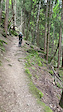
Photos of District Martigny Mountain Bike
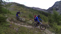
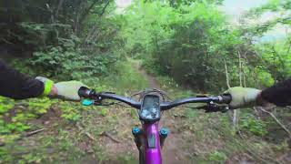
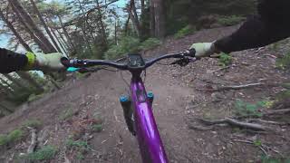
Videos of District Martigny Mountain Bike
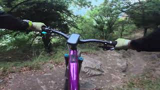
trail: Cretton
0:15 |
17 |
Jul 3, 2024
trail: Portail de Fully
3:37 |
1748 |
Oct 8, 2013
trail: Forêt de Beudon
9:03 |
8 |
Jun 24, 2026 , Fully
trail: Forêt de Chibo
7:50 |
6 |
Jun 24, 2026 , Fully
trail: Chamouère
10:00 |
6 |
Jun 24, 2026 , Fully
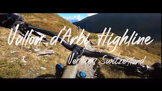
trail: Vallon d'Arbi Highline
3:02 |
141 |
Aug 25, 2024 , Riddes
trail: Vallon d'Arbi Highline
10:00 |
475 |
Dec 2, 2022 , Riddes
Current Trail Warnings
| status | trail | date | condition | user | info |
|---|---|---|---|---|---|
| L'Erié Fully | Jun 14, 2026 @ 9:07am (Europe/Zurich) Jun 14, 2026 | Very Dry | samale |
Recent Trail Reports
| status | trail | date | condition | info | user |
|---|---|---|---|---|---|
| Forêt de Chibo Fully | Jun 24, 2026 @ 1:10pm (Europe/Zurich) Jun 24, 2026 | Very Dry | Grzesfajny | ||
| Chamouère Fully | Jun 24, 2026 @ 1:04pm (Europe/Zurich) Jun 24, 2026 | Very Dry | Grzesfajny | ||
| Forêt de Beudon Fully | Jun 24, 2026 @ 1:02pm (Europe/Zurich) Jun 24, 2026 | Dry | Grzesfajny | ||
| Chemin de Gru Fully | Jun 14, 2026 @ 9:07am (Europe/Zurich) Jun 14, 2026 | Very Dry | samale | ||
| Chiboz - Forêt de Beudon Fully | Jun 14, 2026 @ 9:07am (Europe/Zurich) Jun 14, 2026 | Very Dry | samale | ||
| L'Erié - Sorniot Fully | Jun 14, 2026 @ 9:07am (Europe/Zurich) Jun 14, 2026 | Very Dry | samale | ||
| Col de La Blè Fully | Jun 14, 2026 @ 9:07am (Europe/Zurich) Jun 14, 2026 | Very Dry | samale | ||
| Portail de Fully Fully | Jun 14, 2026 @ 9:07am (Europe/Zurich) Jun 14, 2026 | Very Dry | samale | ||
| Sentier des mines Martigny | Jun 6, 2026 @ 10:30am (Europe/Zurich) Jun 6, 2026 | Ideal | LionelBloch | ||
| Larze Ridge Martigny | May 25, 2026 @ 3:12pm (Europe/Zurich) May 25, 2026 | Ideal | LionelBloch |
Activity Feed
| username | action | type | title | date |
|---|---|---|---|---|
| pitss | ridden | trail | activity #97884629 | Jun 27, 2026 @ 2:08am Jun 27, 2026 |
| Grzesfajny | add | video | activity #97713526 and 1 more | Jun 24, 2026 @ 11:44am Jun 24, 2026 |
| Grzesfajny | add | video | activity #97686615 | Jun 24, 2026 @ 4:08am Jun 24, 2026 |
| Grzesfajny | add | report | activity #97686386 and 2 more | Jun 24, 2026 @ 4:02am Jun 24, 2026 |
| Grzesfajny | vote | trail | activity #97686376 and 2 more | Jun 24, 2026 @ 4:02am Jun 24, 2026 |
Recent Comments
| username | type | title | comment | date |
|---|---|---|---|---|
| trail | Hehehe:) zero chance to anticipate :) for sure... | Jun 23, 2026 @ 10:28am Jun 23, 2026 | ||
| trail | careful, this is not a blue. it's steep, has a... | Jun 21, 2026 @ 7:34am Jun 21, 2026 | ||
| trail | Not recommended, have to go over 2 locked doors | Nov 10, 2025 @ 12:11pm Nov 10, 2025 | ||
| trail | It can feel scary. Its not hard to ride... | Sep 30, 2025 @ 4:06am Sep 30, 2025 | ||
| trail | Very easy and fast, it is really the... | Aug 27, 2025 @ 1:16am Aug 27, 2025 |
Local Badges
-

Epic Ride 50k66 awarded -

Epic Mountain Bike Climb 2k1 awarded -

Big Ride 30k116 awarded -

10 Red Trails3 awarded -

Descent 100k Badge0 awarded -

Descent 10k Badge1 awarded
Local Products
Activity Type Stats
| activitytype | trails | distance | descent | descent distance | total vertical | rating | global rank | state rank | photos | reports | routes | ridelogs |
|---|---|---|---|---|---|---|---|---|---|---|---|---|
| Mountain Bike | 161 | 108 miles | 63,645 ft | 63 miles | 6,535 ft | 117 | 753 | 2 | 2,139 | |||
| E-Bike | 161 | 106 miles | 62,858 ft | 62 miles | 6,535 ft | 4 | 744 | 1 | 557 | |||
| Hike | 171 | 114 miles | 68,189 ft | 66 miles | 8,156 ft | 754 | 694 | |||||
| Trail Running | 171 | 114 miles | 68,189 ft | 66 miles | 8,156 ft | 754 | 258 | |||||
| Backcountry Ski | 4 | 10 miles | 128 ft | 1,831 ft | 5,748 ft | 1 | 202 |
Frequently Asked Questions About District Martigny
▼
What are the best places to ride in District Martigny?
District Martigny has 1 areas to explore for mountain biking. The top rated areas are:
▼
What are the highest rated mountain biking trails in District Martigny?
The highest rated mountain biking trails in District Martigny are:
- Forêt de Beudon (4.5/5)
- Plan des Vaches (4.4/5)
- Catogne Flow (4.4/5)
- Vallon d'Arbi Highline (4.3/5)
- Nant de Catogne (4.3/5)
▼
What is the best time of the year to ride in District Martigny?
Based on ride log data, the most popular months to ride in District Martigny are:
- August (12 activities)
- July (12 activities)
- June (10 activities)
▼
What is the longest trail in District Martigny?
The longest trail in District Martigny is Fontaine Bovine at 2.9 miles. View all trails sorted by distance.
Activities
Trails
- By inversedotch
 & contributors
 - Admins: swiss, trailpapst, VS-Admin, VS-Admin
- #28385 - 2,696 views
- district martigny activity log | embed map of District Martigny mountain bike trails | district martigny mountain biking points of interest polygons
Downloading of trail gps tracks in kml & gpx formats is enabled for District Martigny.
You must login to download files.