close
-
Layers w
- Weather Layers
- Pro
- Pro
- Pro
- Pro
- Pro
- Pro
- More Layers
- Pro
- Pro
- Pro
- Pro
-
Upgrade to

3D
Trail Conditions
- Unknown
- Snow Groomed
- Snow Packed
- Snow Covered
- Snow Cover Partial
- Freeze/thaw Cycle
- Icy
- Prevalent Mud
- Wet
- Variable
- Ideal
- Dry
- Very Dry
Trail Flow (Ridden Direction)
Trailforks scans users ridelogs to determine the most popular direction each trail is ridden. A good flowing trail network will have most trails flowing in a single direction according to their intension.
The colour categories are based on what percentage of riders are riding a trail in its intended direction.
The colour categories are based on what percentage of riders are riding a trail in its intended direction.
- > 96%
- > 90%
- > 80%
- > 70%
- > 50%
- < 50%
- bi-directional trail
- no data
Trail Last Ridden
Trailforks scans ridelogs to determine the last time a trail was ridden.
- < 2 days
- < 1 week
- < 2 weeks
- < 1 month
- < 6 months
- > 6 months
Trail Ridden Direction
The intended direction a trail should be ridden.
- Downhill Only
- Downhill Primary
- Both Directions
- Uphill Primary
- Uphill Only
- One Direction
Contribute Details
Colors indicate trail is missing specified detail.
- Description
- Photos
- Description & Photos
- Videos
Trail Popularity ?
Trailforks scans ridelogs to determine which trails are ridden the most in the last 9 months.
Trails are compared with nearby trails in the same city region with a possible 25 colour shades.
Think of this as a heatmap, more rides = more kinetic energy = warmer colors.
- most popular
- popular
- less popular
- not popular
ATV/ORV/OHV Filter
Max Vehicle Width
inches
US Cell Coverage
Legend

Radar Time
Activity Recordings
Trailforks uses anonymized public activity data.
?
Activity Recordings
Trailforks uses anonymized public activity data.
?
Personal Heatmap
▶
Activity Types
all
/
none
▶
Options
2
Date range
month
–
Winter Trails
Warning
A routing network for winter maps does not exist. Selecting trails using the winter trails layer has been disabled.
Missing Trails
Most Popular
Least Popular
Trails are colored based on popularity. The more popular a trail is, the more red. Less popular trails trend towards green.
Jump Magnitude Heatmap
Heatmap of where riders jump on trails. Zoom in to see individual jumps, click circles to view jump details.
BC Backroad Status
![map legend]()
Service Road Atlas is a free to use, community-driven service for viewing and creating reports on the numerous back-country service roads around B.C. and Alberta.

Slope Aspect
Direction the slope faces
Trails Deemphasized
Trails are shown in grey.
Only show trails with no bike usage.
Suggested Layers
Based on selected activity type
Save the current map location and zoom level as your default home location whenever this page is loaded.
Save
No description for District Surselva has been added yet!
Login or register to submit one.
This region uses the Uk/Euro style trail grading system.
Activities Click to view
- Mountain Bike
409 trails
- E-Bike
407 trails
- Gravel Bike
101 trails
- Adaptive Bike
39 trails
- Hike
393 trails
- Trail Running
400 trails
- Snowshoe
7 trails
- Downhill Ski
78 trails
- Backcountry Ski
14 trails
- Nordic Ski
18 trails
Region Details
- 50
- 54
- 141
- 115
- 42
Stats
- Avg Trail Rating
- Trails (view details)
- 514
- Trails Mountain Bike
- 410
- Trails E-Bike
- 407
- Trails Gravel Bike
- 101
- Trails Adaptive Bike
- 40
- Trails Hike
- 399
- Trails Trail Running
- 400
- Trails Snowshoe
- 7
- Trails Downhill Ski
- 78
- Trails Backcountry Ski
- 14
- Trails Nordic Ski
- 18
- Total Distance
- 486 miles
- Total Descent Distance
- 320 miles
- Total Descent
- 247,111 ft
- Total Vertical
- 7,635 ft
- Highest Trailhead
- 9,701 ft
- Reports
- 3,197
- Photos
- 576
- Ridden Counter
- 41,134
Articles
Video: Lukas Knopf Challenges Claudio Caluori to a Bunny Hop Contest, Mini-Bike Challenge, & More
Jul 17, 2021 from pinkbike.com
There's even a tow-rope challenge, where Claudio definitely cheats.
Video: Claudio Caluori Gets Sketchy in the Snow on his Latest BlaBla Run
Dec 4, 2020 from pinkbike.com
Claudio hits the NeverEndTrail in Laax one more time before winter sets in properly in Switzerland.
Video: Claudio Caluori Takes a Run Down the World's First Fully Electric Built Trail
Jun 27, 2020 from pinkbike.com
Claudio puts the first tires to dirt in Laax.
Video: Velosolutions Create the 'World’s First Fully Electric Built' Trail in Switzerland
May 29, 2020 from pinkbike.com
Claudio's team built the trail using vehicles charged from renewable electricity.
Sub Regions
- Breil/Brigels (28)
- Disentis Sedrun (111)
- Rheinquelle Region (111)
- Flims LAAX (108)
- Ilanz/Glion (33)
- Lumnezia (28)
- Obersaxen Mundaun (31)
- Safiental (26)
- Sumvitg (30)
- Trun (14)
- Vals (5)
Popular District Surselva Mountain Biking Trails
• 100 ★ 4.6 • 1 mile • 0 ft • 1,186 •
Highly rated popular red difficulty family friendly machine groomed. This mountain bike primary trail can be used downhill only and has a moderate overall physical rating with a 0 ft green climb. It features berm, drop, jump, ladder bridge, rock face, roller coaster and skinny. Trail visibility is always easy to follow. On average it takes 2 minutes to complete this trail.
• 100 ★ 3.6 • 2 miles • 0 ft • 1,041 •
Popular red difficulty family friendly singletrack. This mountain bike primary trail can be used downhill only and has a moderate overall physical rating with a 0 ft green climb. It features jump. Trail visibility is always easy to follow. On average it takes 3 minutes to complete this trail.
• 100 ★ 4.2 • 1,411 ft • 0 ft • 945 •
Highly rated popular red difficulty family friendly machine groomed. This mountain bike primary trail can be used downhill only and has a easy overall physical rating with a 0 ft green climb. It features berm and jump. Trail visibility is always easy to follow. On average it takes minutes to complete this trail.
• 90 ★ 4.5 • 3 miles • 5 ft • 940 •
Action pur bietet die Freeride-Strecke vom Crap Sogn Gion (2228 m) nach Laax (1020 m). Die 7 km lange Strecke ist fahrtechnisch anspruchsvoll und bietet von Steilkurve zu Steilkurve ein absolutes Flow-Erlebnis.
• 90 ★ 4.2 • 1 mile • 35 ft • 890 •
Highly rated popular red difficulty family friendly alpine machine groomed. This mountain bike primary trail can be used downhill only and has a moderate overall physical rating with a 35 ft green climb. It features berm, jump and roller coaster. Trail visibility is always easy to follow. On average it takes 6 minutes to complete this trail.
• 100 ★ 3.9 • 2 miles • 2 ft • 839 •
Popular red difficulty singletrack. This mountain bike primary trail can be used downhill only. It features berm, jump and rock garden. Trail visibility is always easy to follow. On average it takes 16 minutes to complete this trail.
• 100 ★ 4.6 • 4,488 ft • 15 ft • 643 •
Highly rated popular red difficulty singletrack. This mountain bike primary trail can be used downhill only. It features berm, jump and rock garden. Trail visibility is always easy to follow. On average it takes 6 minutes to complete this trail.
• 90 ★ 4.1 • 1 mile • 0 ft • 540 •
Highly rated popular red difficulty singletrack. This mountain bike primary trail can be used downhill only. It features berm, jump, gap jump, rock face and rock garden. Trail visibility is always easy to follow. On average it takes 11 minutes to complete this trail.
District Surselva Mountain Bike Routes
Best of Disentis Sedrun Featured
34 miles • 9,088 ft • 26 • Shuttled •
In we start the tour, over the panoramic mountain , to the train station Sedrun. The train now takes us to...
Oberalp Bike #205 Featured
18 miles • 4,778 ft • 18 • Loop •
Paved: 9km Forest Track: 9km SingleTrail: 12km
Vergera Bike Featured
12 miles • 2,704 ft • 7 • Loop •
On the former mule road to the Lukmanier Pass, we are certainly faster on the bike than our ancestors, but...
Trail Tales #08 Dutjer Alp Featured
★ 2.0 • 19 miles • 4,553 ft • 3 •
A small road leads from Illanz to Sevgein, where it subsequently rapidly gains altitude. After passing the...
Nalps Bike 206 Featured
17 miles • 3,496 ft • 14 • Loop •
This circular bike route runs through the entire Disentis and Sedrun holiday region. Shady mountain forest...
★ 3.0 • 23 miles • 6,151 ft • 24 • Point to Point •
Startpunkt: Bergbahn Disentis nach Locker und entspannt startest du am Oberalppass auf der Passstraße und...
Photos of District Surselva Mountain Bike
Videos of District Surselva Mountain Bike
3:32 |
1374 |
Aug 26, 2024
trail: Sogn Martin
0:51 |
82 |
Feb 1, 2024
trail: Vorab Trail: The Rock
0:02 |
120 |
Feb 1, 2024
trail: Vorab
3:45 |
686 |
Oct 2, 2023
trail: Nagens Trail
0:08 |
|
Sep 17, 2023
trail: Never End Trail
3:11 |
39 |
Aug 23, 2023
trail: Segnes Trail
0:00 |
107 |
Jun 14, 2023

trail: Vorab Trail Lower
0:51 |
37 |
Jan 1, 2023
Current Trail Warnings
| status | trail | date | condition | user | info |
|---|---|---|---|---|---|
| Plauncas Cuflegl Rheinquelle Region | Jun 14, 2026 @ 10:54am (Europe/Zurich) Jun 14, 2026 | Ideal | retosedrun | E-Bike | |
| Plaun Segnas Sut Biketrails Flims Laax | Jun 5, 2026 @ 9:45am (Europe/Zurich) Jun 5, 2026 | Unknown | missile77 | Wurde zum Biken verboten: Bike-frei sind... |
Recent Trail Reports
National Scenic Trails & Official Routes
-
St.-Gotthard Fünf-Pässe Bike #85
- Mountain Bike
- E-Bike
-
St.-Gotthard Vier-Pässe Bike #84
- Mountain Bike
- E-Bike
Activity Feed
| username | action | type | title | date |
|---|---|---|---|---|
| retosedrun | add | report | activity #97477251 and 7 more | Jun 21, 2026 @ 6:14am 7 hours |
| vionizefmMs0k | ridden | trail | activity #97383297 and 3 more | Jun 20, 2026 @ 5:09am 1 day |
| cLarn | add | report | activity #97331446 and 4 more | Jun 19, 2026 @ 11:08am 2 days |
| cLarn | add | report | activity #97306660 and 3 more | Jun 19, 2026 @ 4:02am 2 days |
| ChrisChanT | ridden | trail | activity #97260565 and 1 more | Jun 18, 2026 @ 10:14am Jun 18, 2026 |
Recent Comments
| username | type | title | comment | date |
|---|---|---|---|---|
| trail | I believe the pictures and the comment of the... | Jun 8, 2026 @ 12:45pm Jun 8, 2026 | ||
| trail | Ist kein Biketrail mehr. Schieben bis zum... | Jun 5, 2026 @ 12:42am Jun 5, 2026 | ||
| trail | The trail seems to be new built in 2026.... | May 31, 2026 @ 2:01pm May 31, 2026 | ||
| trail | Was für eine Überraschung, zum ersten mal... | May 31, 2026 @ 9:46am May 31, 2026 | ||
| trail | thanks, makes more sense like this, i'd say. | May 25, 2026 @ 1:34pm May 25, 2026 |
Local Badges
-

10 Blue Trails0 awarded -

10 Black Trails2 awarded -

10 Red Trails11 awarded -
JUST RIDE 2025 - Day 36 awarded -

10 Red Trails127 awarded -

Ride the Runca 20x7 awarded
Bike & Skill Parks
| name | type | city | rating |
|---|---|---|---|
| Biketrails Flims Laax | bike park | Flims LAAX | |
| Pumptrack Flims | skill park | Flims LAAX | |
| Murschetg Kidspark Skill Area and Snakerun | skill park | Flims LAAX | |
| Skill Area Flims | skill park | Flims LAAX | |
| Kids Trailcenter Caischavedra | skill park | Disentis Sedrun |
Activity Type Stats
| activitytype | trails | distance | descent | descent distance | total vertical | rating | global rank | state rank | photos | reports | routes | ridelogs |
|---|---|---|---|---|---|---|---|---|---|---|---|---|
| Mountain Bike | 409 | 340 miles | 164,491 ft | 216 miles | 7,382 ft | 564 | 3,198 | 29 | 12,165 | |||
| E-Bike | 407 | 331 miles | 160,764 ft | 211 miles | 7,382 ft | 11 | 3,143 | 48 | 2,145 | |||
| Gravel Bike | 101 | 1 | 34 | |||||||||
| Adaptive Bike | 39 | 1 | ||||||||||
| Hike | 393 | 327 miles | 155,699 ft | 203 miles | 7,382 ft | 3,048 | 1 | 1,863 | ||||
| Trail Running | 400 | 327 miles | 155,699 ft | 203 miles | 7,382 ft | 3,046 | 1 | 582 | ||||
| Snowshoe | 7 | 8 miles | 2,159 ft | 3 miles | 3,763 ft | 7 | 63 | |||||
| Downhill Ski | 78 | 82 miles | 70,633 ft | 81 miles | 6,138 ft | 13 | 3,817 | |||||
| Backcountry Ski | 14 | 27 miles | 5,295 ft | 4 miles | 5,089 ft | 13 | 1,249 | |||||
| Nordic Ski | 18 | 25 miles | 2,388 ft | 12 miles | 2,956 ft | 5 | 685 |
Frequently Asked Questions About District Surselva
▼
What are the best places to ride in District Surselva?
District Surselva has 5 areas to explore for mountain biking. The top rated areas are:
▼
What are the highest rated mountain biking trails in District Surselva?
The highest rated mountain biking trails in District Surselva are:
- Vorab Trail Lower (4.7/5)
- Sogn Martin (4.5/5)
- Vorab Trail: The Rock (4.5/5)
- Crap Masegn (4.5/5)
- Mutta (4.5/5)
▼
What is the best time of the year to ride in District Surselva?
Based on ride log data, the most popular months to ride in District Surselva are:
- July (140 activities)
- August (101 activities)
- September (64 activities)
▼
What is the longest trail in District Surselva?
The longest trail in District Surselva is Carnusapass at 5.1 miles. View all trails sorted by distance.
Activities
- District Surselva Mountain Biking Trails
- District Surselva E-Biking Trails
- District Surselva Gravel Biking Trails
- District Surselva Adaptive Biking Trails
- District Surselva Hiking Trails
- District Surselva Trail Running Trails
- District Surselva Snowshoeing Trails
- District Surselva Skiing Trails
- District Surselva Backcountry Skiing Trails
- District Surselva Nordic Skiing Trails
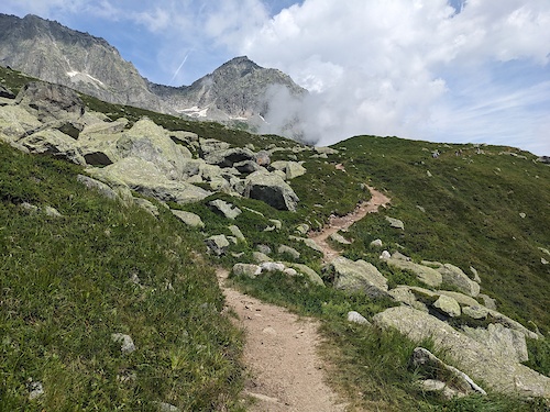
Trails
Points of Interest
- Cuolm Da Vi Gondola Top Information
- [Restaurant] Ustria Alpsu Other
- Piz Maler 2790m Summit
- TCS Camping Disentis
- Leuchtturm Rheinquelle Sight
- Segnes 2094m Other
- S. Catrina Gondola Bottom Information
- Caischavedra Chair Bottom Information
- Gendusas Chair Top Information
- Sedrun Salins Gondola Bottom Information
- Tödi (11,709 ft)
- Glarner Tödi (11,667 ft)
- Stoc Grond (11,161 ft)
- By inversedotch
 & contributors
 - Admins: swiss, trailpapst
- #41152 - 3,903 views
- district surselva activity log | embed map of District Surselva mountain bike trails | district surselva mountain biking points of interest polygons
Downloading of trail gps tracks in kml & gpx formats is enabled for District Surselva.
You must login to download files.