close
-
Layers w
- Weather Layers
- Pro
- Pro
- Pro
- Pro
- Pro
- Pro
- More Layers
- Pro
- Pro
- Pro
- Pro
-
Upgrade to

3D
Trail Conditions
- Unknown
- Snow Groomed
- Snow Packed
- Snow Covered
- Snow Cover Partial
- Freeze/thaw Cycle
- Icy
- Prevalent Mud
- Wet
- Variable
- Ideal
- Dry
- Very Dry
Trail Flow (Ridden Direction)
Trailforks scans users ridelogs to determine the most popular direction each trail is ridden. A good flowing trail network will have most trails flowing in a single direction according to their intension.
The colour categories are based on what percentage of riders are riding a trail in its intended direction.
The colour categories are based on what percentage of riders are riding a trail in its intended direction.
- > 96%
- > 90%
- > 80%
- > 70%
- > 50%
- < 50%
- bi-directional trail
- no data
Trail Last Ridden
Trailforks scans ridelogs to determine the last time a trail was ridden.
- < 2 days
- < 1 week
- < 2 weeks
- < 1 month
- < 6 months
- > 6 months
Trail Ridden Direction
The intended direction a trail should be ridden.
- Downhill Only
- Downhill Primary
- Both Directions
- Uphill Primary
- Uphill Only
- One Direction
Contribute Details
Colors indicate trail is missing specified detail.
- Description
- Photos
- Description & Photos
- Videos
Trail Popularity ?
Trailforks scans ridelogs to determine which trails are ridden the most in the last 9 months.
Trails are compared with nearby trails in the same city region with a possible 25 colour shades.
Think of this as a heatmap, more rides = more kinetic energy = warmer colors.
- most popular
- popular
- less popular
- not popular
ATV/ORV/OHV Filter
Max Vehicle Width
inches
US Cell Coverage
Legend

Radar Time
Activity Recordings
Trailforks uses anonymized public activity data.
?
Activity Recordings
Trailforks uses anonymized public activity data.
?
Personal Heatmap
▶
Activity Types
all
/
none
▶
Options
2
Date range
month
–
Winter Trails
Warning
A routing network for winter maps does not exist. Selecting trails using the winter trails layer has been disabled.
Missing Trails
Most Popular
Least Popular
Trails are colored based on popularity. The more popular a trail is, the more red. Less popular trails trend towards green.
Jump Magnitude Heatmap
Heatmap of where riders jump on trails. Zoom in to see individual jumps, click circles to view jump details.
BC Backroad Status
![map legend]()
Service Road Atlas is a free to use, community-driven service for viewing and creating reports on the numerous back-country service roads around B.C. and Alberta.

Slope Aspect
Direction the slope faces
Trails Deemphasized
Trails are shown in grey.
Only show trails with no bike usage.
Suggested Layers
Based on selected activity type
Save the current map location and zoom level as your default home location whenever this page is loaded.
Save
No description for Dolores has been added yet!
Login or register to submit one.
Activities Click to view
- Mountain Bike
34 trails
- E-Bike
10 trails
- Adaptive Bike
0 trails
- Winter Fat Bike
0 trails
- Horse
4 trails
- Hike
31 trails
- Trail Running
31 trails
- Dirtbike/Moto
5 trails
- ATV/ORV/OHV
4 trails
Region Details
- 5
- 18
- 8
- 1
Region Status
Open as of Jun 13, 2026Stats
- Avg Trail Rating
- Trails (view details)
- 37
- Trails Mountain Bike
- 37
- Trails E-Bike
- 10
- Trails Horse
- 4
- Trails Hike
- 31
- Trails Trail Running
- 31
- Trails Dirtbike/Moto
- 5
- Trails ATV/ORV/OHV
- 4
- Trails Snowshoe
- 2
- Trails Backcountry Ski
- 2
- Total Distance
- 145 miles
- Total Descent
- 9,468 ft
- Total Vertical
- 5,030 ft
- Highest Trailhead
- 10,070 ft
- Reports
- 501
- Photos
- 101
- Ridden Counter
- 3,263
Sub Regions
-
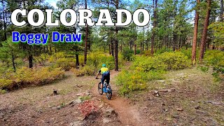
Boggy Draw
- 18
- 5
-
Zuma Bike Ranch
- 1
- 2
- 1
Popular Dolores Mountain Biking Trails
• 100 ★ 3.8 • 8 miles • 613 ft • 640 •
Popular green difficulty singletrack. This mountain bike primary trail can be used both directions and has a easy overall physical rating with a 613 ft green climb. On average it takes 58 minutes to complete this trail.
• 70 ★ 3.9 • 12 miles • 1,278 ft • 381 •
Nice flowing intermediate trail. The north east used to have a really steep section, but a nice re-route has made the whole loop a pretty nice ride.
• 90 ★ 0.0 • 3 miles • 212 ft • 327 •
Popular green difficulty singletrack. This mountain bike primary trail can be used both directions and has a moderate overall physical rating with a 212 ft green climb. On average it takes 26 minutes to complete this trail.
• 80 ★ 3.7 • 9 miles • 866 ft • 315 •
This is a new trail for 2017 that follows the shoreline of the McPhee Reservoir from Bear Canyon Loop heading south all the way to town. It turns inland around the House Creek Campground. The trail is mostly pretty easy but it is a lot...
• 75 ★ 4.0 • 5 miles • 386 ft • 301 •
Popular green difficulty singletrack. This mountain bike primary trail and has a moderate overall physical rating with a 386 ft green climb. On average it takes 45 minutes to complete this trail.
• 50 ★ 4.0 • 6 miles • 373 ft • 271 •
Moderately popular green difficulty singletrack. This mountain bike primary trail and has a easy overall physical rating with a 373 ft green climb. On average it takes 1 hour minutes to complete this trail.
• 95 ★ 4.5 • 8 miles • 502 ft • 262 •
Shush Bekeeh (Bear Tracks) best ridden counterclockwise.
• 80 ★ 0.0 • 5,112 ft • 112 ft • 253 •
Popular green difficulty singletrack. This mountain bike primary trail can be used both directions and has a easy overall physical rating with a 112 ft green climb. Trail visibility is always easy to follow. On average it takes 9 minutes to complete this trail.
Dolores Mountain Bike Routes
★ 1.0 • 29 miles • 2,144 ft • 2 •
Border of boggy with a little sunset ;) Flowy, fast, fun longer route.
6 miles • 784 ft • 4 • Loop •
• 13 miles • 734 ft • 3 •
• 21 miles • 1,409 ft • 4 •
• 13 miles • 669 ft • 5 •
Photos of Dolores Mountain Bike
Videos of Dolores Mountain Bike

trail: McNeil Trail (East)
14:26 |
62 |
Dec 5, 2025 , Dolores
trail: Maverick
14:26 |
44 |
Dec 5, 2025 , Dolores

trail: Boggy Draw Loop
14:26 |
56 |
Dec 5, 2025 , Dolores
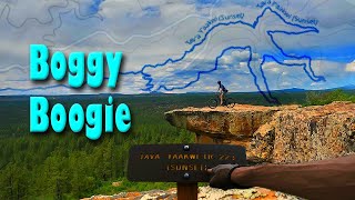
trail: Tav'a Y'aakwi (Sunset)
10:19 |
318 |
Jul 18, 2022 , Dolores
Recent Trail Reports
| status | trail | date | condition | info | user |
|---|---|---|---|---|---|
| Sage Hen Loop | Jun 13, 2026 @ 1:34pm (America/Denver) Jun 13, 2026 | Very Dry | maleficmanatee | ||
| McNeil Trail (East) | Jun 11, 2026 @ 4:03pm (America/Denver) Jun 11, 2026 | Dry | gregwenk | ||
| McNeil Trail (West) | Jun 11, 2026 @ 4:03pm (America/Denver) Jun 11, 2026 | Dry | gregwenk | ||
| Boggy Draw Loop | Jun 11, 2026 @ 4:03pm (America/Denver) Jun 11, 2026 | Dry | gregwenk | ||
| Little Bean Canyon | Jun 6, 2026 @ 3:57pm (America/Denver) Jun 6, 2026 | Very Dry | LameSweater | ||
| Maverick | Jun 4, 2026 @ 3:51pm (America/Denver) Jun 4, 2026 | Dry | gregwenk | ||
| Black Goat | Jun 3, 2026 @ 5:30pm (America/Denver) Jun 3, 2026 | Dry | zac-bassuener RTA | ||
| Black Goat | Jun 3, 2026 @ 5:30pm (America/Denver) Jun 3, 2026 | Very Dry | zac-bassuener RTA | ||
| Italian Canyon Loop | Jun 3, 2026 @ 5:30pm (America/Denver) Jun 3, 2026 | Dry | zac-bassuener RTA | ||
| Shush Bekeeh (Bear Tracks) | May 29, 2026 @ 3:23pm (America/Denver) May 29, 2026 | Dry | gregwenk |
Activity Feed
| username | action | type | title | date |
|---|---|---|---|---|
| Skoofer | ridden | trail | activity #97137986 | Jun 16, 2026 @ 2:28pm Jun 16, 2026 |
| bhuebner0637 | wishlist | trail | activity #97015924 | Jun 14, 2026 @ 5:46pm Jun 14, 2026 |
| maleficmanatee | add | report | activity #96906287 | Jun 13, 2026 @ 12:34pm Jun 13, 2026 |
| gregwenk | add | report | activity #96799191 and 2 more | Jun 12, 2026 @ 6:28am Jun 12, 2026 |
| arloswar | wishlist | region | activity #96611187 | Jun 9, 2026 @ 9:30am Jun 9, 2026 |
Recent Comments
| username | type | title | comment | date |
|---|---|---|---|---|
| trail | One cobblestone climb to keep you... | Jun 14, 2025 @ 8:40am Jun 14, 2025 | ||
| trail | Great trail through the Ponderosa. Not hard at... | Jun 10, 2025 @ 1:51pm Jun 10, 2025 | ||
| report | Mostly dry with a half dozen short, damp but... | Apr 16, 2025 @ 2:28pm Apr 16, 2025 | ||
| trail | As other said the new addition is trail... | Sep 19, 2024 @ 5:29pm Sep 19, 2024 | ||
| trail | Great views and excellent tech featutes all... | Aug 18, 2024 @ 2:56pm Aug 18, 2024 |
Local Badges
-

10 Green Trails40 awarded -

Epic Mountain Bike Climb 2k7 awarded -

Climbing 10k Badge13 awarded -

Mountain Biking 100k Badge0 awarded -

Epic Ride Descent 2k7 awarded -

Descent 10k Badge13 awarded
Bike & Skill Parks
| name | type | city | rating |
|---|---|---|---|
| Lost Canyon Bike and Skate Park | skill park | Dolores |
Activity Type Stats
| activitytype | trails | distance | descent | descent distance | total vertical | rating | global rank | state rank | photos | reports | routes | ridelogs |
|---|---|---|---|---|---|---|---|---|---|---|---|---|
| Mountain Bike | 34 | 139 miles | 9,108 ft | 51 miles | 3,737 ft | #1,883 | #691 | 100 | 518 | 3 | 6,831 | |
| E-Bike | 10 | 40 miles | 1,293 ft | 12 miles | 3,737 ft | #3,607 | #1,247 | 2 | 404 | 133 | ||
| Horse | 4 | 37 miles | 1,581 ft | 8 miles | 3,058 ft | #869 | #608 | 54 | 58 | |||
| Hike | 31 | 128 miles | 8,678 ft | 46 miles | 5,030 ft | #2,083 | #873 | 515 | 445 | |||
| Trail Running | 31 | 128 miles | 8,678 ft | 46 miles | 5,030 ft | #1,693 | #571 | 515 | 180 | |||
| Dirtbike/Moto | 5 | 39 miles | 1,115 ft | 11 miles | 3,143 ft | #749 | #264 | 36 | 11 | |||
| ATV/ORV/OHV | 4 | 38 miles | 1,112 ft | 11 miles | 3,018 ft | #573 | #217 | 36 | 4 | |||
| Snowshoe | 2 | 3 miles | 16 ft | 1,030 ft | 784 ft | 8 | 4 | |||||
| Backcountry Ski | 2 | 4 miles | 20 ft | 1,302 ft | 922 ft | 4 | 12 |
Frequently Asked Questions About Dolores
▼
What are the best places to ride in Dolores?
Dolores has 3 areas to explore for mountain biking. The top rated areas are:
▼
What are the highest rated mountain biking trails in Dolores?
The highest rated mountain biking trails in Dolores are:
- Tav'a Y'aakwi (Sunset) (4.3/5)
- Maverick (4.1/5)
- Sage Hen Loop (4/5)
- Italian Canyon Loop (4/5)
- Shush Bekeeh (Bear Tracks) (4/5)
▼
What is the best time of the year to ride in Dolores?
Based on ride log data, the most popular months to ride in Dolores are:
- May (162 activities)
- July (111 activities)
- October (109 activities)
▼
Where can I park to ride in Dolores?
There are 5 parking locations listed in Dolores. The most popular parking spots are: View all parking and trailhead locations on the map to plan your visit.
Activities
Trails
- By thehypernatural
 & contributors
 - Admins: SJMA
- #46705 - 5,191 views
- dolores activity log | embed map of Dolores mountain bike trails | dolores mountain biking points of interest
Downloading of trail gps tracks in kml & gpx formats is enabled for Dolores.
You must login to download files.