close
-
Layers w
- Weather Layers
- Pro
- Pro
- Pro
- Pro
- Pro
- Pro
- More Layers
- Pro
- Pro
- Pro
- Pro
-
Upgrade to

3D
Trail Conditions
- Unknown
- Snow Groomed
- Snow Packed
- Snow Covered
- Snow Cover Partial
- Freeze/thaw Cycle
- Icy
- Prevalent Mud
- Wet
- Variable
- Ideal
- Dry
- Very Dry
Trail Flow (Ridden Direction)
Trailforks scans users ridelogs to determine the most popular direction each trail is ridden. A good flowing trail network will have most trails flowing in a single direction according to their intension.
The colour categories are based on what percentage of riders are riding a trail in its intended direction.
The colour categories are based on what percentage of riders are riding a trail in its intended direction.
- > 96%
- > 90%
- > 80%
- > 70%
- > 50%
- < 50%
- bi-directional trail
- no data
Trail Last Ridden
Trailforks scans ridelogs to determine the last time a trail was ridden.
- < 2 days
- < 1 week
- < 2 weeks
- < 1 month
- < 6 months
- > 6 months
Trail Ridden Direction
The intended direction a trail should be ridden.
- Downhill Only
- Downhill Primary
- Both Directions
- Uphill Primary
- Uphill Only
- One Direction
Contribute Details
Colors indicate trail is missing specified detail.
- Description
- Photos
- Description & Photos
- Videos
Trail Popularity ?
Trailforks scans ridelogs to determine which trails are ridden the most in the last 9 months.
Trails are compared with nearby trails in the same city region with a possible 25 colour shades.
Think of this as a heatmap, more rides = more kinetic energy = warmer colors.
- most popular
- popular
- less popular
- not popular
ATV/ORV/OHV Filter
Max Vehicle Width
inches
US Cell Coverage
Legend

Radar Time
Activity Recordings
Trailforks uses anonymized public activity data.
?
Activity Recordings
Trailforks uses anonymized public activity data.
?
Personal Heatmap
▶
Activity Types
all
/
none
▶
Options
2
Date range
month
–
Winter Trails
Warning
A routing network for winter maps does not exist. Selecting trails using the winter trails layer has been disabled.
Missing Trails
Most Popular
Least Popular
Trails are colored based on popularity. The more popular a trail is, the more red. Less popular trails trend towards green.
Jump Magnitude Heatmap
Heatmap of where riders jump on trails. Zoom in to see individual jumps, click circles to view jump details.
BC Backroad Status
![map legend]()
Service Road Atlas is a free to use, community-driven service for viewing and creating reports on the numerous back-country service roads around B.C. and Alberta.

Slope Aspect
Direction the slope faces
Trails Deemphasized
Trails are shown in grey.
Only show trails with no bike usage.
Suggested Layers
Based on selected activity type
Save the current map location and zoom level as your default home location whenever this page is loaded.
Save
No description for Dolzago has been added yet!
Login or register to submit one.
This region uses the Uk/Euro style trail grading system.
Activities Click to view
- Mountain Bike
161 trails
- E-Bike
169 trails
- Adaptive Bike
0 trails
- Winter Fat Bike
0 trails
- Horse
40 trails
- Hike
152 trails
- Trail Running
153 trails
Region Details
- 5
- 7
- 52
- 36
- 14
- 7
Region Status
Caution as of 2 daysStats
- Avg Trail Rating
- Trails (view details)
- 130
- Trails Mountain Bike
- 173
- Trails E-Bike
- 169
- Trails Horse
- 40
- Trails Hike
- 154
- Trails Trail Running
- 153
- Total Distance
- 83 miles
- Total Descent
- 36,914 ft
- Total Vertical
- 2,164 ft
- Highest Trailhead
- 2,912 ft
- Reports
- 3,304
- Photos
- 286
- Ridden Counter
- 7,207
Sub Regions
-
Monte di Brianza
- 44
- 39
- 17
- 8
Popular Dolzago Mountain Biking Trails
• 100 ★ 4.6 • 2,726 ft • 0 ft • 266 •
Discesa tecnica con alternanza di gradini, radici, pietre e qualche tratto più scorrevole.
• 100 ★ 3.0 • 1 mile • 27 ft • 234 •
Divertente singletrack nel bosco, poi qualche tratturo
• 100 ★ 4.5 • 3,396 ft • 11 ft • 227 •
Sentiero storico del : segue la linea di discesa del costone sud del Monte fino a Mondonico. Passaggi su roccia fissa alternata a passaggi su terra battuta con sponde e salti, scende veloce su pendenze importanti verso il lato di...
• 100 ★ 4.5 • 1,191 ft • 0 ft • 221 •
Il sentiero flow per eccellenza del San Genesio. La prima parte si presenta con diverse curve con sponda, qualche salto naturale e copiabile, un salto con piccolo gap con chicken line e un paio di shark-fin che mettono alla prova il...
• 90 ★ 4.2 • 4,800 ft • 59 ft • 211 •
Prima parte pianeggiante lungo una gippabile, al primo bivio svoltare a sinistra in direzione Crosaccia e proseguire sempre dritti evitando altre deviazioni. Dopo un piccolo strappo in salita e successivo tratto ripido gradinato in...
• 95 ★ 3.7 • 4,525 ft • 130 ft • 191 •
Facile e divertente saliscendi nel bosco
• 95 ★ 4.3 • 4,147 ft • 163 ft • 186 •
Sentiero di cresta di collegamento tra il e il ristoro alpino del San Genesio. Passato il Roccolo si prende a dx l'asfaltata rotta che in breve diventa carrareccia e successivamente sentiero pedalabile fino al Ristoro Alpino
• 95 ★ 3.8 • 4,613 ft • 4 ft • 186 •
Veloce e divertente, tratto centrale leggermente sconnesso, non particolarmente ripido
Dolzago Mountain Bike Routes
Photos of Dolzago Mountain Bike
Videos of Dolzago Mountain Bike

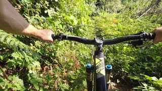
trail: Venom
3:28 |
51 |
Sep 21, 2022
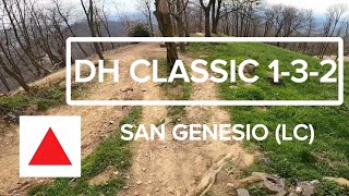
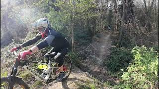
trail: DH Classic 1-3-2
20:34 |
35 |
May 26, 2026 , Dolzago

trail: DH Classic 1-3-2
20:34 |
32 |
May 26, 2026 , Dolzago

trail: DH Classic 1-3-2
20:34 |
24 |
May 26, 2026 , Dolzago

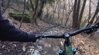
trail: DH Classic 1-3-2
16:15 |
374 |
May 13, 2012
trail: Secaù
26:49 |
49 |
Jun 29, 2025 , Dolzago
trail: Ghost Town
6:54 |
108 |
Apr 20, 2025 , Dolzago
trail: Mangiafoglie
5:28 |
131 |
Mar 20, 2025 , Dolzago
Current Trail Warnings
| status | trail | date | condition | user | info |
|---|---|---|---|---|---|
| Beat Pessina | Jun 4, 2026 @ 5:43pm (Europe/Rome) Jun 4, 2026 | Ideal | FABIOSBIKE | E-Bike Grossa pianta caduta alla fine del ripido... | |
| Traverso Madonna del Casino | May 20, 2026 @ 6:23pm (Europe/Rome) May 20, 2026 | Unknown | edobk | E-Bike Grosso albero caduto di traverso al... |
Recent Trail Reports
| status | trail | date | condition | info | user |
|---|---|---|---|---|---|
| Secaù | Jun 16, 2026 @ 3:31pm (Europe/Rome) 2 days | Dry | andrekona | ||
| Collegamento da Panissera alla mulattiera Bosina-Ravellino(Scoppiagomme) | Jun 15, 2026 @ 5:35pm (Europe/Vaduz) Jun 15, 2026 | Ideal | FABIOSBIKE | ||
| Cresta Capanni | Jun 15, 2026 @ 5:35pm (Europe/Vaduz) Jun 15, 2026 | Ideal | FABIOSBIKE | ||
| Cresta Del Terminon | Jun 15, 2026 @ 5:35pm (Europe/Vaduz) Jun 15, 2026 | Ideal | FABIOSBIKE | ||
| Raccordo Muro Di Nava - Passo Dell'Alpe | Jun 15, 2026 @ 5:35pm (Europe/Vaduz) Jun 15, 2026 | Ideal | FABIOSBIKE | ||
| Muro Nava - San Genesio | Jun 15, 2026 @ 5:35pm (Europe/Vaduz) Jun 15, 2026 | Ideal | FABIOSBIKE | ||
| Sentiero dei Proverbi | Jun 8, 2026 @ 6:09pm (Europe/Rome) Jun 8, 2026 | Ideal | FABIOSBIKE | ||
| Ponte del Bordea | Jun 5, 2026 @ 5:04pm (Europe/Rome) Jun 5, 2026 | Ideal | FABIOSBIKE | ||
| Dog basso | Jun 4, 2026 @ 11:55pm (Europe/Rome) Jun 4, 2026 | Ideal | FABIOSBIKE | ||
| Oli Trail | Jun 2, 2026 @ 2:36pm (Europe/Rome) Jun 2, 2026 | Variable | RiccardoNoob |
Activity Feed
| username | action | type | title | date |
|---|---|---|---|---|
| andrekona | add | report | activity #97105296 | Jun 16, 2026 @ 6:31am 2 days |
| FABIOSBIKE | add | report | activity #97055423 and 4 more | Jun 15, 2026 @ 11:30am 3 days |
| cAb7E1 | wishlist | trail | activity #96807644 | Jun 12, 2026 @ 8:49am Jun 12, 2026 |
| FABIOSBIKE | add | report | activity #96556152 | Jun 8, 2026 @ 12:07pm Jun 8, 2026 |
| FABIOSBIKE | add | report | activity #96307489 | Jun 5, 2026 @ 10:38am Jun 5, 2026 |
Recent Comments
| username | type | title | comment | date |
|---|---|---|---|---|
| report | Non voglio fare polemica e ti rispondo solo... | May 4, 2026 @ 11:11pm May 4, 2026 | ||
| report | Va beh se non riesci a capire che gli animali... | May 4, 2026 @ 3:11pm May 4, 2026 | ||
| report | Report anche simpatico ma , scusa, che c'entra... | May 4, 2026 @ 1:10pm May 4, 2026 | ||
| report | @maooosnow usiamo “chiuso” solo in caso di... | Apr 23, 2026 @ 9:10am Apr 23, 2026 | ||
| trail | Salita molto tech in ebike | Apr 21, 2026 @ 12:22pm Apr 21, 2026 |
Local Badges
-

10 Blue Trails43 awarded -

10 Green Trails49 awarded -

Epic Mountain Bike Climb 2k141 awarded -

Climbing 10k Badge72 awarded -

Mountain Biking 100k Badge4 awarded -

Epic Ride Descent 2k141 awarded
Activity Type Stats
| activitytype | trails | distance | descent | descent distance | total vertical | rating | global rank | state rank | photos | reports | routes | ridelogs |
|---|---|---|---|---|---|---|---|---|---|---|---|---|
| Mountain Bike | 161 | 82 miles | 36,519 ft | 52 miles | 2,165 ft | #1,330 | #33 | 272 | 3,301 | 1 | 9,462 | |
| E-Bike | 169 | 61 miles | 27,933 ft | 38 miles | 2,165 ft | #1,373 | #158 | 9 | 3,245 | 2,098 | ||
| Horse | 40 | 22 miles | 8,182 ft | 14 miles | 2,152 ft | #1,436 | #56 | 144 | ||||
| Hike | 152 | 80 miles | 34,767 ft | 50 miles | 2,165 ft | #1,876 | #64 | 3,160 | 1 | 260 | ||
| Trail Running | 153 | 79 miles | 34,232 ft | 50 miles | 2,165 ft | #1,970 | #62 | 4 | 3,163 | 1 | 283 |
Frequently Asked Questions About Dolzago
▼
What are the best places to ride in Dolzago?
Dolzago has 1 areas to explore for mountain biking. The top rated areas are:
▼
What are the highest rated mountain biking trails in Dolzago?
The highest rated mountain biking trails in Dolzago are:
- Nagot! (Upper) (4.4/5)
- La Casiraghi (4.3/5)
- DH Classic 1-3-2 (4.3/5)
- Beat Pessina (4.3/5)
- Venom (4.3/5)
▼
What is the best time of the year to ride in Dolzago?
Based on ride log data, the most popular months to ride in Dolzago are:
- April (60 activities)
- February (46 activities)
- March (44 activities)
▼
Where can I park to ride in Dolzago?
There are 7 parking locations listed in Dolzago. The most popular parking spots are: View all parking and trailhead locations on the map to plan your visit.
Activities
Trails
- By MatteoDeiCas
 & contributors
 - Admins: marcoangeletti, adessoomaipiu, micheletraversi, NORTHNLINE
- #23802 - 2,062 views
- dolzago activity log | embed map of Dolzago mountain bike trails | dolzago mountain biking points of interest
Downloading of trail gps tracks in kml & gpx formats is enabled for Dolzago.
You must login to download files.