close
-
Layers w
- Weather Layers
- Pro
- Pro
- Pro
- Pro
- Pro
- Pro
- More Layers
- Pro
- Pro
- Pro
- Pro
-
Upgrade to

3D
Trail Conditions
- Unknown
- Snow Groomed
- Snow Packed
- Snow Covered
- Snow Cover Partial
- Freeze/thaw Cycle
- Icy
- Prevalent Mud
- Wet
- Variable
- Ideal
- Dry
- Very Dry
Trail Flow (Ridden Direction)
Trailforks scans users ridelogs to determine the most popular direction each trail is ridden. A good flowing trail network will have most trails flowing in a single direction according to their intension.
The colour categories are based on what percentage of riders are riding a trail in its intended direction.
The colour categories are based on what percentage of riders are riding a trail in its intended direction.
- > 96%
- > 90%
- > 80%
- > 70%
- > 50%
- < 50%
- bi-directional trail
- no data
Trail Last Ridden
Trailforks scans ridelogs to determine the last time a trail was ridden.
- < 2 days
- < 1 week
- < 2 weeks
- < 1 month
- < 6 months
- > 6 months
Trail Ridden Direction
The intended direction a trail should be ridden.
- Downhill Only
- Downhill Primary
- Both Directions
- Uphill Primary
- Uphill Only
- One Direction
Contribute Details
Colors indicate trail is missing specified detail.
- Description
- Photos
- Description & Photos
- Videos
Trail Popularity ?
Trailforks scans ridelogs to determine which trails are ridden the most in the last 9 months.
Trails are compared with nearby trails in the same city region with a possible 25 colour shades.
Think of this as a heatmap, more rides = more kinetic energy = warmer colors.
- most popular
- popular
- less popular
- not popular
ATV/ORV/OHV Filter
Max Vehicle Width
inches
US Cell Coverage
Legend

Radar Time
Activity Recordings
Trailforks uses anonymized public activity data.
?
Activity Recordings
Trailforks uses anonymized public activity data.
?
Personal Heatmap
▶
Activity Types
all
/
none
▶
Options
2
Date range
month
–
Winter Trails
Warning
A routing network for winter maps does not exist. Selecting trails using the winter trails layer has been disabled.
Missing Trails
Most Popular
Least Popular
Trails are colored based on popularity. The more popular a trail is, the more red. Less popular trails trend towards green.
Jump Magnitude Heatmap
Heatmap of where riders jump on trails. Zoom in to see individual jumps, click circles to view jump details.
BC Backroad Status
![map legend]()
Service Road Atlas is a free to use, community-driven service for viewing and creating reports on the numerous back-country service roads around B.C. and Alberta.

Slope Aspect
Direction the slope faces
Trails Deemphasized
Trails are shown in grey.
Only show trails with no bike usage.
Suggested Layers
Based on selected activity type
Save the current map location and zoom level as your default home location whenever this page is loaded.
SaveGreat city in the hearth of the Alps, a great place for all kind of mountain bike
This region uses the Uk/Euro style trail grading system.
Activities Click to view
- Mountain Bike
99 trails
- E-Bike
85 trails
- Adaptive Bike
22 trails
- Winter Fat Bike
5 trails
- Hike
81 trails
- Trail Running
82 trails
Region Details
- 19
- 6
- 16
- 48
- 9
Region Status
Open as of May 31, 2026Stats
- Avg Trail Rating
- Trails (view details)
- 100
- Trails Mountain Bike
- 99
- Trails E-Bike
- 85
- Trails Gravel Bike
- 7
- Trails Adaptive Bike
- 22
- Trails Winter Fat Bike
- 5
- Trails Horse
- 2
- Trails Hike
- 81
- Trails Trail Running
- 82
- Trails Nordic Ski
- 1
- Total Distance
- 119 miles
- Total Descent
- 47,020 ft
- Total Vertical
- 6,539 ft
- Highest Trailhead
- 7,257 ft
- Reports
- 281
- Photos
- 117
- Ridden Counter
- 3,613
Sub Regions
-
Domobianca 365
- 2
-
Montecrestese
- 1
- 3
Popular Domodossola Mountain Biking Trails
• 100 ★ 4.5 • 1,549 ft • 19 ft • 179 •
Flow trail che parte dalla località di Foppiano e giunge al parcheggio principale dell'alpe Lusentino dove partono gli impianti di risalita. il Trail e stato realizzato mantenendo un impronta old style, con strutture north shore e...
• 100 ★ 4.0 • 1,138 ft • 0 ft • 132 •
Flow trail che parte dalla località di Foppiano e giunge al parcheggio principale dell'alpe Lusentino dove partono gli impianti di risalita. il Trail Valle degli orti e stato realizzato mantenendo un impronta old style, con strutture...
• 100 ★ 0.0 • 1 mile • 3 ft • 109 •
La è una traccia storica di Domobianca. Caratterizzato da una tracciatura molto fitta e ricca di tornanti. Il trail richiede molta tecnica e presenta alcuni tratti su roccia che richiedono una ottima tecnica di guida. Adatto a rider...
• 100 ★ 5.0 • 1 mile • 10 ft • 96 •
Flow trai del Bike park Domobianca servito dalla seggiovia Prel, presenti salti e passerelle. il suo sviluppo e caratterizzato da varie velocità sul percorso con curve spondate che attraversano boschi e i tracciati delle piste...
• 90 ★ 4.8 • 3,455 ft • 3 ft • 71 •
Dall'imbocco dell'abitato di Vallesone si scende verso sinistra lungo un primotratto di sentiero largo, poi so svolta sulla destra dove inizia una serie di curve leggermente spondate a tratti veloci, si prosegue verso una zona di salti...
• 95 ★ 0.0 • 2,644 ft • 500 ft • 63 • • hike
Popular green difficulty singletrack. This hike primary trail can be used both directions with a 500 ft green climb. Trail visibility is always easy to follow.
• 95 ★ 5.0 • 3,379 ft • 0 ft • 58 •
il trail e identificabile con la fine della nella zona dell'ultimo tornante della strada che porta all alpe Lusentino. e un trial che nella prima parte ha un impronta flow naturale, per poi diventare un trail più tecnico e veloce fino...
Domodossola Mountain Bike Routes
11 miles • 3,832 ft • 4 • Loop •
Tour Mtb per i sentieri natural di Bei, percorso su fondi misti asfalto, lastricato e single track, salita...
4,298 ft • 536 ft • 3 • Loop •
Route invernale con stazione sciistica aperta con poca neve, salita impegnativa per la pendenza sotto la...
7 miles • 5,082 ft • 3 • Out & Back •
Percorso da Domodossola alla cima del Monte Moncucco, la tratta presenta fondi misti, sia asfalto che...
25 miles • 4,924 ft • 6 • Loop •
not really difficult route , just down to montecrestese some tecnical part
21 miles • 7,123 ft • 2 •
MTB Allmountain, Uphill on Asphalt and Trail Down
Photos of Domodossola Mountain Bike
Videos of Domodossola Mountain Bike
0:00 |
5 |
Sep 18, 2025

trail: Cappella Broggio 1745
3:21 |
24 |
Apr 19, 2021
0:20 |
319 |
Nov 17, 2019
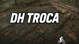
trail: DH Troca
8:36 |
38 |
Sep 17, 2025 , Domodossola
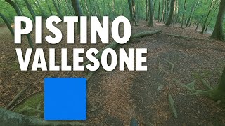
trail: Pistino Vallesone
5:00 |
57 |
Sep 16, 2025 , Domodossola
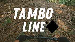
trail: Tambo line
6:20 |
64 |
Sep 15, 2025 , Domodossola

trail: Shaggy Line
0:36 |
47 |
Sep 11, 2025 , Domodossola
trail: Valle degli orti low
3:28 |
60 |
Sep 11, 2025 , Domodossola
Recent Trail Reports
| status | trail | date | condition | info | user |
|---|---|---|---|---|---|
| Prata - Alpe Lusentino | Jun 1, 2026 @ 6:37am (Europe/Rome) May 31, 2026 | Unknown | Elioe0Npc | ||
| Crazy Dog | May 24, 2026 @ 9:21pm (Europe/Rome) May 24, 2026 | Unknown | maooosnow NORTHNLINE | ||
| Ski Alp | May 24, 2026 @ 9:21pm (Europe/Rome) May 24, 2026 | Unknown | maooosnow NORTHNLINE | ||
| Valle degli orti | May 24, 2026 @ 5:32pm (Europe/Rome) May 24, 2026 | Dry | Martinotabozzi | ||
| Valle degli orti low | May 24, 2026 @ 5:32pm (Europe/Rome) May 24, 2026 | Very Dry | Martinotabozzi | ||
| Bei | Apr 29, 2026 @ 3:33pm (Europe/Rome) Apr 29, 2026 | Ideal | Martinotabozzi | ||
| Panchine | Apr 20, 2026 @ 10:12pm (Europe/Rome) Apr 20, 2026 | Ideal | Martinotabozzi | ||
| Panca Dei Giganti | Apr 20, 2026 @ 10:12pm (Europe/Rome) Apr 20, 2026 | Ideal | Martinotabozzi | ||
| Direttissima | Apr 20, 2026 @ 8:57pm (Europe/Rome) Apr 20, 2026 | Ideal | Martinotabozzi | ||
| Elfi | Apr 20, 2026 @ 8:57pm (Europe/Rome) Apr 20, 2026 | Ideal | Martinotabozzi |
Activity Feed
| username | action | type | title | date |
|---|---|---|---|---|
| tomminonthebike2012 | comment | trail | activity #97049333 | Jun 15, 2026 @ 10:03am 2 days |
| acascianini | wishlist | region | activity #96611752 | Jun 9, 2026 @ 9:38am Jun 9, 2026 |
| stefanorulez | difficultyvote | trail | activity #96147936 | Jun 3, 2026 @ 5:24am Jun 3, 2026 |
| Elioe0Npc | add | report | activity #95998537 | May 31, 2026 @ 9:37pm May 31, 2026 |
| Elioe0Npc | vote | trail | activity #95998421 | May 31, 2026 @ 9:32pm May 31, 2026 |
Recent Comments
| username | type | title | comment | date |
|---|---|---|---|---|
| trail | Trail avbstanza flow pochissimi punti... | Jun 15, 2026 @ 10:03am 2 days | ||
| trail | Awesome Loamer! a lot of fun was had! | May 15, 2026 @ 1:38am May 15, 2026 | ||
| trail | Stabil! further down pretty red! awesome... | May 15, 2026 @ 1:30am May 15, 2026 | ||
| trail | stabil steil! | May 14, 2026 @ 3:00am May 14, 2026 | ||
| trail | Easy trail, nothing fancy. The Yellow trail... | May 14, 2026 @ 1:15am May 14, 2026 |
Local Badges
-

Epic Ride Climb 2k240 awarded -

Climbing 10k Badge31 awarded -

Climbing 100k Badge4 awarded -

Epic Ride Descent 2k240 awarded -

Descent 10k Badge40 awarded -

Descent 100k Badge4 awarded
Activity Type Stats
| activitytype | trails | distance | descent | descent distance | total vertical | rating | global rank | state rank | photos | reports | routes | ridelogs |
|---|---|---|---|---|---|---|---|---|---|---|---|---|
| Mountain Bike | 99 | 116 miles | 45,764 ft | 54 miles | 6,539 ft | #1,293 | #30 | 113 | 281 | 6 | 7,448 | |
| E-Bike | 85 | 106 miles | 37,375 ft | 47 miles | 6,539 ft | #371 | #35 | 2 | 223 | 4 | 1,957 | |
| Gravel Bike | 7 | 15 miles | 492 ft | 2 miles | 6,427 ft | #4,528 | #330 | 2 | 7 | |||
| Adaptive Bike | 22 | 35 miles | 2,802 ft | 7 miles | 5,138 ft | #55 | #285 | 35 | ||||
| Winter Fat Bike | 5 | 4 miles | 1,306 ft | 2 miles | 1,568 ft | #106 | #234 | 14 | ||||
| Horse | 2 | 8 miles | 141 ft | 2 miles | 5,194 ft | 7 | ||||||
| Hike | 81 | 104 miles | 38,691 ft | 47 miles | 6,539 ft | #1,650 | #49 | 1 | 227 | 304 | ||
| Trail Running | 82 | 106 miles | 38,806 ft | 47 miles | 6,539 ft | #1,376 | #43 | 226 | 1 | 309 | ||
| Nordic Ski | 1 | 1 mile | 1,220 ft | 5,249 ft | 1,217 ft | 9 | 5 |
Frequently Asked Questions About Domodossola
▼
What are the best places to ride in Domodossola?
Domodossola has 2 areas to explore for mountain biking. The top rated areas are:
▼
What are the highest rated mountain biking trails in Domodossola?
The highest rated mountain biking trails in Domodossola are:
- Faggio (4.1/5)
- Al Runc (4.1/5)
- Spesc Downhill (4.1/5)
- Valle degli orti (4.1/5)
- Pistino Vallesone (4.1/5)
▼
What is the best time of the year to ride in Domodossola?
Based on ride log data, the most popular months to ride in Domodossola are:
- May (30 activities)
- August (25 activities)
- March (23 activities)
▼
Where can I park to ride in Domodossola?
Activities
Trails
- By Alexh1983 & contributors
- Admins: silviu86, adessoomaipiu, marambo
- #27641 - 10,289 views
- domodossola activity log | embed map of Domodossola mountain bike trails | domodossola mountain biking points of interest
Downloading of trail gps tracks in kml & gpx formats is enabled for Domodossola.
You must login to download files.