close
-
Layers w
- Weather Layers
- Pro
- Pro
- Pro
- Pro
- Pro
- Pro
- More Layers
- Pro
- Pro
- Pro
- Pro
-
Upgrade to

3D
Trail Conditions
- Unknown
- Snow Groomed
- Snow Packed
- Snow Covered
- Snow Cover Partial
- Freeze/thaw Cycle
- Icy
- Prevalent Mud
- Wet
- Variable
- Ideal
- Dry
- Very Dry
Trail Flow (Ridden Direction)
Trailforks scans users ridelogs to determine the most popular direction each trail is ridden. A good flowing trail network will have most trails flowing in a single direction according to their intension.
The colour categories are based on what percentage of riders are riding a trail in its intended direction.
The colour categories are based on what percentage of riders are riding a trail in its intended direction.
- > 96%
- > 90%
- > 80%
- > 70%
- > 50%
- < 50%
- bi-directional trail
- no data
Trail Last Ridden
Trailforks scans ridelogs to determine the last time a trail was ridden.
- < 2 days
- < 1 week
- < 2 weeks
- < 1 month
- < 6 months
- > 6 months
Trail Ridden Direction
The intended direction a trail should be ridden.
- Downhill Only
- Downhill Primary
- Both Directions
- Uphill Primary
- Uphill Only
- One Direction
Contribute Details
Colors indicate trail is missing specified detail.
- Description
- Photos
- Description & Photos
- Videos
Trail Popularity ?
Trailforks scans ridelogs to determine which trails are ridden the most in the last 9 months.
Trails are compared with nearby trails in the same city region with a possible 25 colour shades.
Think of this as a heatmap, more rides = more kinetic energy = warmer colors.
- most popular
- popular
- less popular
- not popular
ATV/ORV/OHV Filter
Max Vehicle Width
inches
US Cell Coverage
Legend

Radar Time
Activity Recordings
Trailforks uses anonymized public activity data.
?
Activity Recordings
Trailforks uses anonymized public activity data.
?
Personal Heatmap
▶
Activity Types
all
/
none
▶
Options
2
Date range
month
–
Winter Trails
Warning
A routing network for winter maps does not exist. Selecting trails using the winter trails layer has been disabled.
Missing Trails
Most Popular
Least Popular
Trails are colored based on popularity. The more popular a trail is, the more red. Less popular trails trend towards green.
Jump Magnitude Heatmap
Heatmap of where riders jump on trails. Zoom in to see individual jumps, click circles to view jump details.
BC Backroad Status
![map legend]()
Service Road Atlas is a free to use, community-driven service for viewing and creating reports on the numerous back-country service roads around B.C. and Alberta.

Slope Aspect
Direction the slope faces
Trails Deemphasized
Trails are shown in grey.
Only show trails with no bike usage.
Suggested Layers
Based on selected activity type
Save the current map location and zoom level as your default home location whenever this page is loaded.
Save
No description for Doncaster has been added yet!
Login or register to submit one.
This region uses the Uk/Euro style trail grading system.
Activities Click to view
- Mountain Bike
4 trails
- Gravel Bike
0 trails
- Winter Fat Bike
0 trails
- Hike
3 trails
- Trail Running
3 trails
Region Details
- 1
- 2
- 1
Region Status
Caution as of May 27, 2026Stats
- Avg Trail Rating
- Trails (view details)
- 4
- Trails Mountain Bike
- 4
- Trails E-Bike
- 2
- Trails Hike
- 3
- Trails Trail Running
- 3
- Total Distance
- 1 mile
- Total Descent
- 49 ft
- Total Vertical
- 192 ft
- Highest Trailhead
- 211 ft
- Reports
- 32
- Photos
- 60
- Ridden Counter
- 56
Sub Regions
-
Nearcliffe Woods
- 2
Popular Doncaster Mountain Biking Trails
• 5 ★ 4.5 • 320 ft • 0 ft • 30 •
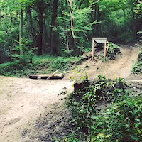
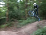
Steetley Woods is located in Conisbrough a town just outside of Doncaster. It has previously held an extreme sports event there. The track contains some big jumps and drops which would require some experience in downhilling to complete....
Doncaster Mountain Bike Routes
14 miles • 279 ft • 0 • Loop •
Nice and easy route past the Potteric Carr and around iPort Lakes
Photos of Doncaster Mountain Bike
Videos of Doncaster Mountain Bike
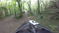
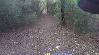
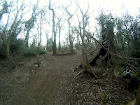
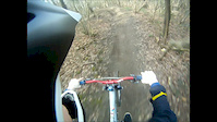
trail: Steetley Woods
2:49 |
1261 |
May 23, 2015
trail: Steetley Woods
0:06 |
1361 |
Jan 20, 2015
trail: Steetley Woods
0:28 |
472 |
Jan 20, 2015

trail: Steetley Woods
3:11 |
387 |
Oct 19, 2014
trail: Steetley Woods
0:10 |
250 |
Mar 18, 2012
trail: Steetley Woods
0:04 |
289 |
Mar 18, 2012
trail: Steetley Woods
0:10 |
627 |
Sep 17, 2010
trail: Steetley Woods
0:19 |
345 |
Sep 7, 2010
Recent Trail Reports
| status | trail | date | condition | info | user |
|---|---|---|---|---|---|
| Steetley Woods | Apr 3, 2023 @ 4:42pm Apr 3, 2023 | Unknown | trailforks Trailforks | ||
| Path | Apr 3, 2023 @ 4:41pm Apr 3, 2023 | Unknown | trailforks Trailforks | ||
| Norton And Campsall Woods | Apr 3, 2023 @ 4:41pm Apr 3, 2023 | Unknown | trailforks Trailforks |
Activity Feed
| username | action | type | title | date |
|---|---|---|---|---|
| DazbAEQ2M | ridden | trail | activity #58040347 | Aug 30, 2024 @ 7:53am Aug 30, 2024 |
| niallbellxd | add | route | activity #57623796 | Aug 22, 2024 @ 7:23am Aug 22, 2024 |
| SamiZ4Wkd | add | trail | activity #53042985 | May 23, 2024 @ 3:39pm May 23, 2024 |
| MtbA-linedirtmerchant | vote | trail | activity #44634548 | Sep 28, 2023 @ 3:17pm Sep 28, 2023 |
| jaydenccc24 | ridden | trail | activity #42358079 | Jul 30, 2023 @ 3:05am Jul 30, 2023 |
Recent Comments
| username | type | title | comment | date |
|---|---|---|---|---|
| trail | @jamesgc yes | Oct 29, 2020 @ 5:16pm Oct 29, 2020 | ||
| trail | @rooster250 Can you get a decent loop in... | Aug 12, 2020 @ 12:58am Aug 12, 2020 | ||
| trail | My local, few jumps and a nice little ride to... | Aug 4, 2020 @ 2:53pm Aug 4, 2020 | ||
| report | If your decent enough why not? | May 28, 2017 @ 4:23pm May 28, 2017 | ||
| report | Will it be alright to ride a hard tail there? | May 16, 2017 @ 11:06pm May 16, 2017 |
Bike & Skill Parks
| name | type | city | rating |
|---|---|---|---|
| Harworth BMX Track | skill park | Doncaster | |
| Balby Carr BMX Track | skill park | Doncaster | |
| Hexthorpe BMX Track | skill park | Doncaster | |
| New Waltham BMX Play Track | skill park | Doncaster |
Local Mountain Biking Directory
-
The Cycle Barn
![The Cycle Barn]()
-
Cycle Supreme
![Cycle Supreme]()
-
Doncaster Valley Cycles
![Doncaster Valley Cycles]()
-
CyclesupremeBike Shop
-
Hudson CyclesBike Shop
-
the crank houseBike Shop
Activity Type Stats
| activitytype | trails | distance | descent | descent distance | total vertical | rating | global rank | state rank | photos | reports | routes | ridelogs |
|---|---|---|---|---|---|---|---|---|---|---|---|---|
| Mountain Bike | 4 | 1 mile | 49 ft | 906 ft | 190 ft | #5,048 | #176 | 60 | 32 | 1 | 6,541 | |
| E-Bike | 2 | 335 ft | 19 | 930 | ||||||||
| Hike | 3 | 1 mile | 49 ft | 906 ft | 190 ft | #5,302 | #121 | 32 | 45 | |||
| Trail Running | 3 | 1 mile | 49 ft | 906 ft | 190 ft | #4,716 | #108 | 32 | 43 |
- By Jacob19 & contributors
- Admins: wisey, MathieuC, cemoorelife, bigbluebike
- #4684 - 15,274 views
- doncaster activity log | embed map of Doncaster mountain bike trails | doncaster mountain biking points of interest
Downloading of trail gps tracks in kml & gpx formats is enabled for Doncaster.
You must login to download files.