close
-
Layers w
- Weather Layers
- Pro
- Pro
- Pro
- Pro
- Pro
- Pro
- More Layers
- Pro
- Pro
- Pro
- Pro
-
Upgrade to

3D
Trail Conditions
- Unknown
- Snow Groomed
- Snow Packed
- Snow Covered
- Snow Cover Partial
- Freeze/thaw Cycle
- Icy
- Prevalent Mud
- Wet
- Variable
- Ideal
- Dry
- Very Dry
Trail Flow (Ridden Direction)
Trailforks scans users ridelogs to determine the most popular direction each trail is ridden. A good flowing trail network will have most trails flowing in a single direction according to their intension.
The colour categories are based on what percentage of riders are riding a trail in its intended direction.
The colour categories are based on what percentage of riders are riding a trail in its intended direction.
- > 96%
- > 90%
- > 80%
- > 70%
- > 50%
- < 50%
- bi-directional trail
- no data
Trail Last Ridden
Trailforks scans ridelogs to determine the last time a trail was ridden.
- < 2 days
- < 1 week
- < 2 weeks
- < 1 month
- < 6 months
- > 6 months
Trail Ridden Direction
The intended direction a trail should be ridden.
- Downhill Only
- Downhill Primary
- Both Directions
- Uphill Primary
- Uphill Only
- One Direction
Contribute Details
Colors indicate trail is missing specified detail.
- Description
- Photos
- Description & Photos
- Videos
Trail Popularity ?
Trailforks scans ridelogs to determine which trails are ridden the most in the last 9 months.
Trails are compared with nearby trails in the same city region with a possible 25 colour shades.
Think of this as a heatmap, more rides = more kinetic energy = warmer colors.
- most popular
- popular
- less popular
- not popular
ATV/ORV/OHV Filter
Max Vehicle Width
inches
US Cell Coverage
Legend

Radar Time
Activity Recordings
Trailforks uses anonymized public activity data.
?
Activity Recordings
Trailforks uses anonymized public activity data.
?
Personal Heatmap
▶
Activity Types
all
/
none
▶
Options
2
Date range
month
–
Winter Trails
Warning
A routing network for winter maps does not exist. Selecting trails using the winter trails layer has been disabled.
Missing Trails
Most Popular
Least Popular
Trails are colored based on popularity. The more popular a trail is, the more red. Less popular trails trend towards green.
Jump Magnitude Heatmap
Heatmap of where riders jump on trails. Zoom in to see individual jumps, click circles to view jump details.
BC Backroad Status
![map legend]()
Service Road Atlas is a free to use, community-driven service for viewing and creating reports on the numerous back-country service roads around B.C. and Alberta.

Slope Aspect
Direction the slope faces
Trails Deemphasized
Trails are shown in grey.
Only show trails with no bike usage.
Suggested Layers
Based on selected activity type
Save the current map location and zoom level as your default home location whenever this page is loaded.
Save
No description for Door County has been added yet!
Login or register to submit one.
Activities Click to view
- Mountain Bike
52 trails
- E-Bike
6 trails
- Horse
4 trails
- Hike
66 trails
- Trail Running
67 trails
- Snowshoe
7 trails
- Backcountry Ski
6 trails
- Nordic Ski
3 trails
Stats
- Avg Trail Rating
- Trails (view details)
- 68
- Trails Mountain Bike
- 52
- Trails E-Bike
- 6
- Trails Horse
- 4
- Trails Hike
- 66
- Trails Trail Running
- 67
- Trails Snowshoe
- 7
- Trails Backcountry Ski
- 6
- Trails Nordic Ski
- 3
- Total Distance
- 74 miles
- Total Descent
- 3,995 ft
- Total Vertical
- 227 ft
- Highest Trailhead
- 807 ft
- Reports
- 22
- Photos
- 48
- Ridden Counter
- 1,676
Sub Regions
- Ellison Bay (22)
- Newport State Park (22)
- Fish Creek (23)
- Peninsula State Park (23)
- Rock Island (0)
- Sturgeon Bay (7)
Popular Door County Mountain Biking Trails
• 75 ★ 4.0 • 2 miles • 80 ft • 92 •
Popular blue difficulty singletrack. This mountain bike primary trail can be used both directions and has a moderate overall physical rating with a 80 ft blue climb. It features berm and jump. Trail visibility is always easy to follow.
• 100 ★ 4.0 • 3,087 ft • 3 ft • 90 •
Popular blue difficulty singletrack. This mountain bike primary trail can be used both directions and has a moderate overall physical rating with a 3 ft blue climb. Trail visibility is always easy to follow.
• 80 ★ 4.0 • 2 miles • 56 ft • 83 •
Popular blue difficulty singletrack. This mountain bike primary trail and has a moderate overall physical rating with a 56 ft blue climb. Trail visibility is always easy to follow.
• 70 ★ 0.0 • 1 mile • 26 ft • 78 • • skixc
Popular blue difficulty singletrack. This nordic ski primary trail can be used both directions and has a moderate overall physical rating with a 26 ft green climb. On average it takes 10 minutes to complete this trail.
• 95 ★ 0.0 • 1 mile • 12 ft • 77 •
Popular green difficulty singletrack. This mountain bike primary trail and has a easy overall physical rating with a 12 ft green climb. Trail visibility is always easy to follow.
• 90 ★ 0.0 • 1 mile • 6 ft • 73 •
Popular green difficulty singletrack. This mountain bike primary trail and has a easy overall physical rating with a 6 ft green climb. Trail visibility is always easy to follow.
• 100 ★ 0.0 • 2 miles • 142 ft • 52 • • skixc
Popular blue difficulty singletrack. This nordic ski primary trail can be used both directions and has a moderate overall physical rating with a 142 ft green climb. Winter use: Skating snow grooming. Trail visibility is always easy to follow. On average it takes 11 minutes to complete this trail.
Door County Mountain Bike Routes
★ 3.0 • 5 miles • 87 ft • 0 •
Videos of Door County Mountain Bike
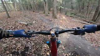
trail: Bear Bumps
2:47 |
861 |
Nov 12, 2024 , Fish Creek
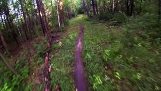
trail: Handcut
7:40 |
2246 |
Feb 9, 2018 , Fish Creek
Recent Trail Reports
| status | trail | date | condition | info | user |
|---|---|---|---|---|---|
| Wild Porcupine Peninsula State Park | Oct 8, 2025 @ 12:52pm (America/Menominee) Oct 8, 2025 | Ideal | Schwab1475 | ||
| Owl City Peninsula State Park | Aug 4, 2025 @ 2:41pm Aug 4, 2025 | Ideal | AzHyjsU9 | ||
| Flying Squirrel Peninsula State Park | Jun 1, 2025 @ 10:29am Jun 1, 2025 | Ideal | pmikrut15 | ||
| Bear Bumps Peninsula State Park | Jun 1, 2025 @ 10:29am Jun 1, 2025 | Ideal | pmikrut15 | ||
| Pileated Pass Peninsula State Park | Jun 1, 2025 @ 10:29am Jun 1, 2025 | Ideal | pmikrut15 | ||
| Potawatomi (East) Sturgeon Bay | Jun 2, 2025 @ 4:30pm Jun 2, 2025 | Ideal | zac-bassuener RTA | ||
| Potawatomi (West) Potawatomi State Park | Jun 2, 2025 @ 4:01pm Jun 2, 2025 | Ideal | zac-bassuener RTA | ||
| Rowleys Bay Newport State Park | Oct 20, 2024 @ 10:19pm Oct 20, 2024 | Ideal | RomanMark | ||
| PSP Trailhead Peninsula State Park | Jul 8, 2024 @ 3:08pm Jul 8, 2024 | Wet | pabrenna | ||
| Old Fang Short Course | Apr 26, 2023 @ 12:37pm Apr 26, 2023 | Ideal | themidwestskier |
Activity Feed
| username | action | type | title | date |
|---|---|---|---|---|
| TheWholeTrail | add | photo | activity #96825275 | Jun 12, 2026 @ 1:33pm Jun 12, 2026 |
| TheWholeTrail | comment | trail | activity #96824835 and 1 more | Jun 12, 2026 @ 1:25pm Jun 12, 2026 |
| Szabif | add | photo | activity #96220069 and 1 more | Jun 4, 2026 @ 5:41am Jun 4, 2026 |
| Szabif | add | photo | activity #96176162 and 1 more | Jun 3, 2026 @ 1:02pm Jun 3, 2026 |
| msmcfate | update | trail | activity #96094698 | Jun 2, 2026 @ 10:34am Jun 2, 2026 |
Recent Comments
| username | type | title | comment | date |
|---|---|---|---|---|
| trail | Sometimes labeled hand cut, sometimes labeled... | Jun 12, 2026 @ 1:34pm Jun 12, 2026 | ||
| trail | The is the better and blacker of the two black... | Jun 12, 2026 @ 1:25pm Jun 12, 2026 | ||
| trail | Trails here are pretty flat. You have to push... | Oct 26, 2025 @ 2:03pm Oct 26, 2025 | ||
| trail | Though this black diamond trail may only be a... | Mar 29, 2020 @ 5:24pm Mar 29, 2020 | ||
| trail | This trail is not just for beginner and... | Mar 29, 2020 @ 5:22pm Mar 29, 2020 |
Local Badges
-

Epic Ride Descent 2k1 awarded -

Descent 10k Badge0 awarded -
Descent 10k Badge0 awarded -
Epic Ride Descent 2k0 awarded -

Descent 100k Badge0 awarded -

Mountain Biking 100k Badge0 awarded
Bike & Skill Parks
| name | type | city | rating |
|---|---|---|---|
| SNOWKRAFT Jump Lines and Pumptrak | skill park | Sturgeon Bay |
Activity Type Stats
| activitytype | trails | distance | descent | descent distance | total vertical | rating | global rank | state rank | photos | reports | routes | ridelogs |
|---|---|---|---|---|---|---|---|---|---|---|---|---|
| Mountain Bike | 52 | 51 miles | 3,071 ft | 17 miles | 226 ft | 49 | 22 | 1 | 3,758 | |||
| E-Bike | 6 | 3 miles | 161 ft | 4,787 ft | 157 ft | 20 | 76 | |||||
| Horse | 4 | 7 miles | 171 ft | 2 miles | 148 ft | |||||||
| Hike | 66 | 69 miles | 3,766 ft | 22 miles | 226 ft | 22 | 508 | |||||
| Trail Running | 67 | 71 miles | 3,829 ft | 23 miles | 226 ft | 22 | 236 | |||||
| Snowshoe | 7 | 10 miles | 394 ft | 2 miles | 197 ft | 9 | ||||||
| Backcountry Ski | 6 | 4 miles | 118 ft | 5,049 ft | 62 ft | 1 | ||||||
| Nordic Ski | 3 | 8 miles | 423 ft | 2 miles | 190 ft | 2 | 148 |
Frequently Asked Questions About Door County
▼
What are the best places to ride in Door County?
Door County has 6 areas to explore for mountain biking. The top rated areas are:
▼
What are the highest rated mountain biking trails in Door County?
The highest rated mountain biking trails in Door County are:
- Old Fang Short Course (4.1/5)
- Black Diamond Loop (4.1/5)
- Bear Bumps (4/5)
- Connector to Orchard (0/5)
- Pileated Pass (0/5)
▼
What is the best time of the year to ride in Door County?
Based on ride log data, the most popular months to ride in Door County are:
- July (62 activities)
- August (46 activities)
- June (28 activities)
▼
What is the longest trail in Door County?
The longest trail in Door County is Potawatomi (West) at 3.3 miles. View all trails sorted by distance.
Activities
Trails
Points of Interest
- By brenthillier
 NSMBA TRAILFORKS & contributors
 - Admins: MW HIKING, feardabeast
- #10953 - 10,296 views
- door county activity log | embed map of Door County mountain bike trails | door county mountain biking points of interest
Downloading of trail gps tracks in kml & gpx formats is enabled for Door County.
You must login to download files.