close
-
Layers w
- Weather Layers
- Pro
- Pro
- Pro
- Pro
- Pro
- Pro
- More Layers
- Pro
- Pro
- Pro
- Pro
-
Upgrade to

3D
Trail Conditions
- Unknown
- Snow Groomed
- Snow Packed
- Snow Covered
- Snow Cover Partial
- Freeze/thaw Cycle
- Icy
- Prevalent Mud
- Wet
- Variable
- Ideal
- Dry
- Very Dry
Trail Flow (Ridden Direction)
Trailforks scans users ridelogs to determine the most popular direction each trail is ridden. A good flowing trail network will have most trails flowing in a single direction according to their intension.
The colour categories are based on what percentage of riders are riding a trail in its intended direction.
The colour categories are based on what percentage of riders are riding a trail in its intended direction.
- > 96%
- > 90%
- > 80%
- > 70%
- > 50%
- < 50%
- bi-directional trail
- no data
Trail Last Ridden
Trailforks scans ridelogs to determine the last time a trail was ridden.
- < 2 days
- < 1 week
- < 2 weeks
- < 1 month
- < 6 months
- > 6 months
Trail Ridden Direction
The intended direction a trail should be ridden.
- Downhill Only
- Downhill Primary
- Both Directions
- Uphill Primary
- Uphill Only
- One Direction
Contribute Details
Colors indicate trail is missing specified detail.
- Description
- Photos
- Description & Photos
- Videos
Trail Popularity ?
Trailforks scans ridelogs to determine which trails are ridden the most in the last 9 months.
Trails are compared with nearby trails in the same city region with a possible 25 colour shades.
Think of this as a heatmap, more rides = more kinetic energy = warmer colors.
- most popular
- popular
- less popular
- not popular
ATV/ORV/OHV Filter
Max Vehicle Width
inches
US Cell Coverage
Legend

Radar Time
Activity Recordings
Trailforks uses anonymized public activity data.
?
Activity Recordings
Trailforks uses anonymized public activity data.
?
Personal Heatmap
▶
Activity Types
all
/
none
▶
Options
2
Date range
month
–
Winter Trails
Warning
A routing network for winter maps does not exist. Selecting trails using the winter trails layer has been disabled.
Missing Trails
Most Popular
Least Popular
Trails are colored based on popularity. The more popular a trail is, the more red. Less popular trails trend towards green.
Jump Magnitude Heatmap
Heatmap of where riders jump on trails. Zoom in to see individual jumps, click circles to view jump details.
BC Backroad Status
![map legend]()
Service Road Atlas is a free to use, community-driven service for viewing and creating reports on the numerous back-country service roads around B.C. and Alberta.

Slope Aspect
Direction the slope faces
Trails Deemphasized
Trails are shown in grey.
Only show trails with no bike usage.
Suggested Layers
Based on selected activity type
Save the current map location and zoom level as your default home location whenever this page is loaded.
Save
No description for Dorset has been added yet!
Login or register to submit one.
This region uses the Uk/Euro style trail grading system.
Activities Click to view
- Mountain Bike
120 trails
- E-Bike
61 trails
- Gravel Bike
0 trails
- Adaptive Bike
0 trails
- Winter Fat Bike
0 trails
- Hike
84 trails
- Trail Running
86 trails
Region Details
- 28
- 1
- 18
- 56
- 7
- 3
- 1
Stats
- Avg Trail Rating
- Trails (view details)
- 116
- Trails Mountain Bike
- 120
- Trails E-Bike
- 61
- Trails Hike
- 85
- Trails Trail Running
- 86
- Total Distance
- 42 miles
- Total Descent
- 7,783 ft
- Total Vertical
- 777 ft
- Highest Trailhead
- 785 ft
- Reports
- 540
- Photos
- 329
- Ridden Counter
- 8,413
Sub Regions
- Blandford Forum (13)
- Ashmore woods (9)
- Blandford (1)
- Bournemouth (1)
- Dorchester (32)
- Puddletown Forest (32)
- Highcliffe (1)
- Poole (9)
- Shaftesbury (1)
- Studland (3)
- Wareham (29)
- Lulworth Ranges (0)
- Wimborne Minster (7)
- Okeford Hill Bike Park (17)
- Whatcombe Wood (3)
Popular Dorset Mountain Biking Trails
• 100 ★ 5.0 • 3 miles • 222 ft • 229 •
Popular green difficulty gravel path. This multi-use trail can be used both directions with a 222 ft blue climb. Trail visibility is always easy to follow. On average it takes 30 minutes to complete this trail.
• 100 ★ 4.5 • 551 ft • 0 ft • 215 •
Popular blue difficulty singletrack. This mountain bike primary trail can be used both directions. It features berm and drop. On average it takes 2 minutes to complete this trail.
• 100 ★ 4.0 • 984 ft • 0 ft • 212 •
Popular blue difficulty singletrack. This mountain bike primary trail can be used downhill only and has a moderate overall physical rating. It features berm, jump and gap jump. On average it takes 1 minutes to complete this trail.
• 95 ★ 4.4 • 909 ft • 0 ft • 203 •
Highly rated popular blue difficulty singletrack. This mountain bike primary trail can be used downhill primary. It features berm, jump and gap jump. Trail visibility is always easy to follow. On average it takes 1 minutes to complete this trail.
• 85 ★ 3.7 • 1,533 ft • 0 ft • 177 •
Popular blue difficulty singletrack. This mountain bike primary trail can be used downhill primary. It features berm and jump. On average it takes 2 minutes to complete this trail.
• 20 ★ 0.0 • 1,381 ft • 0 ft • 157 •
Less popular blue difficulty singletrack. This mountain bike primary trail can be used downhill primary. It features berm and jump. On average it takes 5 minutes to complete this trail.
• 65 ★ 3.0 • 776 ft • 0 ft • 155 •
Moderately popular blue difficulty singletrack. This mountain bike primary trail can be used downhill primary. It features berm and jump. On average it takes 1 minutes to complete this trail.
• 95 ★ 1.0 • 911 ft • 0 ft • 150 •
Same start point as but head right... A few nice jumps and a couple of Bigger drops... I would grade it as red but I only have blue or black and I don't think it is a black.
Dorset Mountain Bike Routes
★ 3.0 • 12 miles • 1,507 ft • 20 • Loop •
Note: many of the TF trails are closed or lost due to logging activity (May 2021), so some adoptation /...
12 miles • 1,883 ft • 29 • Loop •
All except 4 or 5 outliers of the Trailforks listed puddletown forest trails in one continuous loop...
★ 4.0 • 3 miles • 283 ft • 0 • Loop •
A loop that takes in quite a few of the good trails at Cannon Hill. Tricky to follow but not impossible
★ 4.0 • 27 miles • 1,947 ft • 0 • Loop •
Isle of Purbeck loop. Fairly tough ride.
25 miles • 1,895 ft • 0 •
Corfe Castle loop passing Old Harry Rock, ridge way ride to Swyre Head back to Corfe. Very hilly
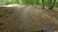
Photos of Dorset Mountain Bike
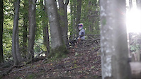
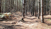
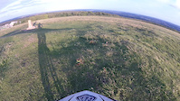
Videos of Dorset Mountain Bike
trail: Rocket Line
0:13 |
84 |
Sep 26, 2024

trail: Jungle Run
2:47 |
202 |
Nov 22, 2020
trail: Devils Dyke
0:56 |
214 |
Oct 10, 2020
trail: Wareham Forest Stump Jumper
0:16 |
321 |
Sep 30, 2020

trail: Devils Dyke
0:33 |
252 |
Feb 1, 2017

trail: Bombhole
0:22 |
332 |
Oct 18, 2016
trail: The steps
0:59 |
240 |
Aug 4, 2016
trail: DH Canford Heath
9:50 |
259 |
Oct 14, 2015
Recent Trail Reports
| status | trail | date | condition | info | user |
|---|---|---|---|---|---|
| Sandy Biff Puddletown Forest | Jan 25, 2026 @ 4:39pm (Europe/London) Jan 25, 2026 | Variable | joeg885 | ||
| Ford Prefect Blandford Forum | Jan 8, 2026 @ 4:53pm (Europe/London) Jan 8, 2026 | Freeze/thaw Cycle | gabt | ||
| Tight and Twisty Puddletown Forest | Nov 23, 2025 @ 5:05pm (Europe/London) Nov 23, 2025 | Wet | joeg885 | ||
| Dual course 2.0 Puddletown Forest | Nov 23, 2025 @ 5:03pm (Europe/London) Nov 23, 2025 | Variable | joeg885 | ||
| Out of the carpark Wareham | Nov 18, 2025 @ 2:31pm (Europe/London) Nov 18, 2025 | Ideal | ThesearchMTB | ||
| Access Wareham | Nov 18, 2025 @ 2:31pm (Europe/London) Nov 18, 2025 | Ideal | ThesearchMTB | ||
| Burm Baby Burm Wareham | Nov 18, 2025 @ 2:31pm (Europe/London) Nov 18, 2025 | Ideal | ThesearchMTB | ||
| Triple Crown Wareham | Nov 18, 2025 @ 2:31pm (Europe/London) Nov 18, 2025 | Ideal | ThesearchMTB | ||
| Lanes to room with a view Wareham | Nov 18, 2025 @ 2:31pm (Europe/London) Nov 18, 2025 | Ideal | ThesearchMTB | ||
| Wareham Mini Gravity Enduro Wareham | Nov 18, 2025 @ 2:31pm (Europe/London) Nov 18, 2025 | Ideal | ThesearchMTB |
Activity Feed
| username | action | type | title | date |
|---|---|---|---|---|
| TomaszMietki | wishlist | route | activity #95303785 | May 23, 2026 @ 4:20am May 23, 2026 |
| TomaszMietki | wishlist | route | activity #95199215 | May 21, 2026 @ 1:59pm May 21, 2026 |
| TomaszMietki | wishlist | route | activity #95199199 | May 21, 2026 @ 1:58pm May 21, 2026 |
| Cassius77 | ridden | trail | activity #94982862 | May 18, 2026 @ 9:51am May 18, 2026 |
| DT2MTB | wishlist | region | activity #94793678 | May 16, 2026 @ 12:54am May 16, 2026 |
Recent Comments
| username | type | title | comment | date |
|---|---|---|---|---|
| trail | A bit risky but great fun if you don’t get shot | Jan 8, 2026 @ 8:54am Jan 8, 2026 | ||
| report | Nissan Almere is back open, and more fun than... | Jan 1, 2025 @ 2:23am Jan 1, 2025 | ||
| trail | Quite difficult to find but well worth it. | Dec 31, 2024 @ 5:45am Dec 31, 2024 | ||
| trail | Trail normally known as "A350" | Nov 5, 2023 @ 11:35am Nov 5, 2023 | ||
| trail | Overgrown at the start | Sep 28, 2023 @ 8:20am Sep 28, 2023 |
Local Badges
-

Top 10 Trails26 awarded -

Climbing 10k Badge4 awarded -

Epic Ride Climb 2k10 awarded -

Completionist14 awarded -

Climbing 100k Badge0 awarded -

Epic Ride 50k433 awarded
Bike & Skill Parks
| name | type | city | rating |
|---|---|---|---|
| Okeford Hill Bike Park | bike park | Okeford Fitzpaine | |
| Bryanston Bumps | skill park | Shaftesbury |
Activity Type Stats
| activitytype | trails | distance | descent | descent distance | total vertical | rating | global rank | state rank | photos | reports | routes | ridelogs |
|---|---|---|---|---|---|---|---|---|---|---|---|---|
| Mountain Bike | 120 | 42 miles | 7,782 ft | 23 miles | 778 ft | 329 | 533 | 11 | 30,000 | |||
| E-Bike | 61 | 20 miles | 4,088 ft | 12 miles | 715 ft | 468 | 4 | 2,524 | ||||
| Hike | 84 | 35 miles | 5,331 ft | 18 miles | 778 ft | 502 | 2 | 1,280 | ||||
| Trail Running | 86 | 35 miles | 5,361 ft | 18 miles | 778 ft | 503 | 1 | 368 |
Frequently Asked Questions About Dorset
▼
What are the best places to ride in Dorset?
Dorset has 7 areas to explore for mountain biking. The top rated areas are:
▼
What are the highest rated mountain biking trails in Dorset?
The highest rated mountain biking trails in Dorset are:
- Cuckoo Corner (4.2/5)
- Jungle Run (4.2/5)
- The Loaminator (4.2/5)
- Pixiedust (4.2/5)
- Fanfare (4.1/5)
▼
What is the best time of the year to ride in Dorset?
Based on ride log data, the most popular months to ride in Dorset are:
- July (108 activities)
- August (94 activities)
- June (91 activities)
▼
What is the longest trail in Dorset?
The longest trail in Dorset is Sika Trail - wareham Forest at 10.4 km. View all trails sorted by distance.
Activities
- By WillieJacobsz
 Trailforks SBP SWW & contributors
 - Admins: UKTP, 20twenty-p, wisey, MathieuC, cemoorelife, DRR
- #6768 - 24,575 views
- dorset activity log | embed map of Dorset mountain bike trails | dorset mountain biking points of interest
Downloading of trail gps tracks in kml & gpx formats is enabled for Dorset.
You must login to download files.