close
-
Layers w
- Weather Layers
- Pro
- Pro
- Pro
- Pro
- Pro
- Pro
- More Layers
- Pro
- Pro
- Pro
- Pro
-
Upgrade to

3D
Trail Conditions
- Unknown
- Snow Groomed
- Snow Packed
- Snow Covered
- Snow Cover Partial
- Freeze/thaw Cycle
- Icy
- Prevalent Mud
- Wet
- Variable
- Ideal
- Dry
- Very Dry
Trail Flow (Ridden Direction)
Trailforks scans users ridelogs to determine the most popular direction each trail is ridden. A good flowing trail network will have most trails flowing in a single direction according to their intension.
The colour categories are based on what percentage of riders are riding a trail in its intended direction.
The colour categories are based on what percentage of riders are riding a trail in its intended direction.
- > 96%
- > 90%
- > 80%
- > 70%
- > 50%
- < 50%
- bi-directional trail
- no data
Trail Last Ridden
Trailforks scans ridelogs to determine the last time a trail was ridden.
- < 2 days
- < 1 week
- < 2 weeks
- < 1 month
- < 6 months
- > 6 months
Trail Ridden Direction
The intended direction a trail should be ridden.
- Downhill Only
- Downhill Primary
- Both Directions
- Uphill Primary
- Uphill Only
- One Direction
Contribute Details
Colors indicate trail is missing specified detail.
- Description
- Photos
- Description & Photos
- Videos
Trail Popularity ?
Trailforks scans ridelogs to determine which trails are ridden the most in the last 9 months.
Trails are compared with nearby trails in the same city region with a possible 25 colour shades.
Think of this as a heatmap, more rides = more kinetic energy = warmer colors.
- most popular
- popular
- less popular
- not popular
ATV/ORV/OHV Filter
Max Vehicle Width
inches
US Cell Coverage
Legend

Radar Time
Activity Recordings
Trailforks uses anonymized public activity data.
?
Activity Recordings
Trailforks uses anonymized public activity data.
?
Personal Heatmap
▶
Activity Types
all
/
none
▶
Options
2
Date range
month
–
Winter Trails
Warning
A routing network for winter maps does not exist. Selecting trails using the winter trails layer has been disabled.
Missing Trails
Most Popular
Least Popular
Trails are colored based on popularity. The more popular a trail is, the more red. Less popular trails trend towards green.
Jump Magnitude Heatmap
Heatmap of where riders jump on trails. Zoom in to see individual jumps, click circles to view jump details.
BC Backroad Status
![map legend]()
Service Road Atlas is a free to use, community-driven service for viewing and creating reports on the numerous back-country service roads around B.C. and Alberta.

Slope Aspect
Direction the slope faces
Trails Deemphasized
Trails are shown in grey.
Only show trails with no bike usage.
Suggested Layers
Based on selected activity type
Save the current map location and zoom level as your default home location whenever this page is loaded.
Save
No description for Dossenheim has been added yet!
Login or register to submit one.
This region uses the Uk/Euro style trail grading system.
Activities Click to view
- Mountain Bike
20 trails
- E-Bike
21 trails
- Hike
16 trails
- Trail Running
16 trails
Region Details
- 1
- 9
- 6
Region Status
Caution as of May 2, 2026Stats
- Avg Trail Rating
- Trails (view details)
- 16
- Trails Mountain Bike
- 21
- Trails E-Bike
- 21
- Trails Hike
- 16
- Trails Trail Running
- 16
- Total Distance
- 6 miles
- Total Descent Distance
- 5 miles
- Total Descent
- 3,247 ft
- Total Vertical
- 1,053 ft
- Highest Trailhead
- 1,837 ft
- Reports
- 372
- Photos
- 45
- Ridden Counter
- 1,650
Popular Dossenheim Mountain Biking Trails
• 100 ★ 5.0 • 2,031 ft • 0 ft • 227 •
Der erste Trail der Steinbrecher-Trails. Flowig und nicht allzu steil geht es vom Weißen Stier hier hinunter, mit ein paar kleineren und auch ein paar größeren Sprünge, wobei diese abrollbar oder umfahrbar sind. Ein paar...
• 90 ★ 4.8 • 3,615 ft • 0 ft • 205 •
Der längste Abschnitt der Steinbrecher-Trails. Abwechslungsreich geht es hier spaßig teilweise ruppig, teilweise flowig in Richtung Dossenheim. Viele Anliegerkurven und einige Sprünge erwarten euch.
• 85 ★ 4.2 • 755 ft • 0 ft • 180 •
Verbindungstrail der Steinbrecher-Trails, vom zum . Relativ flacher Trail, in den aber trotzdem ein paar spaßige Features wie kleine Sprünge oder kleine Kompressionen eingebaut werden konnten.
• 65 ★ 5.0 • 1,467 ft • 0 ft • 167 • • hike
Am Anfang muss man ein klein wenig bergauf fahren, dafür wird man dann mit einer recht rasanten Abfahrt belohnt, bei der es links, rechts und optional auch mal kleinere Absätze bergab geht. Es gibt auch zwei, drei optionale...
• 45 ★ 3.5 • 1,453 ft • 0 ft • 166 • • hike
Der Weg wird immer mal wieder als Rückegasse für die Holzernte verwendet, ändert also von Zeit zu Zeit den Verlauf und die Features. Zur Zeit ist er sehr sehr ausgewaschen und macht nur noch bedingt Spaß. Besser die Alternative fahren.
• 90 ★ 2.4 • 1,752 ft • 0 ft • 163 •
Offiziell ausgewiesener (geteilter) MTB-Trail. Gut 3 Meter breit, ohne Kurven, Features oder besonderen Anspruch. Bergab kann man hier durchaus schnell werden, viel mehr Reiz ist dann aber auch nicht vorhanden. Zumal es auch...
• 95 ★ 5.0 • 761 ft • 0 ft • 126 •
Abschnitt drei der Steinbrecher-Trails und eigentlich bereits Teil des (allerdings getrennt durch eine Asphalt-Straße). Es wechseln sich offene sowie Steilkurven ab, ebenso vorhanden sind kleinere und mittlere (optionale) Sprünge....
• 75 ★ 4.3 • 1,148 ft • 0 ft • 102 •
Kurzer, aber lustiger Trail, immer wieder links, rechts, links, rechts den Hohlweg entlang. Am Schluss leider noch nicht ausgebaut.
Dossenheim Mountain Bike Routes
★ 5.0 • 3 miles • 142 ft • 7 • Point to Point •
Am Weißen Stein startend fährt man erst mal das Gelbe X hinunter. An dessen Ende geht es erstmal flach...
★ 5.0 • 12 miles • 2,097 ft • 9 • Loop •
Der Start ist am , von wo aus man in Richtung fährt. Hat man diesen passiert, findet sich links dann der...
Photos of Dossenheim Mountain Bike
Videos of Dossenheim Mountain Bike
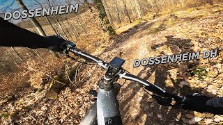
trail: Weißer Stein Trail
0:35 |
199 |
Apr 29, 2020
trail: FarnFarm
0:13 |
142 |
Apr 21, 2020
youtuber
![Random Wege (und ne Katze!) // Heidelberg -...]()

trail: Zum Dörrbrunnen
11:52 |
11 |
Jun 13, 2026 , Dossenheim
youtuber
![Steinbrecher Trails und noch mehr //...]()
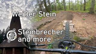
trail: Weißer Stein Trail
12:48 |
39 |
Apr 26, 2026 , Dossenheim
youtuber
![HEIDELBERG WEISSER STEIN Herbst-Tour:...]()
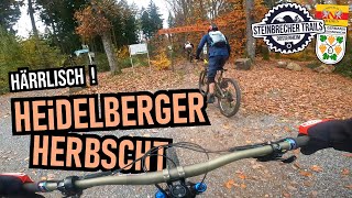
trail: Kronenburgtrail
14:25 |
86 |
Nov 14, 2025 , Dossenheim
trail: Kronenburgtrail
9:00 |
99 |
Jan 20, 2025 , Dossenheim

trail: Weißer Stein Trail
13:28 |
131 |
Aug 11, 2024 , Dossenheim

trail: Die Lore
13:28 |
63 |
Aug 11, 2024 , Dossenheim
Recent Trail Reports
Activity Feed
| username | action | type | title | date |
|---|---|---|---|---|
| sp00n82 | add | video | activity #96914349 | Jun 13, 2026 @ 2:00pm Jun 13, 2026 |
| Megaise | ridden | trail | activity #95573190 | May 26, 2026 @ 10:14am May 26, 2026 |
| MirKo11 | ridden | route | activity #95097056 | May 20, 2026 @ 3:48am May 20, 2026 |
| romERROR | update | trail | activity #93525972 | Apr 27, 2026 @ 10:19am Apr 27, 2026 |
| romERROR | add | report | activity #93525890 | Apr 27, 2026 @ 10:18am Apr 27, 2026 |
Recent Comments
| username | type | title | comment | date |
|---|---|---|---|---|
| trail | Bitte nicht mehr ins Mühlbachtal am Ende des... | Jul 27, 2025 @ 7:34am Jul 27, 2025 | ||
| trail | Der Trail musste leider aufgrund von Auflagen... | Jul 27, 2025 @ 7:29am Jul 27, 2025 | ||
| trail | Das ist irgendwie der einzige Trail, der in... | Jun 13, 2025 @ 11:48am Jun 13, 2025 | ||
| trail | Ganz lustig als kurze Abwechsung zum... | Jun 2, 2025 @ 1:23am Jun 2, 2025 | ||
| trail | Geiles Ding – teils mehrere Varianten... | Jun 2, 2025 @ 1:20am Jun 2, 2025 |
Local Badges
-

Epic Mountain Bike Climb 2k4 awarded -

Climbing 10k Badge3 awarded -

Mountain Biking 100k Badge0 awarded -

Epic Ride Descent 2k4 awarded -

Descent 10k Badge3 awarded -

Descent 100k Badge0 awarded
Activity Type Stats
| activitytype | trails | distance | descent | descent distance | total vertical | rating | global rank | state rank | photos | reports | routes | ridelogs |
|---|---|---|---|---|---|---|---|---|---|---|---|---|
| Mountain Bike | 20 | 6 miles | 3,248 ft | 5 miles | 1,053 ft | #3,749 | #52 | 44 | 393 | 2 | 1,956 | |
| E-Bike | 21 | 6 miles | 3,248 ft | 5 miles | 1,053 ft | #4,636 | #137 | 3 | 315 | 1 | 281 | |
| Hike | 16 | 6 miles | 3,104 ft | 5 miles | 1,053 ft | #7,421 | #122 | 329 | 41 | |||
| Trail Running | 16 | 6 miles | 3,104 ft | 5 miles | 1,053 ft | #7,721 | #146 | 329 | 27 |
Frequently Asked Questions About Dossenheim
▼
What are the highest rated mountain biking trails in Dossenheim?
The highest rated mountain biking trails in Dossenheim are:
- Kronenburgtrail (4.5/5)
- Weißer Stein Achterbahn (4.5/5)
- Weißer Stein Trail (4.4/5)
- Kniebreche (4.3/5)
- Schauenburg Trail Teil 1 (4.3/5)
▼
What is the best time of the year to ride in Dossenheim?
Based on ride log data, the most popular months to ride in Dossenheim are:
- May (5 activities)
- April (4 activities)
- July (2 activities)
▼
Where can I park to ride in Dossenheim?
There are 5 parking locations listed in Dossenheim. The most popular parking spots are: View all parking and trailhead locations on the map to plan your visit.
▼
What is the longest trail in Dossenheim?
The longest trail in Dossenheim is Eisbachtrail at 4,642 ft. View all trails sorted by distance.
Activities
- By orampe & contributors
- Admins: HDRiders, Sasse82, sp00n82, martywis
- #17998 - 4,871 views
- dossenheim activity log | embed map of Dossenheim mountain bike trails | dossenheim mountain biking points of interest
Downloading of trail gps tracks in kml & gpx formats is enabled for Dossenheim.
You must login to download files.