close
-
Layers w
- Weather Layers
- Pro
- Pro
- Pro
- Pro
- Pro
- Pro
- More Layers
- Pro
- Pro
- Pro
- Pro
-
Upgrade to

3D
Trail Conditions
- Unknown
- Snow Groomed
- Snow Packed
- Snow Covered
- Snow Cover Partial
- Freeze/thaw Cycle
- Icy
- Prevalent Mud
- Wet
- Variable
- Ideal
- Dry
- Very Dry
Trail Flow (Ridden Direction)
Trailforks scans users ridelogs to determine the most popular direction each trail is ridden. A good flowing trail network will have most trails flowing in a single direction according to their intension.
The colour categories are based on what percentage of riders are riding a trail in its intended direction.
The colour categories are based on what percentage of riders are riding a trail in its intended direction.
- > 96%
- > 90%
- > 80%
- > 70%
- > 50%
- < 50%
- bi-directional trail
- no data
Trail Last Ridden
Trailforks scans ridelogs to determine the last time a trail was ridden.
- < 2 days
- < 1 week
- < 2 weeks
- < 1 month
- < 6 months
- > 6 months
Trail Ridden Direction
The intended direction a trail should be ridden.
- Downhill Only
- Downhill Primary
- Both Directions
- Uphill Primary
- Uphill Only
- One Direction
Contribute Details
Colors indicate trail is missing specified detail.
- Description
- Photos
- Description & Photos
- Videos
Trail Popularity ?
Trailforks scans ridelogs to determine which trails are ridden the most in the last 9 months.
Trails are compared with nearby trails in the same city region with a possible 25 colour shades.
Think of this as a heatmap, more rides = more kinetic energy = warmer colors.
- most popular
- popular
- less popular
- not popular
ATV/ORV/OHV Filter
Max Vehicle Width
inches
US Cell Coverage
Legend

Radar Time
Activity Recordings
Trailforks uses anonymized public activity data.
?
Activity Recordings
Trailforks uses anonymized public activity data.
?
Personal Heatmap
▶
Activity Types
all
/
none
▶
Options
2
Date range
month
–
Winter Trails
Warning
A routing network for winter maps does not exist. Selecting trails using the winter trails layer has been disabled.
Missing Trails
Most Popular
Least Popular
Trails are colored based on popularity. The more popular a trail is, the more red. Less popular trails trend towards green.
Jump Magnitude Heatmap
Heatmap of where riders jump on trails. Zoom in to see individual jumps, click circles to view jump details.
BC Backroad Status
![map legend]()
Service Road Atlas is a free to use, community-driven service for viewing and creating reports on the numerous back-country service roads around B.C. and Alberta.

Slope Aspect
Direction the slope faces
Trails Deemphasized
Trails are shown in grey.
Only show trails with no bike usage.
Suggested Layers
Based on selected activity type
Save the current map location and zoom level as your default home location whenever this page is loaded.
Save
No description for Dover has been added yet!
Login or register to submit one.
Links
Activities Click to view
- Mountain Bike
42 trails
- E-Bike
34 trails
- Adaptive Bike
0 trails
- Winter Fat Bike
0 trails
- Hike
44 trails
- Trail Running
39 trails
- Snowmobile
16 trails
- Snowshoe
23 trails
- Downhill Ski
91 trails
- Backcountry Ski
8 trails
- Nordic Ski
6 trails
Region Details
- 9
- 10
- 14
- 5
- 4
Region Status
Caution as of Jun 19, 2026Stats
- Avg Trail Rating
- Trails (view details)
- 155
- Trails Mountain Bike
- 42
- Trails E-Bike
- 34
- Trails Hike
- 44
- Trails Trail Running
- 39
- Trails Snowmobile
- 16
- Trails Snowshoe
- 23
- Trails Downhill Ski
- 91
- Trails Backcountry Ski
- 8
- Trails Nordic Ski
- 6
- Total Distance
- 79 miles
- Total Descent
- 41,674 ft
- Total Vertical
- 1,912 ft
- Highest Trailhead
- 3,591 ft
- Reports
- 495
- Photos
- 240
- Ridden Counter
- 23,716
Sub Regions
-
Crosstown Trail Network
- 2
- 10
- 2
-
Horace Hill
- 5
- 1
- 1
-
Mount Snow
- 2
- 3
- 2
- 4
Popular Dover Mountain Biking Trails
• 100 ★ 4.0 • 2 miles • 0 ft • 194 •
Introductory downhill trail. Check trail status reports at https://www.mountsnow.com/the-mountain/mountain-conditions/lift-and-terrain-status.aspx
• 85 ★ 3.0 • 3,894 ft • 0 ft • 172 •
Intermediate flow trail with berms and rollers. Check trail status reports at https://www.mountsnow.com/the-mountain/mountain-conditions/lift-and-terrain-status.aspx
• 95 ★ 3.7 • 3,438 ft • 0 ft • 158 •
Freeride flow trail with technical trail features including medium/large jump and options. Check trail status reports at https://www.mountsnow.com/the-mountain/mountain-conditions/lift-and-terrain-status.aspx
• 90 ★ 2.8 • 1 mile • 38 ft • 139 •
Popular blue difficulty singletrack. This multi-use trail can be used both directions. On average it takes 11 minutes to complete this trail.
• 95 ★ 3.0 • 3,358 ft • 31 ft • 124 •
Popular blue difficulty singletrack. This multi-use trail can be used both directions and has a moderate overall physical rating with a 31 ft blue climb. It features ladder bridge and rock garden. Trail visibility is always easy to follow. On average it takes 9 minutes to complete this trail.
• 80 ★ 3.4 • 2,608 ft • 13 ft • 123 •
Popular blue difficulty singletrack. This multi-use trail can be used downhill primary and has a moderate overall physical rating with a 13 ft blue climb. It features ladder bridge. Trail visibility is always easy to follow. On average it takes 6 minutes to complete this trail.
• 85 ★ 0.0 • 837 ft • 55 ft • 115 •
Popular blue difficulty family friendly singletrack. This multi-use trail can be used both directions and has a easy overall physical rating with a 55 ft green climb. Trail visibility is always easy to follow. On average it takes 3 minutes to complete this trail.
Dover Mountain Bike Routes
2 miles • 230 ft • 3 • Loop •
A great route for a quick lap that includes some of the best downhill sections of trail in the northern...
5 miles • 408 ft • 4 • Loop •
The original airport loop starting from Country Club Road. Alternative loops include > Sherwood Wetland...
8 miles • 782 ft • 35 • Loop •
Hitting as much of the stuff as possible in one loop without too much doubling up
★ 1.0 • 7 miles • 1,290 ft • 7 • Loop •
Mount Snow's XC Trails - base loop first, then the south loop.
• 25 miles • 7,247 ft • 22 •
• 5 miles • 735 ft • 0 •
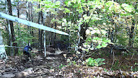
Photos of Dover Mountain Bike
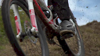
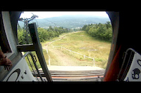
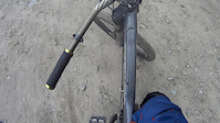
Videos of Dover Mountain Bike

trail: Mount Snow
3:37 |
764 |
Oct 16, 2018
trail: Mount Snow
0:26 |
681 |
Oct 15, 2018

trail: Mount Snow
3:26 |
1637 |
Oct 17, 2017

trail: Mount Snow
3:12 |
963 |
Jul 11, 2016

trail: Mount Snow
5:33 |
92 |
Aug 7, 2015
trail: Mount Snow
2:53 |
226 |
Aug 6, 2014
trail: Mount Snow
2:43 |
370 |
Aug 5, 2014
trail: Gateway
8:32 |
355 |
Jul 1, 2014
Current Trail Warnings
| status | trail | date | condition | user | info |
|---|---|---|---|---|---|
| Sherwood Forest: Wetland Gap | Jun 19, 2026 @ 9:22am (America/New_York) Jun 19, 2026 | Unknown | Mudseason |
Recent Trail Reports
| status | trail | date | condition | info | user |
|---|---|---|---|---|---|
| Evolver | Nov 2, 2025 @ 12:41pm (America/New_York) Nov 2, 2025 | Dry | SteveiWI1Yr | ||
| Short | Sep 20, 2025 @ 12:33pm (America/New_York) Sep 20, 2025 | Ideal | TShannon720 SoVTA | ||
| Play Nice | Sep 20, 2025 @ 12:33pm (America/New_York) Sep 20, 2025 | Dry | TShannon720 SoVTA | ||
| Cannonball Run | Sep 20, 2025 @ 12:33pm (America/New_York) Sep 20, 2025 | Ideal | TShannon720 SoVTA | ||
| Wide Open | Sep 20, 2025 @ 12:33pm (America/New_York) Sep 20, 2025 | Dry | TShannon720 SoVTA | ||
| Kingswood | Sep 20, 2025 @ 12:33pm (America/New_York) Sep 20, 2025 | Dry | TShannon720 SoVTA | ||
| Nottingham | Sep 20, 2025 @ 12:33pm (America/New_York) Sep 20, 2025 | Dry | TShannon720 SoVTA | ||
| Lionheart | Sep 20, 2025 @ 12:33pm (America/New_York) Sep 20, 2025 | Ideal | TShannon720 SoVTA | ||
| Maid Marion | Sep 20, 2025 @ 12:33pm (America/New_York) Sep 20, 2025 | Ideal | TShannon720 SoVTA | ||
| Sherwood Forest | Sep 20, 2025 @ 12:33pm (America/New_York) Sep 20, 2025 | Dry | TShannon720 SoVTA |
Activity Feed
| username | action | type | title | date |
|---|---|---|---|---|
| Mudseason | add | report | activity #97312196 | Jun 19, 2026 @ 6:22am Jun 19, 2026 |
| PaveliBuLqY | wishlist | region | activity #93982693 | May 3, 2026 @ 2:13pm May 3, 2026 |
| RustySam | wishlist | region | activity #93617938 | Apr 28, 2026 @ 5:42pm Apr 28, 2026 |
| adsoles | wishlist | region | activity #93517104 | Apr 27, 2026 @ 7:53am Apr 27, 2026 |
| trailforks | add | event | activity #93498670 | Apr 26, 2026 @ 9:43pm Apr 26, 2026 |
Recent Comments
| username | type | title | comment | date |
|---|---|---|---|---|
| trail | Flowy downhill, well designed | Jul 5, 2024 @ 6:00am Jul 5, 2024 | ||
| trail | This is the service road. A bit of a slog to... | Jun 6, 2024 @ 1:46pm Jun 6, 2024 | ||
| trail | I think that photos from highland | Jun 15, 2020 @ 11:42am Jun 15, 2020 | ||
| report | Great snowshoeing!!! | Feb 20, 2020 @ 5:12pm Feb 20, 2020 | ||
| trail | Not sure where that photo is from but pretty... | Sep 10, 2019 @ 12:05pm Sep 10, 2019 |
Local Badges
-

10 Blue Trails38 awarded -

Epic Ride Climb 2k88 awarded -

Climbing 10k Badge8 awarded -

Climbing 100k Badge0 awarded -

Epic Ride Descent 2k89 awarded -

Descent 10k Badge12 awarded
Bike & Skill Parks
| name | type | city | rating |
|---|---|---|---|
| Mount Snow | bike park | Dover | |
| Mount Snow Ski Resort | bike park | Dover |
Upcoming Local Events
Activity Type Stats
| activitytype | trails | distance | descent | descent distance | total vertical | rating | global rank | state rank | photos | reports | routes | ridelogs |
|---|---|---|---|---|---|---|---|---|---|---|---|---|
| Mountain Bike | 42 | 28 miles | 6,742 ft | 16 miles | 1,890 ft | #4,209 | #1,420 | 234 | 478 | 4 | 1,968 | |
| E-Bike | 34 | 21 miles | 3,533 ft | 10 miles | 1,014 ft | #4,021 | #1,341 | 1 | 441 | 2 | 35 | |
| Hike | 44 | 29 miles | 5,089 ft | 13 miles | 1,913 ft | #5,212 | #1,838 | 463 | 2 | 457 | ||
| Trail Running | 39 | 23 miles | 3,839 ft | 10 miles | 1,890 ft | #5,466 | #1,725 | 455 | 2 | 54 | ||
| Snowmobile | 16 | 8 miles | 1,355 ft | 4 miles | 909 ft | #270 | #141 | 82 | 1 | |||
| Snowshoe | 23 | 12 miles | 1,801 ft | 6 miles | 974 ft | #734 | #324 | 3 | 141 | 52 | ||
| Downhill Ski | 91 | 38 miles | 32,146 ft | 36 miles | 1,644 ft | #124 | #53 | 22 | 3,369 | |||
| Backcountry Ski | 8 | 4 miles | 610 ft | 1 mile | 768 ft | #502 | #131 | 21 | 446 | |||
| Nordic Ski | 6 | 4 miles | 509 ft | 2 miles | 217 ft | #1,224 | #546 | 67 | 101 |
Frequently Asked Questions About Dover
▼
What are the best places to ride in Dover?
Dover has 4 areas to explore for mountain biking. The top rated areas are:
▼
What are the highest rated mountain biking trails in Dover?
The highest rated mountain biking trails in Dover are:
- Play Nice (4.3/5)
- Wide Open (4.3/5)
- Cannonball Run (4.3/5)
- The Way In (4.1/5)
- Sap Bucket (4.1/5)
▼
What is the best time of the year to ride in Dover?
Based on ride log data, the most popular months to ride in Dover are:
- July (40 activities)
- August (36 activities)
- September (26 activities)
▼
Where can I park to ride in Dover?
There are 7 parking locations listed in Dover. The most popular parking spots are: View all parking and trailhead locations on the map to plan your visit.
Activities
Trails
- By TShannon720
 SoVTA & contributors
 - Admins: VMBA, Velomont, Jwduston, SoVTA, WCoTA, NATSVMBA
- #28927 - 5,258 views
- dover activity log | embed map of Dover mountain bike trails | dover mountain biking points of interest polygons
Downloading of trail gps tracks in kml & gpx formats is enabled for Dover.
You must login to download files.