close
-
Layers w
- Weather Layers
- Pro
- Pro
- Pro
- Pro
- Pro
- Pro
- More Layers
- Pro
- Pro
- Pro
- Pro
-
Upgrade to

3D
Trail Conditions
- Unknown
- Snow Groomed
- Snow Packed
- Snow Covered
- Snow Cover Partial
- Freeze/thaw Cycle
- Icy
- Prevalent Mud
- Wet
- Variable
- Ideal
- Dry
- Very Dry
Trail Flow (Ridden Direction)
Trailforks scans users ridelogs to determine the most popular direction each trail is ridden. A good flowing trail network will have most trails flowing in a single direction according to their intension.
The colour categories are based on what percentage of riders are riding a trail in its intended direction.
The colour categories are based on what percentage of riders are riding a trail in its intended direction.
- > 96%
- > 90%
- > 80%
- > 70%
- > 50%
- < 50%
- bi-directional trail
- no data
Trail Last Ridden
Trailforks scans ridelogs to determine the last time a trail was ridden.
- < 2 days
- < 1 week
- < 2 weeks
- < 1 month
- < 6 months
- > 6 months
Trail Ridden Direction
The intended direction a trail should be ridden.
- Downhill Only
- Downhill Primary
- Both Directions
- Uphill Primary
- Uphill Only
- One Direction
Contribute Details
Colors indicate trail is missing specified detail.
- Description
- Photos
- Description & Photos
- Videos
Trail Popularity ?
Trailforks scans ridelogs to determine which trails are ridden the most in the last 9 months.
Trails are compared with nearby trails in the same city region with a possible 25 colour shades.
Think of this as a heatmap, more rides = more kinetic energy = warmer colors.
- most popular
- popular
- less popular
- not popular
ATV/ORV/OHV Filter
Max Vehicle Width
inches
US Cell Coverage
Legend

Radar Time
Activity Recordings
Trailforks uses anonymized public activity data.
?
Activity Recordings
Trailforks uses anonymized public activity data.
?
Personal Heatmap
▶
Activity Types
all
/
none
▶
Options
2
Date range
month
–
Winter Trails
Warning
A routing network for winter maps does not exist. Selecting trails using the winter trails layer has been disabled.
Missing Trails
Most Popular
Least Popular
Trails are colored based on popularity. The more popular a trail is, the more red. Less popular trails trend towards green.
Jump Magnitude Heatmap
Heatmap of where riders jump on trails. Zoom in to see individual jumps, click circles to view jump details.
BC Backroad Status
![map legend]()
Service Road Atlas is a free to use, community-driven service for viewing and creating reports on the numerous back-country service roads around B.C. and Alberta.

Slope Aspect
Direction the slope faces
Trails Deemphasized
Trails are shown in grey.
Only show trails with no bike usage.
Suggested Layers
Based on selected activity type
Save the current map location and zoom level as your default home location whenever this page is loaded.
Save
No description for Downingtown has been added yet!
Login or register to submit one.
Activities Click to view
- Mountain Bike
114 trails
- E-Bike
6 trails
- Gravel Bike
0 trails
- Adaptive Bike
0 trails
- Winter Fat Bike
5 trails
- Horse
49 trails
- Hike
116 trails
- Trail Running
116 trails
- Nordic Ski
62 trails
Region Details
- 7
- 5
- 40
- 43
- 3
- 2
Region Status
Open as of Jun 14, 2026Local Trail Association
Stats
- Avg Trail Rating
- Trails (view details)
- 101
- Trails Mountain Bike
- 114
- Trails E-Bike
- 6
- Trails Winter Fat Bike
- 5
- Trails Horse
- 50
- Trails Hike
- 116
- Trails Trail Running
- 116
- Trails Dirtbike/Moto
- 2
- Trails Nordic Ski
- 62
- Total Distance
- 48 miles
- Total Descent
- 3,797 ft
- Total Vertical
- 399 ft
- Highest Trailhead
- 579 ft
- Reports
- 1,294
- Photos
- 102
- Ridden Counter
- 24,824
Sub Regions
-
Harmony Hill
- 3
- 9
- 15
- 2
- 2
-
Marsh Creek State Park
- 1
- 30
- 27
- 1
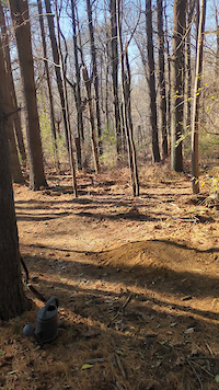
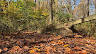
Popular Downingtown Mountain Biking Trails
• 100 ★ 4.9 • 1,417 ft • 0 ft • 742 •
is a short but fun (mostly) downward trail if ridden from the Extension. There are great views riding along the lake leading up to the start of the trail. The trail is 100% singletrack with tight, twisty sections and a few small berms....
• 75 ★ 3.5 • 2,018 ft • 81 ft • 732 •
Ride out from the west side boat ramp down along Marsh Creek and then climb out and up
• 90 ★ 4.7 • 2 miles • 168 ft • 682 •
Long section or rocks along the Carpenter's Cove shoreline. A fun trail with lots of flow when ridden counter-clockwise. A physical challenge when ridden clockwise. Many fun bonus lines to be had in both directions.
• 100 ★ 3.9 • 1 mile • 51 ft • 672 •
The First Trail you will encounter at Marsh Creek State Park. consists of small rock gardens, ladder bridges, and a few optional lines.Once you have ridden the trail a few times, it begins to flow really well. Many hikers use this trail...
• 100 ★ 3.0 • 1,234 ft • 6 ft • 618 •
Gravel road on top of the dam. Beautiful scenery.
• 85 ★ 4.6 • 1,657 ft • 3 ft • 611 •
Black/Blue trail depending on experience level. One extremely sharp and rooty left-hand corner 2/3 of the way down.
• 85 ★ 2.5 • 1,017 ft • 45 ft • 571 •
Gravel road (2-Tracker) climbing up from the bottom of . Only way to climb out from this trail other than climbing back up .
• 80 ★ 3.8 • 3,878 ft • 151 ft • 547 •
A fun yet challenging trail for novice riders. There is one steep, off-camber switchback about half way through.
Downingtown Mountain Bike Routes
★ 2.0 • 9 miles • 877 ft • 7 •
This goes over to and to the school as well as having the most fun parts of harmony hill on the route.
★ 5.0 • 9 miles • 820 ft • 6 • Loop •
9 Mile loop with some technical parts and some good hill climbs.
15 miles • 1,368 ft • 27 • Loop •
A taste of both the South-East and the North West-Side, starting from the Dorland Mills (Cheater) lot.
★ 4.0 • 10 miles • 868 ft • 0 •
I'd say it straddles the line between green and blue. More technical than Nockamixon but, and good deal...
4 miles • 259 ft • 6 • Out & Back •
This is a decent beginner route utilizing the Horse Trails side of Marsh Creek. It is used for taking the...
• 4 miles • 204 ft • 4 •
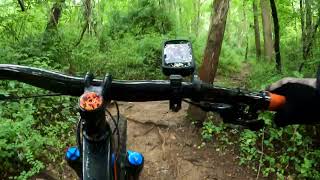
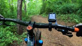
Photos of Downingtown Mountain Bike
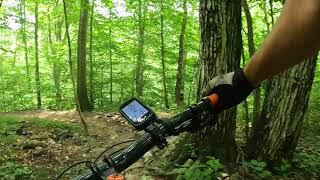
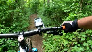
Videos of Downingtown Mountain Bike
trail: Yellow/Black Trail
0:05 |
105 |
Dec 2, 2024
trail: Teeter to Point
0:06 |
84 |
Oct 30, 2022

trail: Goat Trail
0:31 |
414 |
Feb 21, 2022

trail: Jump Track
0:11 |
212 |
Aug 17, 2020
6:15 |
245 |
Aug 17, 2023 , Downingtown
trail: Dorlan Mill Ridge Trail
7:38 |
207 |
Aug 17, 2023 , Downingtown
trail: Bonus Loop
17:44 |
277 |
Aug 17, 2023 , Downingtown
trail: Up To the Teeter-Totter
7:23 |
201 |
Aug 17, 2023 , Downingtown
Current Trail Warnings
| status | trail | date | condition | user | info |
|---|---|---|---|---|---|
| Angry Bob | Jun 13, 2026 @ 10:19am (America/New_York) Jun 13, 2026 | Unknown | Vert1go1 | Big tree down by river | |
| Horse Track Trail | Jun 7, 2026 @ 9:30am (America/New_York) Jun 7, 2026 | Unknown | EWpGv8 |
Recent Trail Reports
| status | trail | date | condition | info | user |
|---|---|---|---|---|---|
| Rising from the Ashes | May 2, 2026 @ 5:24pm (America/New_York) May 2, 2026 | Ideal | Ksmith37841 | ||
| Goat Trail | Apr 30, 2026 @ 9:14am (America/New_York) Apr 30, 2026 | Wet | rdnatale | ||
| White/Black Trail | Apr 30, 2026 @ 6:18am (America/New_York) Apr 30, 2026 | Wet | rdnatale | ||
| Short Bob | Apr 30, 2026 @ 6:18am (America/New_York) Apr 30, 2026 | Wet | rdnatale | ||
| Blue Trail - North | Apr 30, 2026 @ 6:18am (America/New_York) Apr 30, 2026 | Wet | rdnatale | ||
| Blue Trail | Apr 30, 2026 @ 6:18am (America/New_York) Apr 30, 2026 | Wet | rdnatale | ||
| Alternate Trail | Apr 28, 2026 @ 10:41pm (America/New_York) Apr 28, 2026 | Variable | rdnatale | ||
| Yellow/Black Trail | Apr 28, 2026 @ 10:40pm (America/New_York) Apr 28, 2026 | Variable | rdnatale | ||
| Yellow Loop | Apr 26, 2026 @ 5:46pm (America/New_York) Apr 26, 2026 | Variable | Vert1go1 | ||
| Bonus Loop | Apr 10, 2026 @ 6:17pm (America/New_York) Apr 10, 2026 | Ideal | Ksmith37841 |
Activity Feed
| username | action | type | title | date |
|---|---|---|---|---|
| abradley77 | vote | trail | activity #96913724 | Jun 13, 2026 @ 1:53pm Jun 13, 2026 |
| abradley77 | ridden | trail | activity #96893711 | Jun 13, 2026 @ 10:30am Jun 13, 2026 |
| Vert1go1 | add | report | activity #96873853 | Jun 13, 2026 @ 7:19am Jun 13, 2026 |
| EWpGv8 | add | report | activity #96454219 | Jun 7, 2026 @ 6:30am Jun 7, 2026 |
| robertmurph | wishlist | route | activity #95782937 | May 29, 2026 @ 9:23am May 29, 2026 |
Recent Comments
| username | type | title | comment | date |
|---|---|---|---|---|
| trail | We ex | Apr 27, 2026 @ 5:54am Apr 27, 2026 | ||
| trail | Rode this trail 7/18/25 - bees nest at downed... | Jul 18, 2025 @ 10:56am Jul 18, 2025 | ||
| trail | I was pretty disappointed in this one. The... | Oct 24, 2024 @ 3:56am Oct 24, 2024 | ||
| trail | Definitely one of the better downhills at... | Oct 24, 2024 @ 3:54am Oct 24, 2024 | ||
| trail | Almost reminds me of sections of Darling Hill... | Sep 9, 2024 @ 12:25pm Sep 9, 2024 |
Local Badges
-

10 Green Trails368 awarded -

10 Blue Trails421 awarded -

Epic Ride Climb 2k36 awarded -

Climbing 10k Badge123 awarded -

Climbing 100k Badge6 awarded -

Epic Ride Descent 2k36 awarded
Local Mountain Biking Directory
-
Lowe Riders Action SportsBike Shop
-
Downingtown Bicycle ShopBike Shop
Activity Type Stats
| activitytype | trails | distance | descent | descent distance | total vertical | rating | global rank | state rank | photos | reports | routes | ridelogs |
|---|---|---|---|---|---|---|---|---|---|---|---|---|
| Mountain Bike | 114 | 48 miles | 3,796 ft | 21 miles | 400 ft | #482 | #176 | 101 | 1,294 | 5 | 31,383 | |
| E-Bike | 6 | 4 miles | 220 ft | 4,925 ft | 200 ft | #8,072 | #2,449 | 1,141 | 3 | 727 | ||
| Winter Fat Bike | 5 | #368 | #1,169 | 1 | ||||||||
| Horse | 49 | 15 miles | 1,381 ft | 5 miles | 276 ft | #1,855 | #1,043 | 174 | 1 | |||
| Hike | 116 | 48 miles | 3,796 ft | 21 miles | 400 ft | #3,929 | #1,391 | 1 | 1,293 | 1 | 1,237 | |
| Trail Running | 116 | 48 miles | 3,796 ft | 21 miles | 400 ft | #3,508 | #1,044 | 1,293 | 1 | 707 | ||
| Dirtbike/Moto | 2 | 143 | 2 | |||||||||
| Nordic Ski | 62 | 20 miles | 2,165 ft | 8 miles | 285 ft | #836 | #332 | 50 | 13 |
Frequently Asked Questions About Downingtown
▼
What are the best places to ride in Downingtown?
Downingtown has 2 areas to explore for mountain biking. The top rated areas are:
▼
What are the highest rated mountain biking trails in Downingtown?
The highest rated mountain biking trails in Downingtown are:
- White/Black Trail (4.5/5)
- Sole Trail (4.4/5)
- Bonus Loop (4.4/5)
- Ranger Wassel (aka Spagetti Westerns) (4.3/5)
- Teeter to Point (4.3/5)
▼
What is the best time of the year to ride in Downingtown?
Based on ride log data, the most popular months to ride in Downingtown are:
- July (381 activities)
- September (365 activities)
- October (341 activities)
▼
Where can I park to ride in Downingtown?
There are 9 parking locations listed in Downingtown. The most popular parking spots are:
- Covered Bridge Parking Lot
- Parking
- East Branch Brandywine Trailhead
- Parking
- East Branch Brandywine Trail Parking Lot
Activities
Trails
- By HodRaske
 & contributors
 - Admins: brettpalumbo
- #8346 - 6,289 views
- downingtown activity log | embed map of Downingtown mountain bike trails | downingtown mountain biking points of interest
Downloading of trail gps tracks in kml & gpx formats is enabled for Downingtown.
You must login to download files.