close
-
Layers w
- Weather Layers
- Pro
- Pro
- Pro
- Pro
- Pro
- Pro
- More Layers
- Pro
- Pro
- Pro
- Pro
-
Upgrade to

3D
Trail Conditions
- Unknown
- Snow Groomed
- Snow Packed
- Snow Covered
- Snow Cover Partial
- Freeze/thaw Cycle
- Icy
- Prevalent Mud
- Wet
- Variable
- Ideal
- Dry
- Very Dry
Trail Flow (Ridden Direction)
Trailforks scans users ridelogs to determine the most popular direction each trail is ridden. A good flowing trail network will have most trails flowing in a single direction according to their intension.
The colour categories are based on what percentage of riders are riding a trail in its intended direction.
The colour categories are based on what percentage of riders are riding a trail in its intended direction.
- > 96%
- > 90%
- > 80%
- > 70%
- > 50%
- < 50%
- bi-directional trail
- no data
Trail Last Ridden
Trailforks scans ridelogs to determine the last time a trail was ridden.
- < 2 days
- < 1 week
- < 2 weeks
- < 1 month
- < 6 months
- > 6 months
Trail Ridden Direction
The intended direction a trail should be ridden.
- Downhill Only
- Downhill Primary
- Both Directions
- Uphill Primary
- Uphill Only
- One Direction
Contribute Details
Colors indicate trail is missing specified detail.
- Description
- Photos
- Description & Photos
- Videos
Trail Popularity ?
Trailforks scans ridelogs to determine which trails are ridden the most in the last 9 months.
Trails are compared with nearby trails in the same city region with a possible 25 colour shades.
Think of this as a heatmap, more rides = more kinetic energy = warmer colors.
- most popular
- popular
- less popular
- not popular
ATV/ORV/OHV Filter
Max Vehicle Width
inches
US Cell Coverage
Legend

Radar Time
Activity Recordings
Trailforks uses anonymized public activity data.
?
Activity Recordings
Trailforks uses anonymized public activity data.
?
Personal Heatmap
▶
Activity Types
all
/
none
▶
Options
2
Date range
month
–
Winter Trails
Warning
A routing network for winter maps does not exist. Selecting trails using the winter trails layer has been disabled.
Missing Trails
Most Popular
Least Popular
Trails are colored based on popularity. The more popular a trail is, the more red. Less popular trails trend towards green.
Jump Magnitude Heatmap
Heatmap of where riders jump on trails. Zoom in to see individual jumps, click circles to view jump details.
BC Backroad Status
![map legend]()
Service Road Atlas is a free to use, community-driven service for viewing and creating reports on the numerous back-country service roads around B.C. and Alberta.

Slope Aspect
Direction the slope faces
Trails Deemphasized
Trails are shown in grey.
Only show trails with no bike usage.
Suggested Layers
Based on selected activity type
Save the current map location and zoom level as your default home location whenever this page is loaded.
Save
No description for Dragoon has been added yet!
Login or register to submit one.
Activities Click to view
- Hike
22 trails
- Mountain Bike
20 trails
- E-Bike
10 trails
- Horse
20 trails
- Trail Running
22 trails
- Dirtbike/Moto
9 trails
- Observed Trials
9 trails
- ATV/ORV/OHV
9 trails
Region Details
- 7
- 2
- 3
- 3
Region Status
Open as of Dec 5, 2025Local Trail Association
Stats
- Avg Trail Rating
- Trails (view details)
- 16
- Trails Mountain Bike
- 20
- Trails E-Bike
- 10
- Trails Horse
- 20
- Trails Hike
- 22
- Trails Trail Running
- 22
- Trails Dirtbike/Moto
- 9
- Trails Observed Trials
- 9
- Trails ATV/ORV/OHV
- 9
- Total Distance
- 40 miles
- Total Descent Distance
- 13 miles
- Total Descent
- 3,657 ft
- Total Vertical
- 2,209 ft
- Highest Trailhead
- 6,964 ft
- Reports
- 17
- Photos
- 92
- Ridden Counter
- 347
Sub Regions
-
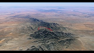
Dragoon Mountains
- 2
- 2
- 3
Popular Dragoon Mountain Biking Trails
• 80 ★ 3.7 • 5 miles • 1,034 ft • 24 •
Nice, scenic trail that climbs up from the Stronghold Campground on the east side to the Stronghold Divide and then drops down on the other side. The trail is a bit brushy and somewhat technical. It is not entirely friendly to bikes...
• 65 ★ 1.0 • 2 miles • 704 ft • 17 • • horse
This is a rutted and rocky trail that appears to be more of a equestrian trail. Not very good for bikes
• 5 ★ 1.0 • 4 miles • 1,625 ft • 11 •
Less popular black diamond difficulty singletrack. This multi-use trail can be used both directions. On average it takes 38 minutes to complete this trail.
• 95 ★ 0.0 • 8 miles • 366 ft • 10 •
Popular blue difficulty singletrack. This mountain bike primary trail can be used both directions.
• 55 ★ 0.0 • 1 mile • 64 ft • 8 • • horse
Moderately popular green difficulty singletrack. This horse primary trail can be used both directions. On average it takes 59 minutes to complete this trail.
• ★ 0.0 • 1 mile • 162 ft • 5 •
This trail starts near the bottom of #332 with some technical singletrack that climbs up a small canyon behind some rock outcrops. After cresting the top it traverses across a flat grassy area before connecting to FR 687. It is a tough...
• ★ 0.0 • 2,211 ft • 8 ft • 3 •
Short trail that runs across a grassland area, shortcutting a sandy section of FR 687. It can be hard to follow in places but the tread is there.
• 5 ★ 0.0 • 2 miles • 191 ft • 1 •
From the north, the trail is a bit hard to find as there are a few social trails leading from the upper trailhead. Look for a carsonite post. nThe first section of trail is a bit rough going through some drainages and then climbing up a...
Photos of Dragoon Mountain Bike
Videos of Dragoon Mountain Bike
trail: Cochise Trail
6:09 |
533 |
Aug 19, 2020 , Dragoon
Recent Trail Reports
| status | trail | date | condition | info | user |
|---|---|---|---|---|---|
| Forest Road 687 | Dec 5, 2025 @ 4:16am (America/Phoenix) Dec 5, 2025 | Ideal | ev-dog SDMBA | ||
| Council Rocks Trail | Dec 5, 2025 @ 3:45am (America/Phoenix) Dec 5, 2025 | Ideal | ev-dog SDMBA | ||
| Stronghold Canyon Road | Dec 5, 2025 @ 4:04am (America/Phoenix) Dec 5, 2025 | Ideal | ev-dog SDMBA | ||
| Middlemarch Road | Dec 5, 2025 @ 3:32am (America/Phoenix) Dec 5, 2025 | Ideal | ev-dog SDMBA | ||
| Cochise Trail | Dec 5, 2025 @ 3:25am (America/Phoenix) Dec 5, 2025 | Ideal | ev-dog SDMBA | ||
| Slavin Gulch | Mar 10, 2024 @ 6:37pm Mar 10, 2024 | Dry | eckdoerry | ||
| Cutoff | Oct 7, 2021 @ 8:06am Oct 7, 2021 | Ideal | mporembs | ||
| Forest Road 345A | Oct 7, 2021 @ 8:06am Oct 7, 2021 | Ideal | mporembs | ||
| Middlemarch Canyon | Oct 7, 2021 @ 8:06am Oct 7, 2021 | Variable | mporembs |
Activity Feed
| username | action | type | title | date |
|---|---|---|---|---|
| VexedNTT | wishlist | trail | activity #87302295 | Jan 16, 2026 @ 2:34pm Jan 16, 2026 |
| the-burd | wishlist | trail | activity #86411302 | Dec 31, 2025 @ 2:56pm Dec 31, 2025 |
| TuacaTom | wishlist | trail | activity #86282874 | Dec 29, 2025 @ 11:53am Dec 29, 2025 |
| msmcfate | update | trail | activity #85400997 | Dec 12, 2025 @ 7:24am Dec 12, 2025 |
| ev-dog | add | photo | activity #85385348 and 12 more | Dec 11, 2025 @ 6:34pm Dec 11, 2025 |
Recent Comments
| username | type | title | comment | date |
|---|---|---|---|---|
| trail | Middlemarch is a much shorter and more... | Dec 8, 2025 @ 2:43pm Dec 8, 2025 | ||
| trail | it's a race course once a year... | Feb 20, 2025 @ 2:06pm Feb 20, 2025 | ||
| trail | Hiking only | Jan 16, 2025 @ 4:46pm Jan 16, 2025 | ||
| trail | Yup. Rode it/hiked it. Major cats claw... | Feb 7, 2024 @ 5:17pm Feb 7, 2024 | ||
| trail | Hiked this, it's super overgrown with thorn... | Jan 8, 2023 @ 11:30pm Jan 8, 2023 |
Local Badges
-

Epic Mountain Bike Climb 2k2 awarded -

Climbing 10k Badge0 awarded -

Mountain Biking 100k Badge0 awarded -

Epic Ride Descent 2k2 awarded -

Descent 10k Badge0 awarded -

Descent 100k Badge0 awarded
Activity Type Stats
| activitytype | trails | distance | descent | descent distance | total vertical | rating | global rank | state rank | photos | reports | routes | ridelogs |
|---|---|---|---|---|---|---|---|---|---|---|---|---|
| Mountain Bike | 20 | 40 miles | 3,648 ft | 13 miles | 2,208 ft | #7,893 | #2,567 | 90 | 17 | 311 | ||
| E-Bike | 10 | 25 miles | 1,955 ft | 9 miles | 2,208 ft | #5,135 | #1,601 | 13 | 6 | |||
| Horse | 20 | 40 miles | 3,648 ft | 13 miles | 2,208 ft | #1,365 | #820 | 7 | 1 | |||
| Hike | 22 | 40 miles | 3,658 ft | 13 miles | 2,208 ft | #5,985 | #2,098 | 2 | 17 | 1 | 205 | |
| Trail Running | 22 | 40 miles | 3,658 ft | 13 miles | 2,208 ft | #5,591 | #1,772 | 17 | 20 | |||
| Dirtbike/Moto | 9 | 25 miles | 1,955 ft | 9 miles | 2,208 ft | #980 | #368 | 3 | ||||
| Observed Trials | 9 | 25 miles | 1,955 ft | 9 miles | 2,208 ft | #237 | #55 | 3 | ||||
| ATV/ORV/OHV | 9 | 25 miles | 1,955 ft | 9 miles | 2,208 ft | #760 | #323 | 3 |
Frequently Asked Questions About Dragoon
▼
What are the best places to ride in Dragoon?
Dragoon has 1 areas to explore for mountain biking. The top rated areas are:
▼
What are the highest rated mountain biking trails in Dragoon?
The highest rated mountain biking trails in Dragoon are:
- Cochise Trail (3.7/5)
- Middlemarch Canyon (3.6/5)
- Slavin Gulch (3.6/5)
- Cochise Horse Trail (0/5)
- Texas Canyon (0/5)
▼
What is the best time of the year to ride in Dragoon?
Based on ride log data, the most popular months to ride in Dragoon are:
- February (7 activities)
- December (5 activities)
- September (4 activities)
▼
Where can I park to ride in Dragoon?
Activities
Trails
- By jeffgicklhorn
 & contributors
 - Admins: AZT, chainslapAZ, schillingsworth, jeffgicklhorn, jpmcghee, msmcfate, cemoorelife, Schwinnshralper26
- #40089 - 1,336 views
- dragoon activity log | embed map of Dragoon mountain bike trails | dragoon mountain biking points of interest
Downloading of trail gps tracks in kml & gpx formats is enabled for Dragoon.
You must login to download files.