close
-
Layers w
- Weather Layers
- Pro
- Pro
- Pro
- Pro
- Pro
- Pro
- More Layers
- Pro
- Pro
- Pro
- Pro
-
Upgrade to

3D
Trail Conditions
- Unknown
- Snow Groomed
- Snow Packed
- Snow Covered
- Snow Cover Partial
- Freeze/thaw Cycle
- Icy
- Prevalent Mud
- Wet
- Variable
- Ideal
- Dry
- Very Dry
Trail Flow (Ridden Direction)
Trailforks scans users ridelogs to determine the most popular direction each trail is ridden. A good flowing trail network will have most trails flowing in a single direction according to their intension.
The colour categories are based on what percentage of riders are riding a trail in its intended direction.
The colour categories are based on what percentage of riders are riding a trail in its intended direction.
- > 96%
- > 90%
- > 80%
- > 70%
- > 50%
- < 50%
- bi-directional trail
- no data
Trail Last Ridden
Trailforks scans ridelogs to determine the last time a trail was ridden.
- < 2 days
- < 1 week
- < 2 weeks
- < 1 month
- < 6 months
- > 6 months
Trail Ridden Direction
The intended direction a trail should be ridden.
- Downhill Only
- Downhill Primary
- Both Directions
- Uphill Primary
- Uphill Only
- One Direction
Contribute Details
Colors indicate trail is missing specified detail.
- Description
- Photos
- Description & Photos
- Videos
Trail Popularity ?
Trailforks scans ridelogs to determine which trails are ridden the most in the last 9 months.
Trails are compared with nearby trails in the same city region with a possible 25 colour shades.
Think of this as a heatmap, more rides = more kinetic energy = warmer colors.
- most popular
- popular
- less popular
- not popular
ATV/ORV/OHV Filter
Max Vehicle Width
inches
US Cell Coverage
Legend

Radar Time
Activity Recordings
Trailforks uses anonymized public activity data.
?
Activity Recordings
Trailforks uses anonymized public activity data.
?
Personal Heatmap
▶
Activity Types
all
/
none
▶
Options
2
Date range
month
–
Winter Trails
Warning
A routing network for winter maps does not exist. Selecting trails using the winter trails layer has been disabled.
Missing Trails
Most Popular
Least Popular
Trails are colored based on popularity. The more popular a trail is, the more red. Less popular trails trend towards green.
Jump Magnitude Heatmap
Heatmap of where riders jump on trails. Zoom in to see individual jumps, click circles to view jump details.
BC Backroad Status
![map legend]()
Service Road Atlas is a free to use, community-driven service for viewing and creating reports on the numerous back-country service roads around B.C. and Alberta.

Slope Aspect
Direction the slope faces
Trails Deemphasized
Trails are shown in grey.
Only show trails with no bike usage.
Suggested Layers
Based on selected activity type
Save the current map location and zoom level as your default home location whenever this page is loaded.
Save
No description for Draguignan has been added yet!
Login or register to submit one.
This region uses the Uk/Euro style trail grading system.
Activities Click to view
- Mountain Bike
372 trails
- E-Bike
349 trails
- Gravel Bike
0 trails
- Adaptive Bike
0 trails
- Winter Fat Bike
0 trails
- Horse
18 trails
- Hike
347 trails
- Trail Running
346 trails
- Dirtbike/Moto
6 trails
- ATV/ORV/OHV
6 trails
- Snowmobile
6 trails
- Snowshoe
7 trails
- Nordic Ski
7 trails
Region Details
- 87
- 104
- 90
- 59
- 28
- 4
Region Status
Open as of 2 daysStats
- Avg Trail Rating
- Trails (view details)
- 378
- Trails Mountain Bike
- 374
- Trails E-Bike
- 349
- Trails Horse
- 18
- Trails Hike
- 347
- Trails Trail Running
- 346
- Trails Dirtbike/Moto
- 6
- Trails ATV/ORV/OHV
- 6
- Trails Snowmobile
- 6
- Trails Snowshoe
- 7
- Trails Nordic Ski
- 7
- Total Distance
- 254 miles
- Total Descent
- 63,204 ft
- Total Vertical
- 2,289 ft
- Highest Trailhead
- 2,727 ft
- Reports
- 5,778
- Photos
- 285
- Ridden Counter
- 14,305
Sub Regions
-
Figanieres / Draguignan (Enduro Zone)
- 69
- 75
- 58
- 28
- 4
-
Figanieres / Draguignan (XC Zone)
- 35
- 15
- 1
Popular Draguignan Mountain Biking Trails
• 100 ★ 4.0 • 2,103 ft • 117 ft • 97 •
Popular blue difficulty family friendly singletrack. This mountain bike primary trail can be used uphill primary and has a moderate overall physical rating with a 117 ft blue climb. Trail visibility is always easy to follow. On average it takes 8 minutes to complete this trail.
• 100 ★ 0.0 • 1,363 ft • 72 ft • 95 •
Popular blue difficulty singletrack. This mountain bike primary trail can be used uphill only and has a moderate overall physical rating with a 72 ft green climb. On average it takes 3 minutes to complete this trail.
• 100 ★ 5.0 • 438 ft • 2 ft • 90 •
Popular red difficulty singletrack. This mountain bike primary trail can be used downhill only and has a moderate overall physical rating. It features rock face. On average it takes minutes to complete this trail.
• 95 ★ 3.5 • 4,584 ft • 286 ft • 87 •
Popular blue difficulty singletrack. This mountain bike primary trail can be used both directions and has a moderate overall physical rating with a 286 ft black diamond climb. On average it takes 12 minutes to complete this trail.
• 90 ★ 4.0 • 925 ft • 0 ft • 83 •
Switchbacks and a rock face at the bottom. A is available to avoid face.
Draguignan Mountain Bike Routes
★ 5.0 • 24 miles • 4,428 ft • 8 •
Enduro Race Oppidum 2015 organised in Les Arcs sur Argens, Var, France
★ 5.0 • 28 miles • 4,661 ft • 14 • Loop •
Parcours du Roc d'azur 2015 faisable hors période de course en evitant les secteurs fermés et privés.
★ 4.0 • 20 miles • 3,717 ft • 21 • Loop •
Une boucle a faire entre Figanieres et Draguignan
4 miles • 662 ft • 3 • Loop •
Malmont - Le Une boucle de difficulté technique de type Bleu. Distance: 6.8 Kms pour 240m de denivelé....
10 miles • 1,927 ft • 10 • Loop •
Difficulté technique: Noir. Plusieurs passages engagés avec des echapatoires possible pour les plus...
22 miles • 5,001 ft • 23 • Loop •
A route starting from the Thronnet domain and looping around the Small Baudron and the Malmont. A lot of...
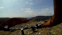
Photos of Draguignan Mountain Bike
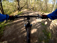
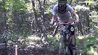
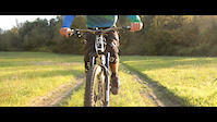
Videos of Draguignan Mountain Bike
trail: La Tour de Guet
5:13 |
126 |
Aug 20, 2016
trail: Gaz en grand - Upper
3:34 |
108 |
Jan 15, 2016

trail: Lower Secrete
9:04 |
328 |
Feb 17, 2015

trail: Ligne Electrique
3:19 |
207 |
Feb 17, 2015
trail: La Secrete
0:57 |
306 |
Jan 30, 2015
trail: Yaya
3:09 |
987 |
Oct 30, 2014
trail: LPT Haute
0:11 |
296 |
Oct 30, 2014
trail: LPT Haute
4:06 |
506 |
Jul 21, 2014
Recent Trail Reports
| status | trail | date | condition | info | user |
|---|---|---|---|---|---|
| Descente de la Claret | May 7, 2026 @ 12:30pm (Europe/Paris) May 7, 2026 | Ideal | tIJzUD | ||
| La Serpentine | May 3, 2026 @ 10:29am (Europe/Monaco) May 3, 2026 | Dry | Cedric7705 | ||
| Relais Soleil - D54 | May 3, 2026 @ 10:29am (Europe/Monaco) May 3, 2026 | Dry | Cedric7705 | ||
| Les Cretes du BikePark | May 3, 2026 @ 10:29am (Europe/Monaco) May 3, 2026 | Dry | Cedric7705 | ||
| La Garde du Goundou | May 3, 2026 @ 10:29am (Europe/Monaco) May 3, 2026 | Dry | Cedric7705 | ||
| Dh du Balltrap | May 3, 2026 @ 10:29am (Europe/Monaco) May 3, 2026 | Dry | Cedric7705 | ||
| La Coyotte | Apr 26, 2026 @ 8:52am (Europe/Monaco) Apr 25, 2026 | Ideal | Cedric7705 | ||
| La Double Noire | Apr 10, 2026 @ 2:21pm (Europe/Paris) Apr 10, 2026 | Very Dry | thomasA0YDIL | ||
| La poudreuse | Mar 14, 2026 @ 2:51pm (Europe/Monaco) Mar 14, 2026 | Variable | Cedric7705 | ||
| En mode Flow #2 | Feb 19, 2026 @ 3:24pm (Europe/Paris) Feb 19, 2026 | Wet | bcou83 |
Activity Feed
| username | action | type | title | date |
|---|---|---|---|---|
| mingliu99 | wishlist | route | activity #96281014 | Jun 5, 2026 @ 1:05am Jun 5, 2026 |
| Jonas_U | wishlist | region | activity #95340397 | May 23, 2026 @ 11:42am May 23, 2026 |
| Memesmaster69 | wishlist | route | activity #95127725 | May 20, 2026 @ 12:46pm May 20, 2026 |
| jyce83 | difficultyvote | trail | activity #94928523 | May 17, 2026 @ 12:07pm May 17, 2026 |
| Domischlachter | ridden | trail | activity #94801716 | May 16, 2026 @ 4:22am May 16, 2026 |
Recent Comments
| username | type | title | comment | date |
|---|---|---|---|---|
| trail | Could be a nice trail, unfortunately it seems... | May 7, 2026 @ 3:38am May 7, 2026 | ||
| trail | La piste des mines est bloquée par un... | Aug 3, 2025 @ 3:55am Aug 3, 2025 | ||
| trail | Dans un très sale état, beaucoup d arbres... | Jun 8, 2025 @ 9:54am Jun 8, 2025 | ||
| report | Début rocailleux avec peu d'intérêt. Partie... | Dec 1, 2024 @ 9:42am Dec 1, 2024 | ||
| trail | There is nothing trail anymore due forrest... | Oct 15, 2024 @ 4:13am Oct 15, 2024 |
Local Badges
-
The Flow2 awarded -
The Draguignan / Figanieres Gnar2 awarded -

Top 10 Trails2 awarded -

Completionist0 awarded -

10 Expert Trails8 awarded -

Epic Ride 50k733 awarded
Bike & Skill Parks
| name | type | city | rating |
|---|---|---|---|
| Bike Park de Figanieres | skill park | Draguignan | |
| Pump Track | skill park | Draguignan |
Local Trail Supporters
- Cyril Lafont
- janko83
Activity Type Stats
| activitytype | trails | distance | descent | descent distance | total vertical | rating | global rank | state rank | photos | reports | routes | ridelogs |
|---|---|---|---|---|---|---|---|---|---|---|---|---|
| Mountain Bike | 372 | 252 miles | 62,543 ft | 123 miles | 2,290 ft | #296 | #1 | 276 | 5,796 | 23 | 8,096 | |
| E-Bike | 349 | 240 miles | 59,518 ft | 117 miles | 2,290 ft | #232 | #34 | 1 | 5,782 | 4 | 2,123 | |
| Horse | 18 | 11 miles | 2,126 ft | 4 miles | 2,011 ft | #353 | #22 | 3,241 | ||||
| Hike | 347 | 239 miles | 57,303 ft | 115 miles | 2,241 ft | #489 | #17 | 8 | 5,754 | 275 | ||
| Trail Running | 346 | 238 miles | 57,028 ft | 114 miles | 2,241 ft | #351 | 5,757 | 908 | ||||
| Dirtbike/Moto | 6 | 4 miles | 1,070 ft | 2 miles | 1,306 ft | #321 | #11 | 3,235 | 2 | |||
| ATV/ORV/OHV | 6 | 4 miles | 1,070 ft | 2 miles | 1,306 ft | #205 | #9 | 3,234 | ||||
| Snowmobile | 6 | 4 miles | 1,070 ft | 2 miles | 1,306 ft | #90 | #1 | 440 | ||||
| Snowshoe | 7 | 4 miles | 1,070 ft | 2 miles | 1,306 ft | #218 | #9 | 440 | 13 | |||
| Nordic Ski | 7 | 4 miles | 1,188 ft | 2 miles | 1,306 ft | #273 | #12 | 440 | 58 |
Frequently Asked Questions About Draguignan
▼
What are the best places to ride in Draguignan?
Draguignan has 2 areas to explore for mountain biking. The top rated areas are:
▼
What are the highest rated mountain biking trails in Draguignan?
The highest rated mountain biking trails in Draguignan are:
- Wazou (4.2/5)
- Bip-Bip (4.2/5)
- Ligne Electrique (4.2/5)
- Black River (4.2/5)
- La SANGLIER PIRATE (4.2/5)
▼
What is the best time of the year to ride in Draguignan?
Based on ride log data, the most popular months to ride in Draguignan are:
- July (36 activities)
- October (32 activities)
- November (30 activities)
▼
Where can I park to ride in Draguignan?
There are 2 parking locations listed in Draguignan. The most popular parking spots are:
Activities
- Draguignan Mountain Biking Trails
- Draguignan E-Biking Trails
- Draguignan Horseback Trails
- Draguignan Hiking Trails
- Draguignan Trail Running Trails
- Draguignan Dirtbiking Trails
- Draguignan ATVing/Offroading Trails
- Draguignan Snowmobiling Trails
- Draguignan Snowshoeing Trails
- Draguignan Nordic Skiing Trails
Trails
- By hpman83
 TRAILFORKS TFFRANCE & contributors
 - Admins: hpman83
- #4308 - 11,750 views
- draguignan activity log | embed map of Draguignan mountain bike trails | draguignan mountain biking points of interest polygons
Downloading of trail gps tracks in kml & gpx formats is enabled for Draguignan.
You must login to download files.