close
-
Layers w
- Weather Layers
- Pro
- Pro
- Pro
- Pro
- Pro
- Pro
- More Layers
- Pro
- Pro
- Pro
- Pro
-
Upgrade to

3D
Trail Conditions
- Unknown
- Snow Groomed
- Snow Packed
- Snow Covered
- Snow Cover Partial
- Freeze/thaw Cycle
- Icy
- Prevalent Mud
- Wet
- Variable
- Ideal
- Dry
- Very Dry
Trail Flow (Ridden Direction)
Trailforks scans users ridelogs to determine the most popular direction each trail is ridden. A good flowing trail network will have most trails flowing in a single direction according to their intension.
The colour categories are based on what percentage of riders are riding a trail in its intended direction.
The colour categories are based on what percentage of riders are riding a trail in its intended direction.
- > 96%
- > 90%
- > 80%
- > 70%
- > 50%
- < 50%
- bi-directional trail
- no data
Trail Last Ridden
Trailforks scans ridelogs to determine the last time a trail was ridden.
- < 2 days
- < 1 week
- < 2 weeks
- < 1 month
- < 6 months
- > 6 months
Trail Ridden Direction
The intended direction a trail should be ridden.
- Downhill Only
- Downhill Primary
- Both Directions
- Uphill Primary
- Uphill Only
- One Direction
Contribute Details
Colors indicate trail is missing specified detail.
- Description
- Photos
- Description & Photos
- Videos
Trail Popularity ?
Trailforks scans ridelogs to determine which trails are ridden the most in the last 9 months.
Trails are compared with nearby trails in the same city region with a possible 25 colour shades.
Think of this as a heatmap, more rides = more kinetic energy = warmer colors.
- most popular
- popular
- less popular
- not popular
ATV/ORV/OHV Filter
Max Vehicle Width
inches
US Cell Coverage
Legend

Radar Time
Activity Recordings
Trailforks uses anonymized public activity data.
?
Activity Recordings
Trailforks uses anonymized public activity data.
?
Personal Heatmap
▶
Activity Types
all
/
none
▶
Options
2
Date range
month
–
Winter Trails
Warning
A routing network for winter maps does not exist. Selecting trails using the winter trails layer has been disabled.
Missing Trails
Most Popular
Least Popular
Trails are colored based on popularity. The more popular a trail is, the more red. Less popular trails trend towards green.
Jump Magnitude Heatmap
Heatmap of where riders jump on trails. Zoom in to see individual jumps, click circles to view jump details.
BC Backroad Status
![map legend]()
Service Road Atlas is a free to use, community-driven service for viewing and creating reports on the numerous back-country service roads around B.C. and Alberta.

Slope Aspect
Direction the slope faces
Trails Deemphasized
Trails are shown in grey.
Only show trails with no bike usage.
Suggested Layers
Based on selected activity type
Save the current map location and zoom level as your default home location whenever this page is loaded.
Save
No description for Draper has been added yet!
Login or register to submit one.
Activities Click to view
- Mountain Bike
197 trails
- E-Bike
183 trails
- Gravel Bike
0 trails
- Adaptive Bike
0 trails
- Winter Fat Bike
0 trails
- Horse
19 trails
- Hike
174 trails
- Trail Running
184 trails
- Snowshoe
10 trails
Region Details
- 21
- 11
- 52
- 80
- 16
Region Status
Open as of 15 hoursLocal Trail Association
Stats
- Avg Trail Rating
- Trails (view details)
- 200
- Trails Mountain Bike
- 205
- Trails E-Bike
- 183
- Trails Horse
- 19
- Trails Hike
- 174
- Trails Trail Running
- 184
- Trails Snowshoe
- 10
- Total Distance
- 140 miles
- Total Descent
- 23,688 ft
- Total Vertical
- 5,157 ft
- Highest Trailhead
- 9,478 ft
- Reports
- 14,407
- Photos
- 1,241
- Ridden Counter
- 371,392
Sub Regions
-
Corner Canyon
- 6
- 36
- 75
- 11
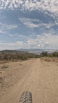
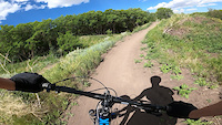
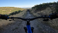
Popular Draper Mountain Biking Trails
• 90 ★ 4.6 • 1 mile • 0 ft • 6,667 •
This is the upper part of the trail that is a very popular mountain bike trail going downhill. Riders love it for many reasons: It is fast, steep in multiple spots, and has different lines through some gnarled rocky formations. Several...
• 100 ★ 4.4 • 2 miles • 15 ft • 6,385 •
This is the improved section with that offers some great speed, but some turns are not bermed, like around the bridge crossing. Little double ups occasionally, does get a lot of traffic and brake bumps as well. Most the turns have high...
• 100 ★ 4.3 • 2,205 ft • 26 ft • 6,133 •
Flow trail is a bit tight at the top, but gets really fast as you transition to the lower Rush. Plenty of kick ups, jumps, drops, and huge berms. This is a favorite downhill trail for beginners and XC riders. The turns are frequent, it...
• 100 ★ 4.1 • 642 ft • 6 ft • 5,875 •
Newest section to Rush at the very bottom that now allow you to ride almost entirely off the dirt road on your way down. With some pretty good size whoops and little optional hip booter jump to the right, great practice trail. Being...
• 100 ★ 4.2 • 4,209 ft • 3 ft • 5,655 •
New with big rock armor berms and fast flow, now provides a full descent. This lowe section is no called Limelight and is the latest section with big rollers that can be doubled and trippled as gaps.
• 100 ★ 3.7 • 512 ft • 0 ft • 5,604 •
New mini-flow section has replaced the old gravel road. Nice flow, berms, a much better way to finish down the canyon
Rush Climb Permanently Closed
• 100 ★ 3.7 • 712 ft • 27 ft • 5,575 •
The quick right turn at the bottom of Rush, takes you on a short singletrack trail towards to the road where you can hook back up with , and start the fun over again.
• 100 ★ 4.0 • 597 ft • 66 ft • 5,501 •
Super fast flow connector between and . Love dropping in on this, nice bridge crossing too.
Draper Mountain Bike Routes
The Real Mighty 5 Featured
★ 4.2 • 28 miles • 5,122 ft • 22 • Loop •
This is the ultimate downhill day at Corner Canyon. This route never uses the same piece of singletrack...
★ 4.3 • 7 miles • 1,278 ft • 22 • Loop •
This is a really popular option for folks to park at the skills park and make their way up to Rush. and...
★ 5.0 • 11 miles • 2,040 ft • 13 • Loop •
Fun loop up to Jacob's Ladder then back over to come down Rush. Take up to the top, then to get to Jacob's...
★ 5.0 • 4 miles • 869 ft • 12 • Loop •
Corner Canyon, Clarks to Rush loop. Clarks is one-way uphill for mountain bikes, Rush is downhill only, no...
★ 5.0 • 10 miles • 1,807 ft • 9 • Loop •
This is a great route if you want to get fun downhill in with easy spin uphill trails. This will take you...
★ 4.4 • 6 miles • 947 ft • 9 • Loop •
This is a great fast loop with an easy downhill.
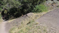
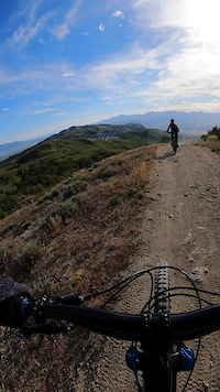
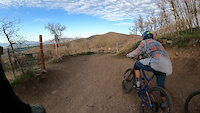
Photos of Draper Mountain Bike
Videos of Draper Mountain Bike
trail: Jacobs Ladder (Lower)
3:23 |
12 |
Sep 5, 2025
trail: Exit Stage Left (Rush)
0:03 |
|
Aug 31, 2024
trail: Maple Hollow DH (Lower)
0:11 |
122 |
Mar 7, 2024
trail: Levitate
0:15 |
246 |
Dec 31, 2022
trail: Jacob's Ladder
0:37 |
263 |
May 31, 2022

trail: Levitate
0:22 |
115 |
Apr 9, 2022

trail: Levitate
0:22 |
|
Apr 9, 2022
trail: Levitate
3:32 |
367 |
May 4, 2021
Recent Trail Reports
| status | trail | date | condition | info | user |
|---|---|---|---|---|---|
| Corner Canyon Access | Jun 18, 2026 @ 6:28am (America/Boise) 15 hours | Dry | BeefHead | ||
| Limelight (Rush) | Jun 18, 2026 @ 6:28am (America/Boise) 15 hours | Dry | BeefHead | ||
| Rattler | Jun 18, 2026 @ 6:28am (America/Boise) 15 hours | Dry | BeefHead | ||
| Ghost Falls | Jun 18, 2026 @ 6:28am (America/Boise) 15 hours | Dry | BeefHead | ||
| Brocks Point | Jun 18, 2026 @ 6:28am (America/Boise) 15 hours | Dry | BeefHead | ||
| Peak View Connector | Jun 18, 2026 @ 6:28am (America/Boise) 15 hours | Dry | BeefHead | ||
| Peacemaker | Jun 18, 2026 @ 6:28am (America/Boise) 15 hours | Dry | BeefHead | ||
| Peak View (Lower) | Jun 18, 2026 @ 6:28am (America/Boise) 15 hours | Dry | BeefHead | ||
| Peak View TH | Jun 18, 2026 @ 6:28am (America/Boise) 15 hours | Dry | BeefHead | ||
| Potato Hill | Jun 18, 2026 @ 6:28am (America/Boise) 15 hours | Dry | BeefHead |
National Scenic Trails & Official Routes
-
Bonneville Shoreline Trail
- Mountain Bike
- E-Bike
- Horse
- Hike
- Trail Running
- Snowshoe
- Nordic Ski

Activity Feed
| username | action | type | title | date |
|---|---|---|---|---|
| vkjCBn | wishlist | trail | activity #97289780 | Jun 18, 2026 @ 6:52pm 1 hours |
| JustinOLqkRG | wishlist | route | activity #97277267 | Jun 18, 2026 @ 2:49pm 5 hours |
| facelessghost | wishlist | route | activity #97276853 | Jun 18, 2026 @ 2:41pm 5 hours |
| IVQ51Oh1 | ridden | trail | activity #97269698 and 5 more | Jun 18, 2026 @ 12:28pm 8 hours |
| BeefHead | add | report | activity #97253040 | Jun 18, 2026 @ 8:11am 12 hours |
Recent Comments
| username | type | title | comment | date |
|---|---|---|---|---|
| report | Slow Was 1. www. W | Jun 7, 2026 @ 10:58am Jun 7, 2026 | ||
| trail | This is the best trail in cc by far in my... | Jun 6, 2026 @ 12:01pm Jun 6, 2026 | ||
| trail | Nice steep sections. Challenges your braking... | May 25, 2026 @ 7:37am May 25, 2026 | ||
| trail | Nice easy climb to get to Canyon Hollow /... | May 19, 2026 @ 3:11pm May 19, 2026 | ||
| trail | Way more fun to descend than to climb. Going... | May 19, 2026 @ 3:08pm May 19, 2026 |
Local Badges
-

Completionist4 awarded -

10 Green Trails3,451 awarded -

10 Blue Trails4,551 awarded -

10 Black Trails1,435 awarded -

Epic Ride Climb 2k813 awarded -

Climbing 10k Badge1,571 awarded
Bike & Skill Parks
| name | type | city | rating |
|---|---|---|---|
| Draper Cycle Park | skill park | Draper | |
| Draper Cycle Park Pumptrack | skill park | Draper |
Activity Type Stats
| activitytype | trails | distance | descent | descent distance | total vertical | rating | global rank | state rank | photos | reports | routes | ridelogs |
|---|---|---|---|---|---|---|---|---|---|---|---|---|
| Mountain Bike | 197 | 121 miles | 21,037 ft | 63 miles | 2,667 ft | #9 | #4 | 1,169 | 14,432 | 108 | 226,632 | |
| E-Bike | 183 | 115 miles | 20,164 ft | 60 miles | 2,362 ft | #83 | #648 | 14 | 14,172 | 20 | 15,664 | |
| Horse | 19 | 21 miles | 2,720 ft | 8 miles | 1,804 ft | #1,133 | #718 | 4,084 | 2 | 5 | ||
| Hike | 174 | 117 miles | 16,699 ft | 51 miles | 5,157 ft | #375 | #177 | 78 | 13,298 | 10 | 6,762 | |
| Trail Running | 184 | 116 miles | 16,385 ft | 52 miles | 2,667 ft | #484 | #190 | 4 | 13,295 | 20 | 14,309 | |
| Snowshoe | 10 | 5 miles | 95 ft | 2,713 ft | 1,588 ft | #443 | #142 | 36 | 1 | 159 |
Frequently Asked Questions About Draper
▼
What are the best places to ride in Draper?
Draper has 1 areas to explore for mountain biking. The top rated areas are:
▼
What are the highest rated mountain biking trails in Draper?
The highest rated mountain biking trails in Draper are:
- Vertigo Jump Line #3 (4.6/5)
- Jacob's Ladder (4.5/5)
- Vertigo (4.5/5)
- Ghost Falls (4.5/5)
- Vertigo Jump Line #2 (4.5/5)
▼
What is the best time of the year to ride in Draper?
Based on ride log data, the most popular months to ride in Draper are:
- July (2,168 activities)
- June (1,797 activities)
- May (1,759 activities)
▼
Where can I park to ride in Draper?
There are 27 parking locations listed in Draper. The most popular parking spots are: View all parking and trailhead locations on the map to plan your visit.
Activities
Trails
Points of Interest
- By clos8
 & contributors
 - Admins: jkwilliamz, UtahJohn, jpmcghee, jasonmalczyk
- #3416 - 79,139 views
- draper activity log | embed map of Draper mountain bike trails | draper mountain biking points of interest
Downloading of trail gps tracks in kml & gpx formats is enabled for Draper.
You must login to download files.