close
-
Layers w
- Weather Layers
- Pro
- Pro
- Pro
- Pro
- Pro
- Pro
- More Layers
- Pro
- Pro
- Pro
- Pro
-
Upgrade to

3D
Trail Conditions
- Unknown
- Snow Groomed
- Snow Packed
- Snow Covered
- Snow Cover Partial
- Freeze/thaw Cycle
- Icy
- Prevalent Mud
- Wet
- Variable
- Ideal
- Dry
- Very Dry
Trail Flow (Ridden Direction)
Trailforks scans users ridelogs to determine the most popular direction each trail is ridden. A good flowing trail network will have most trails flowing in a single direction according to their intension.
The colour categories are based on what percentage of riders are riding a trail in its intended direction.
The colour categories are based on what percentage of riders are riding a trail in its intended direction.
- > 96%
- > 90%
- > 80%
- > 70%
- > 50%
- < 50%
- bi-directional trail
- no data
Trail Last Ridden
Trailforks scans ridelogs to determine the last time a trail was ridden.
- < 2 days
- < 1 week
- < 2 weeks
- < 1 month
- < 6 months
- > 6 months
Trail Ridden Direction
The intended direction a trail should be ridden.
- Downhill Only
- Downhill Primary
- Both Directions
- Uphill Primary
- Uphill Only
- One Direction
Contribute Details
Colors indicate trail is missing specified detail.
- Description
- Photos
- Description & Photos
- Videos
Trail Popularity ?
Trailforks scans ridelogs to determine which trails are ridden the most in the last 9 months.
Trails are compared with nearby trails in the same city region with a possible 25 colour shades.
Think of this as a heatmap, more rides = more kinetic energy = warmer colors.
- most popular
- popular
- less popular
- not popular
ATV/ORV/OHV Filter
Max Vehicle Width
inches
US Cell Coverage
Legend

Radar Time
Activity Recordings
Trailforks uses anonymized public activity data.
?
Activity Recordings
Trailforks uses anonymized public activity data.
?
Personal Heatmap
▶
Activity Types
all
/
none
▶
Options
2
Date range
month
–
Winter Trails
Warning
A routing network for winter maps does not exist. Selecting trails using the winter trails layer has been disabled.
Missing Trails
Most Popular
Least Popular
Trails are colored based on popularity. The more popular a trail is, the more red. Less popular trails trend towards green.
Jump Magnitude Heatmap
Heatmap of where riders jump on trails. Zoom in to see individual jumps, click circles to view jump details.
BC Backroad Status
![map legend]()
Service Road Atlas is a free to use, community-driven service for viewing and creating reports on the numerous back-country service roads around B.C. and Alberta.

Slope Aspect
Direction the slope faces
Trails Deemphasized
Trails are shown in grey.
Only show trails with no bike usage.
Suggested Layers
Based on selected activity type
Save the current map location and zoom level as your default home location whenever this page is loaded.
Save
No description for Dubeň has been added yet!
Login or register to submit one.
Primary Trail Type: Cross-Country
Activities Click to view
- Mountain Bike
7 trails
- Hike
7 trails
- Trail Running
7 trails
Region Details
- 2
- 1
- 4
Region Status
Open as of Jun 15, 2026Stats
- Avg Trail Rating
- Trails (view details)
- 7
- Trails Mountain Bike
- 7
- Trails E-Bike
- 1
- Trails Horse
- 1
- Trails Hike
- 7
- Trails Trail Running
- 7
- Trails ATV/ORV/OHV
- 1
- Total Distance
- 6 miles
- Total Descent
- 1,969 ft
- Total Vertical
- 833 ft
- Highest Trailhead
- 1,984 ft
- Reports
- 572
- Photos
- 19
- Ridden Counter
- 873
Popular Dubeň Mountain Biking Trails
• 100 ★ 4.4 • 3,177 ft • 49 ft • 130 • • hike
Highly rated popular blue difficulty mixed. This hike primary trail can be used uphill primary and has a easy overall physical rating with a 49 ft green climb. On average it takes 5 minutes to complete this trail.
• 95 ★ 4.0 • 1 mile • 58 ft • 127 • • hike
Rýchly hrebienok s niekoľkými krátkymi výšľapmi a pekným strmším záverom. Nice ridge with few short uphills and nice steeper finish.
• 70 ★ 3.5 • 2,065 ft • 73 ft • 105 • • hike
Popular blue difficulty family friendly wilderness trail. This hike primary trail can be used uphill primary and has a easy overall physical rating with a 73 ft green climb. Trail visibility is always easy to follow. On average it takes 3 minutes to complete this trail.
• 55 ★ 0.0 • 1,639 ft • 79 ft • 93 • • hike
Moderately popular green difficulty wilderness trail. This hike primary trail can be used uphill primary and has a easy overall physical rating with a 79 ft green climb. Trail visibility is always easy to follow. On average it takes 3 minutes to complete this trail.
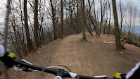
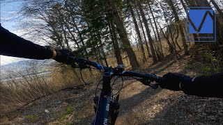
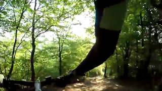
Photos of Dubeň Mountain Bike
Recent Trail Reports
| status | trail | date | condition | info | user |
|---|---|---|---|---|---|
| Dubeň | Jun 15, 2026 @ 5:18pm (Europe/Bratislava) Jun 15, 2026 | Ideal | katko | ||
| Dubeň Hrebeň | Jun 15, 2026 @ 5:18pm (Europe/Bratislava) Jun 15, 2026 | Ideal | katko | ||
| Dubeň okolo vodárne | Jun 15, 2026 @ 5:18pm (Europe/Bratislava) Jun 15, 2026 | Ideal | katko | ||
| Na Dubeň | May 20, 2026 @ 3:57pm (Europe/Bratislava) May 20, 2026 | Ideal | katko | ||
| Dubeň Vodáreň | Apr 23, 2026 @ 6:05pm (Europe/Bratislava) Apr 23, 2026 | Ideal | skorpionx7 | ||
| Na Dubeň ponad horáreň | Apr 1, 2026 @ 4:21pm (Europe/Bratislava) Apr 1, 2026 | Variable | katko | ||
| RS5 | Apr 15, 2024 @ 3:49am Apr 15, 2024 | Prevalent Mud | rovnanik | ||
| Dubeň access road | Jun 16, 2021 @ 7:39am Jun 16, 2021 | Ideal | mrkvosoft |
Activity Feed
| username | action | type | title | date |
|---|---|---|---|---|
| katko | add | report | activity #97087796 and 2 more | Jun 15, 2026 @ 10:08pm Jun 15, 2026 |
| katko | add | report | activity #95155924 and 2 more | May 20, 2026 @ 10:01pm May 20, 2026 |
| Bolsevik | add | report | activity #94710155 | May 14, 2026 @ 1:53pm May 14, 2026 |
| Brzi | vote | trail | activity #93645728 and 1 more | Apr 29, 2026 @ 7:19am Apr 29, 2026 |
| skorpionx7 | add | report | activity #93288311 and 2 more | Apr 24, 2026 @ 9:44am Apr 24, 2026 |
Nearby Areas
| name | distance | ||||
|---|---|---|---|---|---|
| Veľký Vreteň | 4 | 4 | 2.7 km | ||
| Stranik | 1 | 5 | 3 | 2.8 km | |
| ŽILINA OKӨ TRAILS | 6 | 6 | 5 | 1 | 3.3 km |
| Polom | 4 | 2 | 4 | 1 | 6.5 km |
| Lietavský hrad | 3 | 1 | 1 | 6.9 km |
Activity Type Stats
| activitytype | trails | distance | descent | descent distance | total vertical | rating | global rank | state rank | photos | reports | routes | ridelogs |
|---|---|---|---|---|---|---|---|---|---|---|---|---|
| Mountain Bike | 7 | 6 miles | 1,969 ft | 4 miles | 833 ft | #5,744 | #65 | 19 | 571 | 3,645 | ||
| E-Bike | 1 | 702 ft | 36 ft | 531 | 76 | |||||||
| Horse | 1 | 702 ft | 36 ft | 54 | ||||||||
| Hike | 7 | 6 miles | 1,969 ft | 4 miles | 833 ft | #7,980 | #90 | 571 | 151 | |||
| Trail Running | 7 | 6 miles | 1,969 ft | 4 miles | 833 ft | #7,395 | #89 | 571 | 203 | |||
| ATV/ORV/OHV | 1 | 702 ft | 36 ft | 54 |
Frequently Asked Questions About Dubeň
▼
What are the highest rated mountain biking trails in Dubeň?
The highest rated mountain biking trails in Dubeň are:
- Dubeň Hrebeň (4.2/5)
- RS5 (4.1/5)
- Dubeň (4/5)
- Dubeň Vodáreň (3.8/5)
- Na Dubeň (0/5)
▼
What is the best time of the year to ride in Dubeň?
Based on ride log data, the most popular months to ride in Dubeň are:
- August (11 activities)
- June (11 activities)
- September (11 activities)
▼
Where can I park to ride in Dubeň?
Check the Dubeň trail map for trailhead and parking information. Community members regularly update access and parking details for trails in the area.
▼
What is the longest trail in Dubeň?
The longest trail in Dubeň is Dubeň at 1.4 miles. View all trails sorted by distance.
- By jxxw
 TRAILFORKS & contributors
 - Admins: apply
- #28530 - 1,551 views
- dubeň activity log | embed map of Dubeň mountain bike trails | dubeň mountain biking points of interest
Downloading of trail gps tracks in kml & gpx formats is enabled for Dubeň.
You must login to download files.