close
-
Layers w
- Weather Layers
- Pro
- Pro
- Pro
- Pro
- Pro
- Pro
- More Layers
- Pro
- Pro
- Pro
- Pro
-
Upgrade to

3D
Trail Conditions
- Unknown
- Snow Groomed
- Snow Packed
- Snow Covered
- Snow Cover Partial
- Freeze/thaw Cycle
- Icy
- Prevalent Mud
- Wet
- Variable
- Ideal
- Dry
- Very Dry
Trail Flow (Ridden Direction)
Trailforks scans users ridelogs to determine the most popular direction each trail is ridden. A good flowing trail network will have most trails flowing in a single direction according to their intension.
The colour categories are based on what percentage of riders are riding a trail in its intended direction.
The colour categories are based on what percentage of riders are riding a trail in its intended direction.
- > 96%
- > 90%
- > 80%
- > 70%
- > 50%
- < 50%
- bi-directional trail
- no data
Trail Last Ridden
Trailforks scans ridelogs to determine the last time a trail was ridden.
- < 2 days
- < 1 week
- < 2 weeks
- < 1 month
- < 6 months
- > 6 months
Trail Ridden Direction
The intended direction a trail should be ridden.
- Downhill Only
- Downhill Primary
- Both Directions
- Uphill Primary
- Uphill Only
- One Direction
Contribute Details
Colors indicate trail is missing specified detail.
- Description
- Photos
- Description & Photos
- Videos
Trail Popularity ?
Trailforks scans ridelogs to determine which trails are ridden the most in the last 9 months.
Trails are compared with nearby trails in the same city region with a possible 25 colour shades.
Think of this as a heatmap, more rides = more kinetic energy = warmer colors.
- most popular
- popular
- less popular
- not popular
ATV/ORV/OHV Filter
Max Vehicle Width
inches
US Cell Coverage
Legend

Radar Time
Activity Recordings
Trailforks uses anonymized public activity data.
?
Activity Recordings
Trailforks uses anonymized public activity data.
?
Personal Heatmap
▶
Activity Types
all
/
none
▶
Options
2
Date range
month
–
Winter Trails
Warning
A routing network for winter maps does not exist. Selecting trails using the winter trails layer has been disabled.
Missing Trails
Most Popular
Least Popular
Trails are colored based on popularity. The more popular a trail is, the more red. Less popular trails trend towards green.
Jump Magnitude Heatmap
Heatmap of where riders jump on trails. Zoom in to see individual jumps, click circles to view jump details.
BC Backroad Status
![map legend]()
Service Road Atlas is a free to use, community-driven service for viewing and creating reports on the numerous back-country service roads around B.C. and Alberta.

Slope Aspect
Direction the slope faces
Trails Deemphasized
Trails are shown in grey.
Only show trails with no bike usage.
Suggested Layers
Based on selected activity type
Save the current map location and zoom level as your default home location whenever this page is loaded.
SavePopular Trail Networks
view all areas »
No description for Dufferin County has been added yet!
Login or register to submit one.
Activities Click to view
- Mountain Bike
186 trails
- E-Bike
36 trails
- Horse
70 trails
- Hike
281 trails
- Trail Running
274 trails
- Dirtbike/Moto
4 trails
- ATV/ORV/OHV
4 trails
- Snowmobile
20 trails
- Snowshoe
219 trails
- Nordic Ski
97 trails
Stats
- Avg Trail Rating
- Trails (view details)
- 316
- Trails Mountain Bike
- 186
- Trails E-Bike
- 36
- Trails Gravel Bike
- 26
- Trails Winter Fat Bike
- 20
- Trails Horse
- 70
- Trails Hike
- 281
- Trails Trail Running
- 274
- Trails Dirtbike/Moto
- 4
- Trails ATV/ORV/OHV
- 4
- Trails Snowmobile
- 20
- Trails Snowshoe
- 219
- Trails Backcountry Ski
- 2
- Trails Nordic Ski
- 97
- Total Distance
- 197 miles
- Total Descent Distance
- 79 miles
- Total Descent
- 19,682 ft
- Total Vertical
- 892 ft
- Highest Trailhead
- 1,719 ft
- Reports
- 2,800
- Photos
- 375
- Ridden Counter
- 58,901
Sub Regions
- Grand Valley (1)
- Mono (51)
- Mulmur (115)
- Orangeville (10)
- Shelburne (1)
Popular Dufferin County Mountain Biking Trails
• 80 ★ 4.7 • 4,662 ft • 22 ft • 1,413 •
Popular blue difficulty singletrack. This mountain bike primary trail can be used both directions. On average it takes 7 minutes to complete this trail.
• 90 ★ 4.2 • 4,869 ft • 57 ft • 1,197 •
Highly rated popular blue difficulty singletrack. This mountain bike primary trail can be used both directions. On average it takes 7 minutes to complete this trail.
• 85 ★ 3.5 • 794 ft • 4 ft • 1,103 •
Popular blue difficulty singletrack. This mountain bike primary trail can be used both directions. On average it takes minutes to complete this trail.
• 80 ★ 4.8 • 2 miles • 75 ft • 1,074 •
Highly rated popular blue difficulty singletrack. This mountain bike primary trail can be used both directions and has a moderate overall physical rating with a 75 ft blue climb. It features a-frame, berm, bridge, drop, jump, ladder bridge, log ride, rock garden, skinny and teeter totter. On average it takes 17 minutes to complete this trail.
• 80 ★ 4.2 • 1,440 ft • 20 ft • 1,072 •
Popular blue difficulty singletrack. This mountain bike primary trail can be used both directions and has a easy overall physical rating with a 20 ft green climb. On average it takes 2 minutes to complete this trail.
• 75 ★ 4.8 • 1 mile • 37 ft • 1,006 •
Highly rated popular blue difficulty singletrack. This mountain bike primary trail and has a hard overall physical rating with a 37 ft blue climb. On average it takes 8 minutes to complete this trail.
• 100 ★ 4.0 • 692 ft • 0 ft • 975 •
Popular green difficulty singletrack. This mountain bike primary trail can be used both directions. On average it takes minutes to complete this trail.
• 85 ★ 5.0 • 2,802 ft • 81 ft • 955 •
A new trail, offering an alternative to . Fairly easy to navigate single track with some nice turns.
Dufferin County Mountain Bike Routes
★ 5.0 • 8 miles • 503 ft • 6 • Out & Back •
Route created from Fat Bike ride recorded on January 2, 2021
★ 5.0 • 9 miles • 665 ft • 31 •
Great New Route - starts with Ralphs and then the usual inner loop
4 miles • 87 ft • 3 • Loop •
Vicki Barron Lakeside Trail Distance – 8.3 km loop In 2001, the first 2.5 kilometers of the opened with...
14 miles • 1,080 ft • 10 • Loop •
Updated Long Dufferin Loop hitting more good trails
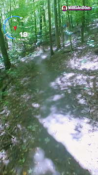
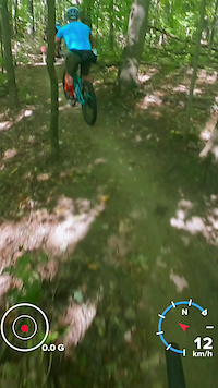
Photos of Dufferin County Mountain Bike
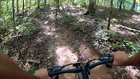
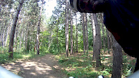
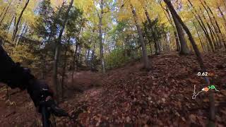
Videos of Dufferin County Mountain Bike
trail: Happy Hour
2:01 |
|
Sep 16, 2025
trail: Lookout Trail Extension
0:17 |
7 |
Sep 16, 2025
trail: Bruce Trail - Hockley
0:06 |
11 |
Jul 2, 2025
0:30 |
14 |
Jun 30, 2025

0:06 |
5 |
Jun 29, 2025
0:09 |
166 |
Apr 12, 2022
trail: Starter Track
4:51 |
331 |
Jul 16, 2015
trail: Mossy Hills
8:13 |
66 |
Nov 16, 2025 , Mulmur
Current Trail Warnings
| status | trail | date | condition | user | info |
|---|---|---|---|---|---|
| Ken's Trail Dufferin County Forest Main Tract | May 25, 2026 @ 1:23pm (America/Toronto) May 25, 2026 | Unknown | loki141 CORC | tree down kens trail |
Recent Trail Reports
Activity Feed
| username | action | type | title | date |
|---|---|---|---|---|
| Chrism7kDvj | add | report | activity #96922061 | Jun 13, 2026 @ 3:42pm Jun 13, 2026 |
| StephaniefHYsVm | wishlist | region | activity #96839639 | Jun 12, 2026 @ 5:50pm Jun 12, 2026 |
| Canadmos | difficultyvote | trail | activity #96108411 | Jun 2, 2026 @ 2:00pm Jun 2, 2026 |
| lukas1551 | wishlist | region | activity #96059626 | Jun 1, 2026 @ 8:08pm Jun 1, 2026 |
| MattRyder | add | report | activity #95963723 | May 31, 2026 @ 11:43am May 31, 2026 |
Recent Comments
| username | type | title | comment | date |
|---|---|---|---|---|
| trail | There are a lot of punji sticks from cut off... | Feb 16, 2026 @ 3:02pm Feb 16, 2026 | ||
| trail | Lots more property boundary markers on this... | Dec 24, 2025 @ 4:19pm Dec 24, 2025 | ||
| report | Perfect. Fine dusting of snow. Dec. 22. Going... | Dec 22, 2025 @ 11:32am Dec 22, 2025 | ||
| report | Would love to go clear these trees that trail... | Nov 1, 2025 @ 5:20pm Nov 1, 2025 | ||
| trail | Is there a proper name for this trail? | Oct 1, 2025 @ 7:03am Oct 1, 2025 |
Local Badges
-

Completionist4 awarded -

Descent 100k Badge0 awarded -

Descent 10k Badge0 awarded -

Big Ride 30k113 awarded -
Big Ride 30k261 awarded -

Top 10 Trails2 awarded
Local Trail Association
Activity Type Stats
| activitytype | trails | distance | descent | descent distance | total vertical | rating | global rank | state rank | photos | reports | routes | ridelogs |
|---|---|---|---|---|---|---|---|---|---|---|---|---|
| Mountain Bike | 186 | 84 miles | 7,762 ft | 31 miles | 853 ft | 216 | 2,772 | 28 | 29,395 | |||
| E-Bike | 36 | 11 miles | 1,280 ft | 4 miles | 768 ft | 2,393 | 1 | 586 | ||||
| Gravel Bike | 26 | 35 | 153 | |||||||||
| Winter Fat Bike | 20 | 8 | 47 | |||||||||
| Horse | 70 | 38 miles | 1,909 ft | 14 miles | 807 ft | 235 | 13 | |||||
| Hike | 281 | 185 miles | 17,680 ft | 73 miles | 892 ft | 162 | 2,779 | 1 | 1,813 | |||
| Trail Running | 274 | 179 miles | 17,211 ft | 71 miles | 892 ft | 2,778 | 1 | 821 | ||||
| Dirtbike/Moto | 4 | 3 miles | 433 ft | 1 mile | 531 ft | 163 | 88 | |||||
| ATV/ORV/OHV | 4 | 3 miles | 433 ft | 1 mile | 531 ft | 163 | 3 | |||||
| Snowmobile | 20 | 13 miles | 1,073 ft | 5 miles | 791 ft | 14 | 4 | |||||
| Snowshoe | 219 | 143 miles | 15,256 ft | 58 miles | 892 ft | 261 | 169 | |||||
| Backcountry Ski | 2 | 4,806 ft | 79 ft | 1,486 ft | 171 ft | 5 | 39 | |||||
| Nordic Ski | 97 | 48 miles | 3,520 ft | 18 miles | 850 ft | 87 | 2 | 800 |
Frequently Asked Questions About Dufferin County
▼
What are the best places to ride in Dufferin County?
Dufferin County has 18 areas to explore for mountain biking. The top rated areas are:
▼
What are the highest rated mountain biking trails in Dufferin County?
The highest rated mountain biking trails in Dufferin County are:
- Central Park Trail (4.4/5)
- The Stick (4.4/5)
- MaxTrail (4.4/5)
- Ken's Trail (4.4/5)
- The Lollipop (4.4/5)
▼
What is the best time of the year to ride in Dufferin County?
Based on ride log data, the most popular months to ride in Dufferin County are:
- July (627 activities)
- August (563 activities)
- May (552 activities)
▼
What is the longest trail in Dufferin County?
The longest trail in Dufferin County is Vicki Barron Lakeside Trail at 4.7 miles. View all trails sorted by distance.
Activities
Trails
- By markholloway
 Trailforks Map Team & contributors
 - Admins: Canadmos
- #10051 - 13,228 views
- dufferin county activity log | embed map of Dufferin County mountain bike trails | dufferin county mountain biking points of interest polygons
Downloading of trail gps tracks in kml & gpx formats is enabled for Dufferin County.
You must login to download files.