close
-
Layers w
- Weather Layers
- Pro
- Pro
- Pro
- Pro
- Pro
- Pro
- More Layers
- Pro
- Pro
- Pro
- Pro
-
Upgrade to

3D
Trail Conditions
- Unknown
- Snow Groomed
- Snow Packed
- Snow Covered
- Snow Cover Partial
- Freeze/thaw Cycle
- Icy
- Prevalent Mud
- Wet
- Variable
- Ideal
- Dry
- Very Dry
Trail Flow (Ridden Direction)
Trailforks scans users ridelogs to determine the most popular direction each trail is ridden. A good flowing trail network will have most trails flowing in a single direction according to their intension.
The colour categories are based on what percentage of riders are riding a trail in its intended direction.
The colour categories are based on what percentage of riders are riding a trail in its intended direction.
- > 96%
- > 90%
- > 80%
- > 70%
- > 50%
- < 50%
- bi-directional trail
- no data
Trail Last Ridden
Trailforks scans ridelogs to determine the last time a trail was ridden.
- < 2 days
- < 1 week
- < 2 weeks
- < 1 month
- < 6 months
- > 6 months
Trail Ridden Direction
The intended direction a trail should be ridden.
- Downhill Only
- Downhill Primary
- Both Directions
- Uphill Primary
- Uphill Only
- One Direction
Contribute Details
Colors indicate trail is missing specified detail.
- Description
- Photos
- Description & Photos
- Videos
Trail Popularity ?
Trailforks scans ridelogs to determine which trails are ridden the most in the last 9 months.
Trails are compared with nearby trails in the same city region with a possible 25 colour shades.
Think of this as a heatmap, more rides = more kinetic energy = warmer colors.
- most popular
- popular
- less popular
- not popular
ATV/ORV/OHV Filter
Max Vehicle Width
inches
US Cell Coverage
Legend

Radar Time
Activity Recordings
Trailforks uses anonymized public activity data.
?
Activity Recordings
Trailforks uses anonymized public activity data.
?
Personal Heatmap
▶
Activity Types
all
/
none
▶
Options
2
Date range
month
–
Winter Trails
Warning
A routing network for winter maps does not exist. Selecting trails using the winter trails layer has been disabled.
Missing Trails
Most Popular
Least Popular
Trails are colored based on popularity. The more popular a trail is, the more red. Less popular trails trend towards green.
Jump Magnitude Heatmap
Heatmap of where riders jump on trails. Zoom in to see individual jumps, click circles to view jump details.
BC Backroad Status
![map legend]()
Service Road Atlas is a free to use, community-driven service for viewing and creating reports on the numerous back-country service roads around B.C. and Alberta.

Slope Aspect
Direction the slope faces
Trails Deemphasized
Trails are shown in grey.
Only show trails with no bike usage.
Suggested Layers
Based on selected activity type
Save the current map location and zoom level as your default home location whenever this page is loaded.
Save
No description for Dunkeld has been added yet!
Login or register to submit one.
This region uses the Uk/Euro style trail grading system.
Activities Click to view
- Mountain Bike
246 trails
- E-Bike
242 trails
- Gravel Bike
1 trails
- Adaptive Bike
1 trails
- Winter Fat Bike
1 trails
- Horse
27 trails
- Hike
147 trails
- Trail Running
147 trails
Region Details
- 85
- 25
- 14
- 45
- 68
- 2
Region Status
Caution as of May 27, 2026Stats
- Avg Trail Rating
- Trails (view details)
- 239
- Trails Mountain Bike
- 247
- Trails E-Bike
- 242
- Trails Gravel Bike
- 1
- Trails Adaptive Bike
- 1
- Trails Winter Fat Bike
- 1
- Trails Horse
- 27
- Trails Hike
- 147
- Trails Trail Running
- 147
- Total Distance
- 146 miles
- Total Descent
- 35,625 ft
- Total Vertical
- 1,461 ft
- Highest Trailhead
- 1,637 ft
- Reports
- 1,998
- Photos
- 295
- Ridden Counter
- 61,221
Articles
Video: Joe Barnes & Hazzard Racing's Chippy Tour of Scotland Begins
Jun 29, 2021 from pinkbike.com
The loam of Inverness and the shale of Dunkeld is a match made in heaven for a trip on the road.
Sub Regions
-
Atholl Hill
- 11
- 4
- 9
- 11
-
Birnam Hill
- 2
- 2
- 6
-
Craigvinean
- 7
- 1
- 4
- 22
- 2
-
Dalmarnock
- 2
- 19
- 27
-
Deuchary Hill
- 2
- 5
- 4
-
Newtyle Hill
- 2
- 3
Popular Dunkeld Mountain Biking Trails
• 95 ★ 4.7 • 1 mile • 13 ft • 1,002 •
Descent from the top of Birnam Hill (King's Seat), via the rim of Birnam quarry. Often used as a stage in the Dunkeld Enduro
• 90 ★ 4.1 • 1 mile • 18 ft • 947 •
Highly rated popular red difficulty singletrack. This mountain bike primary trail can be used downhill primary and has a moderate overall physical rating with a 18 ft blue climb. On average it takes 14 minutes to complete this trail.
• 100 ★ 4.6 • 2,530 ft • 0 ft • 911 •
Highly rated popular red difficulty singletrack. This mountain bike primary trail can be used one direction and has a moderate overall physical rating. It features berm and jump. Trail visibility is always easy to follow. On average it takes 2 minutes to complete this trail.
• 95 ★ 2.0 • 801 ft • 31 ft • 678 •
Popular green difficulty singletrack. This multi-use trail can be used both directions. Trail visibility is always easy to follow. On average it takes 2 minutes to complete this trail.
• 70 ★ 4.0 • 1,115 ft • 0 ft • 586 •
Highly rated popular red difficulty singletrack. This mountain bike primary trail can be used one direction. It features berm, drop, jump and rock garden. Trail visibility is always easy to follow. On average it takes 2 minutes to complete this trail.
• 90 ★ 4.5 • 1,047 ft • 0 ft • 560 •
Highly rated popular black difficulty singletrack. This mountain bike primary trail can be used downhill primary and has a moderate overall physical rating with a 0 ft blue climb. On average it takes 2 minutes to complete this trail.
• 100 ★ 0.0 • 2,661 ft • 185 ft • 551 • • hike
Popular green difficulty gravel path. This hike primary trail can be used both directions and has a moderate overall physical rating with a 185 ft blue climb. Trail visibility is always easy to follow. On average it takes 6 minutes to complete this trail.
Dunkeld Mountain Bike Routes
5 miles • 448 ft • 1 •
The Classic Fiddlers Loop form Dunkeld. This crosses the A9 bridge on a footpath. Note the A9 works as a...
★ 3.0 • 22 miles • 1,874 ft • 1 • Loop •
Starting at Bankfoot, with a road section to warm up. Otherwise mostly off road, with a section through...
★ 3.0 • 28 miles • 5,192 ft • 22 • Loop •
Full route for the Dunkeld Enduro 2019
★ 3.0 • 17 miles • 3,147 ft • 16 • Loop •
This is the route used for the 2021 Dunkeld Enduro Race.
26 miles • 5,812 ft • 13 • Loop •
Frankies maps route of all trails on Atholl Hill as of 07/06/20...
★ 3.0 • 7 miles • 1,352 ft • 10 •
Second Part of the Dunkeld Tour - If we want we could put in runs above hermitage
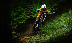
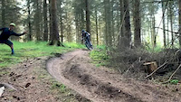
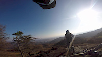
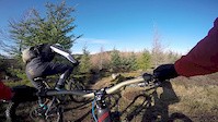
Photos of Dunkeld Mountain Bike
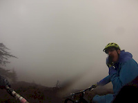
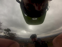
Videos of Dunkeld Mountain Bike
trail: Rake & Ruin
7:57 |
189 |
Aug 14, 2019
trail: Rake & Ruin
6:26 |
88 |
Aug 14, 2019
trail: Electric Beaver
0:05 |
923 |
Jul 6, 2019
trail: Rake & Ruin
4:52 |
449 |
Feb 16, 2019
trail: Cairn to Cottage upper
6:14 |
312 |
Feb 16, 2019
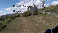
trail: Rudder
3:05 |
570 |
May 7, 2016
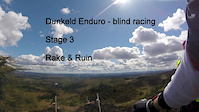
trail: Rake & Ruin
4:24 |
605 |
May 7, 2016
trail: Rake & Ruin
5:31 |
247 |
Apr 30, 2016
Recent Trail Reports
| status | trail | date | condition | info | user |
|---|---|---|---|---|---|
| Hermitage Access Path | May 26, 2026 @ 2:44pm (Europe/London) May 26, 2026 | Dry | stuckbutton GMBC | ||
| Yer Maw Top | May 24, 2026 @ 4:03pm (Europe/London) May 24, 2026 | Dry | stuartw OTA | ||
| Electric Beaver | May 23, 2026 @ 3:11pm (Europe/London) May 23, 2026 | Dry | stuartw OTA | ||
| Kinky Frenchmin | May 23, 2026 @ 10:37am (Europe/London) May 23, 2026 | Unknown | stu555 | ||
| Access Path | May 20, 2026 @ 9:52pm (Europe/London) May 20, 2026 | Dry | bexrex | ||
| Bobbys | May 20, 2026 @ 9:51pm (Europe/London) May 20, 2026 | Dry | bexrex | ||
| Access Path | May 20, 2026 @ 9:50pm (Europe/London) May 20, 2026 | Prevalent Mud | bexrex | ||
| Path | May 20, 2026 @ 9:49pm (Europe/London) May 20, 2026 | Dry | bexrex | ||
| Sacrifice | May 20, 2026 @ 9:48pm (Europe/London) May 20, 2026 | Dry | bexrex | ||
| Rocking Roll | May 20, 2026 @ 9:48pm (Europe/London) May 20, 2026 | Variable | bexrex |
Activity Feed
| username | action | type | title | date |
|---|---|---|---|---|
| Jezjez | ridden | trail | activity #97367531 | Jun 19, 2026 @ 10:55pm 4 hours |
| UnkleCornelius | wishlist | trail | activity #97063019 and 4 more | Jun 15, 2026 @ 1:37pm Jun 15, 2026 |
| UnkleCornelius | wishlist | trail | activity #97063002 | Jun 15, 2026 @ 1:36pm Jun 15, 2026 |
| UnkleCornelius | wishlist | trail | activity #97062928 and 8 more | Jun 15, 2026 @ 1:34pm Jun 15, 2026 |
| gaelm234 | ridden | trail | activity #96956438 | Jun 14, 2026 @ 5:03am Jun 14, 2026 |
Recent Comments
| username | type | title | comment | date |
|---|---|---|---|---|
| trail | ruts mut | Jun 5, 2026 @ 3:49pm Jun 5, 2026 | ||
| report | Forestry land and Scotland went in at the... | May 17, 2026 @ 11:50am May 17, 2026 | ||
| trail | Seems to of been completely destroyed by... | Dec 26, 2025 @ 5:57am Dec 26, 2025 | ||
| trail | Gets little traffic, covered in leaves and... | Dec 26, 2025 @ 5:56am Dec 26, 2025 | ||
| report | Correction to my earlier report. This is the... | Oct 17, 2025 @ 6:28am Oct 17, 2025 |
Local Badges
-

Epic Ride Climb 2k98 awarded -

Climbing 10k Badge123 awarded -

Climbing 100k Badge6 awarded -

Epic Ride Descent 2k97 awarded -

Descent 10k Badge123 awarded -

Descent 100k Badge6 awarded
Activity Type Stats
| activitytype | trails | distance | descent | descent distance | total vertical | rating | global rank | state rank | photos | reports | routes | ridelogs |
|---|---|---|---|---|---|---|---|---|---|---|---|---|
| Mountain Bike | 246 | 146 miles | 35,627 ft | 72 miles | 1,460 ft | #332 | #11 | 273 | 2,001 | 14 | 14,898 | |
| E-Bike | 242 | 145 miles | 35,561 ft | 72 miles | 1,460 ft | #258 | #24 | 10 | 1,772 | 5 | 3,263 | |
| Gravel Bike | 1 | #216 | #161 | 7 | 2 | 22 | ||||||
| Adaptive Bike | 1 | #199 | #215 | 1 | ||||||||
| Winter Fat Bike | 1 | #167 | #190 | 4 | 2 | |||||||
| Horse | 27 | 30 miles | 2,802 ft | 11 miles | 1,280 ft | #317 | #19 | 266 | 2 | |||
| Hike | 147 | 121 miles | 15,371 ft | 49 miles | 1,460 ft | #588 | #20 | 12 | 1,425 | 3 | 592 | |
| Trail Running | 147 | 121 miles | 15,371 ft | 49 miles | 1,460 ft | #607 | #21 | 1,425 | 3 | 978 |
Frequently Asked Questions About Dunkeld
▼
What are the best places to ride in Dunkeld?
Dunkeld has 6 areas to explore for mountain biking. The top rated areas are:
▼
What are the highest rated mountain biking trails in Dunkeld?
The highest rated mountain biking trails in Dunkeld are:
- Rake & Ruin (4.5/5)
- The Blue Route (4.5/5)
- Life Insurance (4.4/5)
- 9.8 (4.4/5)
- Electric Beaver (4.3/5)
▼
What is the best time of the year to ride in Dunkeld?
Based on ride log data, the most popular months to ride in Dunkeld are:
- July (80 activities)
- August (66 activities)
- September (55 activities)
▼
Where can I park to ride in Dunkeld?
There are 9 parking locations listed in Dunkeld. The most popular parking spots are:
- Parking free on High Street but limited spaces
- Parking pay and display
- Parking
- Parking - Douglas Fir Wood
- Parking pay and display
Activities
Trails
Points of Interest
- Cairn Viewpoint of Dunkeld and surrounding areas
- Pine Cone Point Viewpoint
- Creag An Uamhaidh Summit
- Ruins Lodge
- Old Kennels Lodge
- Stewartfield (Ruins) Lodge
- Trig Point Viewpoint
- Viewpoint of Dunkeld and surrounding areas
- Craigvinean Folly Viewpoint
- Craigtop Viewpoint
- Blath Bhalg (622 m)
- Creag nam Mial (550 m)
- Meall Dubh (538 m)
- By frasermcneil
 & contributors
 - Admins: DMBinS, FLS, TTA
- #9600 - 60,104 views
- dunkeld activity log | embed map of Dunkeld mountain bike trails | dunkeld mountain biking points of interest polygons
Downloading of trail gps tracks in kml & gpx formats is enabled for Dunkeld.
You must login to download files.