close
-
Layers w
- Weather Layers
- Pro
- Pro
- Pro
- Pro
- Pro
- Pro
- More Layers
- Pro
- Pro
- Pro
- Pro
-
Upgrade to

3D
Trail Conditions
- Unknown
- Snow Groomed
- Snow Packed
- Snow Covered
- Snow Cover Partial
- Freeze/thaw Cycle
- Icy
- Prevalent Mud
- Wet
- Variable
- Ideal
- Dry
- Very Dry
Trail Flow (Ridden Direction)
Trailforks scans users ridelogs to determine the most popular direction each trail is ridden. A good flowing trail network will have most trails flowing in a single direction according to their intension.
The colour categories are based on what percentage of riders are riding a trail in its intended direction.
The colour categories are based on what percentage of riders are riding a trail in its intended direction.
- > 96%
- > 90%
- > 80%
- > 70%
- > 50%
- < 50%
- bi-directional trail
- no data
Trail Last Ridden
Trailforks scans ridelogs to determine the last time a trail was ridden.
- < 2 days
- < 1 week
- < 2 weeks
- < 1 month
- < 6 months
- > 6 months
Trail Ridden Direction
The intended direction a trail should be ridden.
- Downhill Only
- Downhill Primary
- Both Directions
- Uphill Primary
- Uphill Only
- One Direction
Contribute Details
Colors indicate trail is missing specified detail.
- Description
- Photos
- Description & Photos
- Videos
Trail Popularity ?
Trailforks scans ridelogs to determine which trails are ridden the most in the last 9 months.
Trails are compared with nearby trails in the same city region with a possible 25 colour shades.
Think of this as a heatmap, more rides = more kinetic energy = warmer colors.
- most popular
- popular
- less popular
- not popular
ATV/ORV/OHV Filter
Max Vehicle Width
inches
US Cell Coverage
Legend

Radar Time
Activity Recordings
Trailforks uses anonymized public activity data.
?
Activity Recordings
Trailforks uses anonymized public activity data.
?
Personal Heatmap
▶
Activity Types
all
/
none
▶
Options
2
Date range
month
–
Winter Trails
Warning
A routing network for winter maps does not exist. Selecting trails using the winter trails layer has been disabled.
Missing Trails
Most Popular
Least Popular
Trails are colored based on popularity. The more popular a trail is, the more red. Less popular trails trend towards green.
Jump Magnitude Heatmap
Heatmap of where riders jump on trails. Zoom in to see individual jumps, click circles to view jump details.
BC Backroad Status
![map legend]()
Service Road Atlas is a free to use, community-driven service for viewing and creating reports on the numerous back-country service roads around B.C. and Alberta.

Slope Aspect
Direction the slope faces
Trails Deemphasized
Trails are shown in grey.
Only show trails with no bike usage.
Suggested Layers
Based on selected activity type
Save the current map location and zoom level as your default home location whenever this page is loaded.
SavePopular Trail Networks
view all areas »Activities Click to view
- Mountain Bike
447 trails
- E-Bike
124 trails
- Gravel Bike
24 trails
- Adaptive Bike
0 trails
- Winter Fat Bike
1 trails
- Horse
83 trails
- Hike
472 trails
- Trail Running
457 trails
- Dirtbike/Moto
26 trails
- ATV/ORV/OHV
13 trails
- Downhill Ski
148 trails
- Nordic Ski
37 trails
Region Details
- 65
- 41
- 85
- 156
- 76
- 16
- 1
Region Status
Caution as of 12 hoursLocal Trail Association
Stats
- Avg Trail Rating
- Trails (view details)
- 651
- Trails Mountain Bike
- 470
- Trails E-Bike
- 124
- Trails Gravel Bike
- 24
- Trails Winter Fat Bike
- 1
- Trails Horse
- 83
- Trails Hike
- 472
- Trails Trail Running
- 457
- Trails Dirtbike/Moto
- 26
- Trails ATV/ORV/OHV
- 13
- Trails Snowshoe
- 2
- Trails Downhill Ski
- 151
- Trails Nordic Ski
- 37
- Total Distance
- 835 miles
- Total Descent
- 198,487 ft
- Total Vertical
- 6,545 ft
- Highest Trailhead
- 12,914 ft
- Reports
- 6,632
- Photos
- 1,058
- Ridden Counter
- 159,295
Articles
Video: Durango Derby Brings Elite MTB Racing Back With A Fun-Forward Format
Mar 16, 2023 from pinkbike.com
“Durango deserves a spot in big time MTB racing and the format of the Derby will showcase why,” says Dave Hagen, former FLC Cycling Team...
Sub Regions
-
Animas City Mountain
- 8
- 9
- 2
-
Coal Bank and Molas Pass
- 1
- 5
- 11
- 1
-
Dalla Mountain Park
- 4
- 4
- 1
-
Durango Mesa Park
- 6
- 1
- 1
-
Fort Lewis College
- 1
- 7
- 5
- 2
-
Grandview Ridge
- 2
- 16
- 1
- 1
-
Haviland Lake
- 7
- 8
- 1
-
Hermosa Creek
- 3
- 7
- 6
- 2
-
Hidden Valley
- 11
- 7
-
Horse Gulch
- 5
- 19
- 13
- 3
-
Log Chutes
- 1
- 1
- 7
- 4
- 2
-
Missionary Ridge
- 2
- 11
- 7
- 1
-
Overend Mountain Park
- 2
- 7
- 20
- 8
- 1
-
Perins Peak State Wildlife Area
-
Purgatory Resort
- 5
- 9
- 1
- 1
- 1
-
Smelter Mountain
- 3
-
Three Springs
- 11
- 17
- 4
-
Twin Buttes
- 2
- 9
-
Vallecito Reservoir
- 5
- 2
Popular Durango Mountain Biking Trails
• 100 ★ 4.5 • 1,850 ft • 82 ft • 1,513 •
Popular blue difficulty singletrack. This multi-use trail can be used uphill primary. On average it takes 3 minutes to complete this trail.
• 100 ★ 4.5 • 3,976 ft • 14 ft • 1,471 •
Don't even think about bailing half way down and bypassing this section. Rides fast!
• 100 ★ 3.0 • 1 mile • 279 ft • 1,455 •
A semi-rocky climb with many swithcbacks. Usually dry and dusty with some moderate climbs and rocky spots.
• 95 ★ 4.7 • 1,660 ft • 0 ft • 1,442 •
Popular blue difficulty singletrack. This multi-use trail can be used both directions and has a moderate overall physical rating with a 0 ft blue climb. It features rock garden. Trail visibility is always easy to follow. On average it takes 2 minutes to complete this trail.
• 100 ★ 4.3 • 2,083 ft • 4 ft • 1,438 •
Popular blue difficulty singletrack. This mountain bike primary trail can be used downhill only. On average it takes 2 minutes to complete this trail.
• 100 ★ 4.2 • 2,119 ft • 0 ft • 1,435 •
Once you've made the right off of and flowed through the maze of scrub oak that is Graben's Loop, the trail will bring you to the top of a hill straight out of Beggar's Canyon. You will have arrived at the top of the —one of the most...
• 95 ★ 3.9 • 1 mile • 29 ft • 1,386 •
Best flow trail in the Durango Area. Pretty mellow but keep your eyes peeled there are plenty of fun features even an expert can enjoy. E bikes are allowed permanently!
• 95 ★ 3.3 • 2 miles • 358 ft • 1,308 •
Mellow loop that can be done either direction. Great views of Hogsback
Durango Mountain Bike Routes
Molas to Engineer via White Creek Featured
★ 5.0 • 24 miles • 3,658 ft • 4 • Shuttled •
A beautiful high alpine ride that brings you to 12,484' Rolling Pass on the Colorado Trail and finishes...
20 miles • 2,584 ft • 3 • Shuttled •
This is Durango High Country at it's finest! Can you name a ride with better views than this one... I...
8 miles • 1,078 ft • 4 • Shuttled •
Get your hands ready, this one rocks them! This is the common shuttle route for , a long, steep, and loose...
18 miles • 3,524 ft • 0 • Point to Point •
Day 1 standard route, to Hut, destination for day 1 ride.
10 miles • 1,330 ft • 2 • Shuttled •
The classic Durango High Country route. This ride starts with a shuttle from "Cascade" to the top of Coal...
19 miles • 1,242 ft • 1 • Shuttled •
Hermosa Creek is a old time Durango trail. This ride is great for riders just wanting to get a taste of...
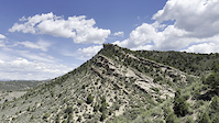
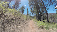
Photos of Durango Mountain Bike
Videos of Durango Mountain Bike
trail: Skyline
0:16 |
2 |
Jun 15, 2026
trail: Cuchillo
0:08 |
10 |
Apr 13, 2026
trail: Westview Loop
0:06 |
24 |
May 31, 2024

trail: Pautskey Point
0:44 |
59 |
Jul 3, 2023
trail: Deer Creek
10:55 |
|
Mar 2, 2023
trail: Telegraph
0:17 |
|
Jun 30, 2022
trail: Haflin Creek
14:02 |
|
Jun 4, 2022
trail: Hermosa Creek
0:37 |
156 |
May 17, 2022
Recent Trail Reports
| status | trail | date | condition | info | user |
|---|---|---|---|---|---|
| CT - Rolling Pass | Jun 19, 2026 @ 7:16pm (America/Denver) 12 hours | Variable | jasbushey Durango | ||
| Cascade Creek (W) | Jun 19, 2026 @ 7:13pm (America/Denver) 12 hours | Dry | jasbushey Durango | ||
| Graysill Creek | Jun 19, 2026 @ 7:12pm (America/Denver) 12 hours | Dry | jasbushey Durango | ||
| CT - Twin Sisters | Jun 18, 2026 @ 10:08pm (America/Denver) 1 day | Unknown | billclintonsgf | ||
| Engineer Mountain | Jun 18, 2026 @ 8:45am (America/Denver) 2 days | Dry | jasbushey Durango | ||
| CT - Blackhawk Connector | Jun 17, 2026 @ 11:24pm (America/Denver) 2 days | Ideal | connormcdee93 | ||
| CT - Blackhawk | Jun 17, 2026 @ 11:23pm (America/Denver) 2 days | Ideal | connormcdee93 | ||
| Pass Creek | Jun 16, 2026 @ 8:58pm (America/Denver) Jun 16, 2026 | Dry | jasbushey Durango | ||
| Deer Creek | Jun 15, 2026 @ 7:41am (America/Denver) Jun 15, 2026 | Dry | jasbushey Durango | ||
| Red Creek | Jun 15, 2026 @ 7:44am (America/Denver) Jun 15, 2026 | Dry | jasbushey Durango |
National Scenic Trails & Official Routes
-
Colorado Trail (Bike)
- Mountain Bike
Activity Feed
| username | action | type | title | date |
|---|---|---|---|---|
| Dscarriere | ridden | trail | activity #97363777 | Jun 19, 2026 @ 8:25pm 10 hours |
| jlevey3 | ridden | route | activity #97362701 | Jun 19, 2026 @ 7:56pm 11 hours |
| jasbushey | add | report | activity #97358314 and 2 more | Jun 19, 2026 @ 6:12pm 12 hours |
| billclintonsgf | comment | trail | activity #97349130 | Jun 19, 2026 @ 3:35pm 15 hours |
| msmcfate | update | trail | activity #97345348 and 2 more | Jun 19, 2026 @ 2:34pm 16 hours |
Recent Comments
| username | type | title | comment | date |
|---|---|---|---|---|
| trail | top half of the trail is an awesome rip,... | Jun 19, 2026 @ 3:35pm 15 hours | ||
| trail | huge jumps 20 foot gaps are all basically... | Jun 18, 2026 @ 6:25pm 2 days | ||
| trail | Good intermediate trail, but the jumps don’t... | Jun 12, 2026 @ 5:07pm Jun 12, 2026 | ||
| trail | Looks like a lot of work went into this trail.... | Jun 12, 2026 @ 5:02pm Jun 12, 2026 | ||
| trail | Animas counter loop - Lupine up, difficult... | Jun 9, 2026 @ 6:41pm Jun 9, 2026 |
Local Badges
-

Completionist0 awarded -
Completionist6 awarded -
Completionist0 awarded -

10 Expert Trails70 awarded -
Completionist3 awarded -
Completionist1 awarded
Bike & Skill Parks
| name | type | city | rating |
|---|---|---|---|
| Purgatory Resort | bike park | Durango | |
| Durango BMX Track | skill park | Durango |
Local Products
Local Trail Supporters
![]()
![Colorado Trail]()
![]()
![]()
- Durango Mesa Park
Activity Type Stats
| activitytype | trails | distance | descent | descent distance | total vertical | rating | global rank | state rank | photos | reports | routes | ridelogs |
|---|---|---|---|---|---|---|---|---|---|---|---|---|
| Mountain Bike | 447 | 654 miles | 134,774 ft | 331 miles | 6,093 ft | #57 | #21 | 1,043 | 6,644 | 70 | 125,454 | |
| E-Bike | 124 | 231 miles | 33,839 ft | 105 miles | 5,295 ft | #388 | #700 | 2 | 3,473 | 5 | 3,177 | |
| Gravel Bike | 24 | 45 miles | 4,423 ft | 19 miles | 4,222 ft | #113 | #818 | 333 | 365 | |||
| Winter Fat Bike | 1 | #102 | #908 | 4 | ||||||||
| Horse | 83 | 291 miles | 50,656 ft | 132 miles | 6,414 ft | #58 | #340 | 1,490 | 9 | |||
| Hike | 472 | 740 miles | 144,987 ft | 357 miles | 6,545 ft | #65 | #45 | 16 | 6,614 | 22 | 10,068 | |
| Trail Running | 457 | 712 miles | 142,011 ft | 347 miles | 6,545 ft | #53 | #31 | 6,543 | 23 | 12,085 | ||
| Dirtbike/Moto | 26 | 122 miles | 23,678 ft | 68 miles | 4,859 ft | #134 | #82 | 8 | 925 | 36 | ||
| ATV/ORV/OHV | 13 | 80 miles | 12,454 ft | 39 miles | 4,859 ft | #91 | #50 | 825 | 14 | |||
| Snowshoe | 2 | 3,130 ft | 23 ft | 997 ft | 102 ft | 82 | 139 | |||||
| Downhill Ski | 148 | 52 miles | 42,008 ft | 49 miles | 4,229 ft | #83 | #37 | 94 | 4,539 | |||
| Nordic Ski | 37 | 15 miles | 919 ft | 5 miles | 1,243 ft | #242 | #67 | 83 | 1,137 |
Frequently Asked Questions About Durango
▼
What are the best places to ride in Durango?
Durango has 25 areas to explore for mountain biking. The top rated areas are:
▼
What are the highest rated mountain biking trails in Durango?
The highest rated mountain biking trails in Durango are:
- Engineer Mountain (4.6/5)
- Send It (4.5/5)
- CT - Twin Sisters (4.5/5)
- Crite's Connect (4.4/5)
- Pautskey Point (4.4/5)
▼
What is the best time of the year to ride in Durango?
Based on ride log data, the most popular months to ride in Durango are:
- July (1,249 activities)
- August (750 activities)
- June (736 activities)
▼
Where can I park to ride in Durango?
There are 64 parking locations listed in Durango. The most popular parking spots are: View all parking and trailhead locations on the map to plan your visit.
Activities
Trails
Points of Interest
- Baldy Mountain Summit
- Powderhouse Lodge
- Backside Bistro Lodge
- Junction Creek Campground Camping
- The Lion's Den Viewpoint
- Castle Rock Summit
- Animas City Mountain Summit
- High Point Viewpoint
- Lizard Head Pass Campground Camping
- Vallecito Campground Camping
- Grizzly Peak (13,642 ft)
- McCauley Peak (13,504 ft)
- Aztec Mountain (13,310 ft)
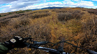
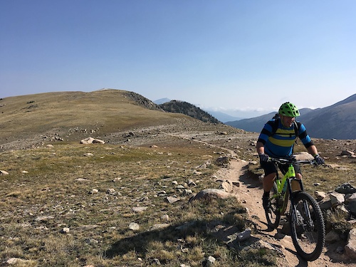
- By canadaka
 Trailforks & contributors
 - Admins: Durango, SJMA
- #4908 - 85,952 views
- durango activity log | embed map of Durango mountain bike trails | durango mountain biking points of interest
Downloading of trail gps tracks in kml & gpx formats is enabled for Durango.
You must login to download files.