close
-
Layers w
- Weather Layers
- Pro
- Pro
- Pro
- Pro
- Pro
- Pro
- More Layers
- Pro
- Pro
- Pro
- Pro
-
Upgrade to

3D
Trail Conditions
- Unknown
- Snow Groomed
- Snow Packed
- Snow Covered
- Snow Cover Partial
- Freeze/thaw Cycle
- Icy
- Prevalent Mud
- Wet
- Variable
- Ideal
- Dry
- Very Dry
Trail Flow (Ridden Direction)
Trailforks scans users ridelogs to determine the most popular direction each trail is ridden. A good flowing trail network will have most trails flowing in a single direction according to their intension.
The colour categories are based on what percentage of riders are riding a trail in its intended direction.
The colour categories are based on what percentage of riders are riding a trail in its intended direction.
- > 96%
- > 90%
- > 80%
- > 70%
- > 50%
- < 50%
- bi-directional trail
- no data
Trail Last Ridden
Trailforks scans ridelogs to determine the last time a trail was ridden.
- < 2 days
- < 1 week
- < 2 weeks
- < 1 month
- < 6 months
- > 6 months
Trail Ridden Direction
The intended direction a trail should be ridden.
- Downhill Only
- Downhill Primary
- Both Directions
- Uphill Primary
- Uphill Only
- One Direction
Contribute Details
Colors indicate trail is missing specified detail.
- Description
- Photos
- Description & Photos
- Videos
Trail Popularity ?
Trailforks scans ridelogs to determine which trails are ridden the most in the last 9 months.
Trails are compared with nearby trails in the same city region with a possible 25 colour shades.
Think of this as a heatmap, more rides = more kinetic energy = warmer colors.
- most popular
- popular
- less popular
- not popular
ATV/ORV/OHV Filter
Max Vehicle Width
inches
US Cell Coverage
Legend

Radar Time
Activity Recordings
Trailforks uses anonymized public activity data.
?
Activity Recordings
Trailforks uses anonymized public activity data.
?
Personal Heatmap
▶
Activity Types
all
/
none
▶
Options
2
Date range
month
–
Winter Trails
Warning
A routing network for winter maps does not exist. Selecting trails using the winter trails layer has been disabled.
Missing Trails
Most Popular
Least Popular
Trails are colored based on popularity. The more popular a trail is, the more red. Less popular trails trend towards green.
Jump Magnitude Heatmap
Heatmap of where riders jump on trails. Zoom in to see individual jumps, click circles to view jump details.
BC Backroad Status
![map legend]()
Service Road Atlas is a free to use, community-driven service for viewing and creating reports on the numerous back-country service roads around B.C. and Alberta.

Slope Aspect
Direction the slope faces
Trails Deemphasized
Trails are shown in grey.
Only show trails with no bike usage.
Suggested Layers
Based on selected activity type
Save the current map location and zoom level as your default home location whenever this page is loaded.
Save
No description for Durban has been added yet!
Login or register to submit one.
Activities Click to view
- Mountain Bike
64 trails
- E-Bike
30 trails
- Gravel Bike
0 trails
- Adaptive Bike
0 trails
- Winter Fat Bike
0 trails
- Horse
4 trails
- Hike
49 trails
- Trail Running
49 trails
Region Details
- 8
- 12
- 29
- 13
- 2
Region Status
Open as of Mar 30, 2025Local Trail Association
Stats
- Avg Trail Rating
- Trails (view details)
- 67
- Trails Mountain Bike
- 64
- Trails E-Bike
- 30
- Trails Horse
- 4
- Trails Hike
- 49
- Trails Trail Running
- 49
- Total Distance
- 34 miles
- Total Descent
- 6,206 ft
- Total Vertical
- 1,729 ft
- Highest Trailhead
- 1,909 ft
- Reports
- 263
- Photos
- 179
- Ridden Counter
- 5,157
Sub Regions
-
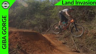
Giba Gorge MTB Park
- 7
- 29
- 13
- 2
-
Kenneth Stainbank Nature Reserve
- 5
Popular Durban Mountain Biking Trails
• 95 ★ 1.5 • 1 mile • 454 ft • 152 •
Popular blue difficulty singletrack. This mountain bike primary trail can be used uphill primary and has a moderate overall physical rating with a 454 ft blue climb. Trail visibility is always easy to follow. On average it takes 19 minutes to complete this trail.
• 85 ★ 3.7 • 2,913 ft • 39 ft • 127 •
Popular blue difficulty singletrack. This mountain bike primary trail can be used one direction and has a moderate overall physical rating with a 39 ft blue climb. Trail visibility is always easy to follow. On average it takes 7 minutes to complete this trail.
• 80 ★ 4.0 • 1,096 ft • 37 ft • 124 •
Popular blue difficulty singletrack. This mountain bike primary trail can be used uphill primary and has a moderate overall physical rating with a 37 ft blue climb. Trail visibility is always easy to follow. On average it takes 2 minutes to complete this trail.
• 85 ★ 3.5 • 2,119 ft • 39 ft • 117 •
Popular blue difficulty singletrack. This mountain bike primary trail can be used downhill primary. On average it takes 2 minutes to complete this trail.
• 85 ★ 4.0 • 1,765 ft • 4 ft • 113 •
Popular blue difficulty singletrack. This mountain bike primary trail can be used one direction and has a moderate overall physical rating with a 4 ft blue climb. Trail visibility is always easy to follow. On average it takes 2 minutes to complete this trail.
• 50 ★ 4.0 • 3,048 ft • 114 ft • 106 •
Moderately popular blue difficulty singletrack. This mountain bike primary trail can be used one direction and has a moderate overall physical rating with a 114 ft blue climb. On average it takes 6 minutes to complete this trail.
• 75 ★ 3.5 • 3,018 ft • 148 ft • 96 •
A couple switch backs with contour driven sections between each turn. Part of the Green route.
• 80 ★ 3.0 • 3,445 ft • 41 ft • 92 •
Popular blue difficulty singletrack. This mountain bike primary trail can be used downhill primary and has a moderate overall physical rating with a 41 ft blue climb. It features berm, jump, gap jump and wallride. Trail visibility is always easy to follow. On average it takes 4 minutes to complete this trail.
Durban Mountain Bike Routes
★ 3.0 • 9 miles • 1,406 ft • 15 • Out & Back •
Moderate route with some technical sections and steep climbs
2 miles • 253 ft • 1 • Out & Back •
This route is the easiest route in the park. Runs in both directions and is the most popular route that...
7 miles • 920 ft • 11 • Out & Back •
Moderate route with technical sections and steep inclines and declines in areas
• 6 miles • 1,196 ft • 8 •
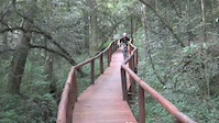
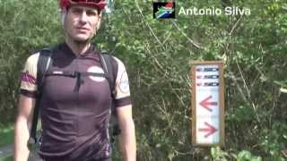
Photos of Durban Mountain Bike

Recent Trail Reports
| status | trail | date | condition | info | user |
|---|---|---|---|---|---|
| Freeride Section | Mar 30, 2025 @ 11:44pm Mar 30, 2025 | Dry | TeotsGZOz | ||
| Happy Ending Ext | Jun 8, 2024 @ 12:57am Jun 8, 2024 | Dry | kyran12 EMBA | ||
| Happy Ending | Jun 8, 2024 @ 12:57am Jun 8, 2024 | Dry | kyran12 EMBA | ||
| Mainline | Jun 8, 2024 @ 12:57am Jun 8, 2024 | Dry | kyran12 EMBA | ||
| Mainline Ext | Jun 8, 2024 @ 12:57am Jun 8, 2024 | Dry | kyran12 EMBA | ||
| Intebane (Bush Pig) | Jun 8, 2024 @ 12:57am Jun 8, 2024 | Dry | kyran12 EMBA | ||
| Zetembes | Jun 8, 2024 @ 12:57am Jun 8, 2024 | Dry | kyran12 EMBA | ||
| Bizhub 2 | Jun 8, 2024 @ 12:57am Jun 8, 2024 | Dry | kyran12 EMBA | ||
| Mamba House | Jun 8, 2024 @ 12:57am Jun 8, 2024 | Dry | kyran12 EMBA | ||
| Gravity Dice | Jun 8, 2024 @ 12:57am Jun 8, 2024 | Dry | kyran12 EMBA |
Activity Feed
| username | action | type | title | date |
|---|---|---|---|---|
| Mathews45L1i | wishlist | region | activity #96614334 | Jun 9, 2026 @ 10:16am Jun 9, 2026 |
| Conley0Eemzs | vote | route | activity #91311249 | Mar 26, 2026 @ 2:47am Mar 26, 2026 |
| JiIyoTXj | vote | trail | activity #87848295 and 2 more | Jan 26, 2026 @ 8:39am Jan 26, 2026 |
| Braamvt | wishlist | route | activity #86284856 | Dec 29, 2025 @ 12:32pm Dec 29, 2025 |
| Nigelrichardson | vote | route | activity #84577630 | Nov 22, 2025 @ 8:47pm Nov 22, 2025 |
Local Badges
-

10 Green Trails26 awarded -

10 Blue Trails87 awarded -

Epic Ride Climb 2k28 awarded -

Climbing 10k Badge35 awarded -

Climbing 100k Badge6 awarded -

Epic Ride Descent 2k29 awarded
Bike & Skill Parks
| name | type | city | rating |
|---|---|---|---|
| Giba Gorge MTB Park | bike park | Durban | |
| Kids YBike Track | skill park | Durban | |
| BMX Track | skill park | Durban | |
| KwaDabeka Pump Track By Velosolutions | skill park | Durban | |
| Bulwer Park Pump Track | skill park | Durban |
Activity Type Stats
| activitytype | trails | distance | descent | descent distance | total vertical | rating | global rank | state rank | photos | reports | routes | ridelogs |
|---|---|---|---|---|---|---|---|---|---|---|---|---|
| Mountain Bike | 64 | 31 miles | 5,722 ft | 16 miles | 1,729 ft | #1,507 | #37 | 171 | 263 | 3 | 8,503 | |
| E-Bike | 30 | 15 miles | 2,264 ft | 6 miles | 709 ft | #1,456 | #77 | 259 | 3 | 269 | ||
| Horse | 4 | 2 miles | 62 ft | 1,322 ft | 417 ft | #321 | #7 | 29 | 1 | |||
| Hike | 49 | 29 miles | 4,324 ft | 13 miles | 1,729 ft | #2,050 | #54 | 259 | 2 | 53 | ||
| Trail Running | 49 | 29 miles | 4,324 ft | 13 miles | 1,729 ft | #1,553 | #50 | 259 | 3 | 568 |
Frequently Asked Questions About Durban
▼
What are the best places to ride in Durban?
Durban has 2 areas to explore for mountain biking. The top rated areas are:
▼
What are the highest rated mountain biking trails in Durban?
The highest rated mountain biking trails in Durban are:
- Fish and Chips (4.2/5)
- The Alley (4.1/5)
- Bizhub 1 (4.1/5)
- Ruffs (4.1/5)
- Cat Trail (4.1/5)
▼
What is the best time of the year to ride in Durban?
Based on ride log data, the most popular months to ride in Durban are:
- July (32 activities)
- February (15 activities)
- January (14 activities)
▼
Where can I park to ride in Durban?
There are 2 parking locations listed in Durban. The most popular parking spots are:
Activities
Trails
Points of Interest
- By ralley
 & contributors
 - Admins: EMBA, SCC
- #9362 - 9,870 views
- durban activity log | embed map of Durban mountain bike trails | durban mountain biking points of interest
Downloading of trail gps tracks in kml & gpx formats is enabled for Durban.
You must login to download files.