close
-
Layers w
- Weather Layers
- Pro
- Pro
- Pro
- Pro
- Pro
- Pro
- More Layers
- Pro
- Pro
- Pro
- Pro
-
Upgrade to

3D
Trail Conditions
- Unknown
- Snow Groomed
- Snow Packed
- Snow Covered
- Snow Cover Partial
- Freeze/thaw Cycle
- Icy
- Prevalent Mud
- Wet
- Variable
- Ideal
- Dry
- Very Dry
Trail Flow (Ridden Direction)
Trailforks scans users ridelogs to determine the most popular direction each trail is ridden. A good flowing trail network will have most trails flowing in a single direction according to their intension.
The colour categories are based on what percentage of riders are riding a trail in its intended direction.
The colour categories are based on what percentage of riders are riding a trail in its intended direction.
- > 96%
- > 90%
- > 80%
- > 70%
- > 50%
- < 50%
- bi-directional trail
- no data
Trail Last Ridden
Trailforks scans ridelogs to determine the last time a trail was ridden.
- < 2 days
- < 1 week
- < 2 weeks
- < 1 month
- < 6 months
- > 6 months
Trail Ridden Direction
The intended direction a trail should be ridden.
- Downhill Only
- Downhill Primary
- Both Directions
- Uphill Primary
- Uphill Only
- One Direction
Contribute Details
Colors indicate trail is missing specified detail.
- Description
- Photos
- Description & Photos
- Videos
Trail Popularity ?
Trailforks scans ridelogs to determine which trails are ridden the most in the last 9 months.
Trails are compared with nearby trails in the same city region with a possible 25 colour shades.
Think of this as a heatmap, more rides = more kinetic energy = warmer colors.
- most popular
- popular
- less popular
- not popular
ATV/ORV/OHV Filter
Max Vehicle Width
inches
US Cell Coverage
Legend

Radar Time
Activity Recordings
Trailforks uses anonymized public activity data.
?
Activity Recordings
Trailforks uses anonymized public activity data.
?
Personal Heatmap
▶
Activity Types
all
/
none
▶
Options
2
Date range
month
–
Winter Trails
Warning
A routing network for winter maps does not exist. Selecting trails using the winter trails layer has been disabled.
Missing Trails
Most Popular
Least Popular
Trails are colored based on popularity. The more popular a trail is, the more red. Less popular trails trend towards green.
Jump Magnitude Heatmap
Heatmap of where riders jump on trails. Zoom in to see individual jumps, click circles to view jump details.
BC Backroad Status
![map legend]()
Service Road Atlas is a free to use, community-driven service for viewing and creating reports on the numerous back-country service roads around B.C. and Alberta.

Slope Aspect
Direction the slope faces
Trails Deemphasized
Trails are shown in grey.
Only show trails with no bike usage.
Suggested Layers
Based on selected activity type
Save the current map location and zoom level as your default home location whenever this page is loaded.
Save
No description for Durham has been added yet!
Login or register to submit one.
Activities Click to view
- Mountain Bike
16 trails
- Gravel Bike
1 trails
- Adaptive Bike
0 trails
- Winter Fat Bike
0 trails
- Hike
46 trails
- Trail Running
46 trails
Region Details
- 1
- 5
- 4
- 4
- 2
Region Status
Caution as of Jun 23, 2026Stats
- Avg Trail Rating
- Trails (view details)
- 51
- Trails Mountain Bike
- 16
- Trails Gravel Bike
- 1
- Trails Hike
- 46
- Trails Trail Running
- 46
- Total Distance
- 74 miles
- Total Descent
- 4,227 ft
- Total Vertical
- 361 ft
- Highest Trailhead
- 613 ft
- Reports
- 1,815
- Photos
- 45
- Ridden Counter
- 6,952
Sub Regions
-
Little River Park
- 1
- 3
- 4
- 1
Popular Durham Mountain Biking Trails
• 35 ★ 0.0 • 3 miles • 377 ft • 23 •
Less popular white difficulty family friendly machine groomed. This multi-use trail can be used both directions and has a easy overall physical rating with a 377 ft green climb. Trail visibility is always easy to follow. On average it takes 28 minutes to complete this trail.
• 45 ★ 0.0 • 2,996 ft • 65 ft • 12 •
Moderately popular white difficulty family friendly machine groomed. This mountain bike primary trail can be used both directions and has a easy overall physical rating with a 65 ft green climb. Trail visibility is always easy to follow. On average it takes 1 minutes to complete this trail.
• 30 ★ 0.0 • 4 miles • 160 ft • 12 •
Less popular white difficulty family friendly paved path. This mountain bike primary trail can be used both directions and has a easy overall physical rating with a 160 ft green climb. Trail visibility is always easy to follow. On average it takes 11 minutes to complete this trail.
• 40 ★ 0.0 • 4 miles • 191 ft • 8 •
Moderately popular white difficulty paved path. This mountain bike primary trail can be used both directions with a 191 ft green climb. Trail visibility is always easy to follow.
• 5 ★ 4.0 • 5 miles • 272 ft • 7 •
Less popular black diamond difficulty singletrack. This mountain bike primary trail. On average it takes 1 hour37 minutes to complete this trail.
• 20 ★ 2.0 • 1 mile • 54 ft • 4 •
Beginner Friendly Tail located close to HW 15/501 that is short and sweet. 2 or 3 small hills that are good for Beginners to build confidence
Durham Mountain Bike Routes
5 miles • 332 ft • 7 • Loop •
Clockwise loop at Little River, Durham NC. Please visit trianglemtb.com to ensure trails are open before...
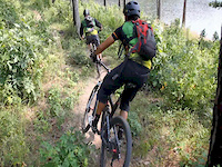
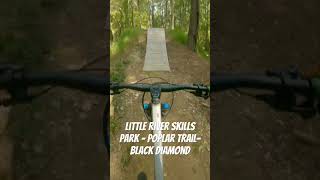
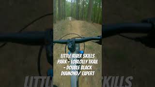
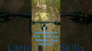
Photos of Durham Mountain Bike

Current Trail Warnings
| status | trail | date | condition | user | info |
|---|---|---|---|---|---|
| Yellow - Intermediate | Jun 23, 2026 @ 4:45pm (America/New_York) Jun 23, 2026 | Wet | Pedalpowernc Little River | ||
| White Loop - Beginner | Jun 23, 2026 @ 4:45pm (America/New_York) Jun 23, 2026 | Wet | Pedalpowernc Little River | ||
| Red Loop - Advanced | Jun 23, 2026 @ 4:45pm (America/New_York) Jun 23, 2026 | Wet | Pedalpowernc Little River |
Recent Trail Reports
| status | trail | date | condition | info | user |
|---|---|---|---|---|---|
| Hickory | Jun 23, 2026 @ 4:45pm (America/New_York) Jun 23, 2026 | Wet | Pedalpowernc Little River | ||
| Connector | Jun 23, 2026 @ 4:45pm (America/New_York) Jun 23, 2026 | Wet | Pedalpowernc Little River | ||
| Cedar | Jun 23, 2026 @ 4:45pm (America/New_York) Jun 23, 2026 | Wet | Pedalpowernc Little River | ||
| Beech | Jun 23, 2026 @ 4:45pm (America/New_York) Jun 23, 2026 | Wet | Pedalpowernc Little River | ||
| Access Rd | Jun 23, 2026 @ 4:45pm (America/New_York) Jun 23, 2026 | Wet | Pedalpowernc Little River | ||
| Cross Country Connector | Jul 7, 2024 @ 3:50am Jul 7, 2024 | Wet | trailforks Trailforks | ||
| Newlight | May 18, 2023 @ 11:25am May 18, 2023 | Dry | hughrNVTU | ||
| Sally Meyerhoff Trail | Apr 28, 2021 @ 5:35am Apr 28, 2021 | Very Dry | Craho | ||
| Al Buehler Trail | Jul 8, 2019 @ 8:45am Jul 8, 2019 | Unknown | heatherrocklear |
Activity Feed
| username | action | type | title | date |
|---|---|---|---|---|
| bkellas | wishlist | region | activity #97866712 | Jun 26, 2026 @ 5:18pm 2 days |
| Pedalpowernc | add | report | activity #97650184 and 9 more | Jun 23, 2026 @ 1:45pm Jun 23, 2026 |
| ranger302 | ridden | trail | activity #96620248 and 3 more | Jun 9, 2026 @ 11:41am Jun 9, 2026 |
| Pedalpowernc | add | report | activity #95775961 and 9 more | May 29, 2026 @ 7:32am May 29, 2026 |
| Pedalpowernc | add | report | activity #95626967 and 9 more | May 27, 2026 @ 5:22am May 27, 2026 |
Recent Comments
| username | type | title | comment | date |
|---|---|---|---|---|
| trail | Really enjoyed this. As someone still learning... | Oct 20, 2025 @ 7:29am Oct 20, 2025 | ||
| trail | The skills area is closed while the county's... | Dec 20, 2021 @ 5:56am Dec 20, 2021 | ||
| trail | Great park, needs some TLC but the novelty of... | Mar 22, 2021 @ 11:23am Mar 22, 2021 |
Local Badges
-

Epic Ride Climb 2k3 awarded -

Climbing 10k Badge51 awarded -

Climbing 100k Badge1 awarded -

Epic Ride Descent 2k3 awarded -

Descent 10k Badge51 awarded -

Descent 100k Badge1 awarded
Activity Type Stats
| activitytype | trails | distance | descent | descent distance | total vertical | rating | global rank | state rank | photos | reports | routes | ridelogs |
|---|---|---|---|---|---|---|---|---|---|---|---|---|
| Mountain Bike | 16 | 24 miles | 1,565 ft | 11 miles | 351 ft | #5,415 | #1,820 | 45 | 1,813 | 1 | 6,363 | |
| Gravel Bike | 1 | 1,519 ft | 26 ft | 817 ft | 26 ft | #709 | #1,190 | 247 | 12 | |||
| Hike | 46 | 74 miles | 4,137 ft | 30 miles | 361 ft | #1,238 | #571 | 1,773 | 345 | |||
| Trail Running | 46 | 74 miles | 4,137 ft | 30 miles | 361 ft | #3,499 | #1,036 | 1,773 | 334 |
Frequently Asked Questions About Durham
▼
What are the best places to ride in Durham?
Durham has 3 areas to explore for mountain biking. The top rated areas are:
▼
What are the highest rated mountain biking trails in Durham?
The highest rated mountain biking trails in Durham are:
- Poplar (4.1/5)
- Beech (4.1/5)
- Connector (4/5)
- Newlight (4/5)
- Yellow - Intermediate (3.8/5)
▼
What is the best time of the year to ride in Durham?
Based on ride log data, the most popular months to ride in Durham are:
- July (87 activities)
- August (75 activities)
- September (65 activities)
▼
Where can I park to ride in Durham?
There are 4 parking locations listed in Durham. The most popular parking spots are: View all parking and trailhead locations on the map to plan your visit.
- By brenthillier
 NSMBA TRAILFORKS & contributors
 - Admins: FritzNeal, TORC
- #3783 - 9,678 views
- durham activity log | embed map of Durham mountain bike trails | durham mountain biking points of interest
Downloading of trail gps tracks in kml & gpx formats is enabled for Durham.
You must login to download files.