close
-
Layers w
- Weather Layers
- Pro
- Pro
- Pro
- Pro
- Pro
- Pro
- More Layers
- Pro
- Pro
- Pro
- Pro
-
Upgrade to

3D
Trail Conditions
- Unknown
- Snow Groomed
- Snow Packed
- Snow Covered
- Snow Cover Partial
- Freeze/thaw Cycle
- Icy
- Prevalent Mud
- Wet
- Variable
- Ideal
- Dry
- Very Dry
Trail Flow (Ridden Direction)
Trailforks scans users ridelogs to determine the most popular direction each trail is ridden. A good flowing trail network will have most trails flowing in a single direction according to their intension.
The colour categories are based on what percentage of riders are riding a trail in its intended direction.
The colour categories are based on what percentage of riders are riding a trail in its intended direction.
- > 96%
- > 90%
- > 80%
- > 70%
- > 50%
- < 50%
- bi-directional trail
- no data
Trail Last Ridden
Trailforks scans ridelogs to determine the last time a trail was ridden.
- < 2 days
- < 1 week
- < 2 weeks
- < 1 month
- < 6 months
- > 6 months
Trail Ridden Direction
The intended direction a trail should be ridden.
- Downhill Only
- Downhill Primary
- Both Directions
- Uphill Primary
- Uphill Only
- One Direction
Contribute Details
Colors indicate trail is missing specified detail.
- Description
- Photos
- Description & Photos
- Videos
Trail Popularity ?
Trailforks scans ridelogs to determine which trails are ridden the most in the last 9 months.
Trails are compared with nearby trails in the same city region with a possible 25 colour shades.
Think of this as a heatmap, more rides = more kinetic energy = warmer colors.
- most popular
- popular
- less popular
- not popular
ATV/ORV/OHV Filter
Max Vehicle Width
inches
US Cell Coverage
Legend

Radar Time
Activity Recordings
Trailforks uses anonymized public activity data.
?
Activity Recordings
Trailforks uses anonymized public activity data.
?
Personal Heatmap
▶
Activity Types
all
/
none
▶
Options
2
Date range
month
–
Winter Trails
Warning
A routing network for winter maps does not exist. Selecting trails using the winter trails layer has been disabled.
Missing Trails
Most Popular
Least Popular
Trails are colored based on popularity. The more popular a trail is, the more red. Less popular trails trend towards green.
Jump Magnitude Heatmap
Heatmap of where riders jump on trails. Zoom in to see individual jumps, click circles to view jump details.
BC Backroad Status
![map legend]()
Service Road Atlas is a free to use, community-driven service for viewing and creating reports on the numerous back-country service roads around B.C. and Alberta.

Slope Aspect
Direction the slope faces
Trails Deemphasized
Trails are shown in grey.
Only show trails with no bike usage.
Suggested Layers
Based on selected activity type
Save the current map location and zoom level as your default home location whenever this page is loaded.
Save
No description for Duvall has been added yet!
Login or register to submit one.
Activities Click to view
- Mountain Bike
96 trails
- E-Bike
56 trails
- Gravel Bike
0 trails
- Adaptive Bike
0 trails
- Winter Fat Bike
0 trails
- Horse
9 trails
- Hike
91 trails
- Trail Running
87 trails
Region Details
- 21
- 2
- 34
- 34
- 3
Region Status
Caution as of Jun 18, 2026Local Trail Association
Stats
- Avg Trail Rating
- Trails (view details)
- 94
- Trails Mountain Bike
- 96
- Trails E-Bike
- 56
- Trails Horse
- 9
- Trails Hike
- 91
- Trails Trail Running
- 87
- Total Distance
- 69 miles
- Total Descent
- 7,562 ft
- Total Vertical
- 1,373 ft
- Highest Trailhead
- 1,416 ft
- Reports
- 1,449
- Photos
- 394
- Ridden Counter
- 9,427
Sub Regions
-
Cherry Valley
- 1
- 12
- 13
- 1
-
Marckworth State Forest
- 2
- 2
-
Moss Lake
- 15
- 15
- 2
-
Ring Hill Forest
- 5
Popular Duvall Mountain Biking Trails
• 100 ★ 4.0 • 1,865 ft • 113 ft • 275 •
A well oriented singletrack trail that begins near the main entrance. The trail climbs the grade well, exiting back onto the main access trail where another trail begins. Great alternative to either climbing or descending the primary...
• 80 ★ 0.0 • 4,839 ft • 158 ft • 258 •
Popular green difficulty singletrack. This mountain bike primary trail can be used both directions. On average it takes 6 minutes to complete this trail.
• 100 ★ 3.9 • 3,241 ft • 17 ft • 247 •
Aptly named trail that's fun, slightly loose, has little things to pop off of. Much more wild and raw than something like Duthie Hill trails. Good time!
• 90 ★ 4.3 • 2,769 ft • 13 ft • 246 •
Downhill flowing singletrack through ferns and trees. The trail has multiple A-lines and B-lines so you can mix it up and keep the trail interesting. Tight singletrack even in late summer, some rocks and tree roots thrown in that get...
• 90 ★ 3.6 • 3,390 ft • 32 ft • 231 •
A fun tight singletrack trail, winding its way around through lush ferns and forest. The trail has some fun twisted turns to it, but the trail is still quite raw. It has rocks, slippery roots here and there. This is no Duthie. That...
• 100 ★ 4.5 • 2,195 ft • 223 ft • 224 •
Single Track climbing trail adjacent to the access road that climbs about 200 vertical feet to the mid-way point of Cherry Valley.
• 100 ★ 3.0 • 1,512 ft • 100 ft • 209 •
While you could pedal up this, best off to go up the road incase someone is bombing down it. The road turns into single track to the top of this trail (near ). On the way down expect to have some fun! A bit of tech, flow and a few...
Duvall Mountain Bike Routes
8 miles • 1,319 ft • 12 • Loop •
fun route around Cherry valley You're coming down, cyclops, and are downhill trails
• 7 miles • 1,187 ft • 8 •
• 10 miles • 586 ft • 0 •
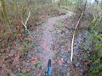
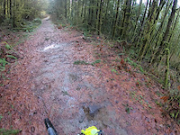
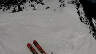
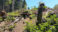
Photos of Duvall Mountain Bike
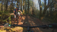
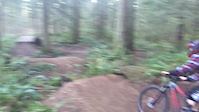
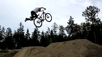
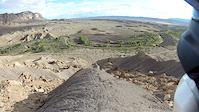
Videos of Duvall Mountain Bike
trail: You're Goin Down
3:24 |
133 |
Jan 29, 2023
trail: Cyclops
3:56 |
303 |
Jan 28, 2023
trail: Outer Limits
0:38 |
770 |
May 27, 2021
trail: RIM
0:22 |
540 |
Jan 28, 2019
trail: Landing
0:22 |
63 |
Apr 3, 2016
trail: Yellow
0:25 |
239 |
Dec 13, 2015
trail: Landing
0:52 |
5217 |
Aug 14, 2015
trail: Ridge
0:08 |
301 |
Jul 5, 2015
Recent Trail Reports
| status | trail | date | condition | info | user |
|---|---|---|---|---|---|
| Funner | Jun 18, 2026 @ 6:03pm (Pacific/Midway) Jun 18, 2026 | Ideal | bennettdarren | ||
| Mowtown | Jun 18, 2026 @ 6:03pm (Pacific/Midway) Jun 18, 2026 | Ideal | bennettdarren | ||
| Creekside Trail | Jun 6, 2026 @ 6:16pm (America/Los_Angeles) Jun 6, 2026 | Variable | bennettdarren | ||
| Dense | Jun 10, 2026 @ 8:23am (America/Vancouver) Jun 10, 2026 | Variable | kb7rsk | ||
| Black Label | Jun 10, 2026 @ 8:23am (America/Vancouver) Jun 10, 2026 | Variable | kb7rsk | ||
| Dense (Alternate) | Jun 10, 2026 @ 8:23am (America/Vancouver) Jun 10, 2026 | Variable | kb7rsk | ||
| Waterbars Up! | Jun 10, 2026 @ 8:23am (America/Vancouver) Jun 10, 2026 | Variable | kb7rsk | ||
| You're Goin Down | Jun 10, 2026 @ 8:23am (America/Vancouver) Jun 10, 2026 | Variable | kb7rsk | ||
| Cyclops | Jun 10, 2026 @ 8:23am (America/Vancouver) Jun 10, 2026 | Variable | kb7rsk | ||
| Elevator | Jun 10, 2026 @ 8:23am (America/Vancouver) Jun 10, 2026 | Variable | kb7rsk |
Activity Feed
| username | action | type | title | date |
|---|---|---|---|---|
| bennettdarren | add | report | activity #97455577 and 1 more | Jun 20, 2026 @ 10:10pm Jun 20, 2026 |
| bennettdarren | add | report | activity #97016999 and 1 more | Jun 14, 2026 @ 6:15pm Jun 14, 2026 |
| bennettdarren | comment | report | activity #96713421 and 2 more | Jun 10, 2026 @ 7:31pm Jun 10, 2026 |
| kb7rsk | add | report | activity #96691077 and 12 more | Jun 10, 2026 @ 12:54pm Jun 10, 2026 |
| cameronsch | checkin | trail | activity #96543030 | Jun 8, 2026 @ 8:57am Jun 8, 2026 |
Recent Comments
| username | type | title | comment | date |
|---|---|---|---|---|
| report | Thanks for the assist and report | Jun 10, 2026 @ 7:33pm Jun 10, 2026 | ||
| report | Thanks! Already cleared the open area before... | Jun 10, 2026 @ 7:33pm Jun 10, 2026 | ||
| report | Thank for getting the branch and all the reports! | Jun 10, 2026 @ 7:31pm Jun 10, 2026 | ||
| report | Rock on, well done! | Mar 13, 2026 @ 10:43am Mar 13, 2026 | ||
| trail | Rode on my gravel bike with no problems. Must... | Feb 15, 2026 @ 2:53pm Feb 15, 2026 |
Local Badges
-

10 Green Trails92 awarded -

10 Blue Trails125 awarded -

Epic Ride Climb 2k8 awarded -

Climbing 10k Badge23 awarded -

Climbing 100k Badge0 awarded -

Epic Ride Descent 2k9 awarded
Activity Type Stats
| activitytype | trails | distance | descent | descent distance | total vertical | rating | global rank | state rank | photos | reports | routes | ridelogs |
|---|---|---|---|---|---|---|---|---|---|---|---|---|
| Mountain Bike | 96 | 69 miles | 7,562 ft | 28 miles | 1,371 ft | #1,770 | #655 | 386 | 1,439 | 3 | 6,230 | |
| E-Bike | 56 | 51 miles | 4,501 ft | 20 miles | 1,060 ft | #2,994 | #1,113 | 648 | 199 | |||
| Horse | 9 | 6 miles | 1,093 ft | 3 miles | 492 ft | #2,797 | #1,559 | 170 | 4 | |||
| Hike | 91 | 67 miles | 6,929 ft | 27 miles | 1,371 ft | #3,563 | #1,250 | 10 | 1,401 | 1 | 589 | |
| Trail Running | 87 | 65 miles | 6,768 ft | 26 miles | 1,060 ft | #3,260 | #955 | 1,401 | 95 |
Frequently Asked Questions About Duvall
▼
What are the best places to ride in Duvall?
Duvall has 4 areas to explore for mountain biking. The top rated areas are:
▼
What are the highest rated mountain biking trails in Duvall?
The highest rated mountain biking trails in Duvall are:
- Cyclops (4.3/5)
- Elevator (4.2/5)
- You're Goin Down (4.2/5)
- Upper Elevator (4.1/5)
- No Road (4.1/5)
▼
What is the best time of the year to ride in Duvall?
Based on ride log data, the most popular months to ride in Duvall are:
- July (95 activities)
- August (74 activities)
- April (71 activities)
▼
Where can I park to ride in Duvall?
There are 8 parking locations listed in Duvall. The most popular parking spots are: View all parking and trailhead locations on the map to plan your visit.
Activities
Trails
- By ACree
 & contributors
 - Admins: EMBA-C2S, EMBA-C2S
- #5975 - 7,116 views
- duvall activity log | embed map of Duvall mountain bike trails | duvall mountain biking points of interest
Downloading of trail gps tracks in kml & gpx formats is enabled for Duvall.
You must login to download files.