close
-
Layers w
- Weather Layers
- Pro
- Pro
- Pro
- Pro
- Pro
- Pro
- More Layers
- Pro
- Pro
- Pro
- Pro
-
Upgrade to

3D
Trail Conditions
- Unknown
- Snow Groomed
- Snow Packed
- Snow Covered
- Snow Cover Partial
- Freeze/thaw Cycle
- Icy
- Prevalent Mud
- Wet
- Variable
- Ideal
- Dry
- Very Dry
Trail Flow (Ridden Direction)
Trailforks scans users ridelogs to determine the most popular direction each trail is ridden. A good flowing trail network will have most trails flowing in a single direction according to their intension.
The colour categories are based on what percentage of riders are riding a trail in its intended direction.
The colour categories are based on what percentage of riders are riding a trail in its intended direction.
- > 96%
- > 90%
- > 80%
- > 70%
- > 50%
- < 50%
- bi-directional trail
- no data
Trail Last Ridden
Trailforks scans ridelogs to determine the last time a trail was ridden.
- < 2 days
- < 1 week
- < 2 weeks
- < 1 month
- < 6 months
- > 6 months
Trail Ridden Direction
The intended direction a trail should be ridden.
- Downhill Only
- Downhill Primary
- Both Directions
- Uphill Primary
- Uphill Only
- One Direction
Contribute Details
Colors indicate trail is missing specified detail.
- Description
- Photos
- Description & Photos
- Videos
Trail Popularity ?
Trailforks scans ridelogs to determine which trails are ridden the most in the last 9 months.
Trails are compared with nearby trails in the same city region with a possible 25 colour shades.
Think of this as a heatmap, more rides = more kinetic energy = warmer colors.
- most popular
- popular
- less popular
- not popular
ATV/ORV/OHV Filter
Max Vehicle Width
inches
US Cell Coverage
Legend

Radar Time
Activity Recordings
Trailforks uses anonymized public activity data.
?
Activity Recordings
Trailforks uses anonymized public activity data.
?
Personal Heatmap
▶
Activity Types
all
/
none
▶
Options
2
Date range
month
–
Winter Trails
Warning
A routing network for winter maps does not exist. Selecting trails using the winter trails layer has been disabled.
Missing Trails
Most Popular
Least Popular
Trails are colored based on popularity. The more popular a trail is, the more red. Less popular trails trend towards green.
Jump Magnitude Heatmap
Heatmap of where riders jump on trails. Zoom in to see individual jumps, click circles to view jump details.
BC Backroad Status
![map legend]()
Service Road Atlas is a free to use, community-driven service for viewing and creating reports on the numerous back-country service roads around B.C. and Alberta.

Slope Aspect
Direction the slope faces
Trails Deemphasized
Trails are shown in grey.
Only show trails with no bike usage.
Suggested Layers
Based on selected activity type
Save the current map location and zoom level as your default home location whenever this page is loaded.
SaveEagle Mountain is located in a Coastal Temperate Rainforest and as such can receive heavy amounts of rainfall during winter months. This heavy rainfall can easily saturate the ground and lead to erosion and runoff concerns. Both the Mossom Creek and Noons Creek Watersheds support active salmon hatcheries. As such, sedimentary concerns are heightened from November through March of each year. This critical time for the salmon hatcheries is known as the “Fish Window”. High sediment levels and turbidity measurements in the water increase the mortality of the fish eggs.
Legitimization and rehabilitation of the trails is in process with the plan of providing a great network of trails to enjoy, while still protecting the special environment that is Eagle Mountain.
Visit torca.ca for info on upcoming trail days.
Legitimization and rehabilitation of the trails is in process with the plan of providing a great network of trails to enjoy, while still protecting the special environment that is Eagle Mountain.
Visit torca.ca for info on upcoming trail days.
Primary Trail Type: All-Mountain & Downhill
Land Status: Crown Land
 google parking directions
 Access Info:
Park in the gravel lot beside Aspenwood Elementary on Panorama and climb up the Lower Backyard Trail to get to the bottom of IMBY, which is the start of a single track climbing route. OR park on Eagle Mountain Bouldevard and access the trails via the power line road. OR park near the golf course at the end of Plateau Blvd and ride/push up the Lungbuster access road. You could also leave a 2nd car down at Buntzen Lake.
Links
Activities Click to view
- Mountain Bike
78 trails
- E-Bike
33 trails
- Hike
85 trails
- Trail Running
72 trails
- Dirtbike/Moto
30 trails
- Observed Trials
17 trails
- ATV/ORV/OHV
5 trails
Region Details
- 17
- 2
- 3
- 20
- 28
- 1
Region Status
Open as of 2 daysStats
- Avg Trail Rating
- Trails (view details)
- 79
- Trails Mountain Bike
- 79
- Trails E-Bike
- 33
- Trails Hike
- 86
- Trails Trail Running
- 72
- Trails Dirtbike/Moto
- 30
- Trails Observed Trials
- 17
- Trails ATV/ORV/OHV
- 5
- Total Distance
- 34 miles
- Total Descent
- 12,367 ft
- Total Vertical
- 2,406 ft
- Highest Trailhead
- 2,821 ft
- Reports
- 5,294
- Photos
- 2,109
- Ridden Counter
- 48,631
Popular Eagle Mountain Mountain Biking Trails
• 100 ★ 3.9 • 3,022 ft • 364 ft • 1,997 •
is a technical singletrack climbing only trail. It's narrow trail bed will test your technical climbing prowess. There are many tight switchbacks and very few recovery sections making it a challenging climb; the perfect place to perfect...
• 100 ★ 3.9 • 1,280 ft • 117 ft • 1,952 •
The new entrance is complete! you can access this trail off , just past where the entrance used to be. Follow the newly installed signage and head up the hill as if going to Eastbound and down, and just before the Noons creek crossing,...
• 100 ★ 4.5 • 2,556 ft • 29 ft • 1,785 •
is a more advanced trail with steep root sections a few drops and more tec features with some flowy bits in there for good measure.
• 95 ★ 4.6 • 2,280 ft • 13 ft • 1,627 •
Been around a long time. Rebuilt 2018-19 nice big wood features.
• 95 ★ 4.3 • 771 ft • 0 ft • 1,552 •
Fast and flowy with multiple berms and rollers. This trail was completed in June 2018 by Creeping Dirt as part of the new construction under the Letter Of Understanding from Rec Sites and Trails BC.
• 100 ★ 3.1 • 1,243 ft • 112 ft • 1,540 • • moto
Connector trail that is mostly used by motos. It has become very eroded in sections. If climbing to or beyond, is a way better option.
• 100 ★ 3.6 • 2,513 ft • 250 ft • 1,477 •
Wide gravel trail that is fairly fun descent, with lots of small kickers on the side to play around on. But don't go too fast and watch out for walkers, this is a multi-use community path.
Eagle Mountain Mountain Bike Routes
★ 3.9 • 6 miles • 1,592 ft • 15 • Loop •
This is a great route to see what Eagle Mtn. has to offer. Thanks to TORCA for all the hard work done in...
★ 5.0 • 2 miles • 916 ft • 2 • Point to Point •
Are you up for some therapy? If so, then you better have extended benefits. You start with , then you'll...
6 miles • 977 ft • 6 •
Easy loop of Academy and . Optionally descend Sugar Mountain and Little Bear for some more fun!
★ 5.0 • 5 miles • 1,499 ft • 7 • Loop • Race •
Casual weeknight racing is back for 2022! Three timed downhill stages will occur along this loop, the...
★ 4.0 • 4 miles • 1,292 ft • 9 • Race •
Stage 1 - A short climbing piece on Stage 2 - Stage 3 - , , Are you ready to Enduro? Our TORCA 500 Enduro...
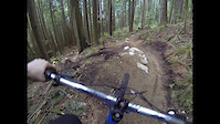
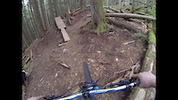
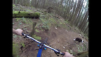
Photos of Eagle Mountain Mountain Bike
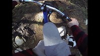
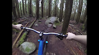
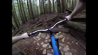
Videos of Eagle Mountain Mountain Bike
trail: Shaloam
0:56 |
351 |
Apr 23, 2024
trail: Manhandler
0:37 |
71 |
Apr 17, 2024
trail: Three Little Pigs
0:55 |
24 |
Apr 16, 2024

trail: Manhandler
0:37 |
|
Apr 16, 2024
trail: Shaloam
0:37 |
85 |
Apr 16, 2024
trail: Shaloam
0:55 |
66 |
Apr 12, 2024
trail: Hammer Time
0:01 |
25 |
Feb 1, 2024
trail: East Bound and Down
0:49 |
30 |
Feb 1, 2024
Current Trail Warnings
| status | trail | date | condition | user | info |
|---|---|---|---|---|---|
| The Dentist - Upper | Jun 17, 2026 @ 3:17pm (America/Vancouver) 2 days | Dry | fluid2 | ||
| Spencer's Slabs | Jun 10, 2026 @ 10:01pm (America/Vancouver) Jun 10, 2026 | Unknown | calfredson TORCA | Closed due to Fortis construction at the... | |
| Little Bastard | Jun 10, 2026 @ 10:01pm (America/Vancouver) Jun 10, 2026 | Unknown | calfredson TORCA | Closed due to Fortis construction at the... |
Recent Trail Reports
Activity Feed
| username | action | type | title | date |
|---|---|---|---|---|
| fluid2 | add | report | activity #97229771 and 12 more | Jun 17, 2026 @ 8:35pm 1 day |
| Sahawkeye | ridden | trail | activity #96973254 | Jun 14, 2026 @ 8:42am Jun 14, 2026 |
| samoyurets | comment | report | activity #96848142 | Jun 12, 2026 @ 9:40pm Jun 12, 2026 |
| BryceeHiMKn | difficultyvote | trail | activity #96789287 | Jun 12, 2026 @ 1:00am Jun 12, 2026 |
| rgard | wishlist | route | activity #96759049 | Jun 11, 2026 @ 1:39pm Jun 11, 2026 |
Recent Comments
| username | type | title | comment | date |
|---|---|---|---|---|
| report | Thank you 🤘 | Jun 12, 2026 @ 9:40pm Jun 12, 2026 | ||
| report | All cleaned up and good to ride. | May 6, 2026 @ 5:05pm May 6, 2026 | ||
| report | its pretty beat up | Apr 29, 2026 @ 12:03pm Apr 29, 2026 | ||
| report | I’ll get up there early next week to clean... | Apr 29, 2026 @ 9:11am Apr 29, 2026 | ||
| report | Thanks. Hiked it today. What a great... | Apr 13, 2026 @ 7:20pm Apr 13, 2026 |
Nearby Areas
| name | distance | ||||
|---|---|---|---|---|---|
| Bear Creek | 2 | 1 | 2 | 1.3 km | |
| Ridge Park | 5 | 10 | 2 | 1 | 1.5 km |
| Bert Flinn | 12 | 19 | 2 | 1.9 km | |
| Buntzen Lake Recreation Area | 3 | 13 | 2 | 2.6 km | |
| The Chines | 1 | 1 | 3.5 km |
Local Badges
-

Completionist4 awarded
Activity Type Stats
| activitytype | trails | distance | descent | descent distance | total vertical | rating | global rank | state rank | photos | reports | routes | ridelogs |
|---|---|---|---|---|---|---|---|---|---|---|---|---|
| Mountain Bike | 78 | 29 miles | 11,119 ft | 15 miles | 2,136 ft | #195 | #27 | 2,010 | 5,302 | 10 | 25,782 | |
| E-Bike | 33 | 7 miles | 2,680 ft | 4 miles | 1,460 ft | #856 | #41 | 15 | 4,494 | 2 | 2,367 | |
| Hike | 85 | 29 miles | 10,108 ft | 14 miles | 2,405 ft | #212 | #19 | 73 | 5,019 | 1 | 3,271 | |
| Trail Running | 72 | 26 miles | 9,324 ft | 13 miles | 2,136 ft | #1,439 | #50 | 6 | 4,935 | 1 | 3,203 | |
| Dirtbike/Moto | 30 | 15 miles | 3,107 ft | 5 miles | 1,841 ft | #27 | #15 | 12 | 1,174 | 465 | ||
| Observed Trials | 17 | 9 miles | 3,163 ft | 4 miles | 1,093 ft | #47 | #15 | 124 | 35 | |||
| ATV/ORV/OHV | 5 | 2 miles | 1,266 ft | #219 | #21 | 749 | 12 |
Frequently Asked Questions About Eagle Mountain
▼
What are the highest rated mountain biking trails in Eagle Mountain?
The highest rated mountain biking trails in Eagle Mountain are:
- Marvin (4.7/5)
- Mossom Creek (Middle) (4.6/5)
- Spencer's Slabs (4.6/5)
- Manhandler (4.5/5)
- El Dingo Blanco (4.5/5)
▼
What is the best time of the year to ride in Eagle Mountain?
Based on ride log data, the most popular months to ride in Eagle Mountain are:
- July (357 activities)
- August (295 activities)
- May (223 activities)
▼
Where can I park to ride in Eagle Mountain?
There are 2 parking locations listed in Eagle Mountain. The most popular parking spots are:
▼
What is the longest trail in Eagle Mountain?
The longest trail in Eagle Mountain is Full Pull at 1.9 miles. View all trails sorted by distance.
Activities
Trails
- By canadaka
 Trailforks & contributors
 - Admins: TORCA: Eagle, TORCA, Taichibiker
- #239 - 123,048 views
- eagle mountain activity log | embed map of Eagle Mountain mountain bike trails | eagle mountain mountain biking points of interest polygons
Downloading of trail gps tracks in kml & gpx formats is enabled for Eagle Mountain.
You must login to download files.