close
-
Layers w
- Weather Layers
- Pro
- Pro
- Pro
- Pro
- Pro
- Pro
- More Layers
- Pro
- Pro
- Pro
- Pro
-
Upgrade to

3D
Trail Conditions
- Unknown
- Snow Groomed
- Snow Packed
- Snow Covered
- Snow Cover Partial
- Freeze/thaw Cycle
- Icy
- Prevalent Mud
- Wet
- Variable
- Ideal
- Dry
- Very Dry
Trail Flow (Ridden Direction)
Trailforks scans users ridelogs to determine the most popular direction each trail is ridden. A good flowing trail network will have most trails flowing in a single direction according to their intension.
The colour categories are based on what percentage of riders are riding a trail in its intended direction.
The colour categories are based on what percentage of riders are riding a trail in its intended direction.
- > 96%
- > 90%
- > 80%
- > 70%
- > 50%
- < 50%
- bi-directional trail
- no data
Trail Last Ridden
Trailforks scans ridelogs to determine the last time a trail was ridden.
- < 2 days
- < 1 week
- < 2 weeks
- < 1 month
- < 6 months
- > 6 months
Trail Ridden Direction
The intended direction a trail should be ridden.
- Downhill Only
- Downhill Primary
- Both Directions
- Uphill Primary
- Uphill Only
- One Direction
Contribute Details
Colors indicate trail is missing specified detail.
- Description
- Photos
- Description & Photos
- Videos
Trail Popularity ?
Trailforks scans ridelogs to determine which trails are ridden the most in the last 9 months.
Trails are compared with nearby trails in the same city region with a possible 25 colour shades.
Think of this as a heatmap, more rides = more kinetic energy = warmer colors.
- most popular
- popular
- less popular
- not popular
ATV/ORV/OHV Filter
Max Vehicle Width
inches
US Cell Coverage
Legend

Radar Time
Activity Recordings
Trailforks uses anonymized public activity data.
?
Activity Recordings
Trailforks uses anonymized public activity data.
?
Personal Heatmap
▶
Activity Types
all
/
none
▶
Options
2
Date range
month
–
Winter Trails
Warning
A routing network for winter maps does not exist. Selecting trails using the winter trails layer has been disabled.
Missing Trails
Most Popular
Least Popular
Trails are colored based on popularity. The more popular a trail is, the more red. Less popular trails trend towards green.
Jump Magnitude Heatmap
Heatmap of where riders jump on trails. Zoom in to see individual jumps, click circles to view jump details.
BC Backroad Status
![map legend]()
Service Road Atlas is a free to use, community-driven service for viewing and creating reports on the numerous back-country service roads around B.C. and Alberta.

Slope Aspect
Direction the slope faces
Trails Deemphasized
Trails are shown in grey.
Only show trails with no bike usage.
Suggested Layers
Based on selected activity type
Save the current map location and zoom level as your default home location whenever this page is loaded.
Save
No description for Eastbourne has been added yet!
Login or register to submit one.
This region uses the Uk/Euro style trail grading system.
Activities Click to view
- Mountain Bike
37 trails
- E-Bike
30 trails
- Gravel Bike
0 trails
- Adaptive Bike
1 trails
- Winter Fat Bike
1 trails
- Hike
28 trails
- Trail Running
28 trails
Region Details
- 5
- 1
- 18
- 5
Region Status
Open as of May 18, 2026Stats
- Avg Trail Rating
- Trails (view details)
- 29
- Trails Mountain Bike
- 37
- Trails E-Bike
- 30
- Trails Adaptive Bike
- 1
- Trails Winter Fat Bike
- 1
- Trails Horse
- 3
- Trails Hike
- 28
- Trails Trail Running
- 28
- Total Distance
- 21 miles
- Total Descent
- 4,342 ft
- Total Vertical
- 459 ft
- Highest Trailhead
- 504 ft
- Reports
- 173
- Photos
- 179
- Ridden Counter
- 3,562
Sub Regions
-
Friston Forest
- 13
- 4
-
Paradise Woods
- 1
- 2
Popular Eastbourne Mountain Biking Trails
• 85 ★ 3.9 • 1 mile • 6 ft • 297 •
Nice long run with a few craters to drop into to keep it interesting. Can be ridden around if needed.
• 100 ★ 3.4 • 1,775 ft • 6 ft • 258 •
Popular blue difficulty singletrack. This mountain bike primary trail can be used downhill primary. On average it takes 1 minutes to complete this trail.
• 95 ★ 4.7 • 1,781 ft • 0 ft • 217 •
run is one of the original trails of Friston Forest and has been there since the 1980s. Featured in some of the early MBUK video tapes and sprung videos. This trail is suited for AM/Enduro/.XC bikes mainly. Long travel Dh bikes are...
• 65 ★ 4.5 • 2,392 ft • 0 ft • 215 •
Built and created by Chris Mitchell and Grant fox of Southcoast suspension a nice flowing piece of single track with a long left hander the trial utilises an old river bed which makes the last 250m great fun
• 90 ★ 4.5 • 3,478 ft • 3 ft • 190 •
One of the most well known trails in Friston. Connects too many other trails.
• 95 ★ 4.7 • 3,126 ft • 2 ft • 176 •
Tight singletrack through trees, lots of bar flicking, slight off camber section midway.
• 100 ★ 5.0 • 1,496 ft • 0 ft • 166 •
One of the most well known trails in Friston Forest and a great trail for learning new skills.
• 40 ★ 5.0 • 3,743 ft • 14 ft • 159 •
Moderately popular blue difficulty singletrack. This mountain bike primary trail can be used downhill primary. On average it takes 4 minutes to complete this trail.
Eastbourne Mountain Bike Routes
2 miles • 396 ft • 2 • Loop •
Starts at a great pub the Tigers Inn at East Dean (with plenty of parking) it takes riders through Friston...
9 miles • 1,073 ft • 0 •
Jevington to Beachy Head and the Seven Sisters, getting you to Friston Forest
• 8 miles • 1,057 ft • 2 •
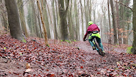
Photos of Eastbourne Mountain Bike
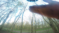
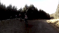
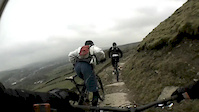
Videos of Eastbourne Mountain Bike
trail: The X-files
0:50 |
754 |
Jan 4, 2019
trail: Doris and Bert
2:09 |
475 |
Apr 21, 2015

trail: Schralp Me Silly
0:20 |
496 |
Apr 21, 2015

trail: Trail 2
0:06 |
160 |
Mar 27, 2015

trail: Trail 2
4:06 |
320 |
Mar 27, 2015

trail: Trail 2
0:39 |
127 |
Mar 13, 2015
trail: Track 2
3:33 |
153 |
Feb 22, 2015
trail: Final Descent
3:20 |
499 |
Nov 21, 2014
Recent Trail Reports
| status | trail | date | condition | info | user |
|---|---|---|---|---|---|
| Final Descent | May 18, 2026 @ 3:10pm (Europe/London) May 18, 2026 | Dry | Necron11 | ||
| Snow Link | May 18, 2026 @ 3:10pm (Europe/London) May 18, 2026 | Ideal | Necron11 | ||
| Tron | May 18, 2026 @ 3:10pm (Europe/London) May 18, 2026 | Dry | Necron11 | ||
| roots galore | May 11, 2026 @ 3:14pm (Europe/London) May 11, 2026 | Ideal | Necron11 | ||
| 5/10 | Apr 13, 2026 @ 4:24pm (Europe/London) Apr 13, 2026 | Ideal | Necron11 | ||
| The X-files | Mar 22, 2026 @ 7:46am (Europe/London) Mar 22, 2026 | Ideal | JakeHLVlgz | ||
| Clint Eastwood | Dec 31, 2025 @ 9:43am (Europe/London) Dec 31, 2025 | Freeze/thaw Cycle | philipbell83 | ||
| Snakes & Ladders | Dec 31, 2025 @ 9:43am (Europe/London) Dec 31, 2025 | Freeze/thaw Cycle | philipbell83 | ||
| Crater Run | Dec 31, 2025 @ 9:43am (Europe/London) Dec 31, 2025 | Freeze/thaw Cycle | philipbell83 | ||
| Snow Run | Dec 6, 2025 @ 2:05pm (Europe/London) Dec 6, 2025 | Wet | Andrew6uII0s |
Activity Feed
| username | action | type | title | date |
|---|---|---|---|---|
| RaefF53oBw | ridden | trail | activity #96825805 | Jun 12, 2026 @ 1:43pm Jun 12, 2026 |
| blakeackland | wishlist | trail | activity #96755128 | Jun 11, 2026 @ 12:24pm Jun 11, 2026 |
| trailforks | add | video | activity #96420414 | Jun 6, 2026 @ 6:00pm Jun 6, 2026 |
| Necron11 | add | report | activity #94977699 | May 18, 2026 @ 8:28am May 18, 2026 |
| Necron11 | add | report | activity #94977698 and 1 more | May 18, 2026 @ 8:28am May 18, 2026 |
Recent Comments
| username | type | title | comment | date |
|---|---|---|---|---|
| trail | Conditions were great , dry and fast | Apr 27, 2025 @ 10:43pm Apr 27, 2025 | ||
| report | Perfect | Apr 27, 2025 @ 12:18am Apr 27, 2025 | ||
| trail | Some small tables on this run good for new riders | Nov 4, 2021 @ 10:22am Nov 4, 2021 | ||
| trail | Running really well, couple of muddy spots but... | Aug 14, 2021 @ 3:19am Aug 14, 2021 | ||
| trail | Really sloppy and muddy still - best avoided... | Aug 14, 2021 @ 3:18am Aug 14, 2021 |
Local Badges
-

10 Blue Trails108 awarded -

Epic Ride Climb 2k30 awarded -

Climbing 10k Badge49 awarded -

Climbing 100k Badge5 awarded -

Epic Ride Descent 2k31 awarded -

Descent 10k Badge51 awarded
Activity Type Stats
| activitytype | trails | distance | descent | descent distance | total vertical | rating | global rank | state rank | photos | reports | routes | ridelogs |
|---|---|---|---|---|---|---|---|---|---|---|---|---|
| Mountain Bike | 37 | 21 miles | 4,341 ft | 12 miles | 459 ft | #3,324 | #109 | 179 | 173 | 3 | 9,030 | |
| E-Bike | 30 | 19 miles | 3,507 ft | 11 miles | 436 ft | #3,326 | #115 | 150 | 1,785 | |||
| Adaptive Bike | 1 | #196 | #214 | |||||||||
| Winter Fat Bike | 1 | #163 | #189 | 1 | ||||||||
| Horse | 3 | 3 miles | 299 ft | 2 miles | 302 ft | 16 | ||||||
| Hike | 28 | 18 miles | 3,123 ft | 9 miles | 459 ft | #6,505 | #167 | 161 | 437 | |||
| Trail Running | 28 | 18 miles | 3,123 ft | 9 miles | 459 ft | #6,042 | #159 | 161 | 72 |
Frequently Asked Questions About Eastbourne
▼
What are the best places to ride in Eastbourne?
Eastbourne has 2 areas to explore for mountain biking. The top rated areas are:
▼
What are the highest rated mountain biking trails in Eastbourne?
The highest rated mountain biking trails in Eastbourne are:
- The X-files (4.3/5)
- Snow Run (4.2/5)
- Snakes & Ladders (4.2/5)
- Doris and Bert (4.2/5)
- Former Stumpy (4.2/5)
▼
What is the best time of the year to ride in Eastbourne?
Based on ride log data, the most popular months to ride in Eastbourne are:
- June (74 activities)
- July (48 activities)
- August (47 activities)
▼
Where can I park to ride in Eastbourne?
There are 4 parking locations listed in Eastbourne. The most popular parking spots are: View all parking and trailhead locations on the map to plan your visit.
Activities
Trails
- By brenthillier
 NSMBA TRAILFORKS & contributors
 - Admins: wisey, MathieuC, cemoorelife
- #6741 - 7,045 views
- eastbourne activity log | embed map of Eastbourne mountain bike trails | eastbourne mountain biking points of interest
Downloading of trail gps tracks in kml & gpx formats is enabled for Eastbourne.
You must login to download files.